Ticker for May 21, 2014
MESONET TICKER ... MESONET TICKER ... MESONET TICKER ... MESONET TICKER ...
May 21, 2014 May 21, 2014 May 21, 2014 May 21, 2014

No, this is not the John Cusack movie from the '80s, but even they were talking
about the High Plains drought to come in 30 years throughout much of that movie.
At least that's the way I remember it.
The big slow-moving/cutoff upper-level low that we've talked about for awhile
should be about to work its magic on western Oklahoma and the Panhandle. We might
as well just start out with the exciting stuff first, so here ya go, the fantasy-
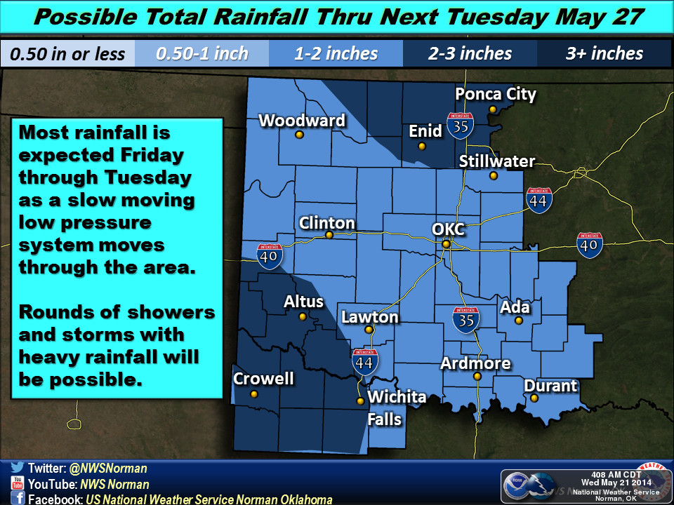
cast of the year so far ... 7-days, up to 3 inches of rain across western
Oklahoma (and the southeast, but they don't need it quite as much).
This map is through next Wednesday morning.

To say that these 7-day rain forecasts have not panned out very well this year
would be an understatement, but we also haven't seen a storm system like this
one this year either. We've talked about the need for it time and time again, just
a slow-moving upper-level storm over the Four Corners area pumping up Gulf
moisture into the region to interact with surface and mid-level features to
produce gobs of rain.
That sounded like I know what I'm talking about until I used "gobs," dangit!
But seriously, this one really needs to hit, as evidenced by the various Mesonet
rainfall maps we have to look at diagnosing the current drought situation.
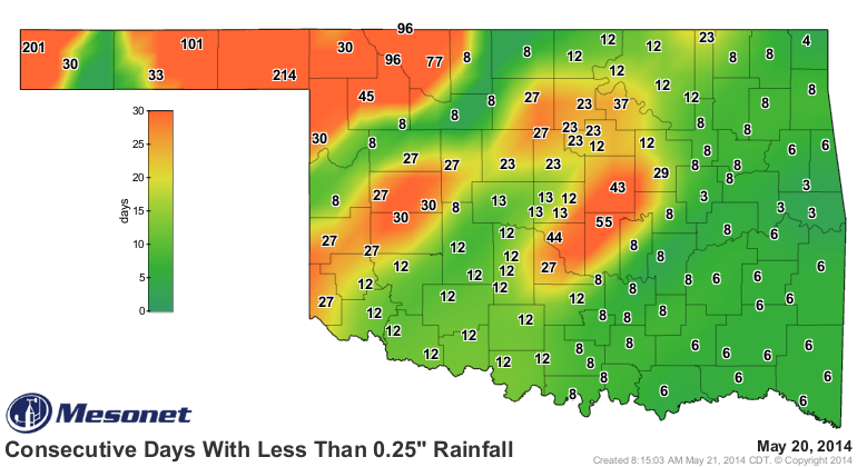
214 days since Slapout has had a quarter-inch of rain in a single day? By my
estimates, that's one more day that 213, so quite a lengthy period indeed.
Kenton is not much better at 201. Also notice some of our central OK stations
are up above the 40-50 range as well, with Shawnee up to 55 days.
The last 30 days, normally one of the wettest times of the year, have been
pitiful.
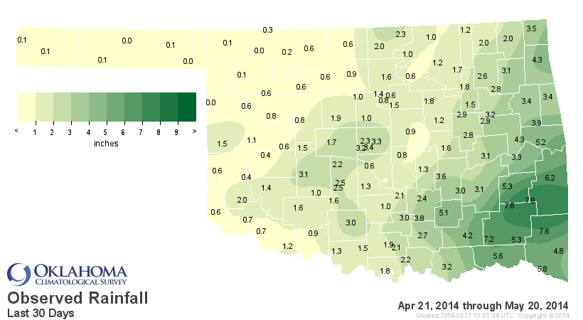
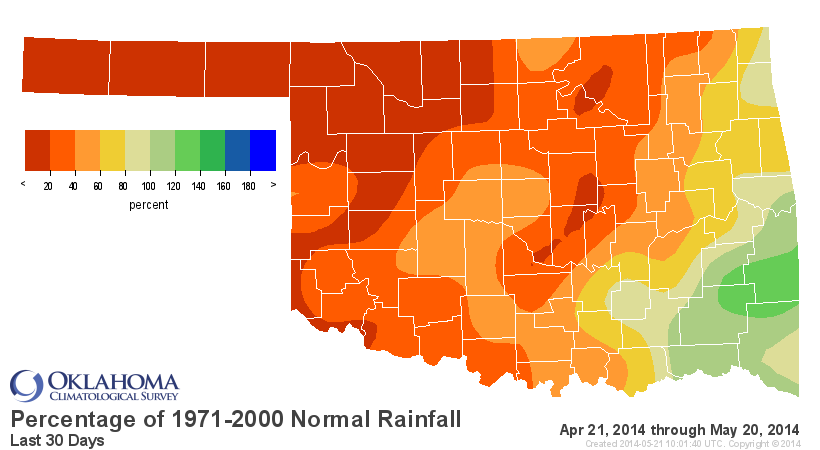
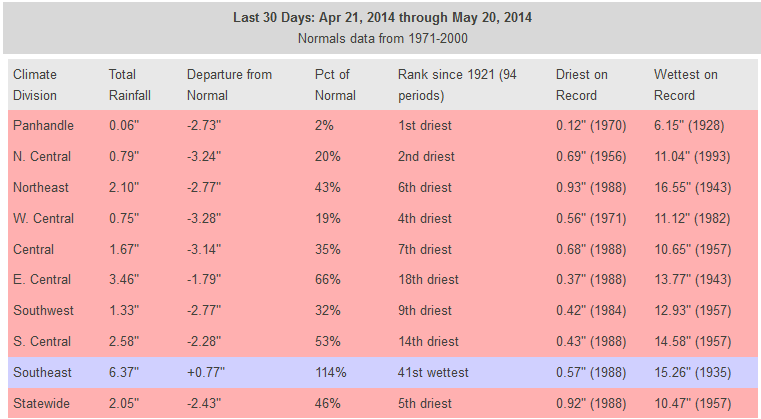
The Oklahoma Panhandle climate division has only had 0.06" of rain on average
over the last 30 days. That's 2% of normal! If you're gonna go that low, might
as well go with skim. N. Central OK is not much better with only 0.79", 3.24"
below normal and the 2nd driest such period since 1921. That's also why this
year's wheat crop went from pretty promising earlier this year to downright
pathetic. The year-to-date stats tell the rest of that story.

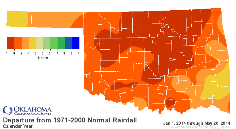
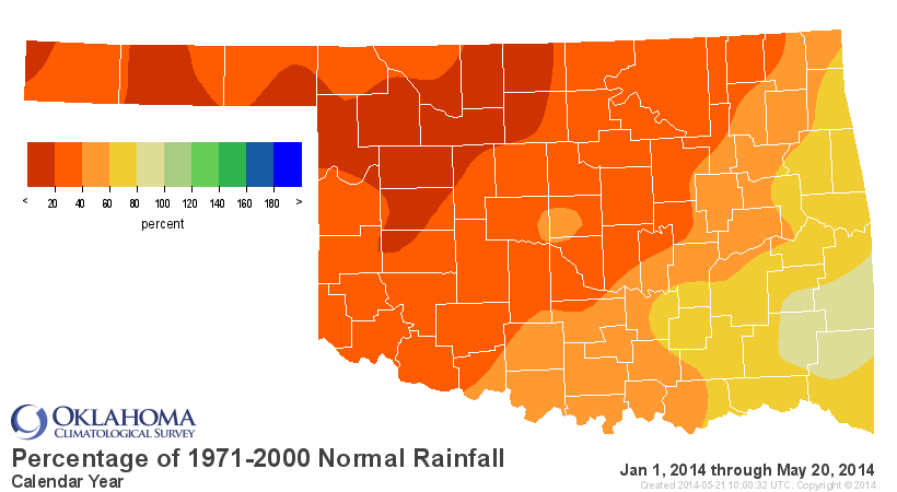
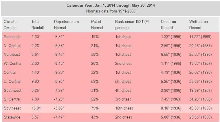
ZOUNDS! The Panhandle, NC, NE and C OK all at their driest Jan 1-May 20 periods
since 1921, and WC parts aren't much better off with their 2nd driest. That
adds up to the 2nd driest statewide average since 1921 at 5.57", nearly 7.5"
below normal.
LUCKILY, the wettest part of the year *NORMALLY* occurs in the next four weeks,
as you can see from the statewide average long-term rainfall graph from the
Oklahoma Mesonet (averaged over 1999-2013).
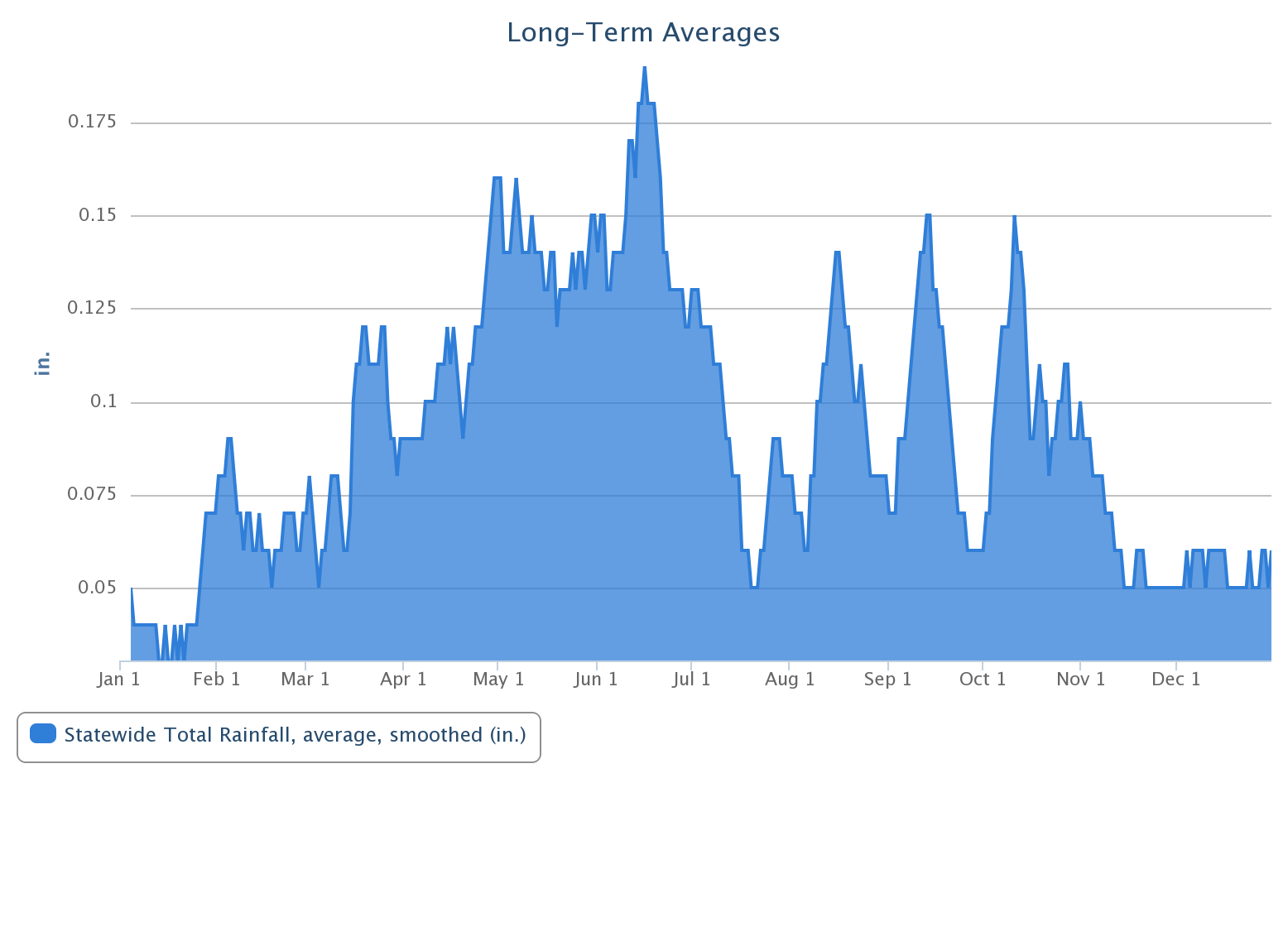
And this of course is what has happened thus far.

The Panhandle is sort of a different animal, tied in a bit more closely to the
summer monsoon season of the Desert Southwest. Their rainy period is basically
June-August.

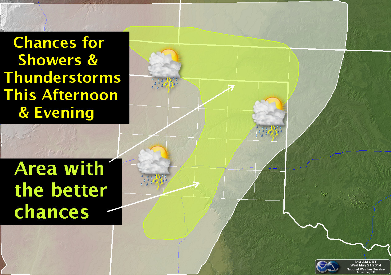
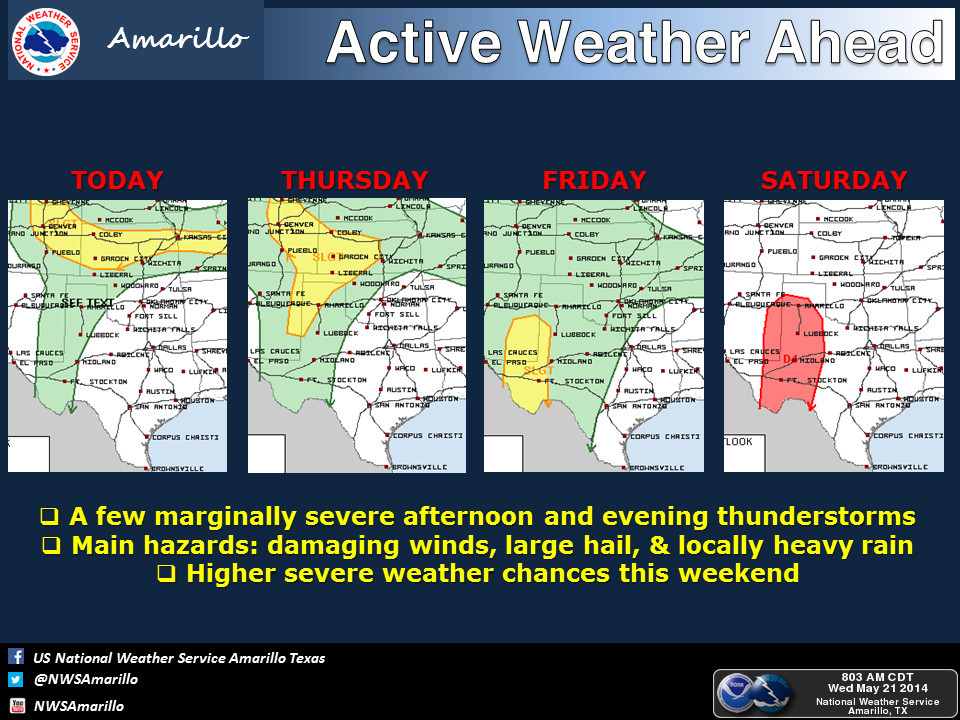
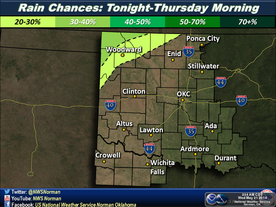
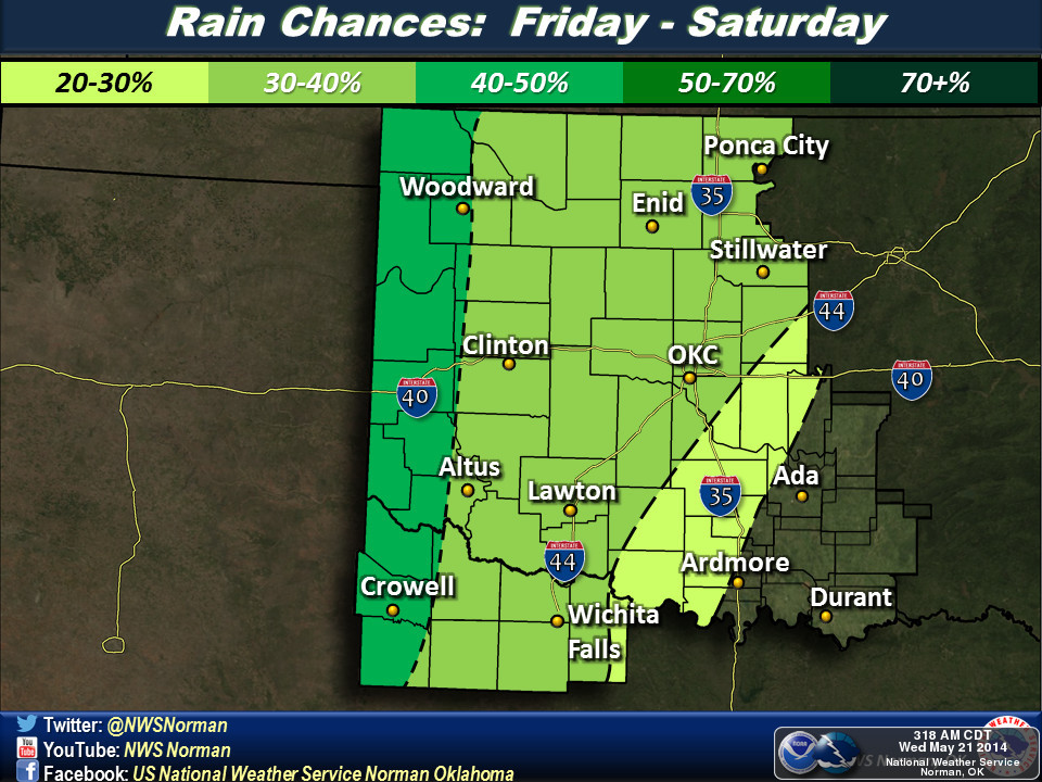
So there's still lots of hope to be found, both in the short- and long-term. We
just need for that cutoff low to start working its magic. Here's a look at the
timing and whatnot from the local NWS offices. Hopefully the show will kick
off tonight out west.

With so much sand out west now, should make for some lovely beach-going weather
next week.
Gary McManus
State Climatologist
Oklahoma Mesonet
Oklahoma Climatological Survey
(405) 325-2253
gmcmanus@mesonet.org
May 21 in Mesonet History
| Record | Value | Station | Year |
|---|---|---|---|
| Maximum Temperature | 102°F | GRA2 | 2005 |
| Minimum Temperature | 34°F | EVAX | 2022 |
| Maximum Rainfall | 4.46 inches | CENT | 2013 |
Mesonet records begin in 1994.
Search by Date
If you're a bit off, don't worry, because just like horseshoes, “almost” counts on the Ticker website!