Ticker for April 15, 2014
MESONET TICKER ... MESONET TICKER ... MESONET TICKER ... MESONET TICKER ...
April 15, 2014 April 15, 2014 April 15, 2014 April 15, 2014
The Damage is done
How much damage, and where? That remains to be seen. I'd be shocked if all the
wheat that has passed the jointing phase made it out unscathed. And that's not to
say it will be a total loss, but with numbers like these, it's gonna be a close
one.


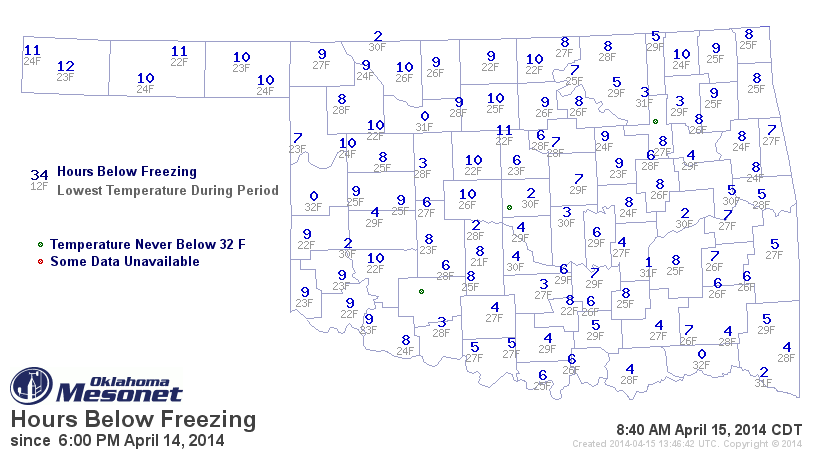
Those are not pretty maps, especially the below-28 version where you can see
Blackwell up in Kay County got down to 22 degrees for a low, but was also below
28 degrees for 7 hours. The Panhandle had similar numbers, as expected, but even
Altus as far down as the Red River boundary with Texas matched Blackwell's
numbers. The wheat down in the southwest, or what was left of it, was incredibly
drought stressed, so that is definitely not good news. In central Oklahoma,
Kingfisher and Marshall reached 22 degrees for a low and spent 8 hours at or
below 28 degrees. From the below-24 degrees map, you can see Kingfisher and
Hooker spent 4 hours below at or below 24 degrees.
For the sake of the Panhandle residents, who spent an extra day behind the cold
front, I produced the same maps except starting Saturday night. They're pretty
similar for down-state, as they call us out that way, but the hours below are
much more extensive. As many as 28 hours spent below freezing out in Cimarron
County, and 23 hours below 28 degrees.
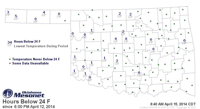
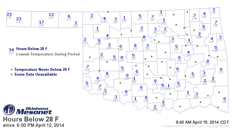
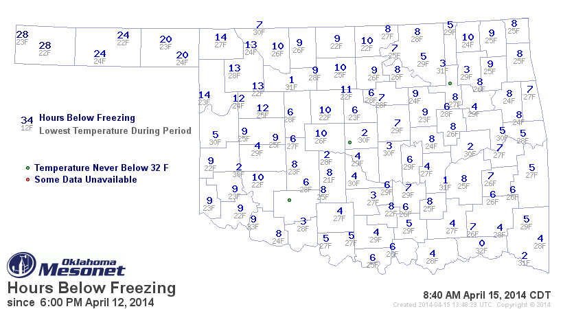
In a word ... yikes! As noted by several experts already, it will take days to
determine the true extent of any damage done by the freezing temperatures.
The good news is there is a rain that is going to occur quick on the heels of
this freeze event, with another storm system moving in on Thursday. Another
storm looks zoned in for Easter Sunday as well. Maybe a quarter- to half-inch
is forecast for western Oklahoma right now. Let's hope that multiplies between
now and then.
This cold is record-breaking, as you can see from the Mesonet minimum temperature
map vs. the all-time record lows from the historical COOP network.
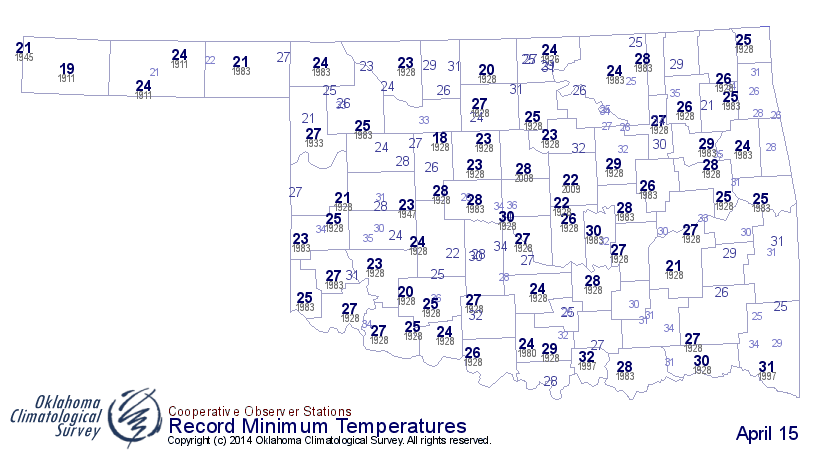
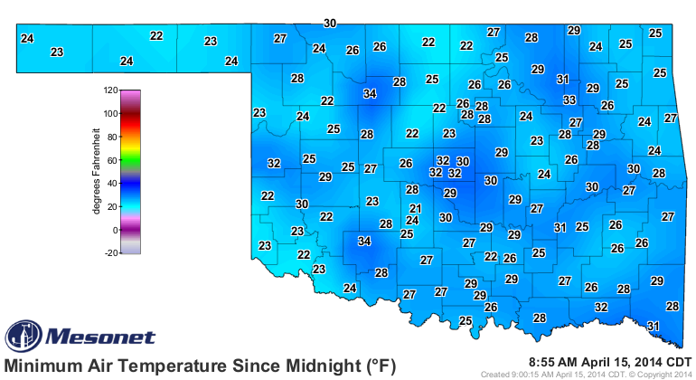
Oklahoma City broke its historical record low for today with a minimum temp of
27, besting the old record of 30 degrees set way back on this date in 1928. No
doubt many other locales across the state will report record-breaking lows
as their data is released.
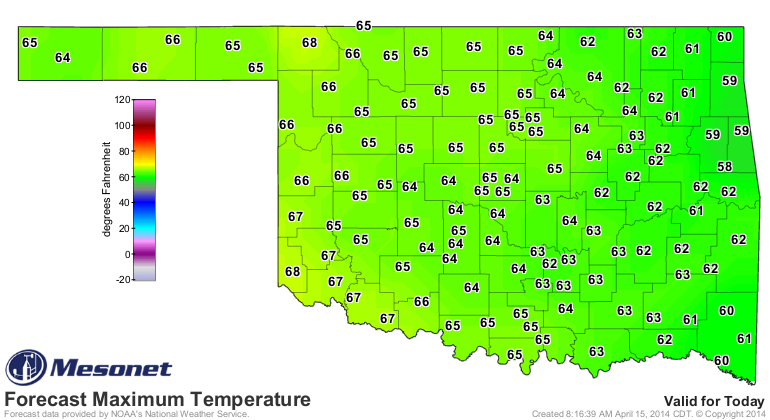
Looks like we can enjoy a nice warm-up today, and some more reasonable-yet-not-
seasonable lows tomorrow morning. Looks like there could be another freeze in
the northwest Friday morning, however, but nothing like last night.
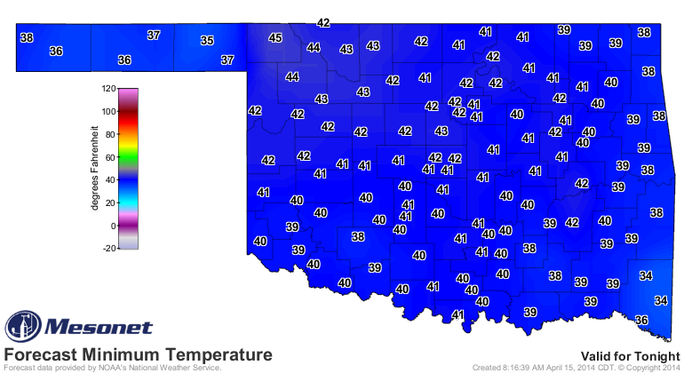
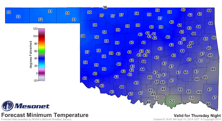
As we've said before, a freeze this late is not uncommon, but it's well past
the average date of last freeze (based on the 1981-2010 data) for much of
southern Oklahoma. And that means at or below 32 degrees. The 22-degree readings
might be pushing the envelope just a bit. And we're still at least in the range
of the latest last freeze (again, 1981-2010 data) for most of the state. That
date gets into late May for the Panhandle.
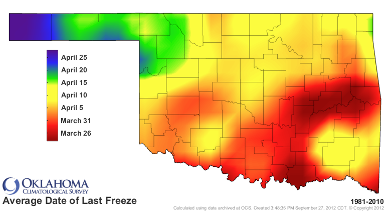
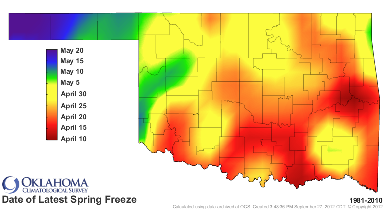
We've had enough, right? Time to switch from those maps to these maps!
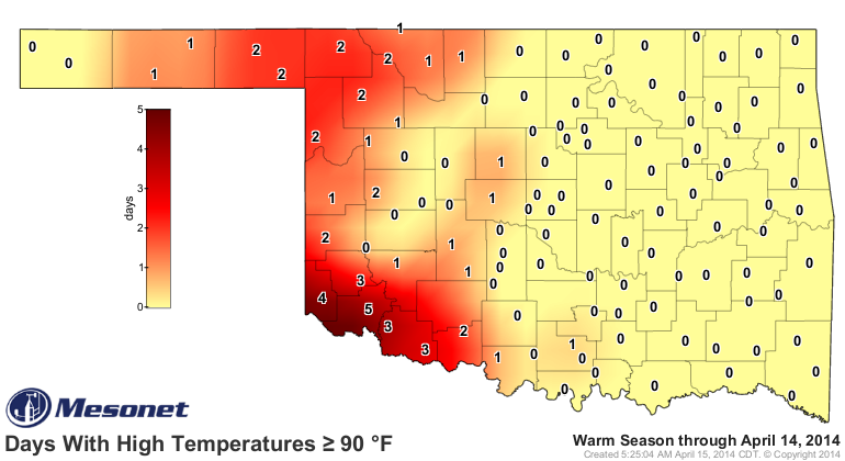
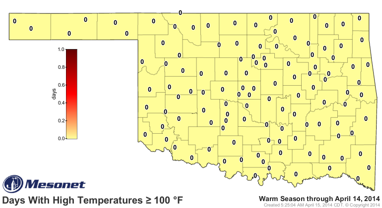
Cold weather crazies ... start complaining now! It makes my heart feel good.
Gary McManus
State Climatologist
Oklahoma Climatological Survey
Oklahoma Mesonet
(405) 325-2253
gmcmanus@mesonet.org
April 15 in Mesonet History
| Record | Value | Station | Year |
|---|---|---|---|
| Maximum Temperature | 102°F | GRA2 | 2006 |
| Minimum Temperature | 19°F | KENT | 2020 |
| Maximum Rainfall | 3.01″ | BOIS | 2016 |
Mesonet records begin in 1994.
Search by Date
If you're a bit off, don't worry, because just like horseshoes, “almost” counts on the Ticker website!