Ticker for April 10, 2014
MESONET TICKER ... MESONET TICKER ... MESONET TICKER ... MESONET TICKER ...
April 10, 2014 April 10, 2014 April 10, 2014 April 10, 2014
Another week, another surge of drought
Before we get started, let me caution you again on the forecast for El Nino to
form this summer.
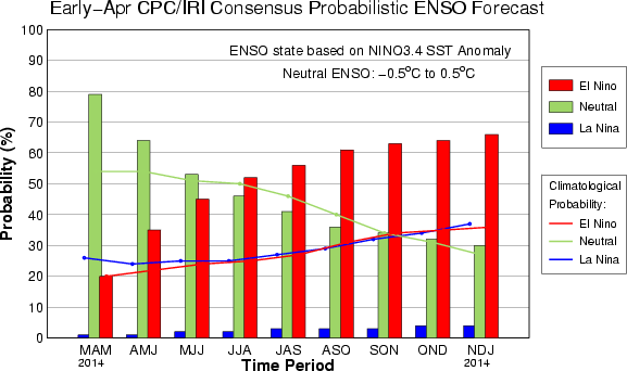
While it is looking more and more likely as we go through spring, a developing/
maturing El Nino normally does not impact our area during the warm season, so
any hope of help before later into the fall is probably misplaced. When we start
to get into October, then we might start to see some impact ( in the form of
increased rainfall that could last through to early spring with a bit of
momentum). So hopes for help this summer, or even as early as this spring, are a
bit premature. El Nino's impacts for Oklahoma in the form of wetter and cooler
than normal weather are definitely a cool season phenomenon.
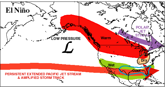
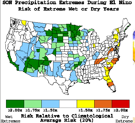
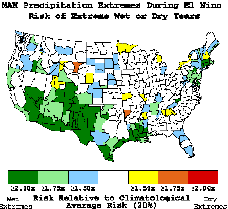
Check out this figure showing you the normal impacts across North America, then
the statistical precipitation impacts.
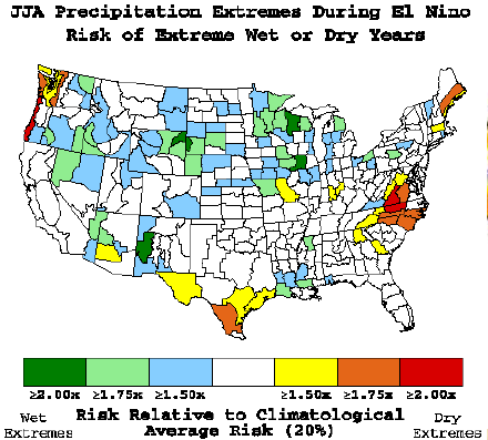
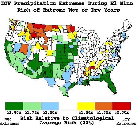
Hey, let's hope we don't need help next cool season!
-------------------------------------------------------------------------------
Drought made significant strides across western and northern Oklahoma once again,
even while taking a step back across southeastern Oklahoma. We did ask for
the increase across the west and north thanks to wimpy returns on the last few
storm systems in addition to many more days with low relative humidity, strong
winds and even some summertime heat at times.
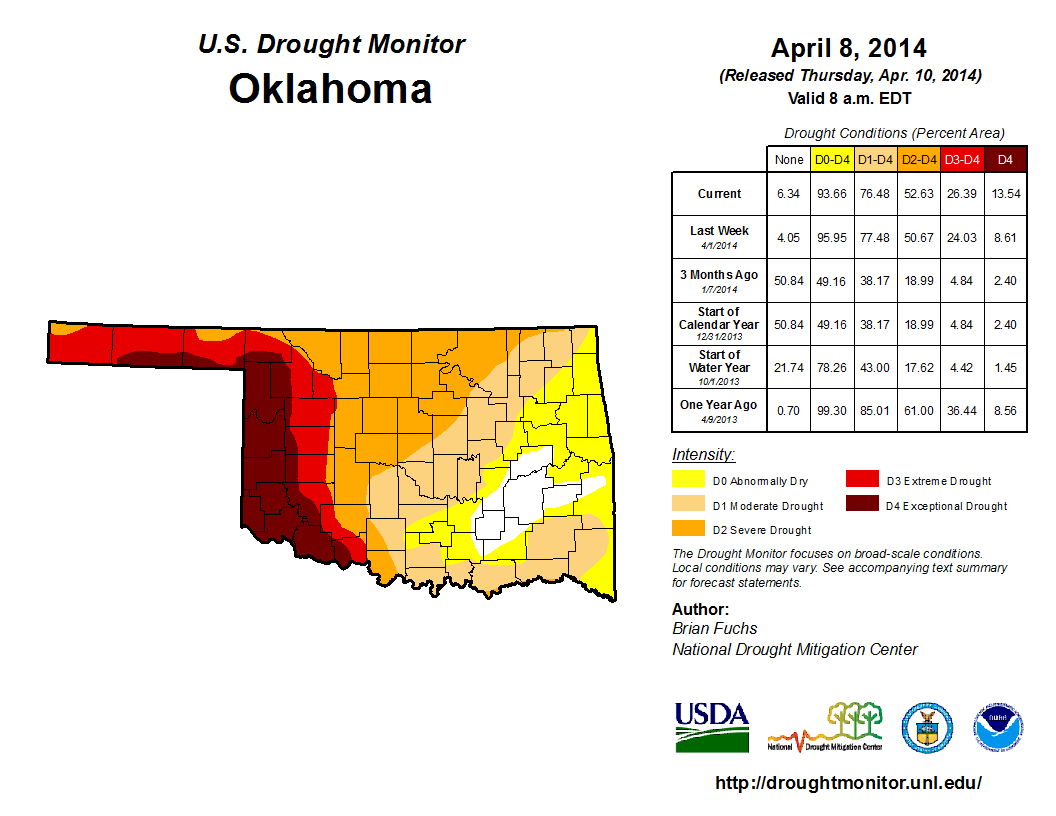
With Exceptional (D4) drought now pushing north into southern Harper County
and then to the west along the southern quarter of Beaver and Texas counties,
that category jumped from 8.6% to 13.5% since last week, and from 2.4% three
months ago. The amount in at least Extreme (D3) drought rose to 26.4% from 24%
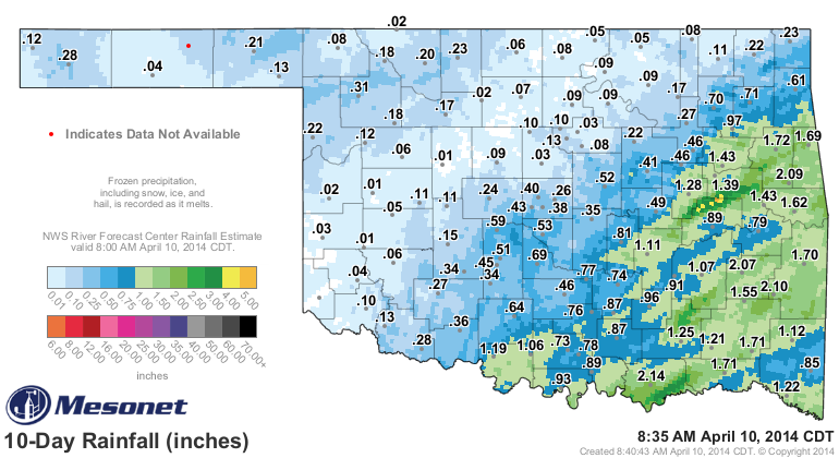
last week, and from 4.8% three months ago. The reduction in southeastern OK
was due to the relatively generous rainfall amounts over the last 7-10 days.
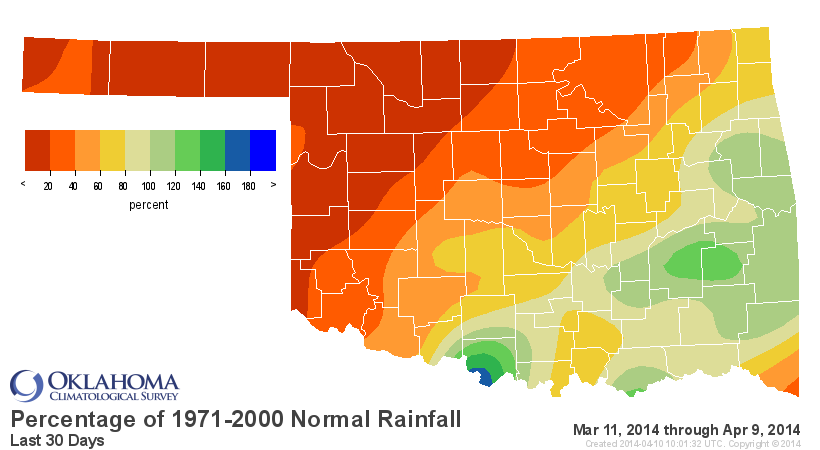
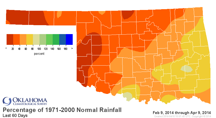
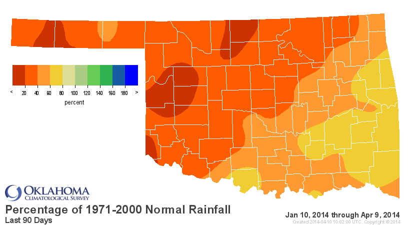
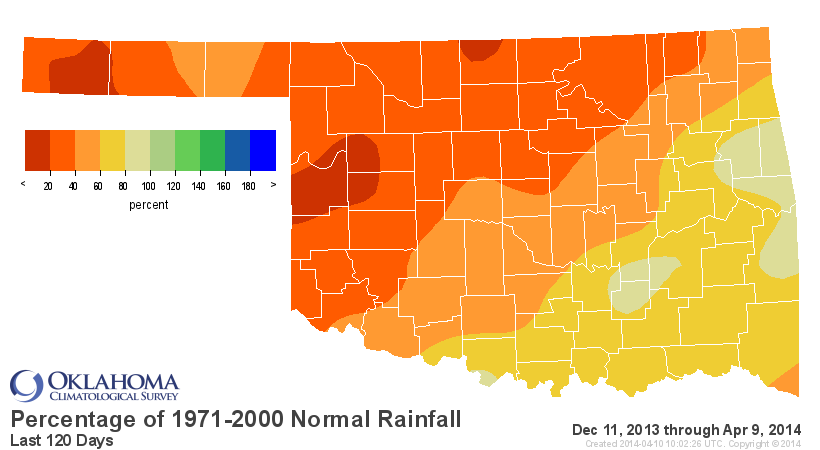
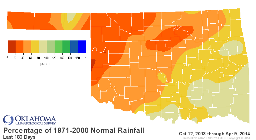
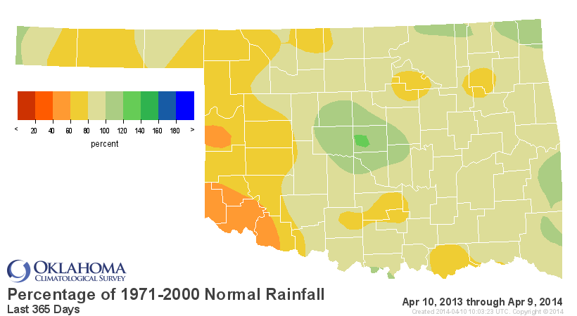
You go back farther than that, however, and things are dry across the entire
state, but particularly up in the northwestern two-thirds of the state. Here
are the percent of normal maps for the various time frames out to a year. When
you go back 365 days, you capture all of that rain from mid-February through
mid-August of last year. But even at that time frame when other parts of the
state are from 80-100% of normal, the far west is from 40-80% of normal. That
green bullseye right across central Oklahoma helps represent the second wettest
year on record for OKC.
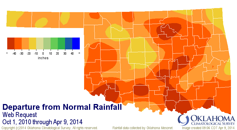
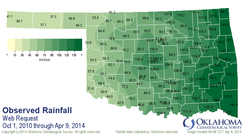
As an added bonus, here's a look all the way back to the beginning of this
drought, at least for the western half of Oklahoma, on Oct. 1, 2010 through
yesterday.
Oct. 1, 2010-Apr. 9, 2014 Mesonet Rainfall Maps
And the statistics table from that same period
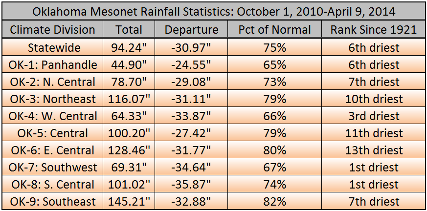
At least on a Climate Division basis (here's the map of the Oklahoma Climate
Divisions)
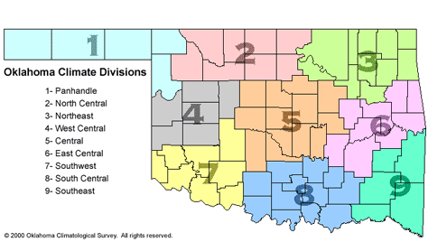
each area of the state is at least 24" down (the Panhandle) for the year, but
as much as 36" inches across south central Oklahoma. Percent of normal figures
show that the 24" deficit in the Panhandle is actually worse than the 35"
deficit in the south central region, about 65% to 74%. But you can see there
that the Panhandle, west central and southwestern Oklahoma are all down in the
65-67% of normal range, and indeed the drought has remained the most significant
in those areas. And this map doesn't help matters for more recent drought
impacts.
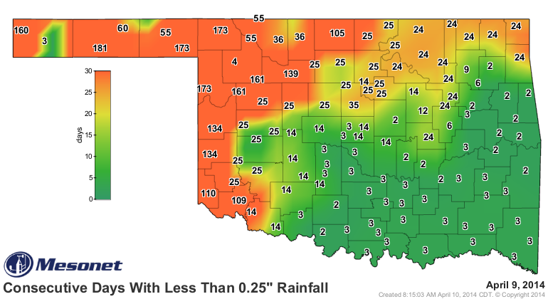
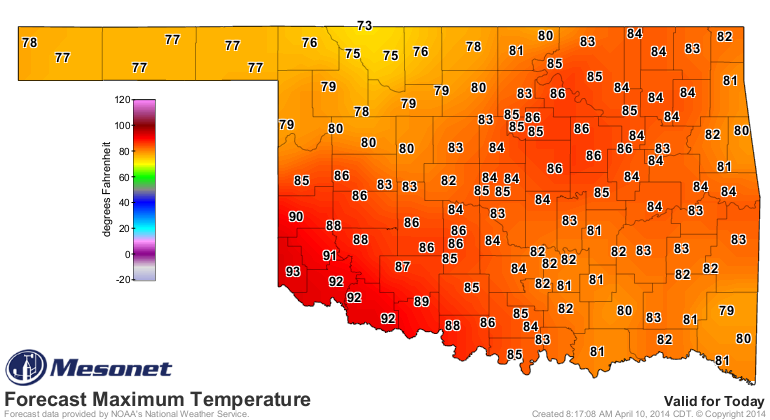
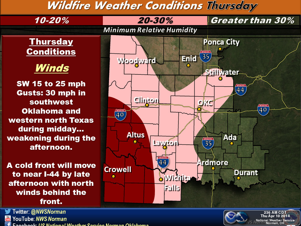
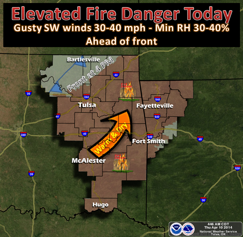
Prospects for the future? Well, even currently, these types of conditions
accelerate the drought even more rapidly. The hottest day of the year so far
yesterday with several locations reaching as high as 91 degrees to go along
with low relative humidty.

Strong winds, gusting to over 40 mph.
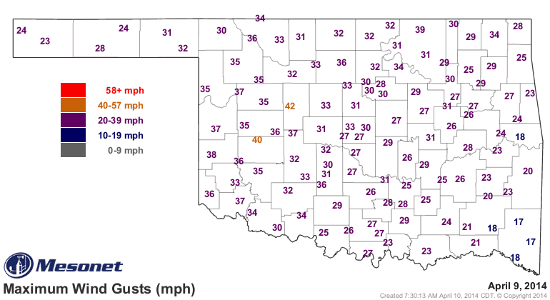
And more of the same for today, unfortunately.
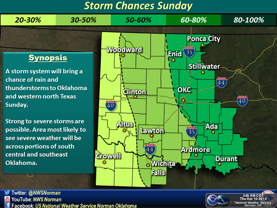
The prospects for precipitation go up this weekend, but for far western Oklahoma,
I'm afraid they're going to be gasping for breath through dusty air once again
when all is said and done.
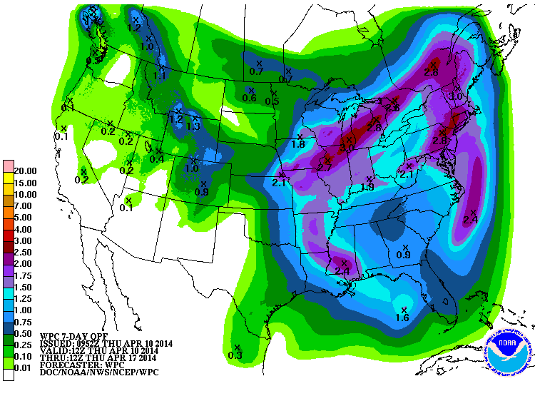
Even farther out, I see no drought-quenching rains just yet.
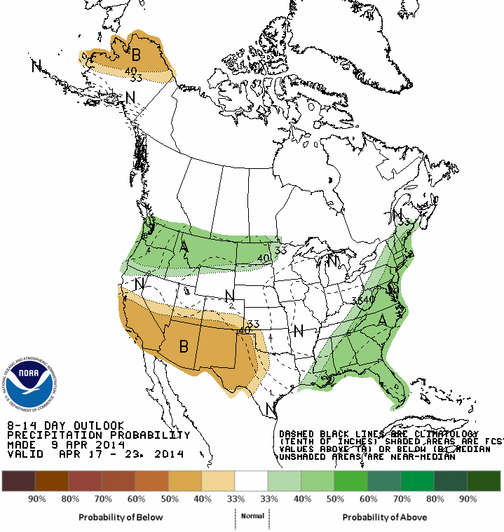
It's spring, though, and that can change in a hurry. Each new forecast run
has the hope of more rainfall.
Hopefully.
Gary McManus
State Climatologist
Oklahoma Climatological Survey
(405) 325-2253
gmcmanus@mesonet.org
April 10 in Mesonet History
| Record | Value | Station | Year |
|---|---|---|---|
| Maximum Temperature | 94°F | HOLL | 2019 |
| Minimum Temperature | 14°F | BOIS | 2013 |
| Maximum Rainfall | 3.83″ | COPA | 1994 |
Mesonet records begin in 1994.
Search by Date
If you're a bit off, don't worry, because just like horseshoes, “almost” counts on the Ticker website!