Ticker for April 8, 2014
MESONET TICKER ... MESONET TICKER ... MESONET TICKER ... MESONET TICKER ...
April 8, 2014 April 8, 2014 April 8, 2014 April 8, 2014
Whither tornadoes?
The folks at the Norman NWS office sent us pretty interesting today concerning
the dearth of severe weather we've seen since last year, tornadoes in particular.
I'll just shamelessly cut and paste what they sent me. Lazy? I prefer
"practical." Keep in mind this info is strictly for the NWS Norman forecast
office, so it does not hold true for the entire state (I've adjusted the dates
to account for today as well).
- The last tornado warning we issued was at 810pm on Friday, May 31, 2013. It
expired at 900pm.
- If we get through today, April 8th, this will be day 312 without a tornado
warning
- The previous longest streak was 293 days - June 1, 1990 to March 20, 1991
We talked about this previously, and since then, there still hasn't been a tornado
touch down (at least a reported tornado) in the state since August 7, 2013. If we
count today, that brings the consecutive day total to 244 days. That still ranks
as the third longest period on record, at least dating back to 1950 when accurate
statistics began, but we're quickly closing in on #2 (248 days from 7/16/1990-
3/20/1991). This info also comes from the NWS Norman office, but this data is
for the entire state.
-***-
Top-10 Consecutive Day Streaks in Oklahoma Without A Reported Tornado
Rank Days Period
1. 292 05/17/2003 - 03/03/2004
2. 248 07/16/1990 - 03/20/1991
3. 244 08/08/2013 - 04/08/2014
4. 234 07/04/1976 - 02/22/1977
5. 220 08/24/1977 - 03/31/1978
6. 200 08/08/1955 - 02/23/1956
7. 193 09/06/1978 - 03/17/1979
8. 189 10/11/1969 - 04/17/1970
9. 188 09/27/1967 - 04/01/1968
10.(t) 187 08/16/1952 - 02/18/1953
08/29/1962 - 03/03/1963
09/22/2006 - 03/27/2007
-****-
If we can make it to Sunday, the current streak will move into second place.
Right now (AHEM!), that appears to be a decent bet. There will be a chance for
some storms this weekend, apparently, but I can't see too many forecasters
gearing up for any bigtime severe weather event. BUT, it is April and so things
can sometimes pop up (or pop down, in this case) unexpectedly. Here's a bit
of info from our friends across the hall at the Norman NWS office.
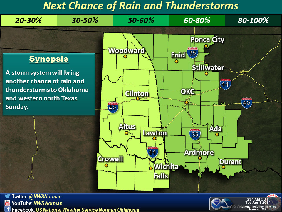
"MANY HAVE ASKED ABOUT SEVERE WEATHER CHANCES. THE ANSWER...
IT IS STILL TOO FAR OUT TO MAKE ANY CONFIDENT
DECISION OF ANY VALUE WRT SEVERE WEATHER. WITH DIFFERING
SOLUTIONS... AN EXACT ANSWER IS NON-EXISTENT. AS WITH EVERY
FORECAST... CONTINUE TO CHECK BACK AS WE GET CLOSER TO THE WEEKEND
FOR UPDATES AS GUIDANCE IMPROVES AND CONFIDENCE INCREASES. WHAT YOU
CAN DO NOW IS BE PREPARED... NOT JUST FOR THE WEEKEND... BUT ALWAYS."
And from our friends across the, uhhhhh, state, up in the Tulsa NWS office.
They're screaming it just like Norman, so they must be serious.
"THE CHANCES OF SHOWERS AND THUNDERSTORMS RETURN SATURDAY NIGHT AND
CONTINUE ON SUNDAY AS A COLD FRONT MOVES THROUGH THE REGION SUNDAY
INTO SUNDAY NIGHT. THERE ARE EARLY INDICATIONS THAT THE STORMS ON
SUNDAY COULD BE STRONG TO SEVERE. THE SHOWERS WILL END ON MONDAY
AS THE STORM SYSTEM DEPARTS TO THE EAST."
With that possible threat of storms comes rain, which is needed more and more
each day as the sun climbs higher into the sky along with water stress.
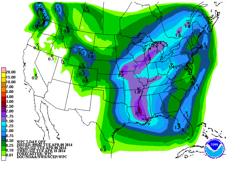
More important also because the state needs the moisture to start greening up
so we can start to reduce some of this fire danger we see every few days (for
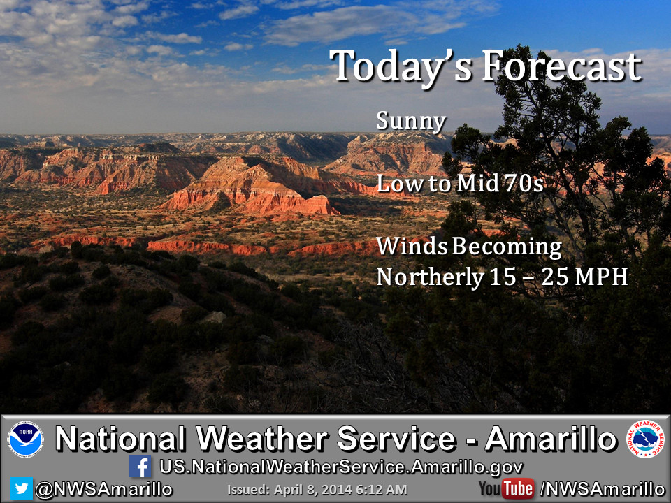
days at a time as well). The Amarillo NWS office, which has gotten accustomed
to high fire danger these days, is apparently so happy to have a day without
blowing dust they're going with a nice "Little House on the Mesas" theme
today.
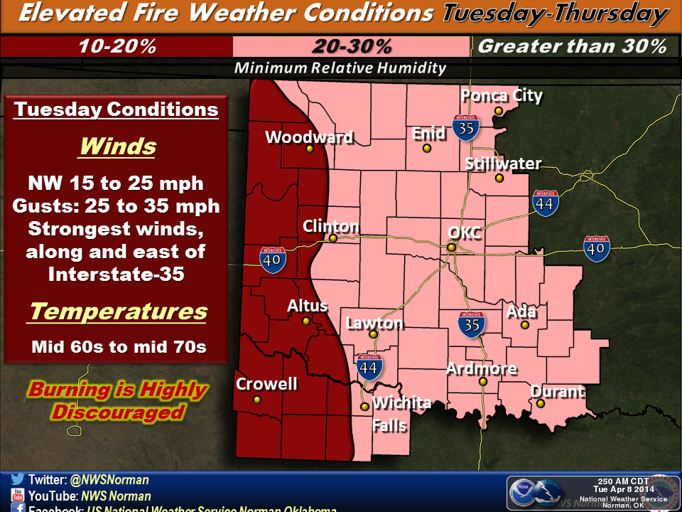
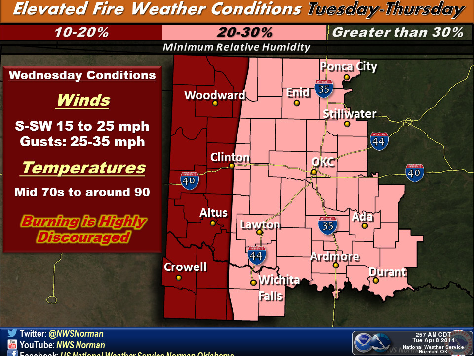
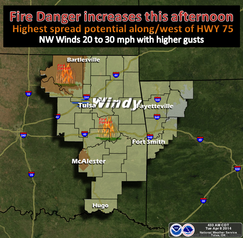
Nevertheless, much of the Oklahoma Panhandle is under a Fire Weather Watch
for today. Plus, I'll bet they get blowing dust anyway.
By the way, if we want to beat that top tornado-less streak of 292 days, we'll
have to make it until May 27th.
Make it so.
Gary McManus
State Climatologist
Oklahoma Climatological Survey
(405) 325-2253
gmcmanus@mesonet.org
April 8 in Mesonet History
| Record | Value | Station | Year |
|---|---|---|---|
| Maximum Temperature | 96°F | MANG | 2020 |
| Minimum Temperature | 17°F | JAYX | 2007 |
| Maximum Rainfall | 3.22″ | BIXB | 2008 |
Mesonet records begin in 1994.
Search by Date
If you're a bit off, don't worry, because just like horseshoes, “almost” counts on the Ticker website!