Ticker for April 7, 2014
MESONET TICKER ... MESONET TICKER ... MESONET TICKER ... MESONET TICKER ...
April 7, 2014 April 7, 2014 April 7, 2014 April 7, 2014
Weird, quasi-spherical liquid objects falling from the sky
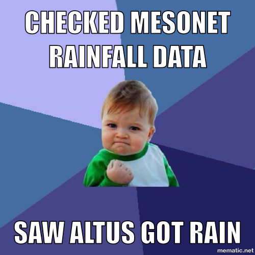
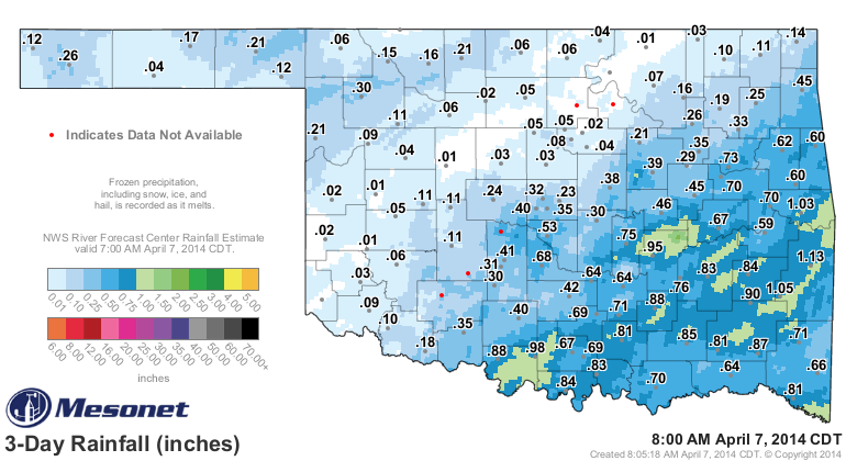
The rain was about what was expected over parts of the state this weekend (Altus'
0.09 inches should keep them for awhile. That's almost a year's worth of rain
in those parts these days. The southeastern quarter got the bulk of the good
stuff with more than an inch in localized areas, maybe a bit more. The
northwestern half was largely left out in the cold (dry), however.
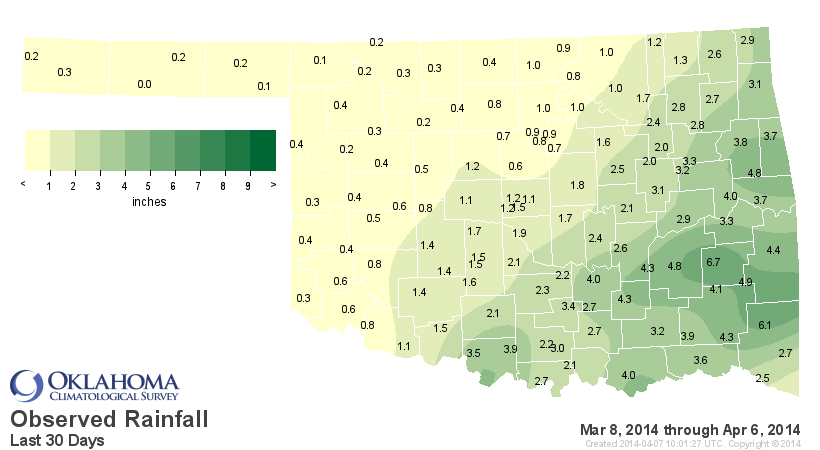
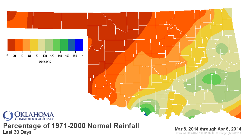
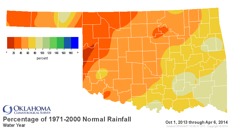
That gives the southeastern quarter a pretty good dose of moisture over the
last 30 days or so, certainly the only part of the state above normal and in
very stark contrast to whats going on for the rest of the state.
So this weekend's rainfall may have dropped Woodward down to "1" day without at
least a quarter-inch of rainfall on any single day, but for the rest of far
western Oklahoma east over into north central Oklahoma, it's a different story.
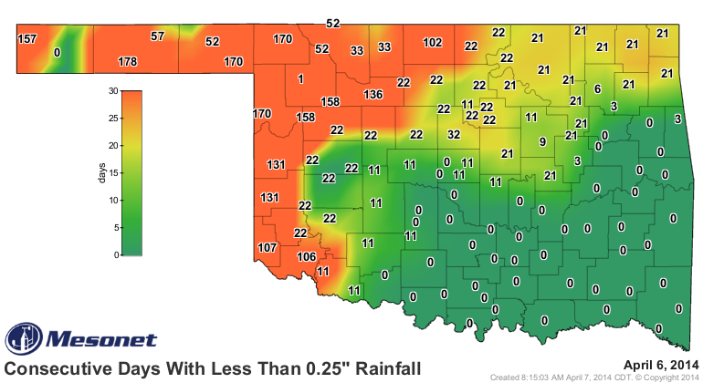
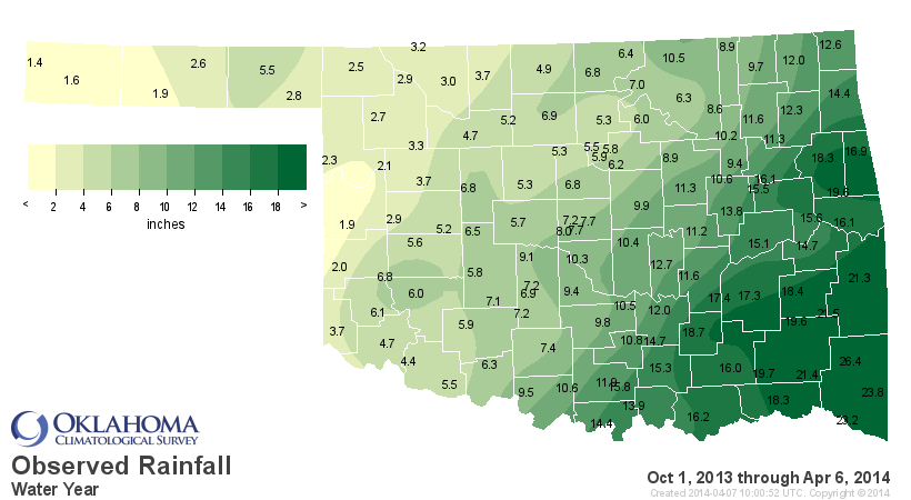
Altus' 0.09 inches brings them up to 4.7 inches since Oct. 1, 2013, but even
that is looked upon by folks to the north and west with envy.
Water Year (Oct. 1, 2013-Present) Maps
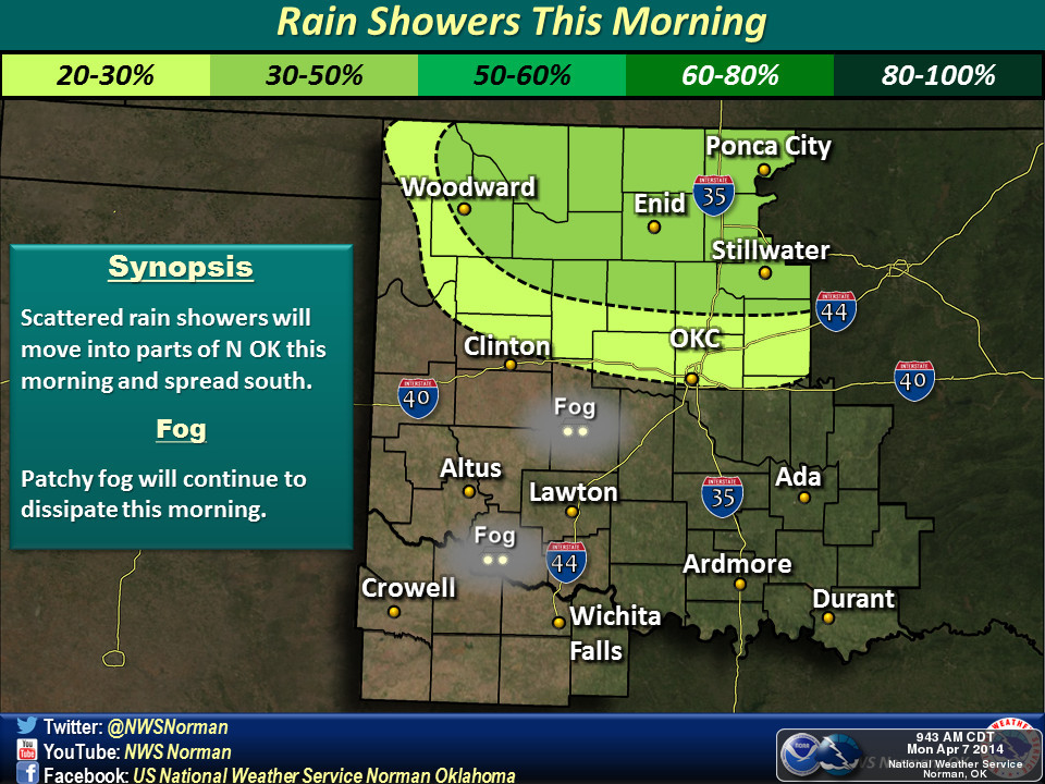
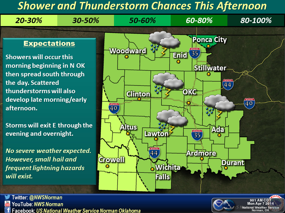
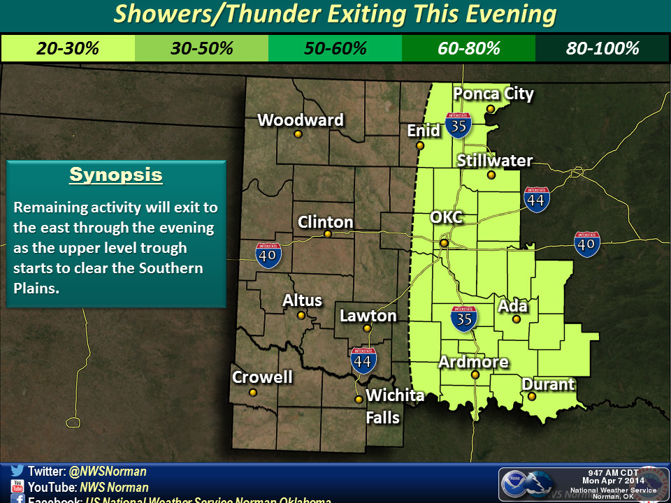
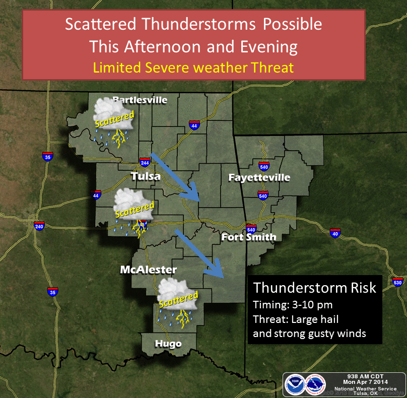
Now it is raining now up in the northwest, and we do see chances for LIGHT
rain through much of the day ... hit and miss showers, really, that shouldn't
amount to much.
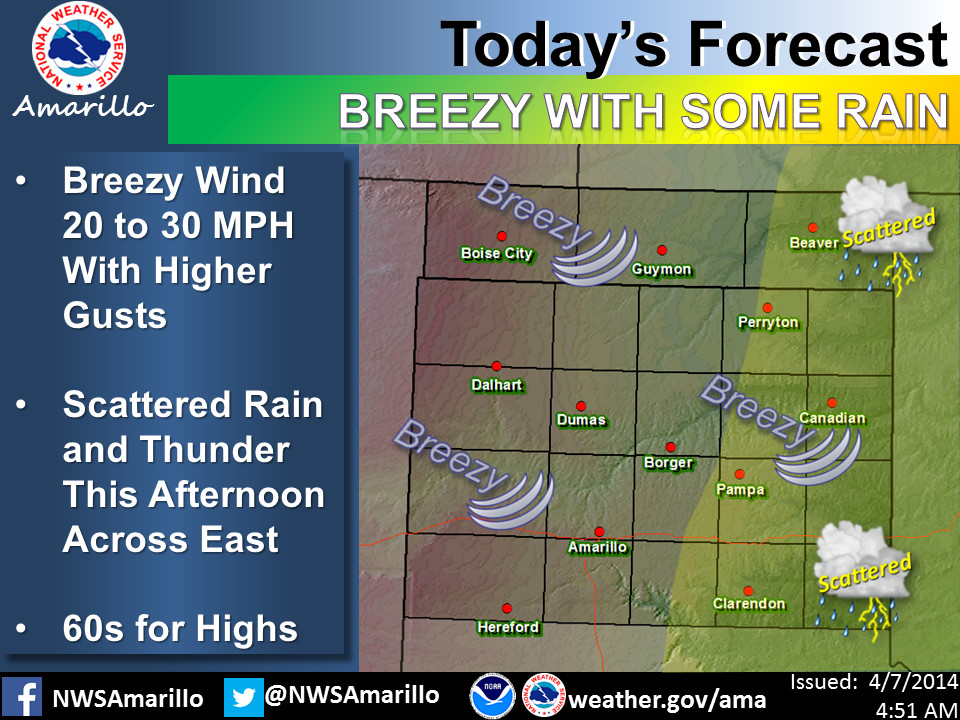
After that, it's right back into a warming trend and also increased fire danger
(as our NWS friends remind us).
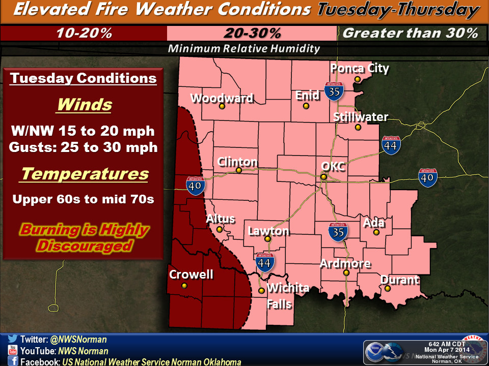
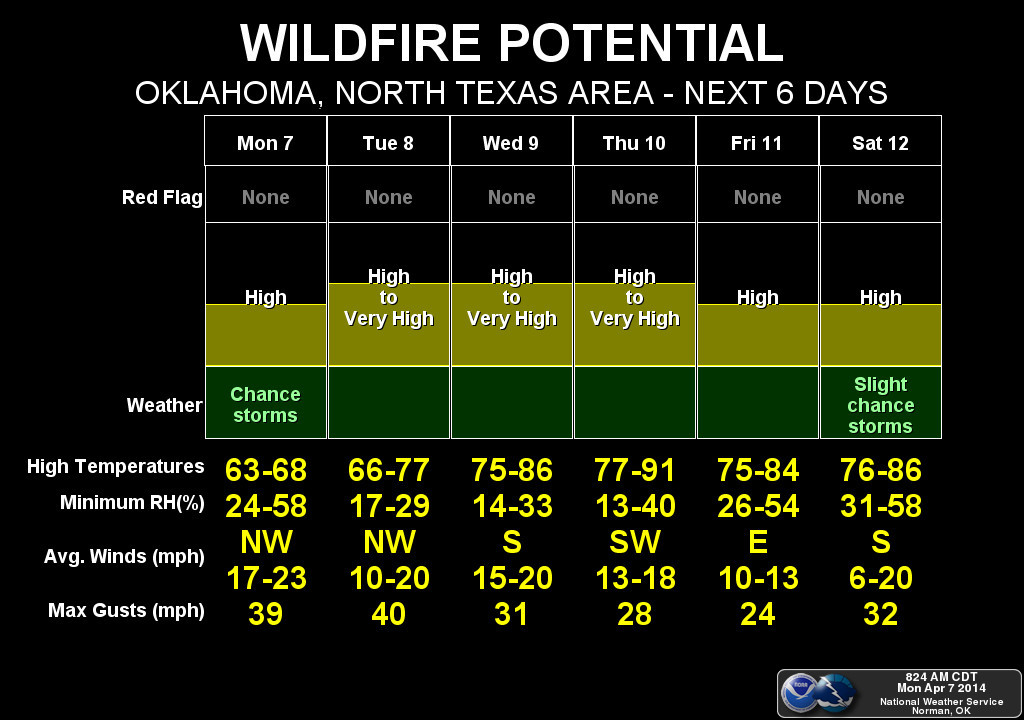
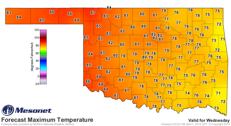
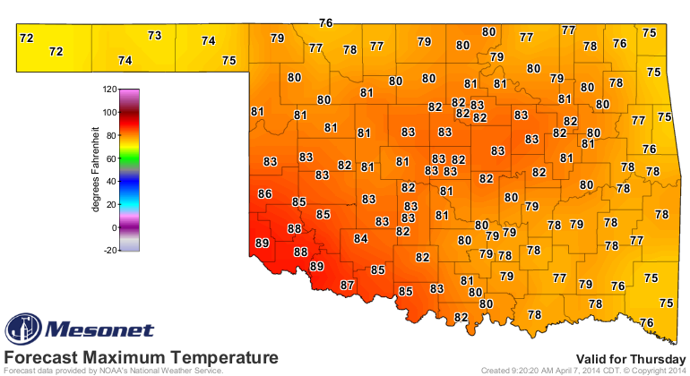
So watch for a nice warm up this week. Thursday will be the warmest day of
the next week, it appears, although Wednesday should be right there with it.
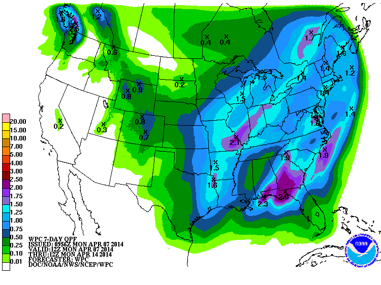
Our next chance for rain looks like it might show up next weekend. That's a
long way out still, but you can see some decent rains starting to paint the
7-day rainfall forecast map from WPC.
Three guesses where the highest amounts are forecast!
Gary McManus
State Climatologist
Oklahoma Climatological Survey
(405) 325-2253
gmcmanus@mesonet.org
April 7 in Mesonet History
| Record | Value | Station | Year |
|---|---|---|---|
| Maximum Temperature | 96°F | HOLL | 2015 |
| Minimum Temperature | 16°F | CAMA | 2009 |
| Maximum Rainfall | 6.03″ | ANTL | 2002 |
Mesonet records begin in 1994.
Search by Date
If you're a bit off, don't worry, because just like horseshoes, “almost” counts on the Ticker website!