Ticker for April 3, 2014
MESONET TICKER ... MESONET TICKER ... MESONET TICKER ... MESONET TICKER ...
April 3, 2014 April 3, 2014 April 3, 2014 April 3, 2014
STEEEERIIIIIIKE ONE! Drought approves.
Our hearts go out to the Oklahoma tornado victims from last night.

Those deliciously fried treats can really burn the roof of your mouth as their
lava-like filling oozes out with every bite. (I'm from Moore, I can do tornado
jokes). But, yesterday's severe weather outbreak not only failed to materialize,
yesterday's any-type-of-weather outbreak was a miserable failure (note: that is
the reason yesterday's Ticker, the NWS, etc., kept using the words "IF storms
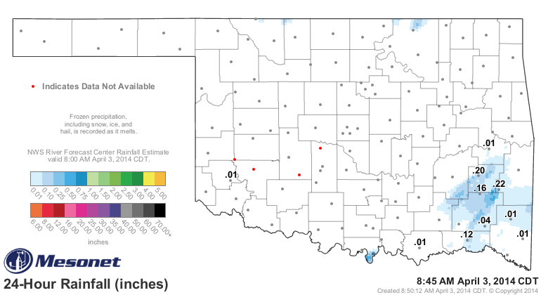
break out"). Here's the rainfall map for yesterday. Congrats to Talihina for their
0.22-inch deluge.
More importantly, here are the rainfall maps for the year-to-date period. I could
go further back, but why cause that much depression?
Jan. 1-Apr. 3 Mesonet Rainfall
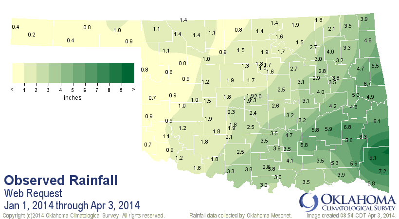
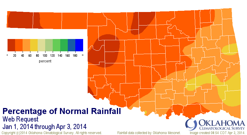
Wow, congrats to Boise City for their 0.2 inches this year. Don't spend that
all in one place, folks! However, you can plainly see that there is something
of a SW-NE rainfall gradient. We thought that it was a bit odd that the
gradient was oriented that way but the Drought Monitor was oriented more S-N
than anything, then the reports of dry conditions started rolling in from
northern Oklahoma ... shrinking farm ponds, stressed wheat, fires, and a lack
of green-up that can no longer be blamed on temperatures. Therefore, we asked
for a bit of a correction/downgrade to the Drought Monitor depiction this week
that more closely matches the precip deficit maps. Do you think that one deficit
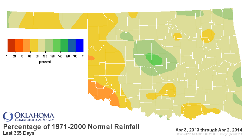
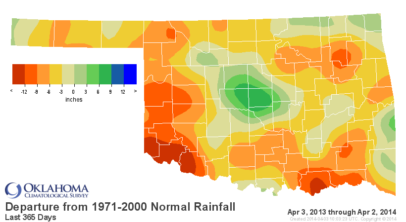
map doesn't tell the story? Okay, here are some others.
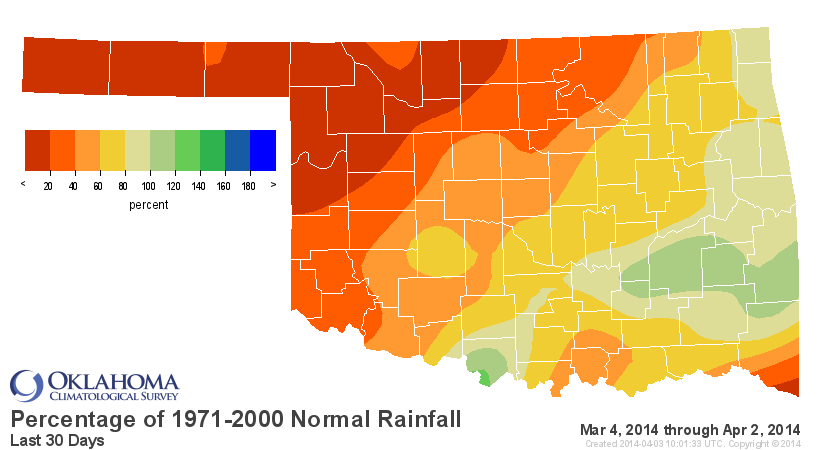
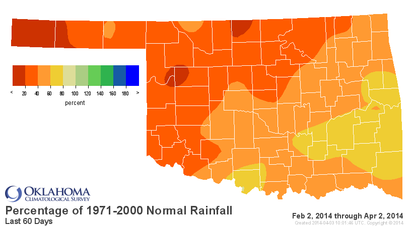
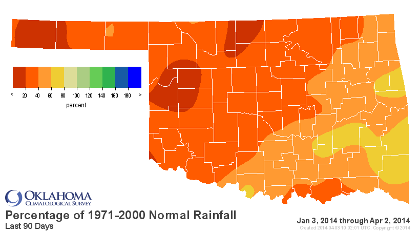
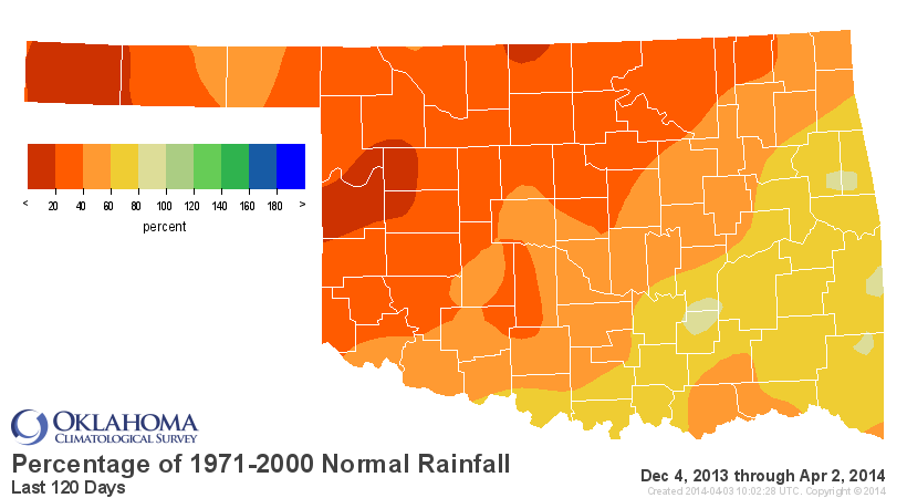
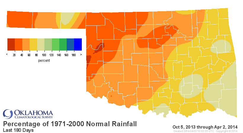
And the last 365-day map shows you why that extreme (D3)-Exceptional (D4) drought
is still so entrenched across far W OK and the Panhandle.
At any rate, this is the U.S. Drought Monitor map for this week.
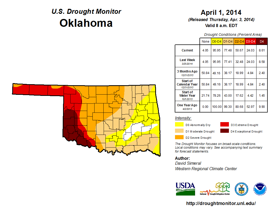
Everything is the same as last week except that quite a lot of moderate (D1)
drought across north central Oklahoma down into central Oklahoma was downgraded
to severe (D2) drought ... from 8.5% of the state overall to 26.6%. So the
amount of the state in AT LEAST severe drought went 32.5% to 50.7%.
We just came off of our 6th driest January-March on record at nearly 4 inches
below normal statewide with a statewide average of 1.78 inches. We've had more
than three months now of on-and-off again high-to-extreme wildfire conditions.
All of that wind and dry air, in combination with the lack of rainfall, has
once again caused us to spiral downwards into more significant drought. This
last storm was a dud, at least yesterday. There are still chances for storms
and the associated precip today, but mostly across eastern Oklahoma. The rest of
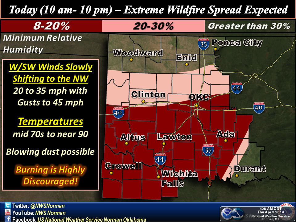
us shall not see a Festivus, but instead lots of wind, low humidity, and heat,
and therefore extreme fire danger and then a cold front.
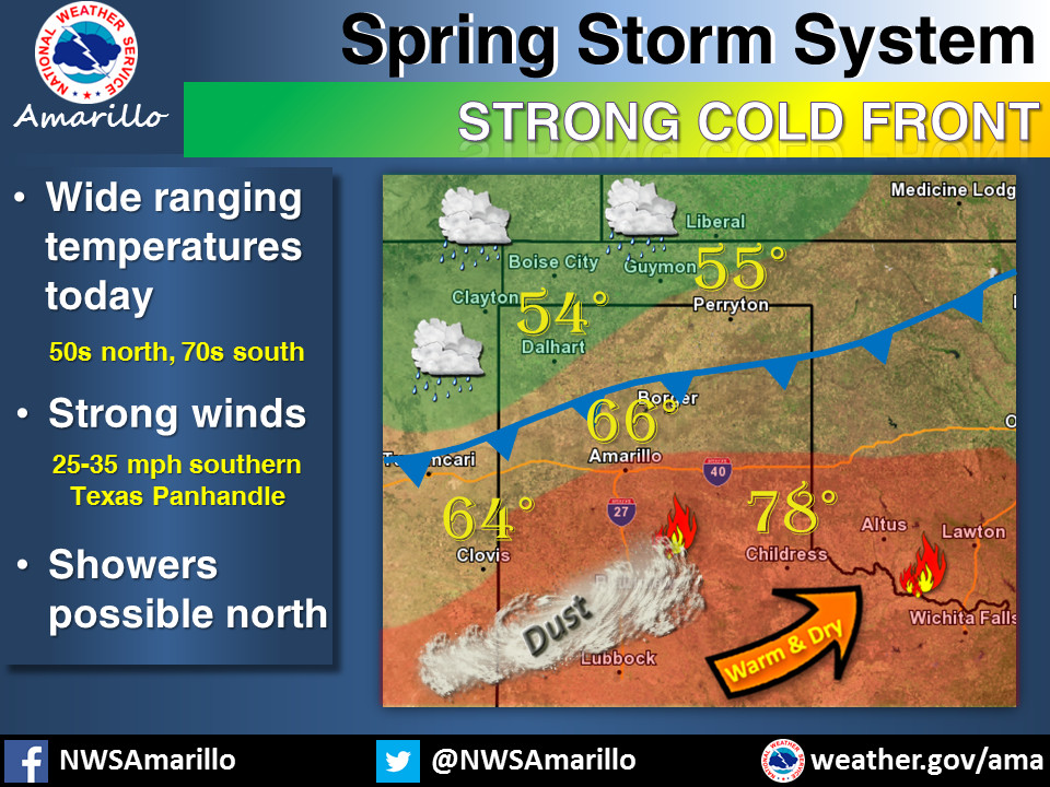
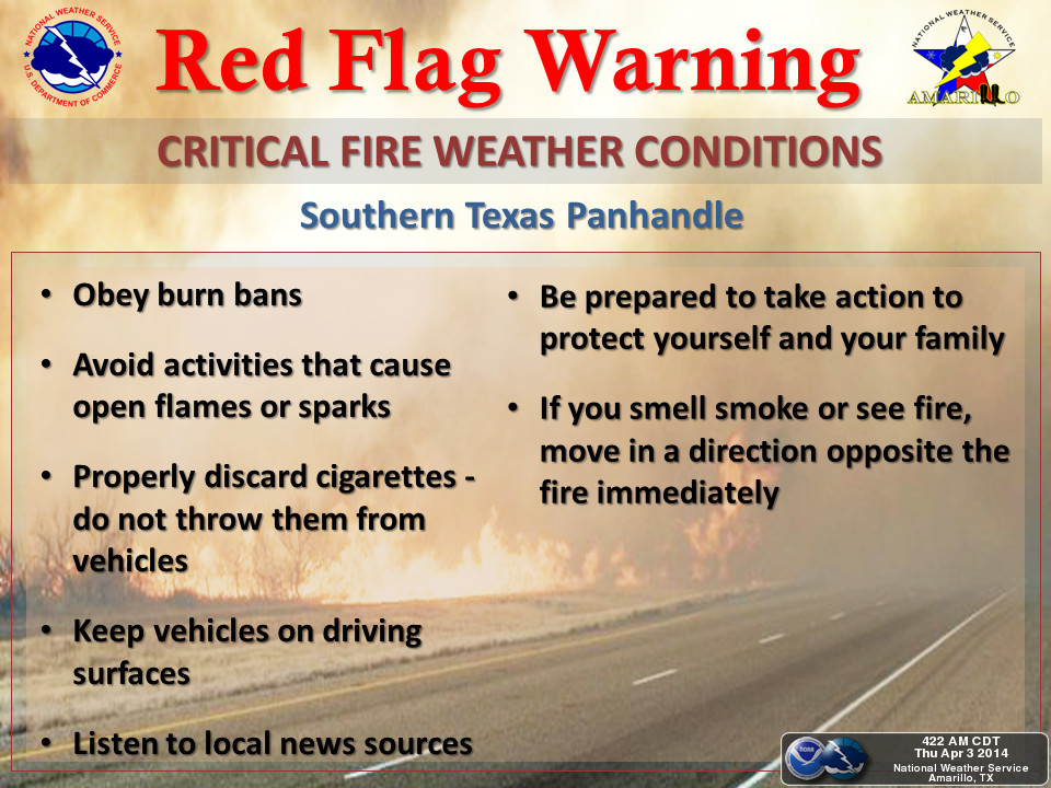
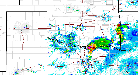
Pinch me, I'm dreaming. Here are some graphics from the local NWS offices
detailing the complex weather pattern today as the storm system moves off to
the east, taking rain (and severe weather) chances with it, while we await the
dryline then cold front.
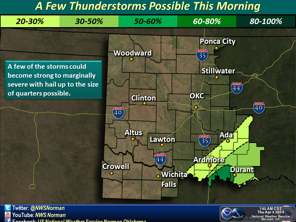
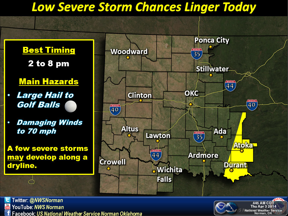
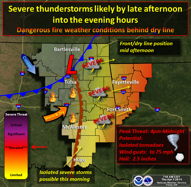
It is raining down south and east as we write, after all. Those areas are in
drought, they need it. It would sure look nice over western Oklahoma, though.
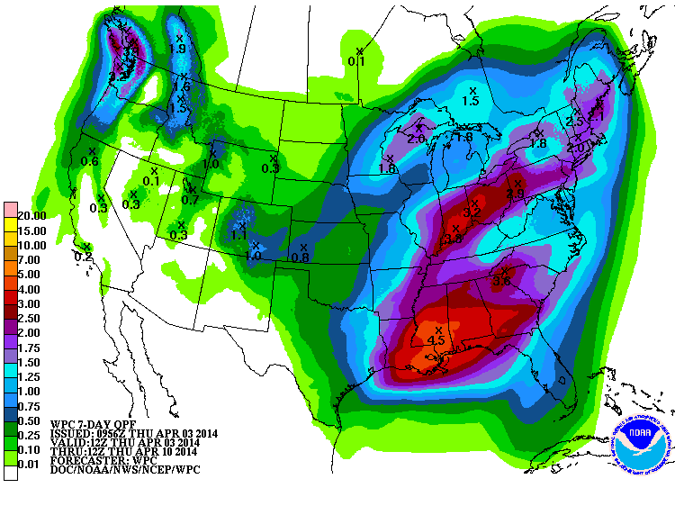
Our next chance of rain comes in this weekend, with Sunday appearing to be
the wettest day as of now. Not a drought-breaker, but crucial moisture if it
should appear for the stressed wheat crop.
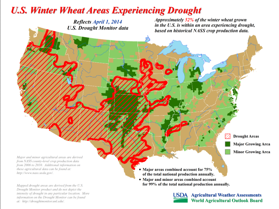
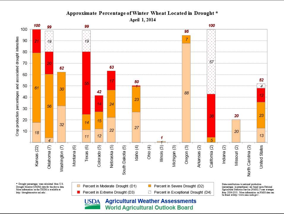
Nearly 100% of Oklahoma's winter wheat crop is experiencing drought right now.
It's remarkable that only about half of it is in "poor" to "very poor"
conditions. However, Oklahoma is not alone.
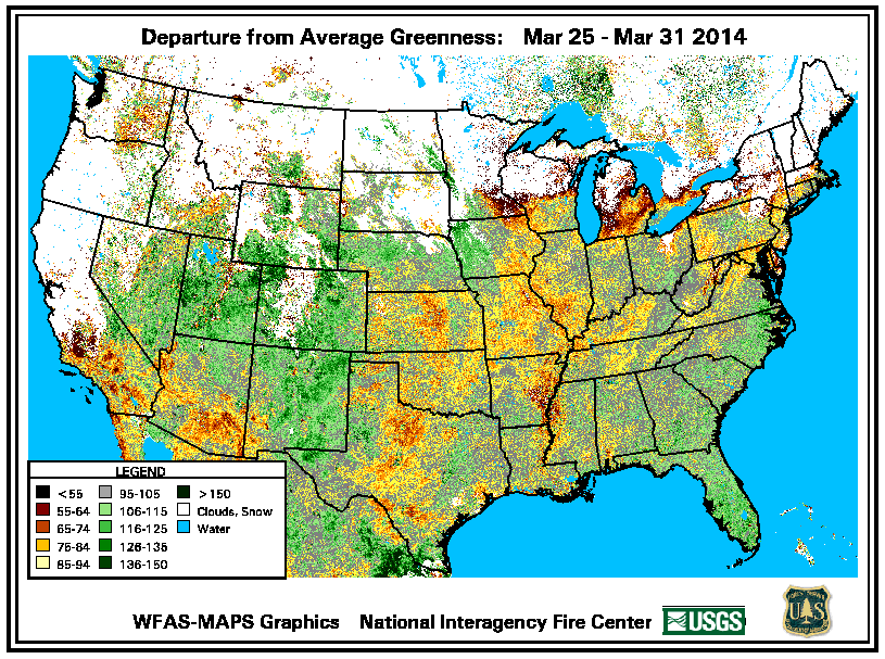
How green is it now, compared to the long-term average for this time of year?
This is actually for the last week of March. Yellows and reds are not good.
Some of this is temperature related ... hard to green up when it's been so
cool out, but more and more it's moisture (or lack thereof) related.
Next week looks dry, but there is at least some sign of enhanced rain chances
down the road from the CPC 8-14 day outlook.
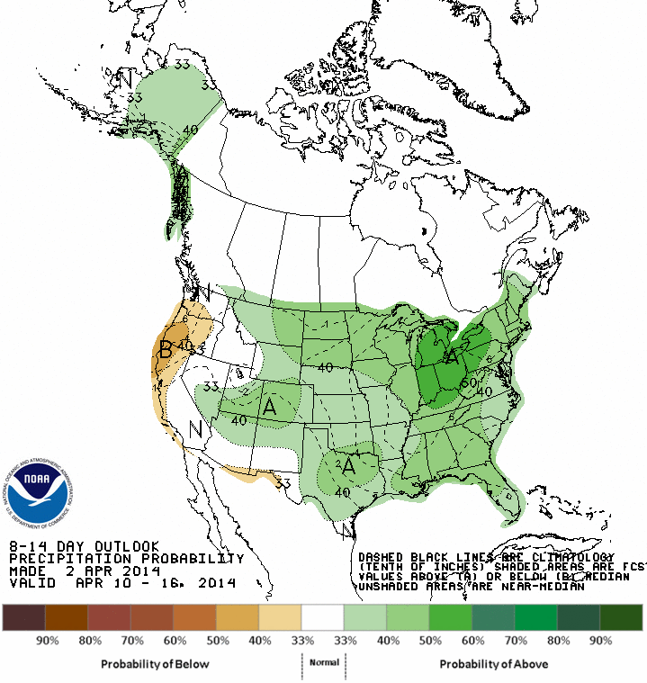
Those things are often fantasy-casts, but we'll take it right now just to make
us feel better. Hope for downpours this weekend. What can it hurt?
Gary McManus
State Climatologist
Oklahoma Climatological Survey
(405) 325-2253
gmcmanus@mesonet.org
April 3 in Mesonet History
| Record | Value | Station | Year |
|---|---|---|---|
| Maximum Temperature | 103°F | ALTU | 2011 |
| Minimum Temperature | 15°F | KENT | 2002 |
| Maximum Rainfall | 3.12 inches | WAUR | 2012 |
Mesonet records begin in 1994.
Search by Date
If you're a bit off, don't worry, because just like horseshoes, “almost” counts on the Ticker website!