Ticker for April 2, 2014
MESONET TICKER ... MESONET TICKER ... MESONET TICKER ... MESONET TICKER ...
April 2, 2014 April 2, 2014 April 2, 2014 April 2, 2014
Bad hair day
Well, if I still had hair of course. I do actually have enough to go kerflooey
with all this moisture in the air. As expected, the retreat (or advancement)
northward of that stationary front from yesterday as a warm front brought with
it a very welcome visitor from the Gulf of Mexico, and there are now two distinct
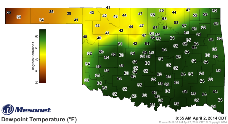
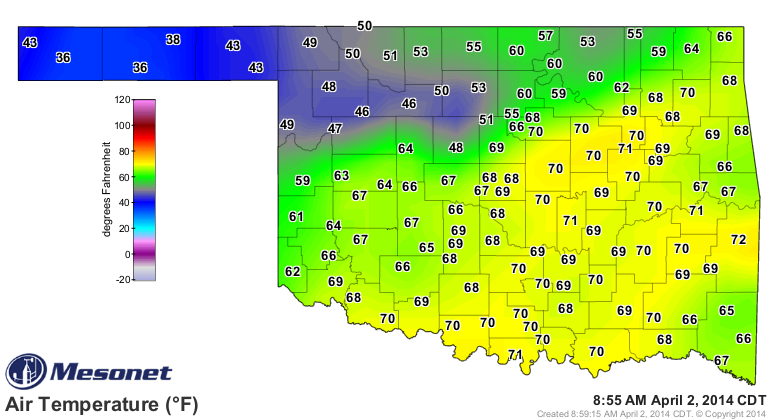
air masses in the state. Check out the dewpoint and air temperature maps from
the Mesonet and you'll see what I'm talking about.
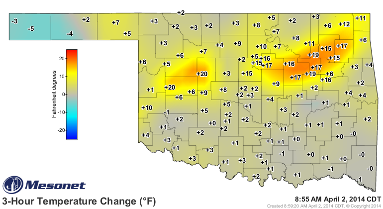
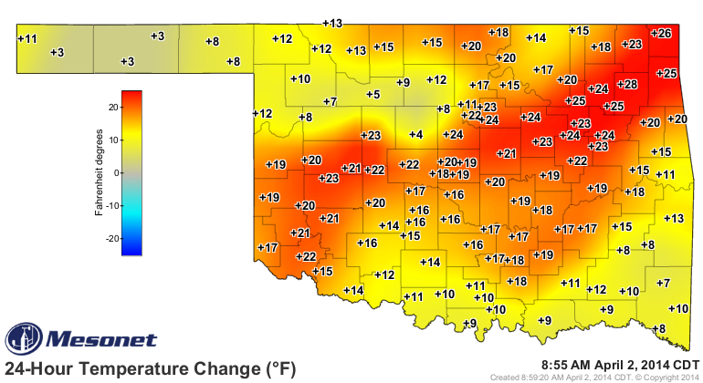
Even more awesome are the 3-hour and 24-hour temperature change maps. Wow, what a
difference 3 hours and, uhhhhh, 24 hours can make!
You just know there's somebody in Watonga that went to work this morning in a
coat when it was 40 degrees at 7:30am and then an hour and 20 degrees later,
they're stewing in their own gravy. Check out that rise in dewpoint (green area
in the top panel with temperature on the meteogram below) as well. You can also
see the winds switch from the NE, weaken from the north, then get strong from
the SSW.
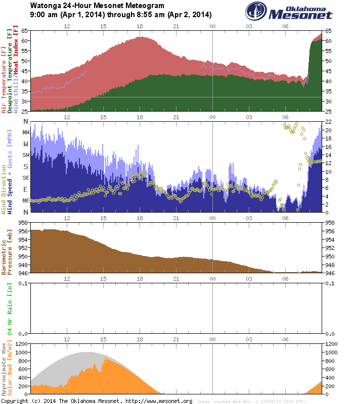
After 6 months worth of strong cold fronts, that meteogram looks pretty darned
good to me. The widespread dewpoints in the mid-60s are the first of those
we've seen in the state since November 17, 2013. There were some dewpoints in
the 60s at a few stations in the SE back on March 28, 2014, and also a few back
on November 21, 2013, but not widespread in either case like today ... certainly
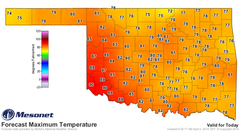
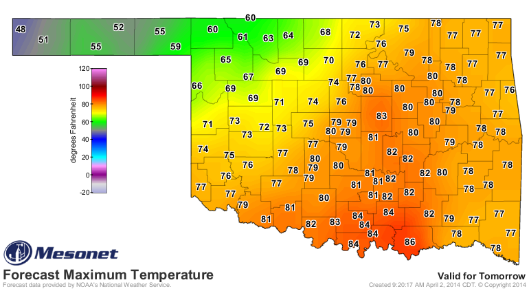
not up into central and northern Oklahoma. And, we could see our hottest day
of the year today, with temps reaching close to 90 down across SW OK in that
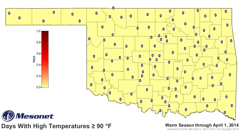
dry and hot air. If SW OK does reach 90 degrees, that would be the first temp
that high measured by the Mesonet since October 12, 2013, almost 6 months ago.
Holy cow, that's a long 90-degree drought!
This map might finally see a "1" on it.
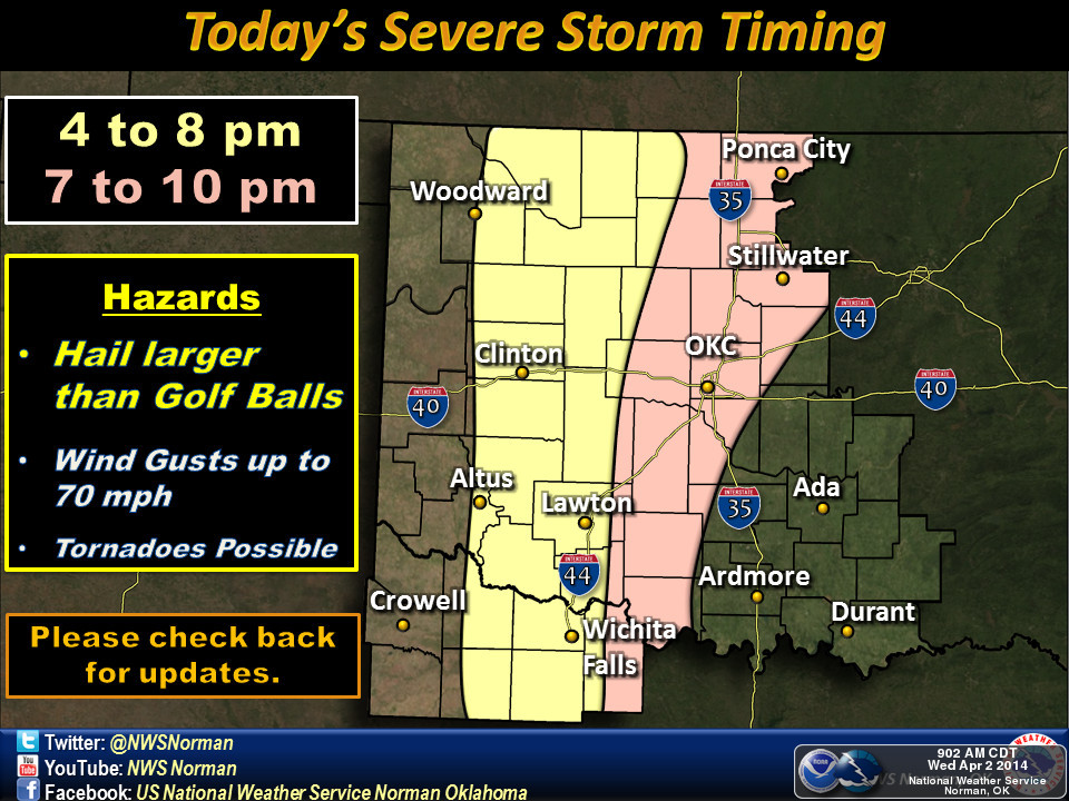
Now here's the bad side ... all that heat and moisture could possibly fuel
severe weather today. There will be that warm front in place, and a dryline
approaching from the west, so storm triggers will be available. As of now, the
local NWS forecasters are unsure whether we'll see just a few isolated storms
or a line of discrete supercells. Either way, the usual suspects with springtime
severe weather will be possible (but not certain) ... severe winds, large hail
and even tornadoes. This really doesn't appear to be a big tornado event at
this time (both meanings of that inexact phrase apply, not a lot of tornadoes
or even a large risk of tornadoes, nor large tornadoes themselves).
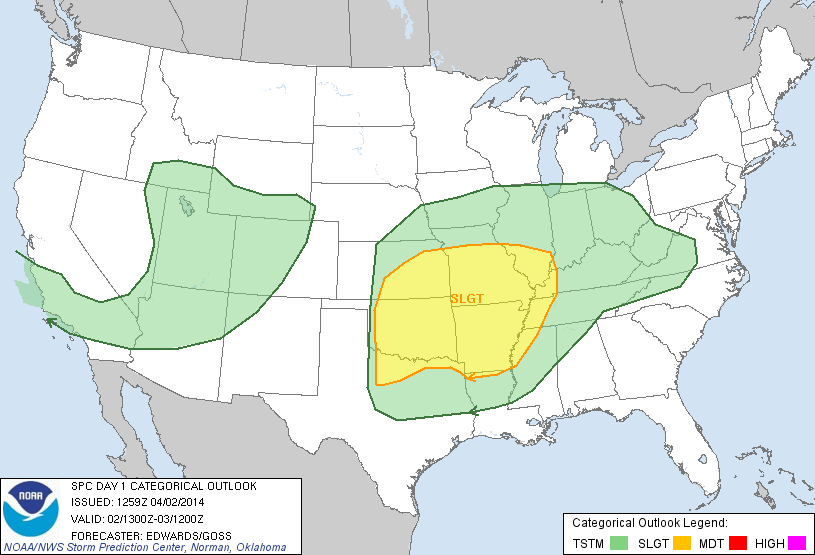
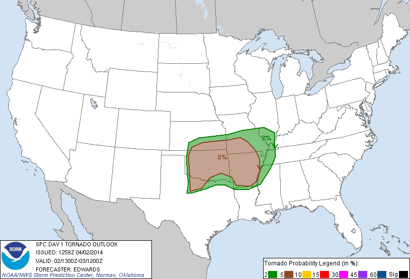
Right now, the Storms Prediction Center (SPC) has us under a slight risk, within
a rather large, amorphous area of low tornado probability. Again, the severe
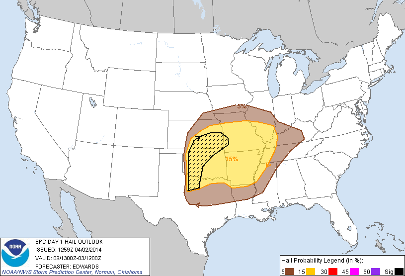
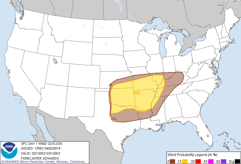
winds and hail probabilities are larger at this time, with a "hatched" area on
the hail probability map indicating increased odds of 2-inch or larger hail.
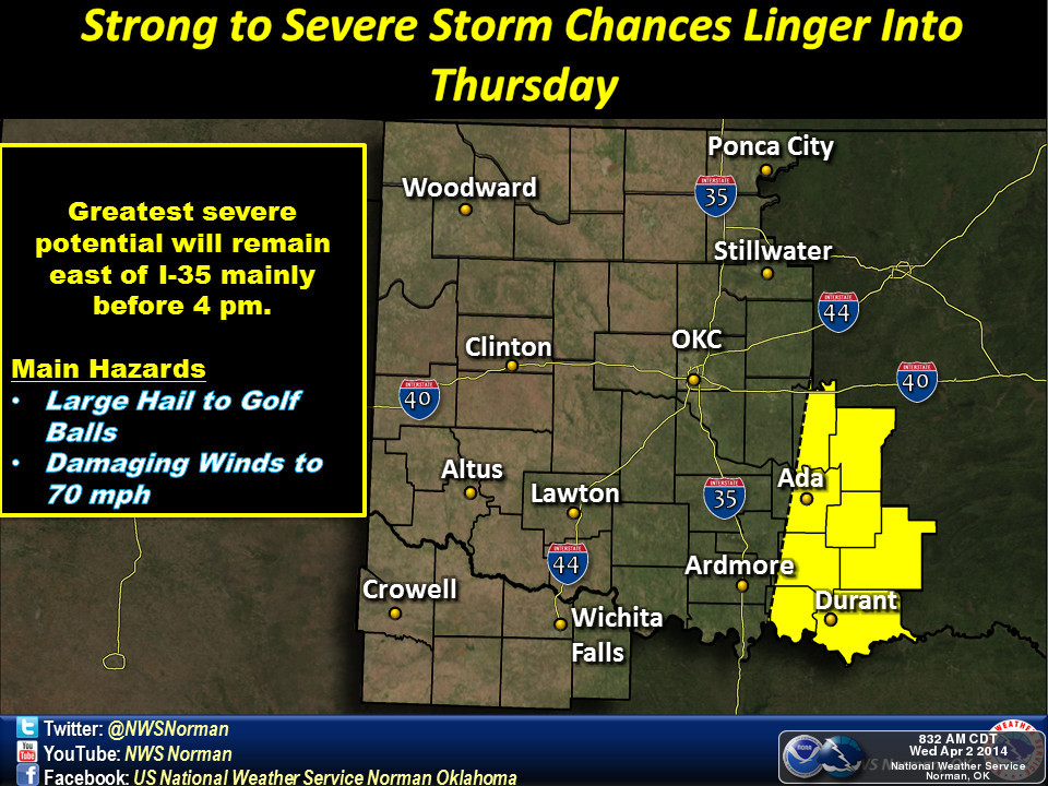
Even better news (ahem, AS OF NOW) is that this appears to be more of a late
afternoon to evening event, meaning those folks worried about schoolkids getting
caught out in severe weather should remain alert, but can relax just a bit. Check
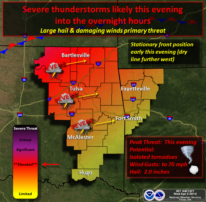
out what our friends from our local NWS offices are advising us about today. For
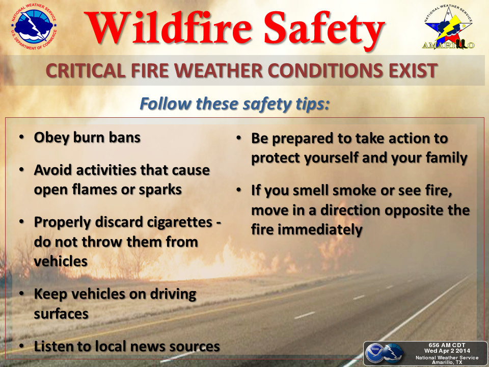
out west, sorry, but your event looks to be devoid of moisture and heavy on the
dry hot winds, blowing dust and extreme fire danger.
Severe WX Graphics
Fire WX Graphics
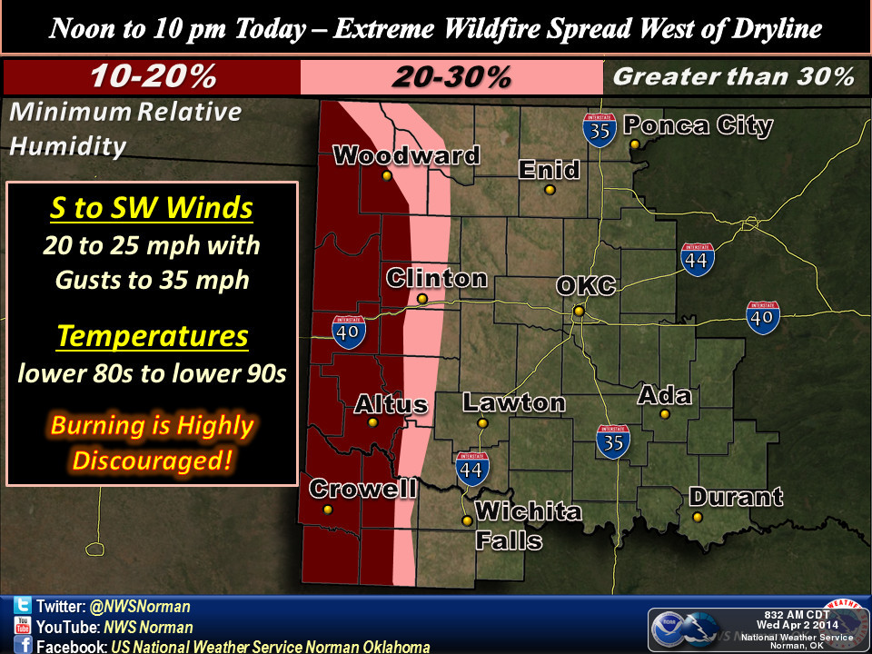
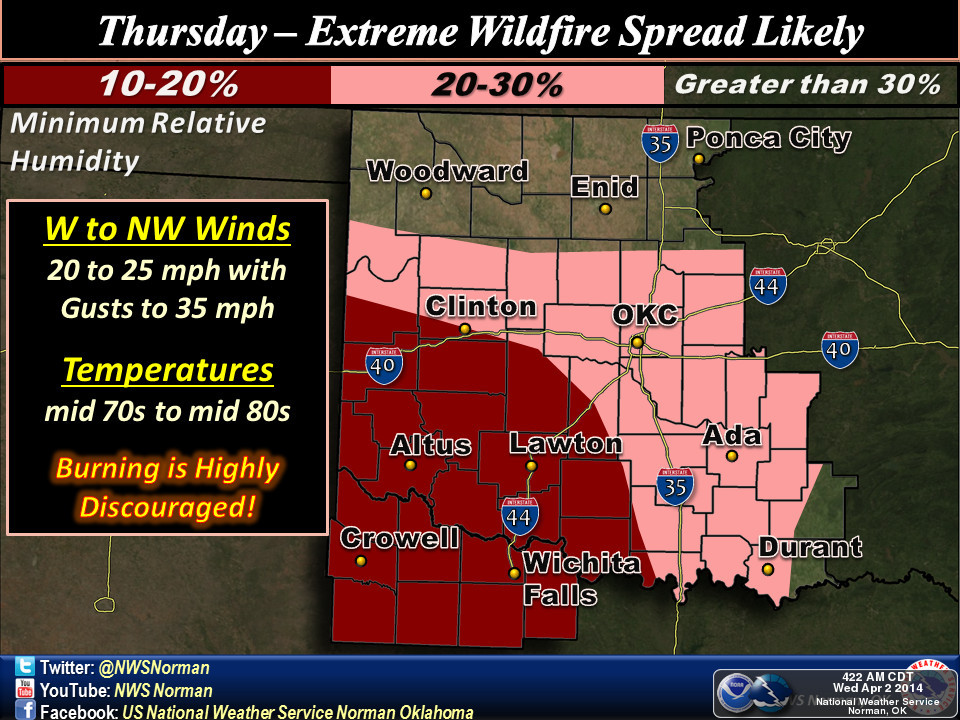
This is very April 2011-ish where eastern Oklahoma had multiple severe weather
events (actually 50 tornadoes that April, a record at the time, and every
single one of them was east of I-35) and western Oklahoma got sandblasted behind
lots of drylines.
Watch for watches and warnings today from whatever source you normally find
the most reliable, and multiple sources are even more desirable. We're already
seeing a Red Flag Fire Warning (Western OK and Panhandle) and Fire Weather
Watch (south central Oklahoma), but severe weather varieties (severe t-storm or
tornado) will probably come later today.
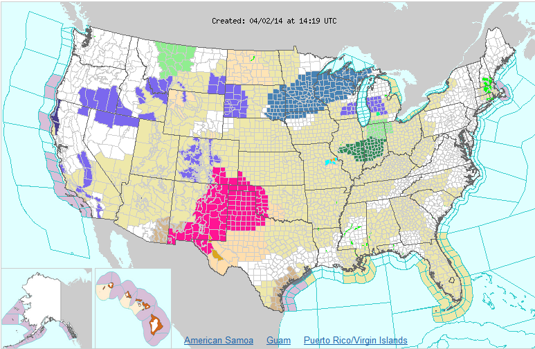
Need rain? This might not be your best bet. That might come this weekend, but
at least we're seeing some signs of the wet stuff in the forecast for everybody.
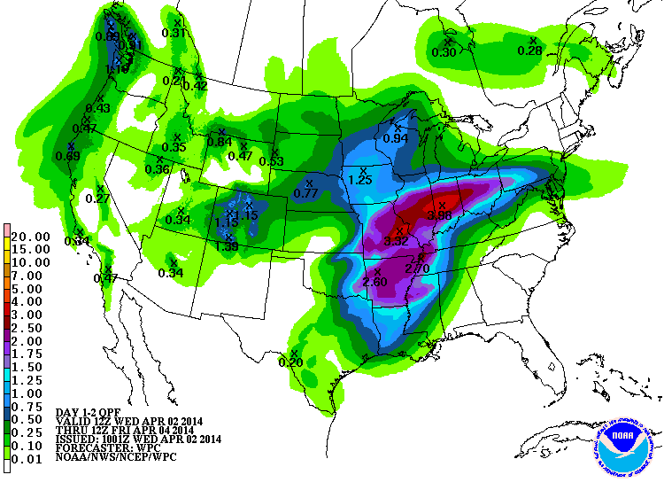
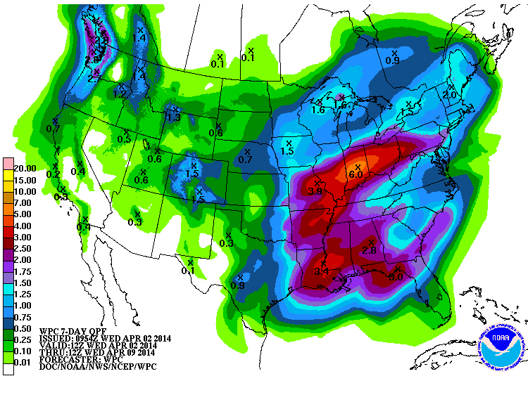
So stay calm, stay weather aware, and do NOT smoke 'em if you got 'em (at least
don't throw those cig butts out the window).
DISCLAIMER: All the above info might have changed in the hour it took me to
write this.
Gary McManus
State Climatologist
Oklahoma Climatological Survey
(405) 325-2253
gmcmanus@mesonet.org
April 2 in Mesonet History
| Record | Value | Station | Year |
|---|---|---|---|
| Maximum Temperature | 92°F | BUFF | 2003 |
| Minimum Temperature | 21°F | EVAX | 2018 |
| Maximum Rainfall | 3.46″ | TALI | 2013 |
Mesonet records begin in 1994.
Search by Date
If you're a bit off, don't worry, because just like horseshoes, “almost” counts on the Ticker website!