Ticker for April 1, 2014
MESONET TICKER ... MESONET TICKER ... MESONET TICKER ... MESONET TICKER ...
April 1, 2014 April 1, 2014 April 1, 2014 April 1, 2014
Severe weather sesaon is here, and March weather summary
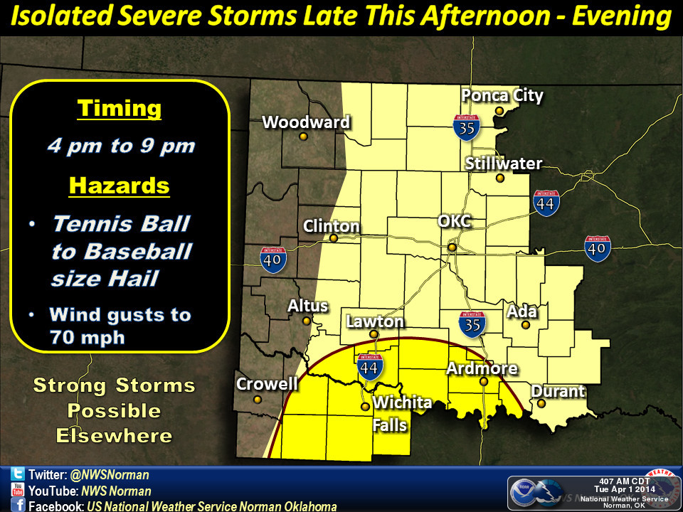
Storm chances ramp up today, including the odds for a bit of severe weather.
This doesn't look like some sort of widespread severe weather outbreak. In fact,
looking at the info from the local NWS offices, there's the possibility that
storms might have a bit of trouble even initiating due to a strong capping
inversion (i.e., we might not get enough daytime heating to produce storms, let
alone severe weather). Nevertheless, there are storm chances, and since it's
springtime, that also usually means any severe storms that do occur might start
the old rotation routine and a few tornadoes might occur. Here's a bit of a
primer on severe weather safety from our friends across the hall at the Norman
NWS office. As Brad told Spicoli in "Fast Times at Ridgemont High" ... "Learn
it. Know it. Live it."
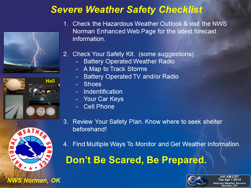
That one is particular to the Norman NWS office. Be sure to keep up to date
with your local NWS office for information concerning your area.
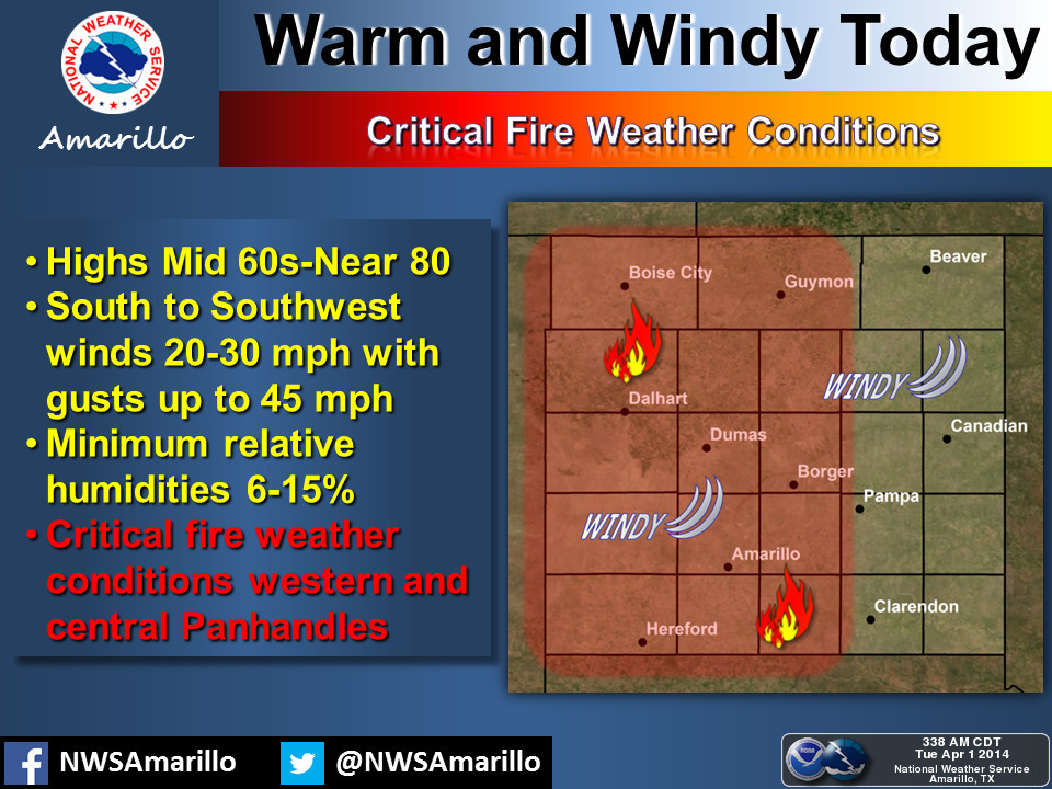
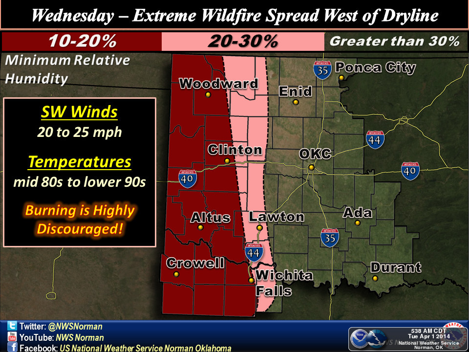
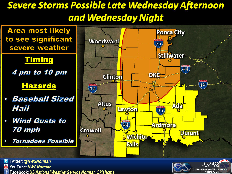
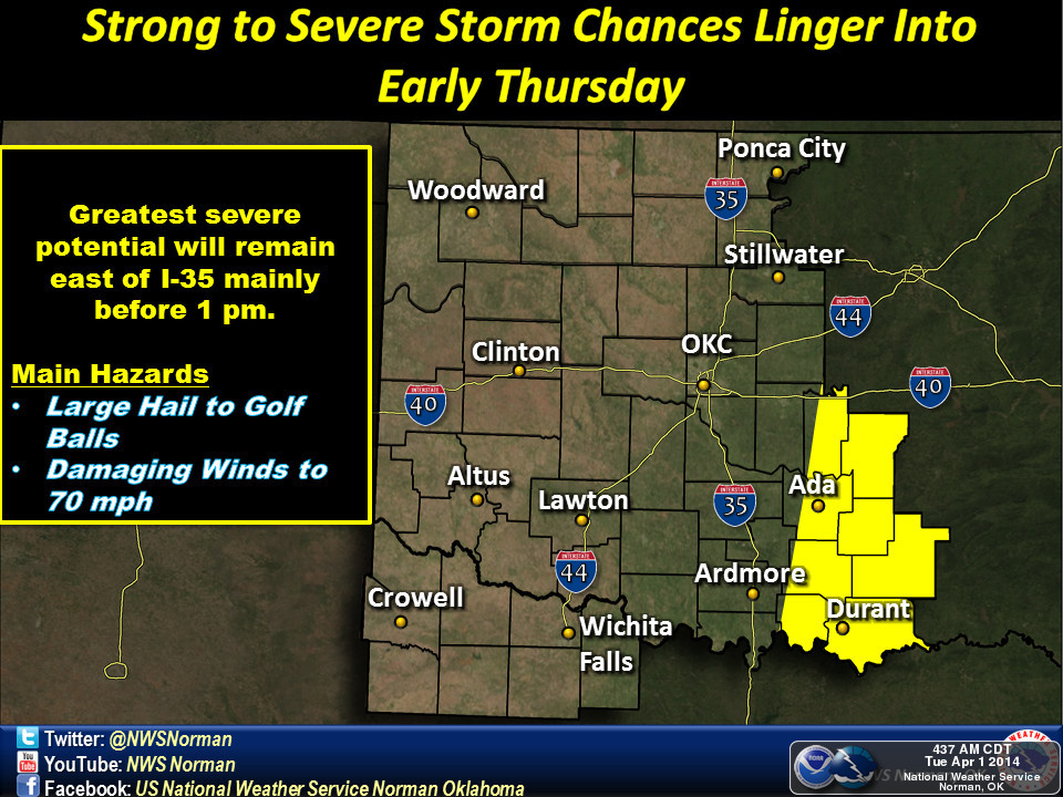
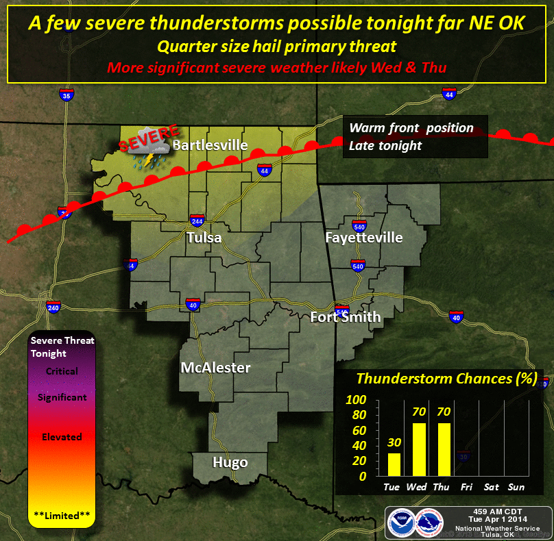
Here are some graphics from the local NWS offices pinpointing storm chances
today and over the next few days. For the folks out west, this looks to be
more of a firestorm danger than severe weather situation.
Fire Danger
Severe Wx Chances
I wish there was better news regarding moisture chances for western Oklahoma
with this storm.
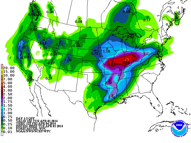
Maybe down the road, although that looks a bit iffy as well.
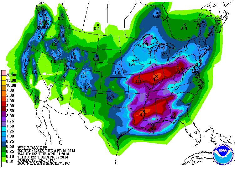
Remember ... no storms, no tornadoes, no moisture.
Learn it. Know it. Live it.
-------------------------------------------------------------------------------
March Weather Wrap-up
Oklahoma's weather during March was so boring only a Mother (Nature) could love
it. Dust storms and wildfires livened things up a bit, but there was very little
in the way of traditional severe weather. Through March 31, the number of
consecutive days without a reported tornado in Oklahoma rose to 236, the third
longest stretch since accurate records began in 1950. The last reported tornado
in Oklahoma occurred back on August 7, 2013, when a small EF0 twister touched
down near Turpin in Beaver County. The longest tornado drought on record is 292
days from May 17, 2003, to March 3, 2004. Snow and sleet kept winter in the news
the first few days of the month with amounts of nearly 6 inches reported across
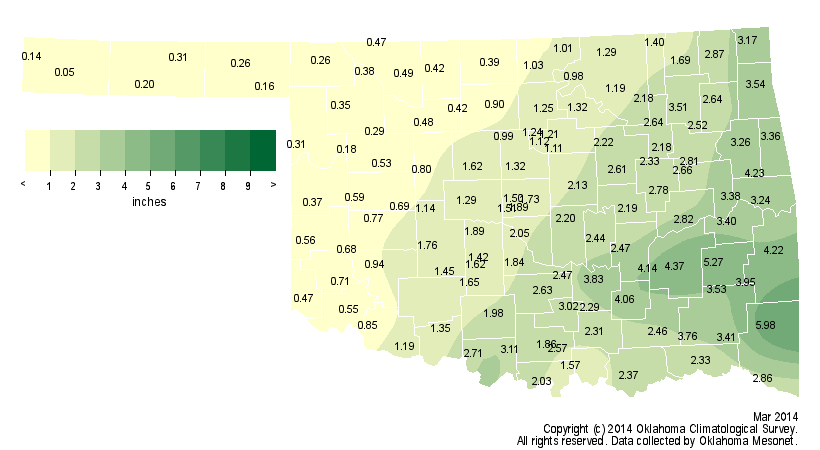
northern Oklahoma. Despite that moisture, it was dry across most of the state and
in some areas, exceedingly so. The Oklahoma Mesonet site at Boise City brought up
the rear with a scant 0.05 inches of liquid moisture. Of the 120 existing
Mesonet sites, 33 came in with less than an inch of moisture, and 64 recorded
less than 2 inches. Mt. Herman in McCurtain County recorded the most with 5.98
inches. The statewide average was 1.75 inches, 1.36 inches below normal to rank
as the 38th driest March since records began in 1895.
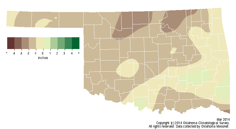
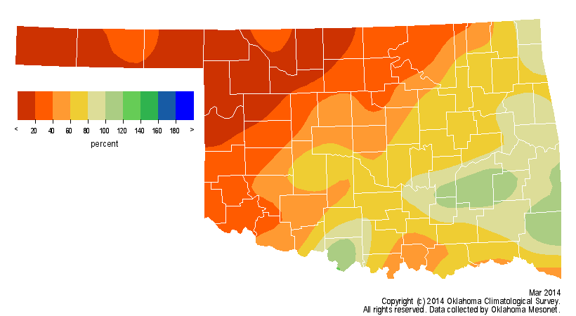
March was the seventh consecutive month that the statewide average
precipitation total dipped below normal, and the 30th month out of the previous
42 to do so, dating back to October 2010. The cumulative statewide
precipitation deficit over that period rose to approximately 28.9 inches.
March also continued a tendency for cooler than normal weather. According to
preliminary data from the Mesonet, the statewide average temperature was 46.4
degrees, the 23rd coolest March on record at 3.8 degrees below normal.
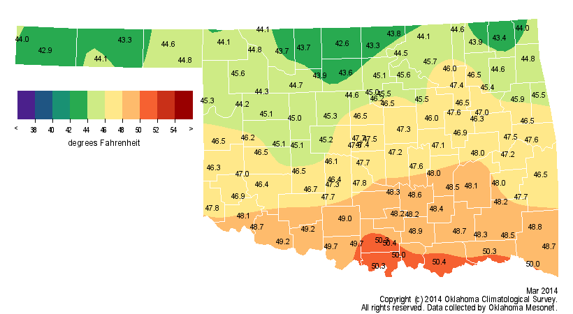
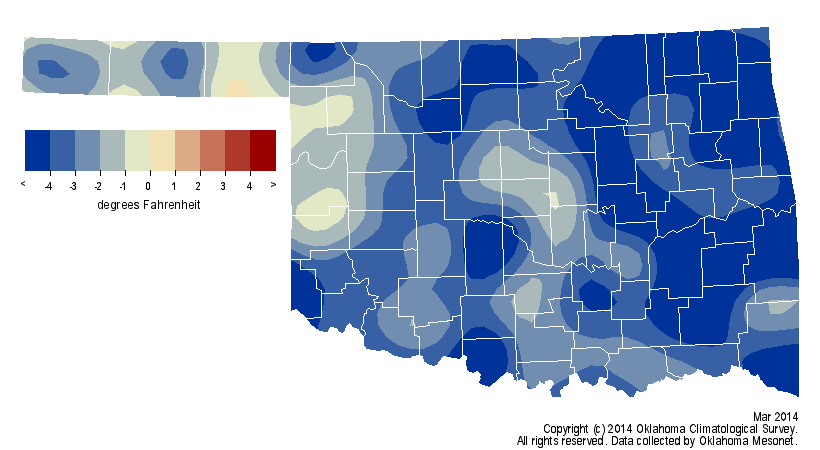
That is the 12th month out of the last 14 to finish cooler than normal, dating
back to February 2013. The month's highest temperature of 88 degrees was
recorded at four separate locations on the 31st. The lowest temperature for the
month, minus 7 degrees, was reported at Buffalo on the third. Several low
temperature records were either tied or broken at stations in northeastern
Oklahoma during those first few icy days of the month.
The combination of drought, high winds and low relative humidity produced
numerous days with extreme wildfire conditions. Fires burned several hundred
acres in Logan County on March 20, destroying two mobile homes. A Texas
wildfire on the 18th spread for 20 miles and burned its way into Ellis County,
Oklahoma. It required several Oklahoma and Texas firefighter units to
extinguish the blaze. Many other wildfires were reported throughout the month.
Those same weather conditions also produced intense dust storms that some local
Panhandle residents likened to the Dust Bowl storms of the 1930s. The biggest
"duster" was possibly the March 11 storm that kicked up dust from eastern
Colorado down into the High Plains of the Oklahoma and Texas panhandles.
Another dust storm on the 18th spread much farther to the east, obscuring the
sky throughout western and central Oklahoma.
The drought that helped produce those dust storms intensified across the High
Plains into western Oklahoma. The latest U.S. Drought Monitor report indicated
a significant increase in extreme to exceptional drought across the western
third of Oklahoma, now encompassing 24 percent of the state.
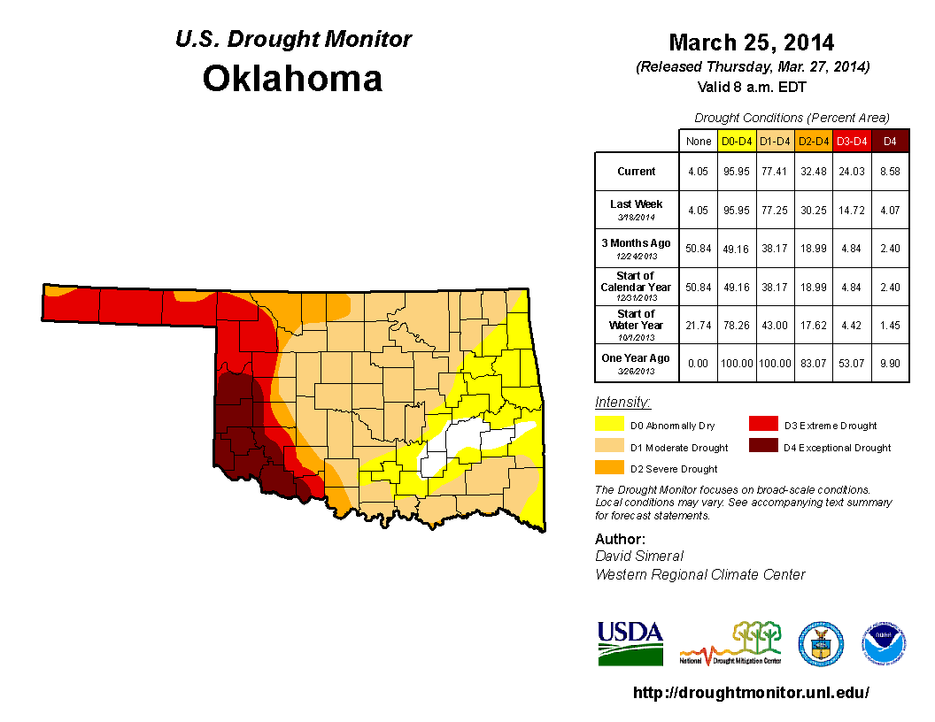
That's an increase of nearly 20 percent since October 1, 2013.
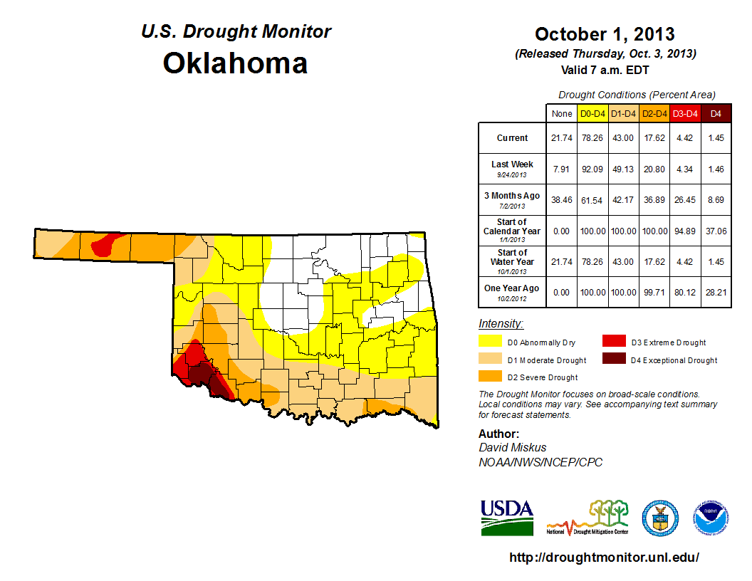
Moderate to severe drought covered approximately 53 percent of the state and
nearly 19 percent was considered to be in "Abnormally Dry" conditions. Only
four percent of Oklahoma was portrayed devoid of any dry conditions. The
Drought Monitor?s intensity scale slides from moderate-severe-extreme-
exceptional, with exceptional being the worst classification.
The latest April outlooks from the National Weather Service's Climate
Prediction Center (CPC) gave no indication of increased odds for either above-,
below- or near-normal temperatures and precipitation.
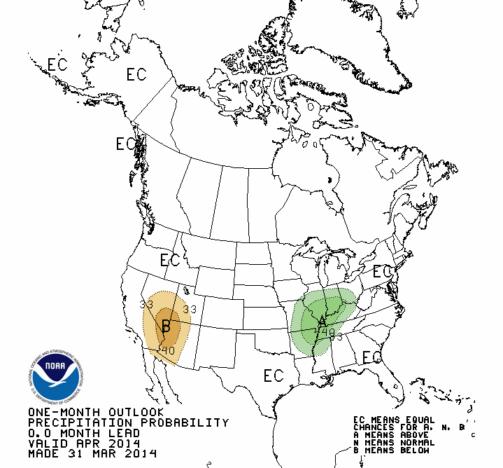
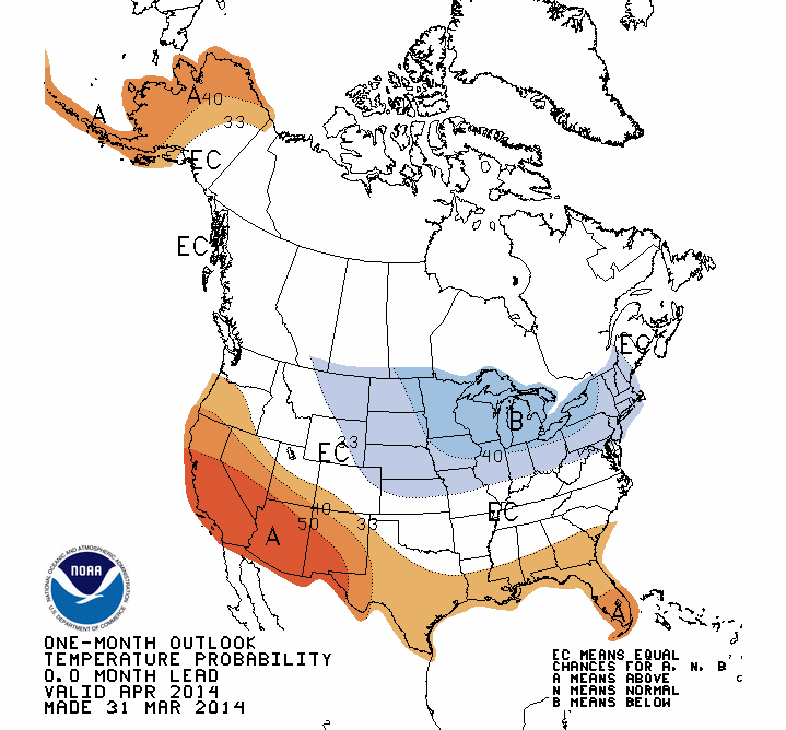
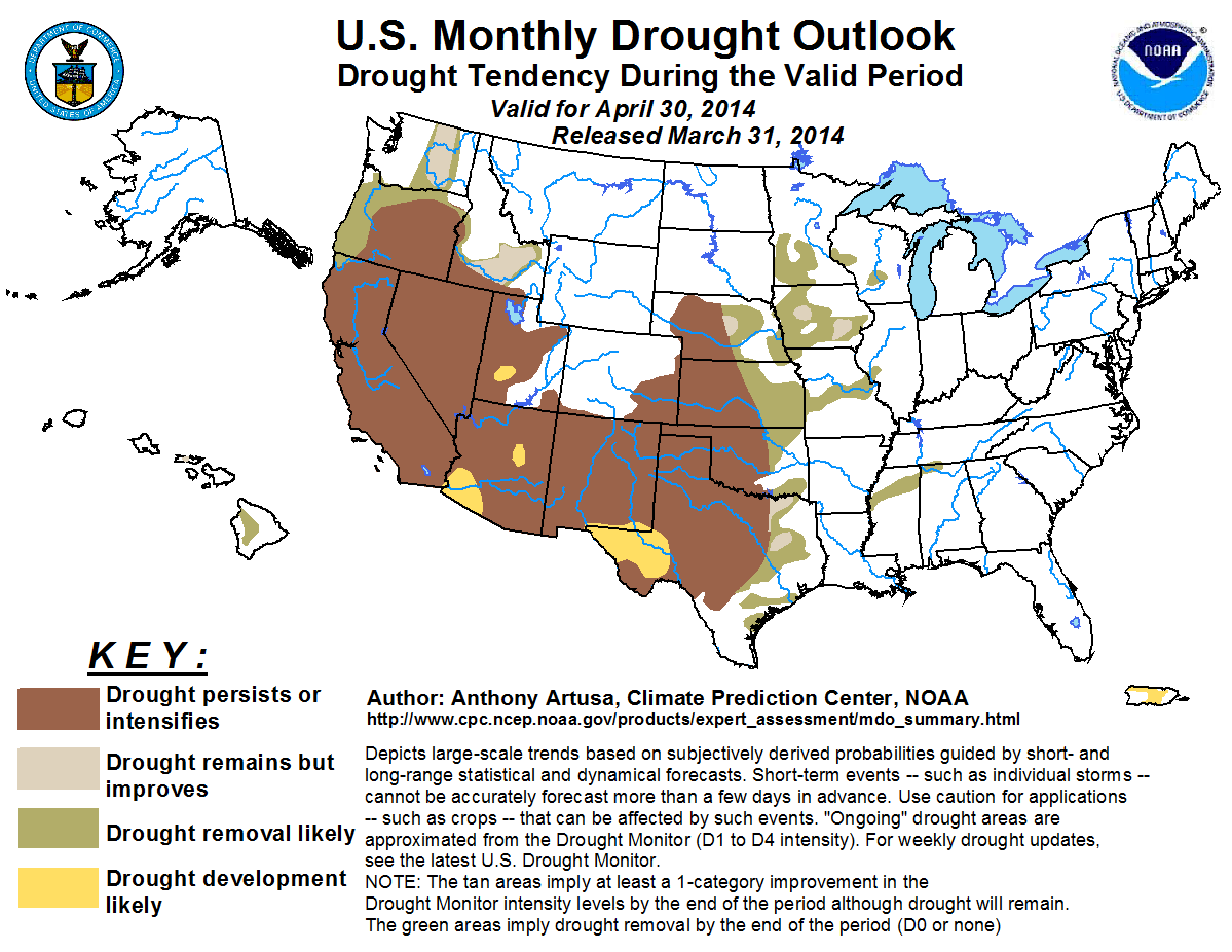
CPC's U.S. Monthly Drought Outlook for April shows drought either continuing or
intensifying across the western half of the state through the month, with
drought removal likely across northeastern and southeastern areas of the state.
Gary McManus
State Climatologist
Oklahoma Climatological Survey
(405) 325-2253
gmcmanus@mesonet.org
April 1 in Mesonet History
| Record | Value | Station | Year |
|---|---|---|---|
| Maximum Temperature | 98°F | ALTU | 2012 |
| Minimum Temperature | 19°F | EVAX | 2023 |
| Maximum Rainfall | 2.57″ | TIPT | 2006 |
Mesonet records begin in 1994.
Search by Date
If you're a bit off, don't worry, because just like horseshoes, “almost” counts on the Ticker website!