Ticker for March 31, 2014
MESONET TICKER ... MESONET TICKER ... MESONET TICKER ... MESONET TICKER ...
March 31, 2014 March 31, 2014 March 31, 2014 March 31, 2014
Severe WX Season is ready ... ARE YOU?
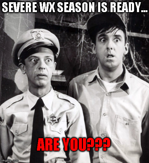
Did you clean your cellar of all the old tramps (and spiders and snakes and dead
mice, etc.) this weekend in preparation for what the NWS forecasters are now
saying is a chance for tornadoes on Tuesday and Wednesday??
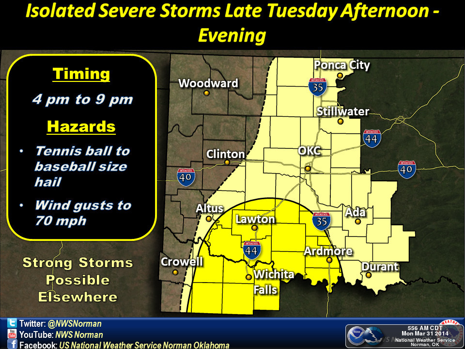
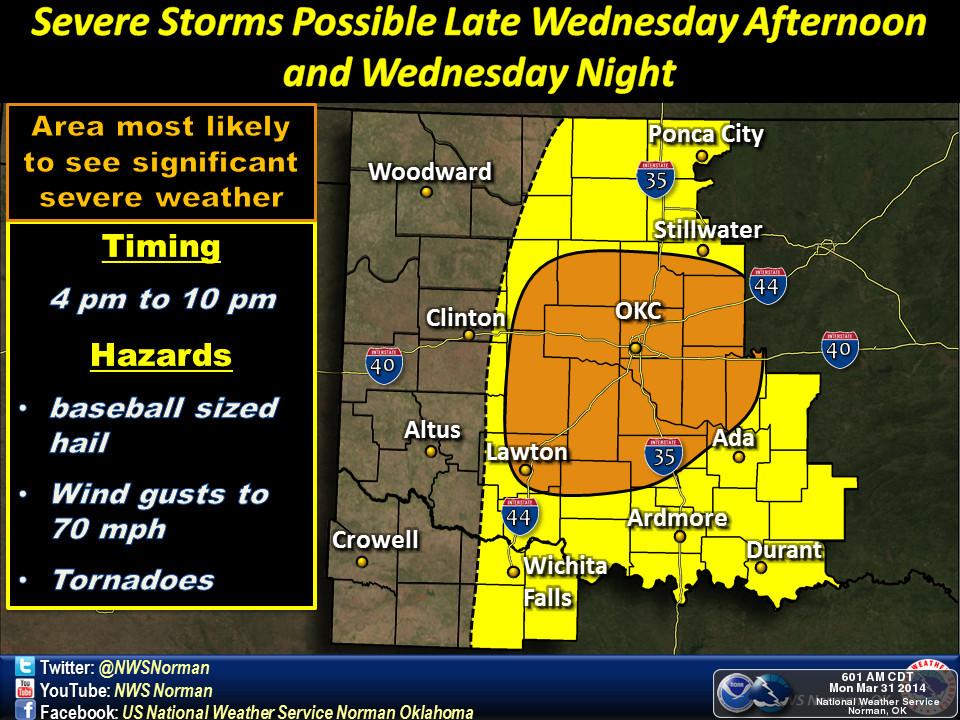
This is all due to a cold front which will move into the state tonight, stall,
and then move back to the north as a warm front on Tuesday. That's the important
part since it will bring low-level moisture from the Gulf to the north into
Oklahoma along with it. This will come with a dryline and all the other goodies
that go along with this type of spring storm (i.e., possible severe storms
complete with large hail and severe winds AND possible tornadoes). Supercells
are the players to watch out for on both days. Wednesday appears to be have the
most significant threat at this time (could change, of course), but from Tuesday
through Thursday, somewhere in the state COULD see severe weather. Thursday is
included as the main upper-level storm system travels from the west of Oklahoma
to the east.
This is the type of setup we've been missing for quite awhile with an upper-
level low to the west long enough to allow that rich Gulf moisture to travel
to the north, certainly much better for the rain chances than these light-speed
cold fronts we've seen over the last three months. Speaking of rain chances,
this might shock you but eastern Oklahoma has a greater chance for significant
moisture totals from this storm system.
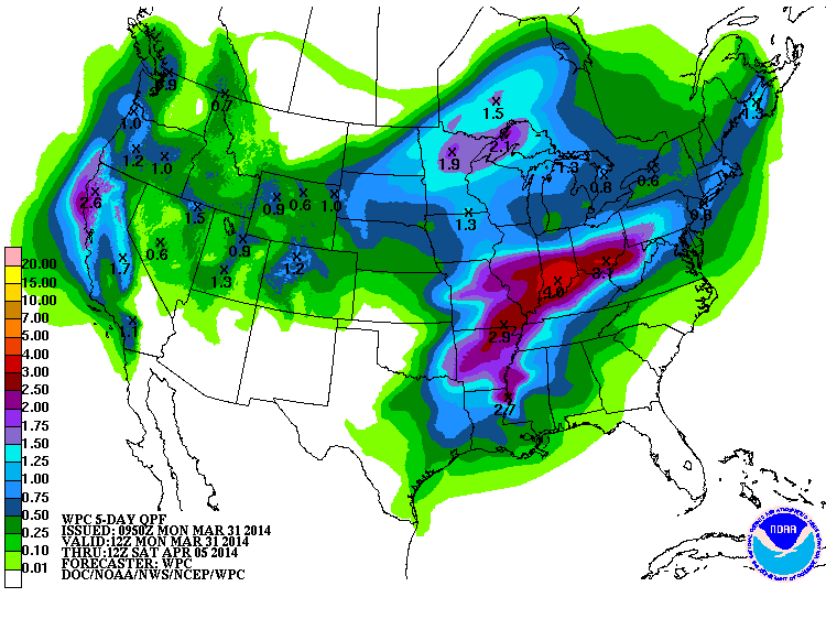
Doesn't look like much for the west even though they have at least a chance of
severe storms Tuesday and Wednesday. The trouble is getting those storms to
fire in the first place, so no, this is probably not a big rain event for
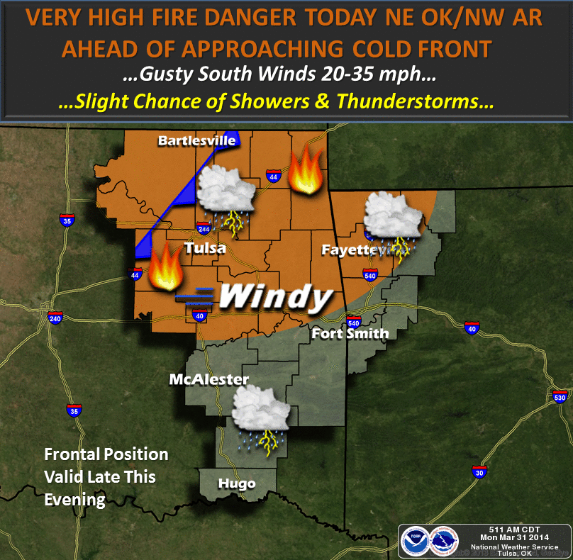
the west. They will have fire concerns today through Thursday, another big
shocker! Today will have the most concerning risk of wildfires.
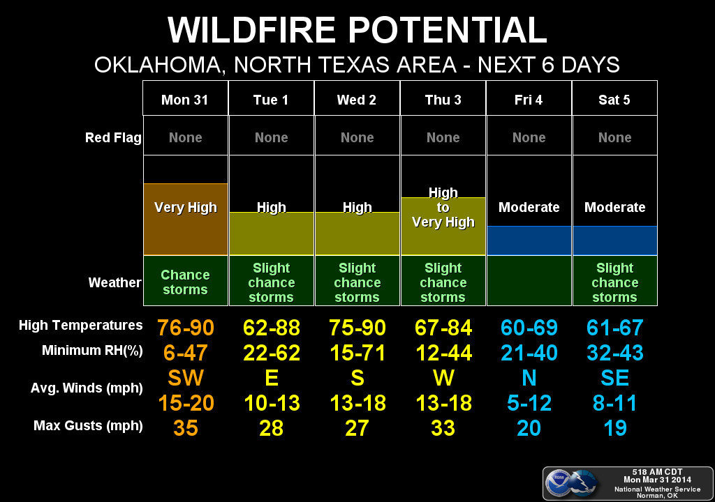
See that fire danger plummet on the Norman chart over the weekend? That's
thanks to a cold front and a bit of an increase in moisture, which should bring
further rain chances. Perhaps that will bring better moisture to the west. At
least the 7-day rainfall forecast has more green over western Oklahoma as a
result.
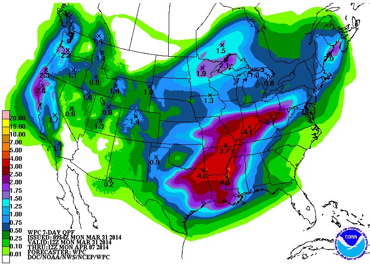
I'm betting that rainfall forecast will change a lot in the next few days, but
I just like looking at the blues and greens over western Oklahoma and the
Panhandle, so I'll run with it.
It's been 236 days since Oklahoma has had a confirmed tornado touchdown (an
EF0 3.5 miles WSW of Turpin in Beaver County on Aug. 7, 2013 ... the last of 82
for the year). That's 33 weeks and 5 days, or 5664 hours, or 339,840 minutes,
or 20,390,400 seconds. From my neighborhood near SW 149th and Western, just a
few streets to the south of Briarwood and Plaza Towers Elementary schools,
here's hoping it's at least another 20,390,400 seconds before our next one.
Gary McManus
State Climatologist
Oklahoma Climatological Survey
(405) 325-2253
gmcmanus@mesonet.org
March 31 in Mesonet History
| Record | Value | Station | Year |
|---|---|---|---|
| Maximum Temperature | 97°F | BUTL | 2010 |
| Minimum Temperature | 16°F | EVAX | 2019 |
| Maximum Rainfall | 5.36″ | BOWL | 2015 |
Mesonet records begin in 1994.
Search by Date
If you're a bit off, don't worry, because just like horseshoes, “almost” counts on the Ticker website!