Ticker for February 26, 2014
MESONET TICKER ... MESONET TICKER ... MESONET TICKER ... MESONET TICKER ...
February 26, 2014 February 26, 2014 February 26, 2014 February 26, 2014
Here we go again!
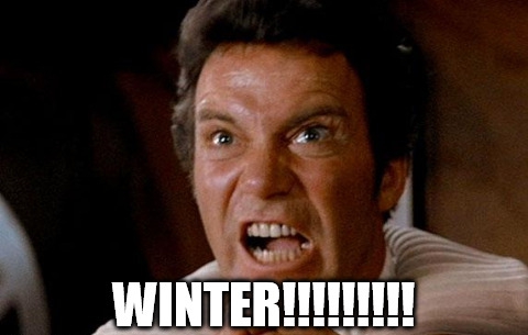
Remember yesterday morning when you went outside and thought "wow, it's cold out
here!"? Well, I hope that remained a fond memory this morning as you walked
outside and said "Okay, now it's REALLY cold out here." The proof's in the frozen
pudding. In fact, it's 10-25 degrees colder than yesterday at this time.
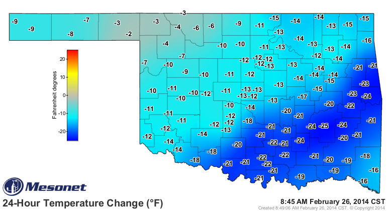
And since it was cold (at least I thought it was) yesterday, today's Mesonet maps
must not be too pleasant. Let's take a look.
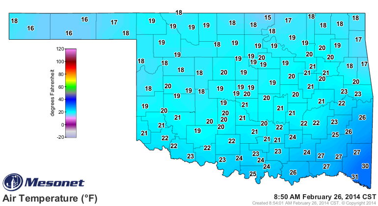
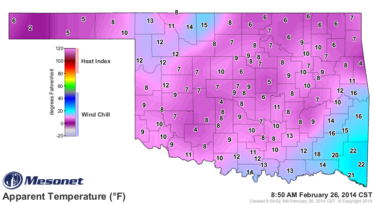
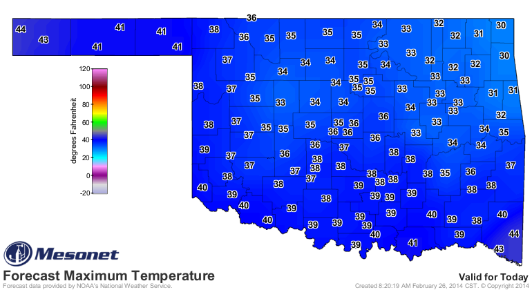
Aha, thought so. Temperatures in the teens and wind chills in the single digits.
Thanks a lot, Mother Nature. And to think we all got spoiled by about 10 days of
warm weather this month (or the 20 or so warm days this entire winter), but we
have to remember it's still February. Heck, even March can get downright cold at
times, and that's exactly what's going to happen for the first week of March.
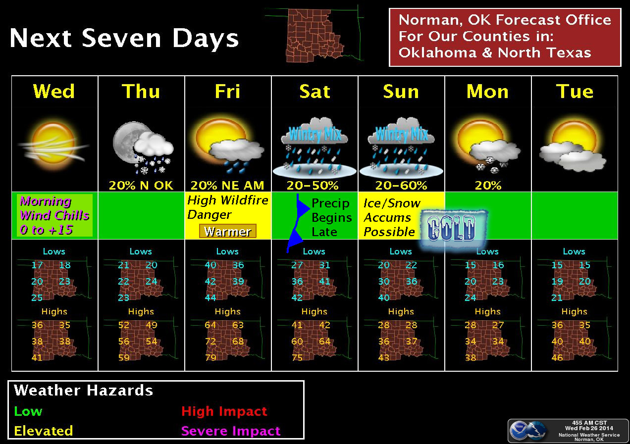
We'll have a nice Saturday, relatively again, but a cold front is going to blast
through that night and keep us below normal for awhile. Until then, we'll see
the roller coaster of post-front and pre-front winds switching from northerly
(BRRRR!!!) to southerly (AHHHHHH!!!).
Here's a post-front BRRR!!!
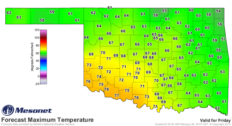
A pre-front AHHHHHH!!!
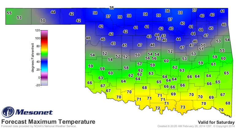
Even a post-front BRRR!!! and pre-front AHHHHH!!! all in one day!
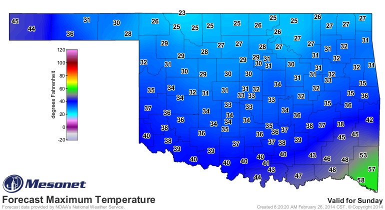
Before finally settling into a longer stretch of cold track on Sunday. BRRR!!!
Following that, we probably have a week or so of below-normal temperatures,
and even a possible snow/ice/sleet/cold rain on Sunday. BRRR!!!
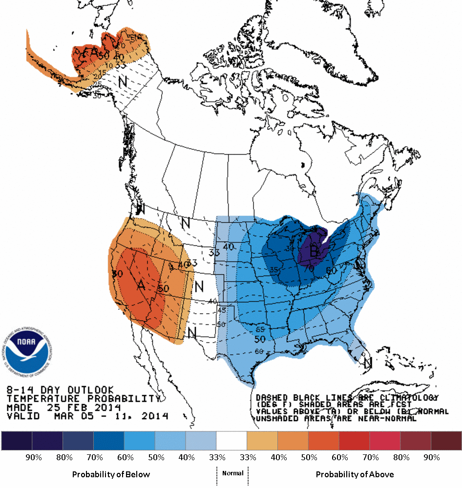
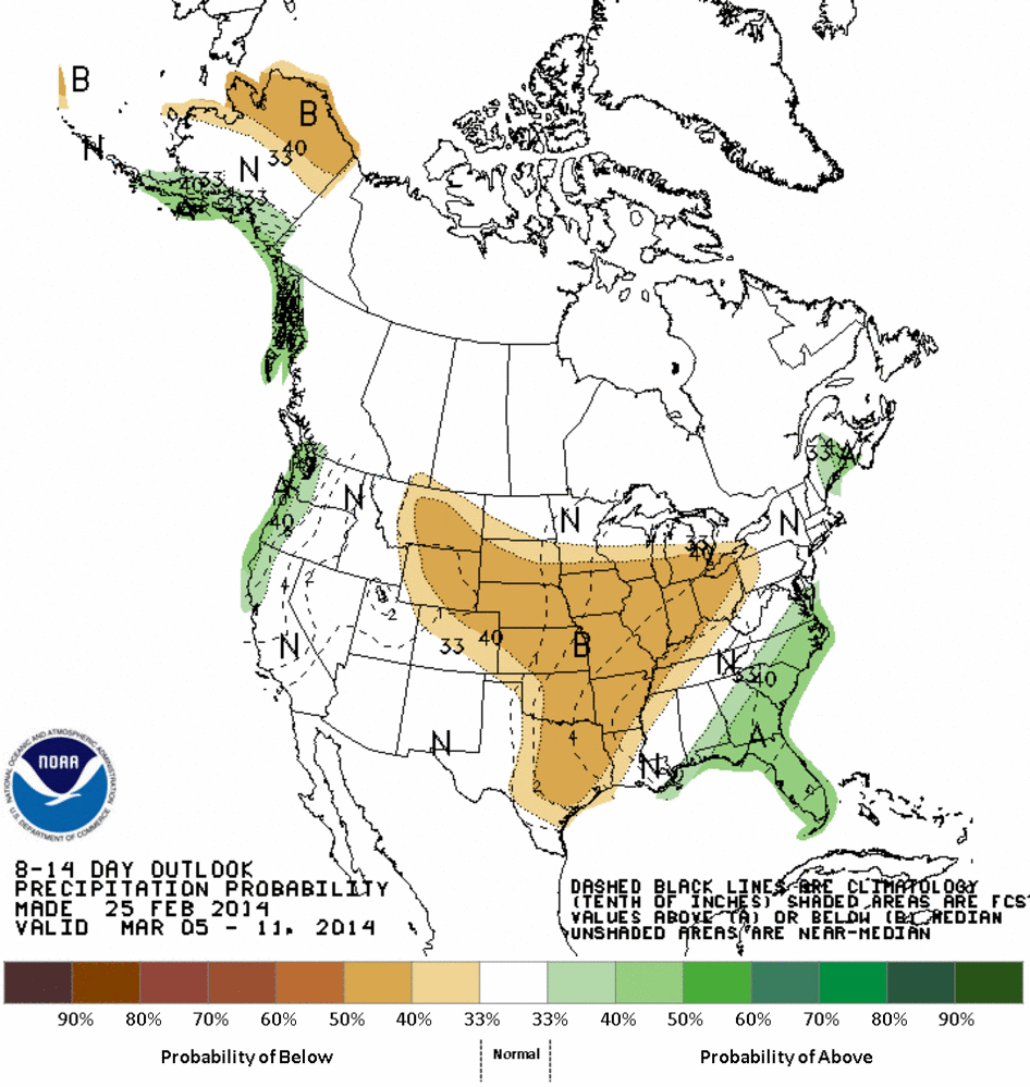
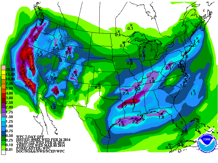
At least there is some decent moisture associated with the next week with a
couple of those storm systems (mostly Sunday's), although not nearly enough for
the western parts of the state.
When Sunday and Monday roll around and we have highs in the 20s and 30s with
brutal wind chills and some type of frozen precip, remember today fondly, even
as you remember yesterday fondly today.
By the way, those BRRR!!!s and AHHHHH!!!s are copyrighted.
Gary McManus
State Climatologist
Oklahoma Climatological Survey
(405) 325-2253
gmcmanus@mesonet.org
February 26 in Mesonet History
| Record | Value | Station | Year |
|---|---|---|---|
| Maximum Temperature | 93°F | MANG | 2024 |
| Minimum Temperature | 0°F | BOIS | 2002 |
| Maximum Rainfall | 1.61″ | NOWA | 1997 |
Mesonet records begin in 1994.
Search by Date
If you're a bit off, don't worry, because just like horseshoes, “almost” counts on the Ticker website!