Ticker for February 25, 2014
MESONET TICKER ... MESONET TICKER ... MESONET TICKER ... MESONET TICKER ...
February 25, 2014 February 25, 2014 February 25, 2014 February 25, 2014
Oklahoma to spring ... come in, spring ... over
Well, it was fun while it lasted. Even yesterday's highs in the 40s and low 50s
(hey, they hit 70 in the Panhandle!)
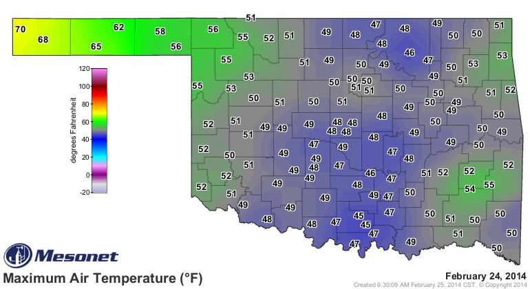
would be preferable over what we'll see today with mostly 30s and 40s.
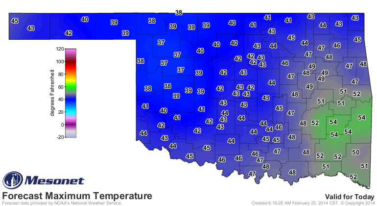
Maybe I just miss the warmth of Friday and Saturday after a relatively cold
Sunday and Monday. So we were cold the first 12 days of the month, mostly warm
for the next 10, slightly chilled the last two, and now we're in for a stretch of
either slightly below- to near-normal weather, depending on the day, to finish
out the month.
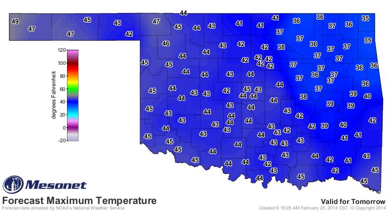
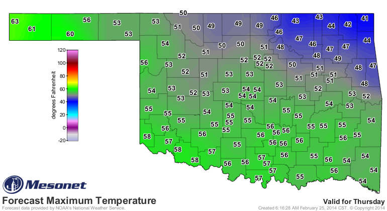
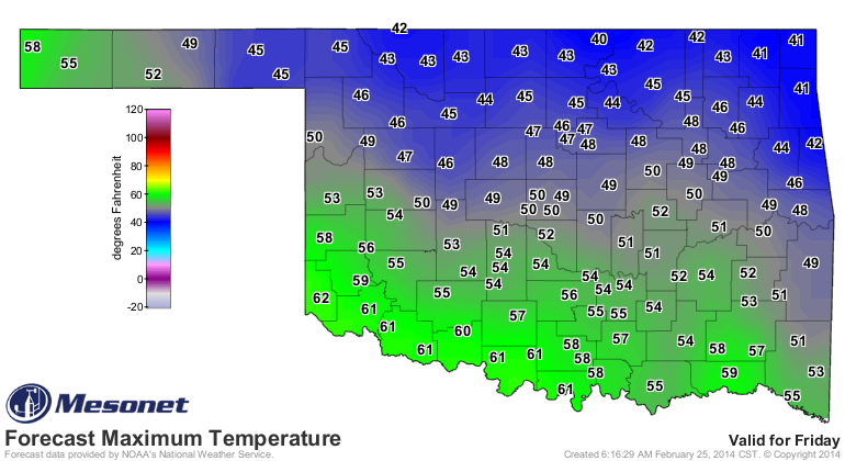
Following that, we'll have another sorta cold type of weekend with highs in the
40s and 50s, another visit by some arttic-ish style air late in the weekend,
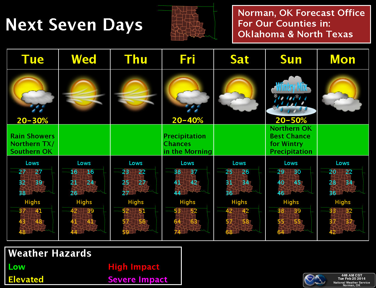
and then who knows what. NWS-Norman says some chances for wintry precipitation
in the north on Sunday with the front and then a cold Monday.
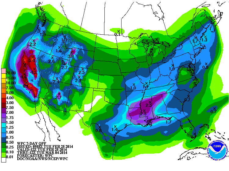
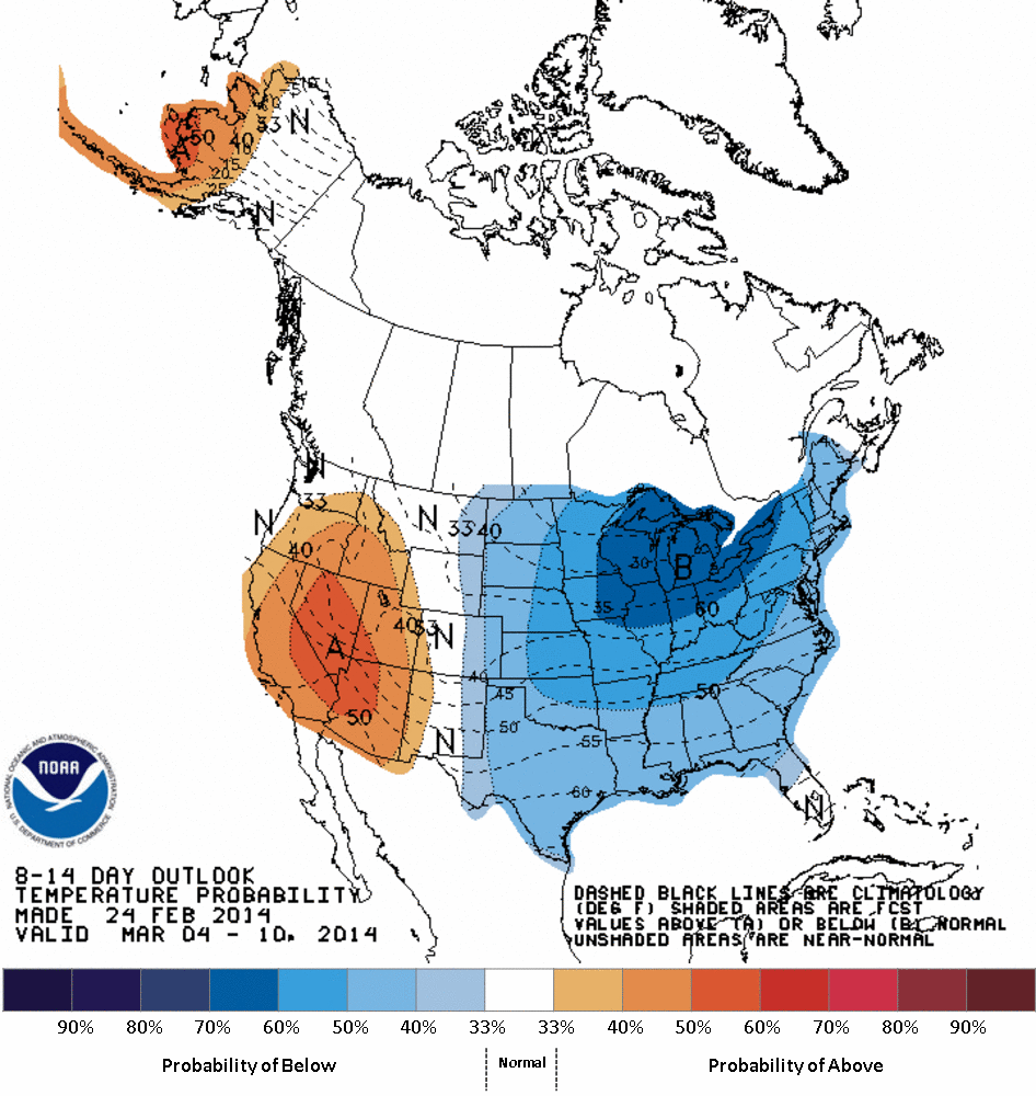
The CPC says get ready for a cooler than normal first 10 days of March, but
also probably dry after our chance for moisture early in the month. Here's the
7-day moisture forecast (from WPC) and then the 8-14 day outlooks (from CPC).
And no, I'm not on PCP giving you all these acronyms. I have to put up with this
everyday!
8-14 Day Outlooks
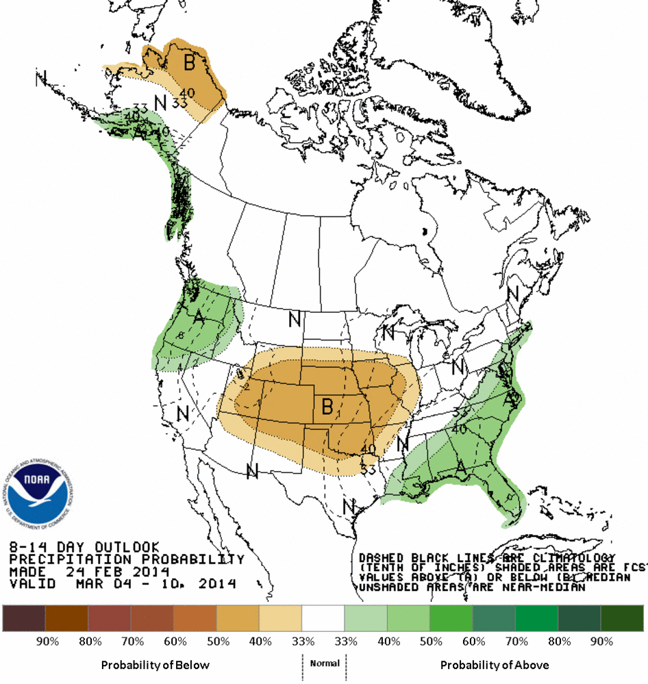
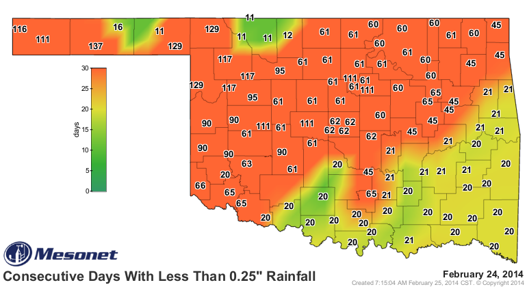
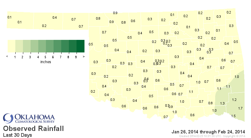
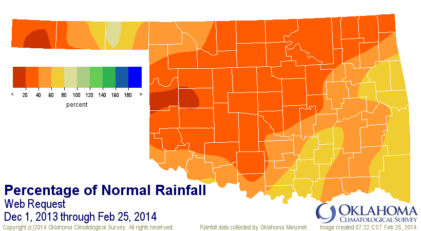
That moisture forecast simply ain't enough, folks. We're getting seriously dry
again. Here are a host of scary looking maps that tell the story.
Consecutive Days Without At Least A Quarter-Inch of Moisture
30-Day Rainfall Maps
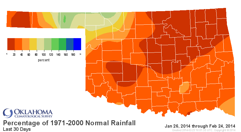
60-Day Rainfall Maps and Stats/Rankings
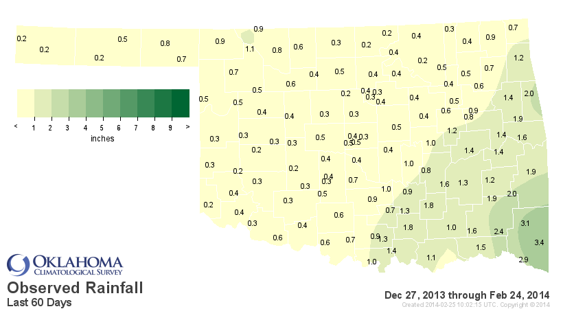
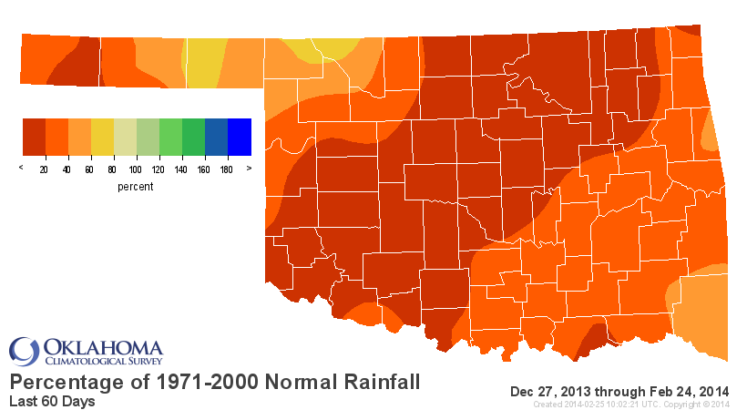
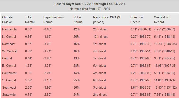
Yeah, you're reading that right ... for the NE and central areas of the state,
the last 60 days have been the driest since robust records began in 1921. And
the other areas (and statewide) aren't much better.
Given our piddling chances of moisture through Friday, this winter
(climatological winter runs from December 1-February 28/29) is going to end up
somewhere close to the top-10 driest on record.
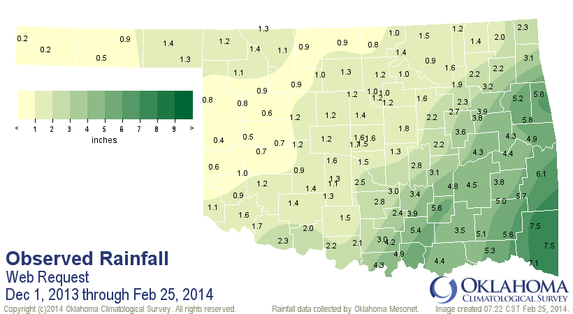
If I've said it once, I'll say it again ... "Roadhouse" is the best movie ever
made. That's beside the point, however. The real point is, once again, thank
goodness we're in the cool season and this isn't April or May (or June or July
and so on and so forth) or we'd be seeing explosive drought intensification
across most of Oklahoma.
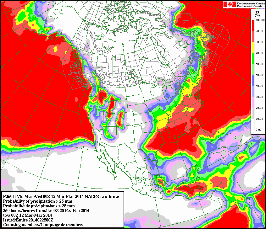
Here are the odds of accumulating at least 4/10ths of an inch of moisture
through March 12 from our friends up north in Canada, hosers. Not too good, eh?
The good news is spring is right around the corner. We just need it to be sprung
a little quicker this year ... at least the rains.
Gary McManus
State Climatologist
Oklahoma Climatological Survey
(405) 325-2253
gmcmanus@mesonet.org
February 25 in Mesonet History
| Record | Value | Station | Year |
|---|---|---|---|
| Maximum Temperature | 85°F | HOLL | 1999 |
| Minimum Temperature | -2°F | CHER | 2003 |
| Maximum Rainfall | 1.79″ | KIN2 | 2013 |
Mesonet records begin in 1994.
Search by Date
If you're a bit off, don't worry, because just like horseshoes, “almost” counts on the Ticker website!