Ticker for February 18, 2014
MESONET TICKER ... MESONET TICKER ... MESONET TICKER ... MESONET TICKER ...
February 18, 2014 February 18, 2014 February 18, 2014 February 18, 2014
Pick a climate, February!
I'm a bit more partial to the current February weather we're having as opposed to
what we saw the first 12 days or so. You remember those days, right? Like Boise
City having a HIGH TEMPERATURE OF 6 DEGREES on the 5th after A LOW TEMPERATURE OF
-2 DEGREES?? Starting about the 13th, however, we've gone back into some of what
we saw during January. Let's just look at the statewide averages for the two
periods and see what types of differences we've had, shall we? Allllllrighty then!
Remember, these are statewide averages.
-***-
Period Max T Dep. Min T Dep. Avg. T Dep.
February 1-12 31.8 -20.3 17.7 -9.4 24.7 -14.9
February 13-17 63.9 +9.9 30.3 +1.3 47.1 +5.6
February 1-17 41.2 -11.5 21.4 -6.3 31.3 -8.9
-****-
Granted, the second stanza (Feb. 13-17) is only five days compared to the
prolonged cold of the month's first 12 days, but all that does is accentuate just
how cold it was and for how long. Hey, 20.3 degrees below normal on your highs
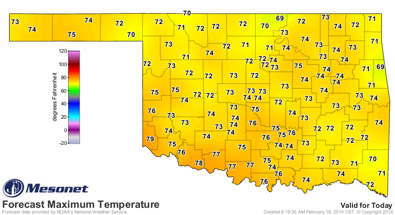
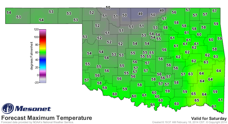
over a 12 day period is just a tad significant. Now we are going to have a few
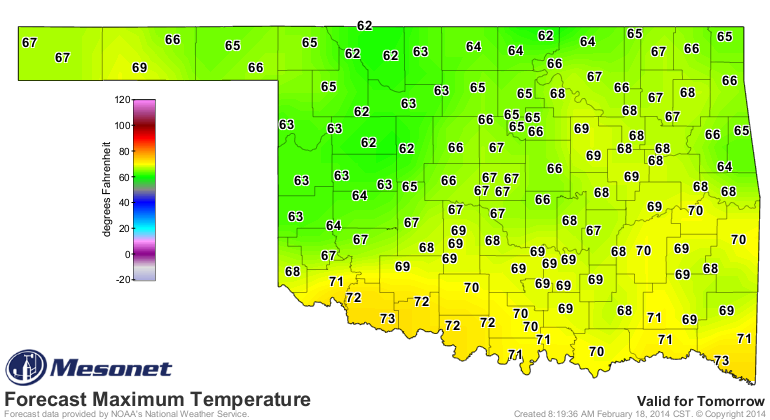
more much-above-normal days here, with today being the warmest. Following that,
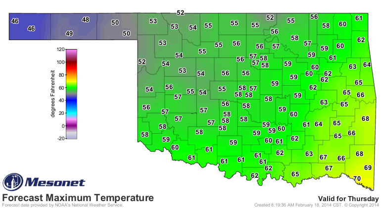
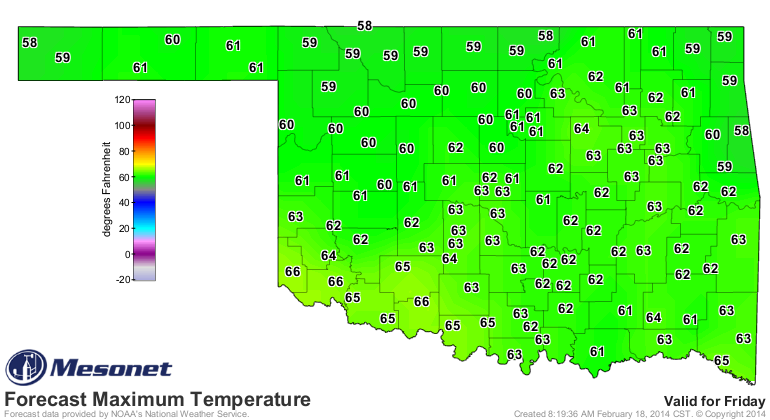
we should have a week of normal-to-above normal temperatures, but nothing drastic
like the last couple of days.
That will get us through the 22nd, then we'll have another six days to go. It does
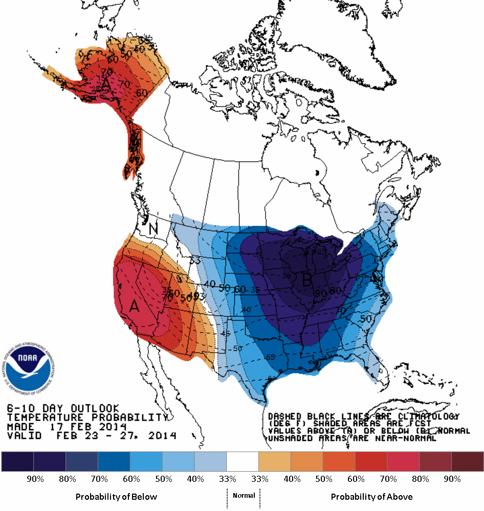
look like we'll have another "brushing" of arctic air from the northeast as
the battle between the ridge building in the west and the trough digging in the
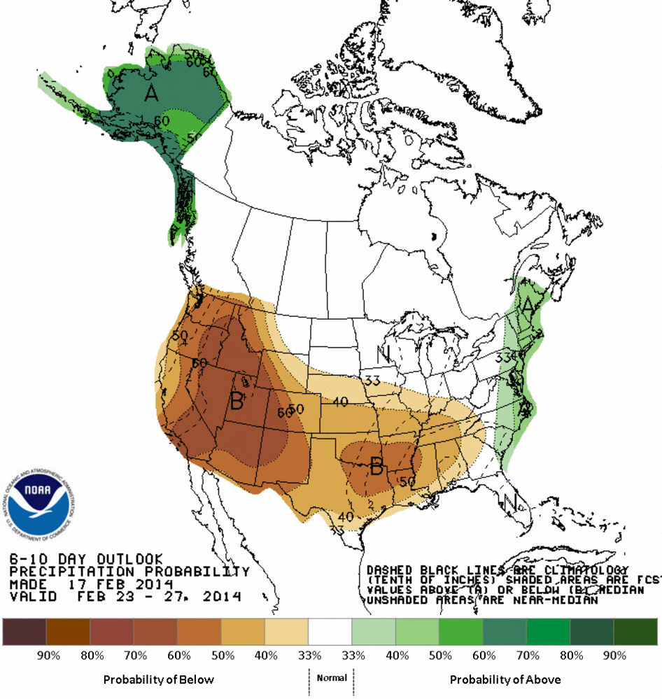
east shifts to the trough's favor again. Check out the 6-10 and 8-14 day outlooks
from the CPC.
Feb. 23-27 Outlooks
Feb. 25-March 3 Outlooks
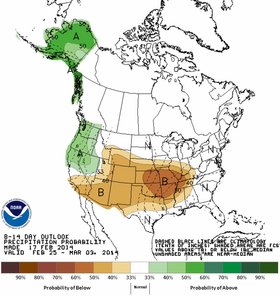
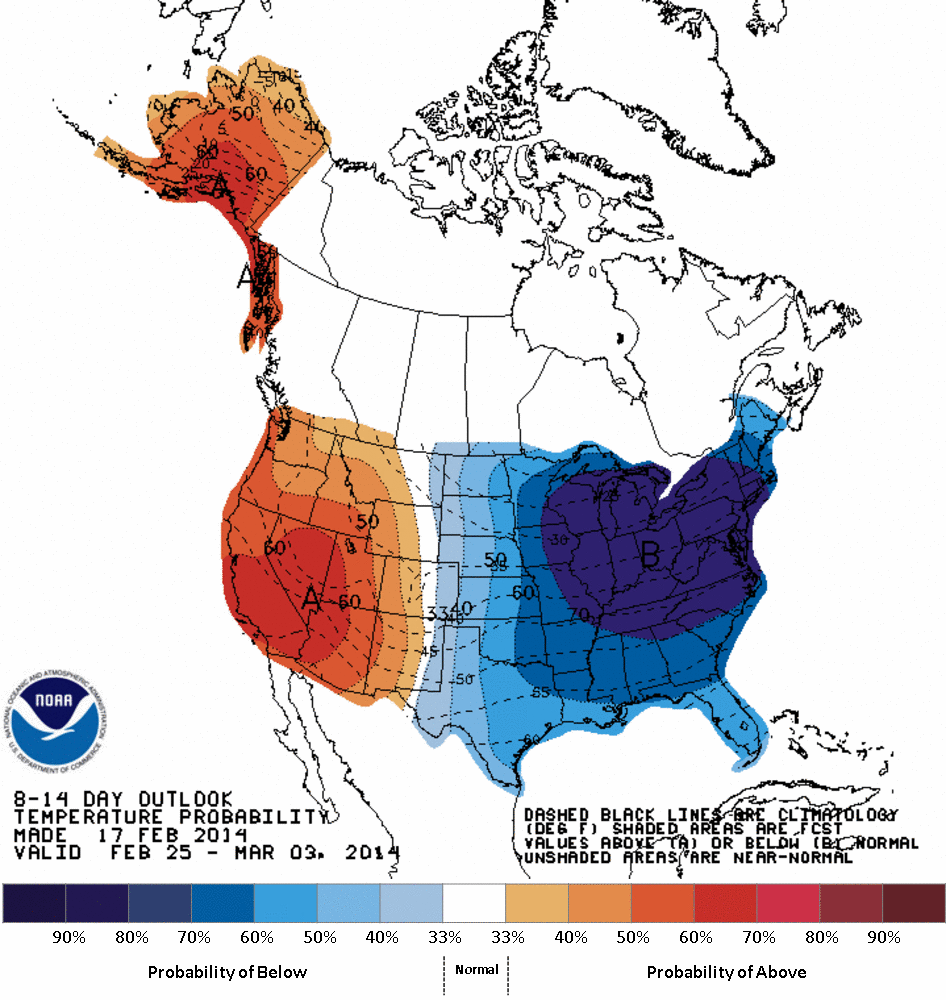
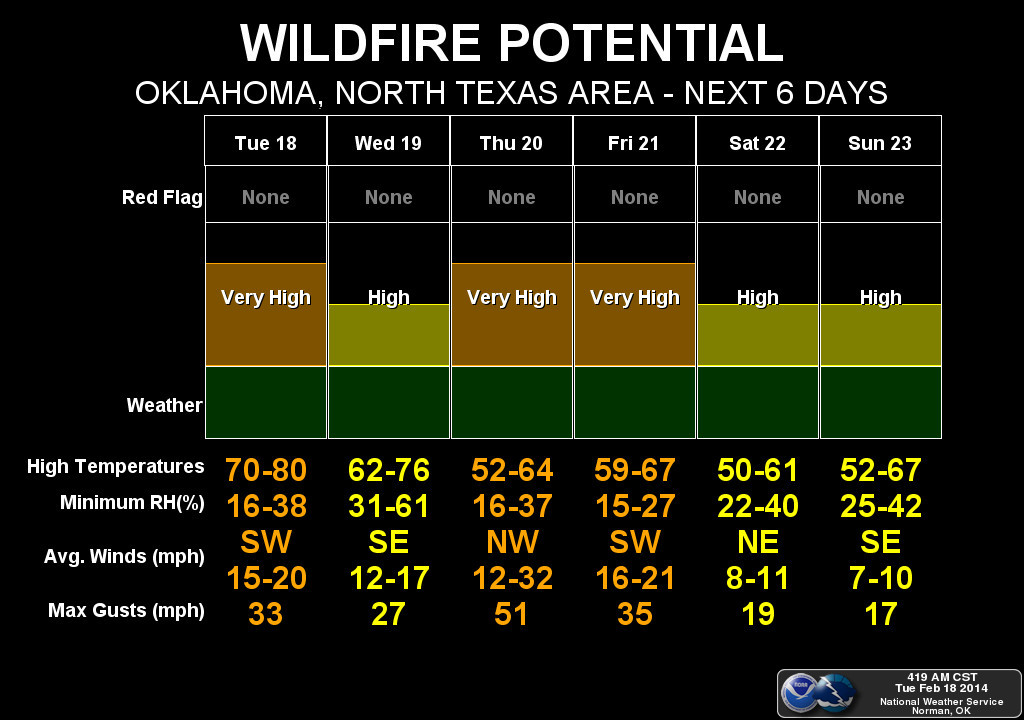
Not only do you see greatly increased odds of below normal temperatures, but
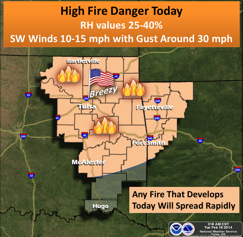
the odds favoring dry weather as well. That's not good news, of course, with this
being the prime fire season in the state. Forget about all that snow that fell and
its moisture. Fire this time of year cares about day-to-day weather conditions
(i.e., wind and low humidity, and the warmth here and there won't help either).
But let's not forget just how dry it has been either, despite that snow. January
was the 8th driest on record, and February for most of the state has been
exceedingly dry as well. Combine those two together and you are looking a lot
like January-February (thus far) 2011. And that's without 2011's dry-enhancing
La Nina!
Jan. 1-Feb. 18, 2011 (Statewide avg. 1.00", 1.62" below normal, 12th driest)
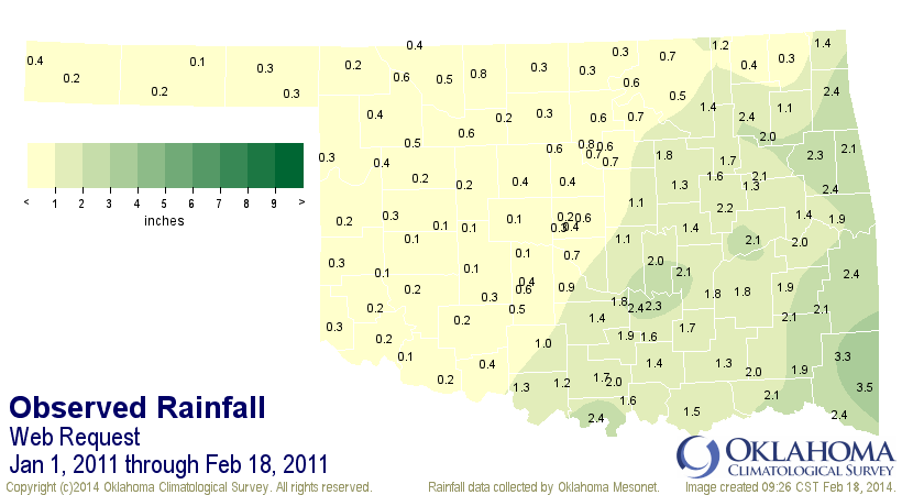
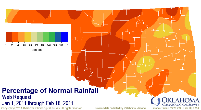
Jan. 1-Feb. 18, 2014 (Statewide avg. 0.76", 1.86" below normal, 6th driest)
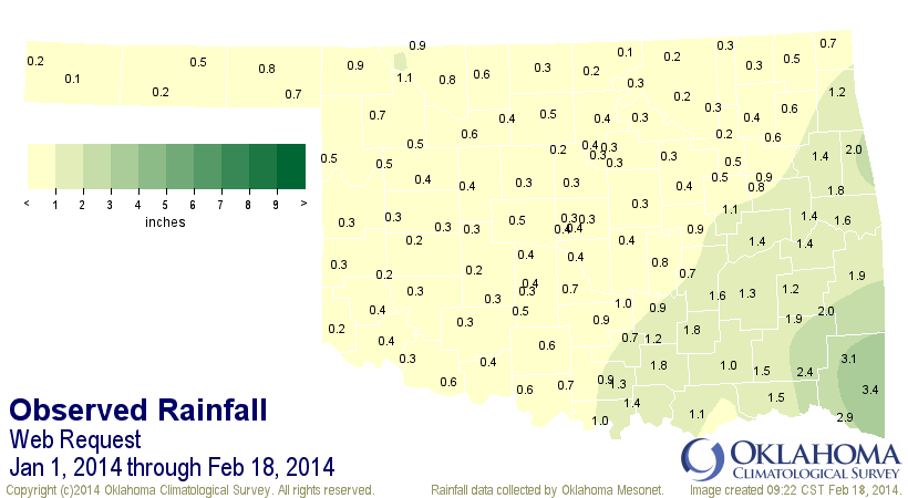
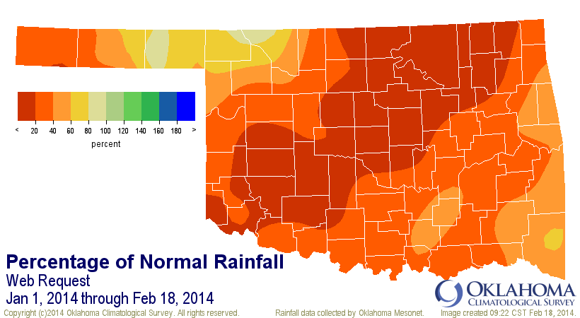
Certainly not saying we're headed for another 2011 (shudder)! But we can't discount
how dry it has been either. And temperatures for that 2011 period were eerily
similar as well (play "Twilight Zone" music here).
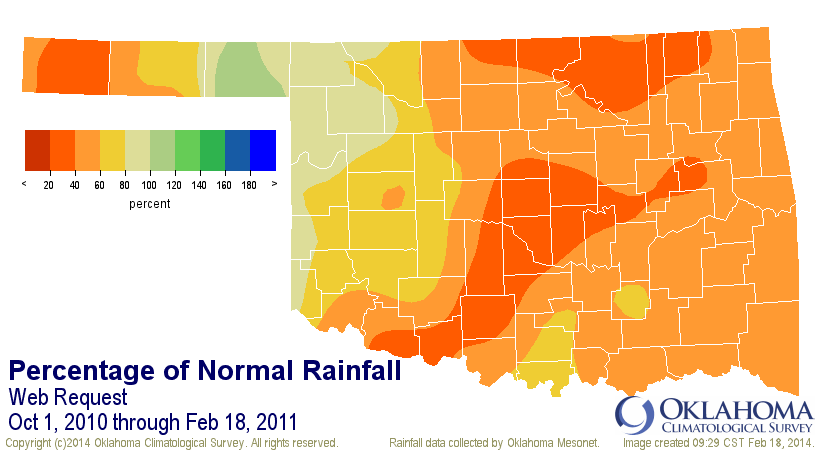
Heck, let's just check out the Oct. 1-Feb. 18 stretches from both period and see
what they look like. Remember that we can "almost" pinpoint the 2011 drought's
beginnings to Oct. 1, 2010.
Oct. 1-Feb. 18,2011 (Statewide Avg. 5.52", 5.34" below normal, 7th driest)
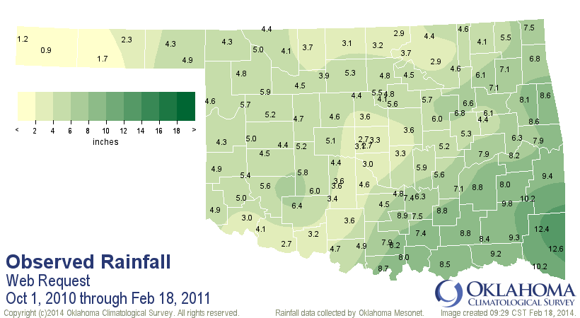
Oct. 1-Feb. 18, 2014 (Statewide Avg. 7.07", 3.79" below normal, 20th driest)
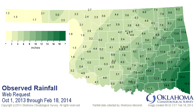
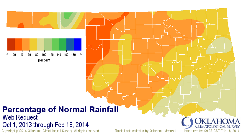
See, there you go! This same period in 2010-11 was nothing like what we're seeing
now ... 7th driest vs. 20th driest. That makes me feel a lot better.
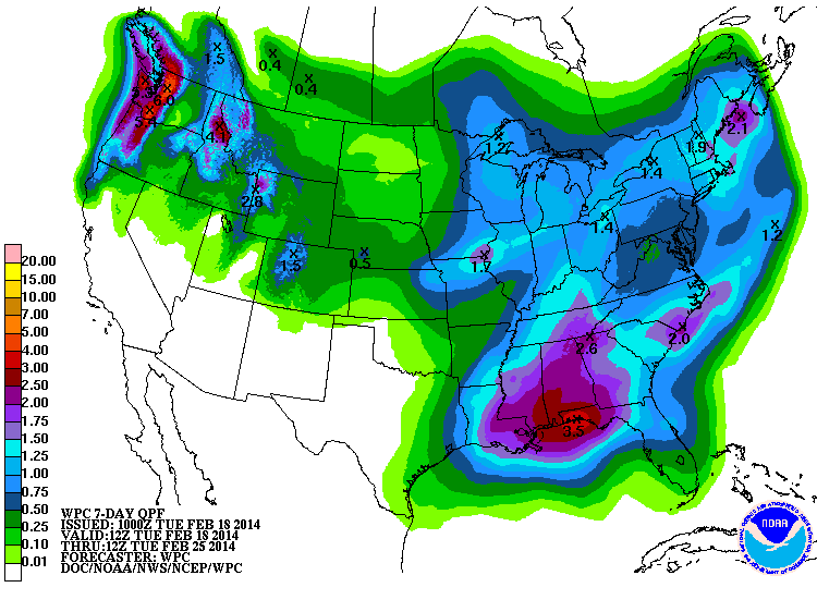
Sarcasm? Yeah, right ... when have I ever used sarcasm. After all, we have a good
tenth of an inch (or so) to look forward to in the next 7 days. Soak it up!
Gary McManus
State Climatologist
Oklahoma Climatological Survey
(405) 325-2253
gmcmanus@mesonet.org
February 18 in Mesonet History
| Record | Value | Station | Year |
|---|---|---|---|
| Maximum Temperature | 91°F | BUFF | 2016 |
| Minimum Temperature | -8°F | TIPT | 2021 |
| Maximum Rainfall | 0.78″ | TIPT | 1998 |
Mesonet records begin in 1994.
Search by Date
If you're a bit off, don't worry, because just like horseshoes, “almost” counts on the Ticker website!