Ticker for February 13, 2014
MESONET TICKER ... MESONET TICKER ... MESONET TICKER ... MESONET TICKER ...
February 13, 2014 February 13, 2014 February 13, 2014 February 13, 2014
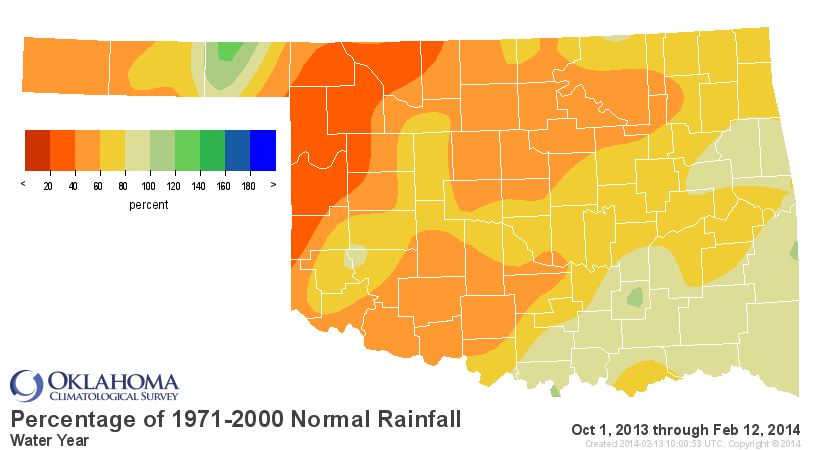
Drought improvements? We don't snow yet.
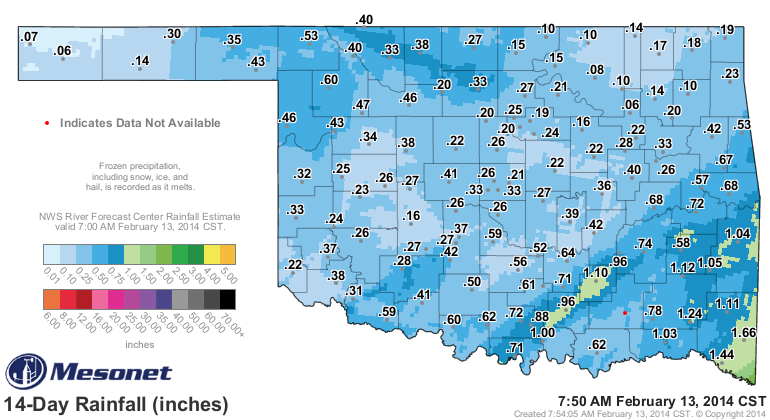
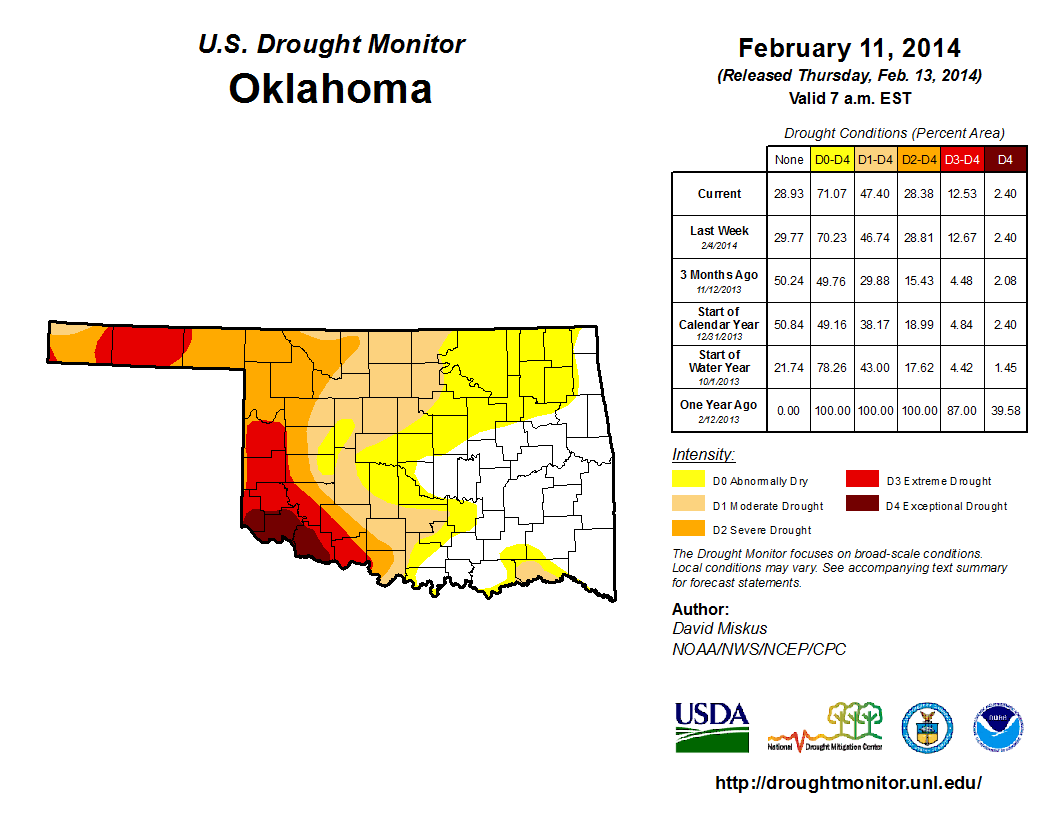
The newest U.S. Drought Monitor report shows *limited* improvement way up in NW
Oklahoma in the Woods County area where we showed Alva getting more than a foot
of snow. That all melted down to a bit more than three-quarters of an inch, but
that's the perfect *take the rain gauge in and melt the snow and see what you get*
method perfected by cooperative observers. In reality, especially when we were
cloudy and below freezing for so long (not much melting going on, in other words),
some of that snow evaporated (sublimated) into the atmosphere and that moisture
was lost. So in the perfect case, dealing with the last two week's worth of
possible moisture (we're really only supposed to look at the last week's worth,
Tuesday through Tuesday, but everything's been frozen throughout that 14-day
period), we would have seen about a quarter-inch to three-quarters of an inch
of liquid moisture across much of the state. More in some places, less in others.
So up in the Woods County area, we did see a bit of improvement. But we'll have
to wait and see on next week's map if we had even more positive impacts from the
melting snow.
The problem we face now is a return to January-like weather, which sounds
extremely odd as we head into late February. What I mean by that is the day-to-
day weather conditions that created all that fire danger in January are
expected to return through much of the next two weeks, except this time with
few bouts of cold air. Those warm windy and dry days will once again start to
have detrimental impacts on our drought condition if it lasts too long.
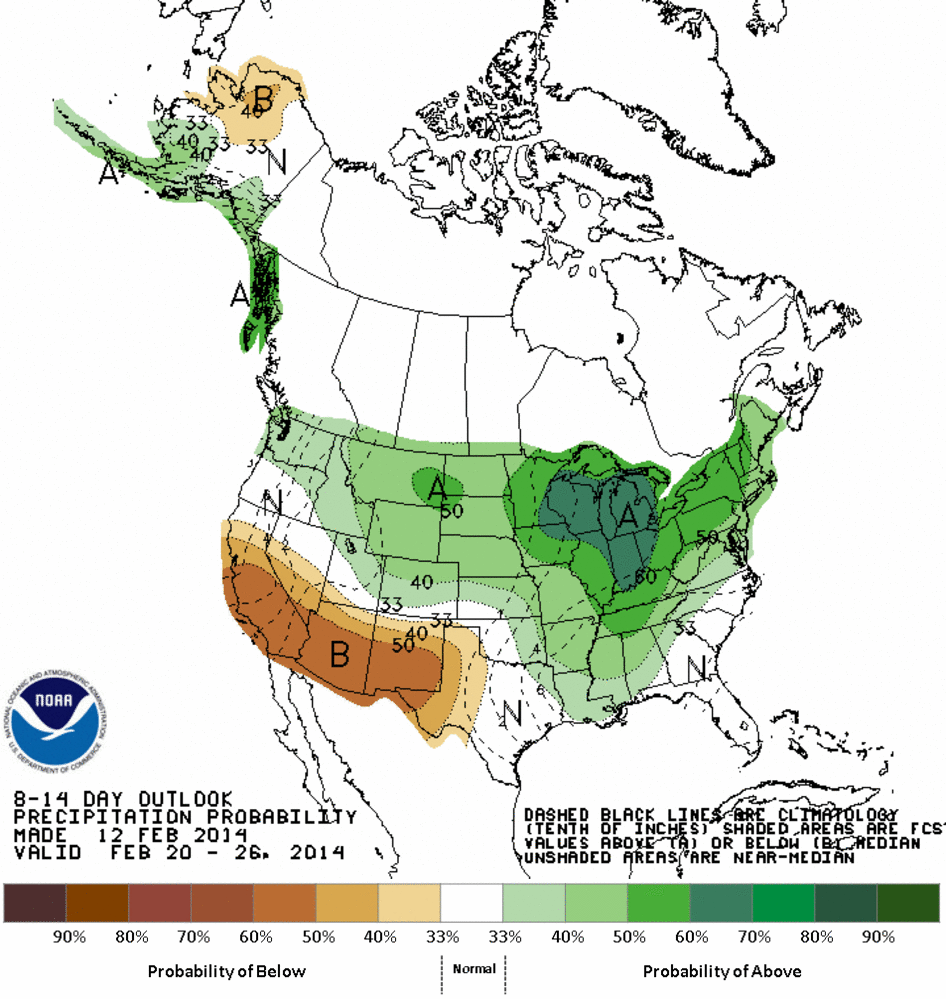
Right now, the extended outlooks from the Climate Prediction Center continue to
show increased odds of above normal temps for our area throughout most of the
rest of February. However, we are seeing signs of some moisture in these
outlooks, perhaps. Unfortunately, not in the areas that need it the most ...
western Oklahoma.
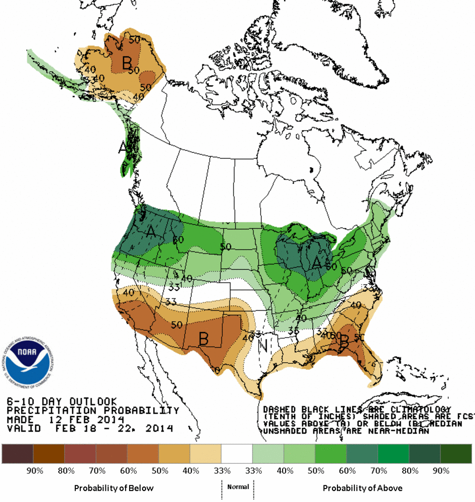
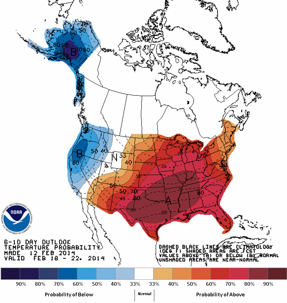
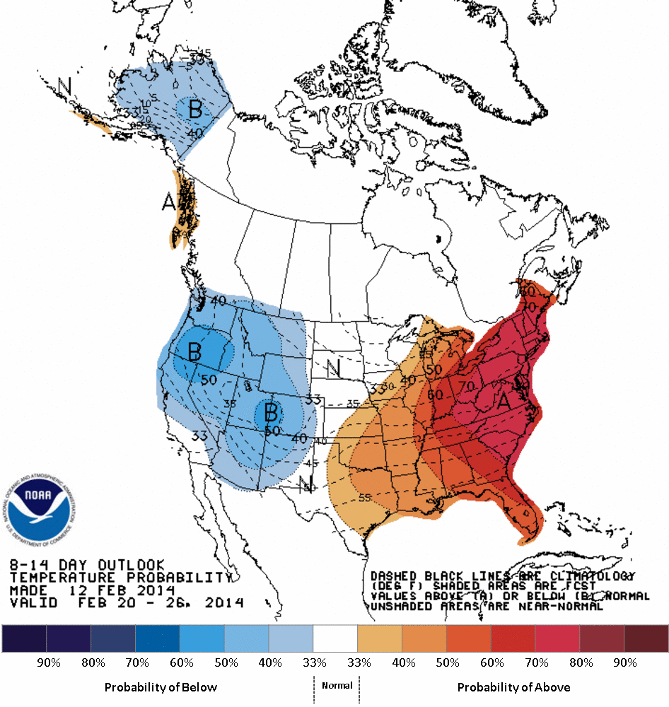
We also see a pocket of cooler than normal air, or at least increased odds of
such, out across the western U.S., so perhaps that signals the warmth to be
a minor aberration as I discussed yesterday. A couple of other tools we look
at are less than optimistic for the next week and also the rest of the month.
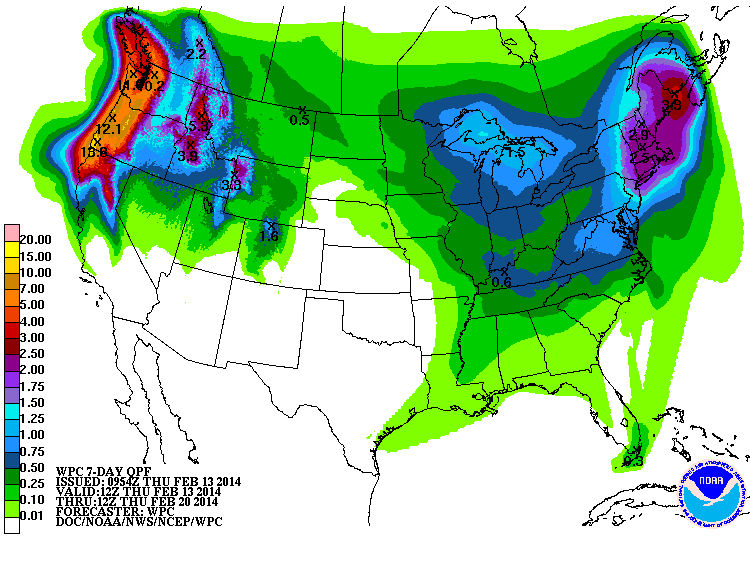
The 7-day precip forecast from WPC shows zilch for the state through next
Thursday morning.
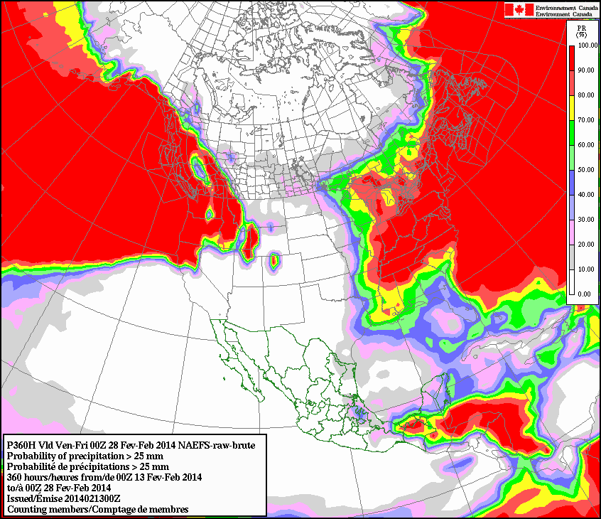
The Canadian forecast model shows most of Oklahoma with a less than 10 percent
chance to accumulate at least 4/10ths on an inch through February 28.
So here comes the warm and dry, and the fire danger conditions.
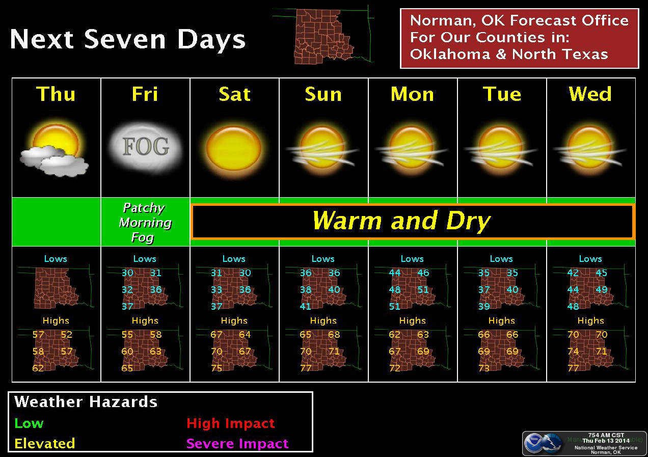
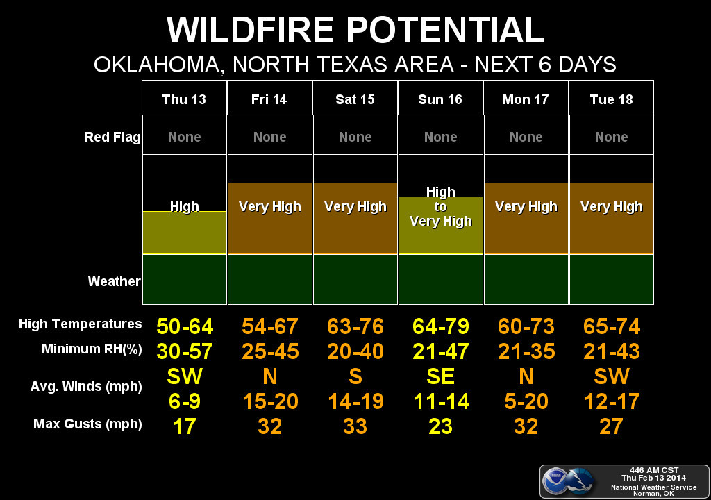
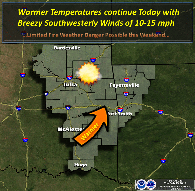
The snow was wonderful (not really, it was terrible, but I acquiesce to those
that need moisture ... but it could have fallen as rain at 60 degrees, too!),
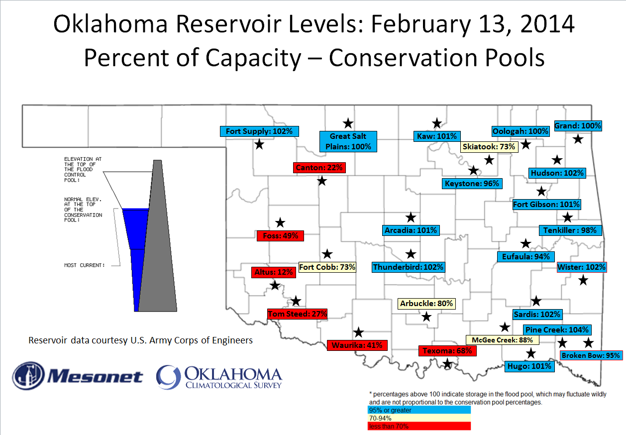
but when we're still dealing with building deficits, we need more moisture. For
western Oklahoma, lots of it. Just ask their lakes.
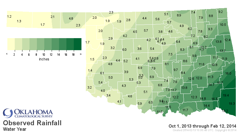
Eastern Oklahoma lakes are mostly okay, although Skiatook has been down for
a considerable amount of time while the lakes around it have rebounded nicely.
Texoma is in trouble at 68% of their normal conservation pool. Tom Steed, Altus
and Canton ... dead in the water (or out of it).
Gary McManus
State Climatologist
Oklahoma Climatological Survey
Wk: (405) 325-2253
Cell: (405) 823-9054
gmcmanus@mesonet.org
February 13 in Mesonet History
| Record | Value | Station | Year |
|---|---|---|---|
| Maximum Temperature | 79°F | KENT | 2016 |
| Minimum Temperature | -8°F | EVAX | 2025 |
| Maximum Rainfall | 2.32″ | BBOW | 2001 |
Mesonet records begin in 1994.
Search by Date
If you're a bit off, don't worry, because just like horseshoes, “almost” counts on the Ticker website!