Ticker for February 11, 2014
MESONET TICKER ... MESONET TICKER ... MESONET TICKER ... MESONET TICKER ...
February 11, 2014 February 11, 2014 February 11, 2014 February 11, 2014
Winter. It keeps going and going and going ...
Another day, another 24 hours spent below freezing for most of the state. Things
have gotten so bad we're looking at our Mesonet station at Hinton possibly
breaking the all-time Mesonet record for consecutive hours below zero. Yeah,
Hinton! Check out the map of consecutive hours below freezing.
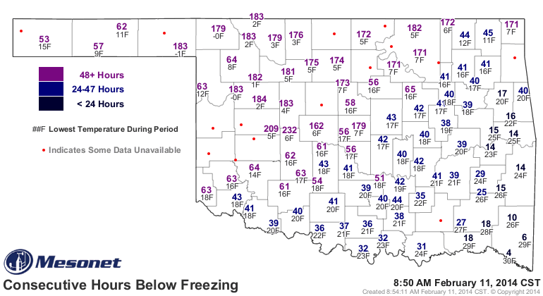
Hinton is already up to 232 hours, and quite a few other stations across the
northwestern half of the state are above 170 hours. Vinita and Miami hold the top
two spots in the all-time consecutive hours below freezing record for the Mesonet
(temperature data goes back to 1997) at 282.3 and 260.6 hours, respectively.
Those records were set between Dec. 23, 2000-Jan. 4, 2001 (January 3rd for Miami).
Luckily, it doesn't appear Hinton is going to make it another 50 hours to claim
the top spot. The NWS office in Norman predicts Hinton will finally make it
above freezing sometime around 11 a.m. tomorrow. That would take them up to, let's
see ... all my fingers and toes, ought from naught, etc., about 258 consecutive
hours below freezing. That's a heckuva long time!
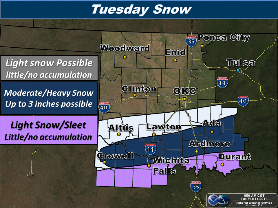
But even as it continues to snow today (up to 3 inches possible in southern
Oklahoma)
we look ahead to tomorrow and later in the week for a return to normal-to-above-
normal temperatures.
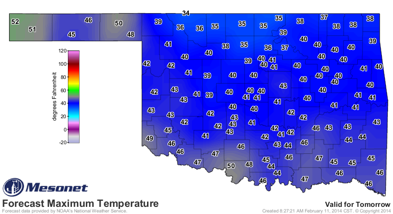
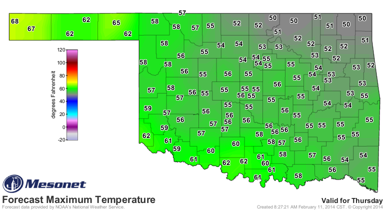
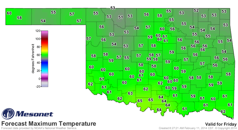
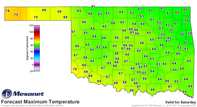
That good fortune (come on ... even the most ardent winter-loving folks have
to be tired of it by now!) should continue into the weekend as well. 60s and
70s this weekend? Count me in!
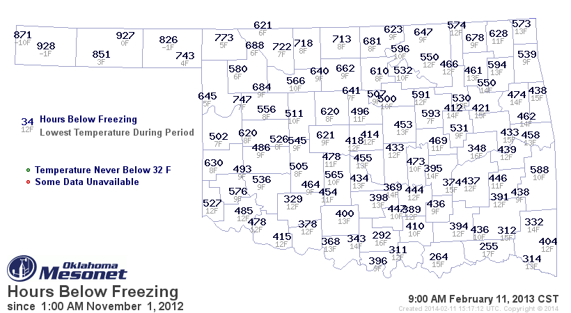
We can always remember last winter a bit more fondly now that this one has
trudged on (with a bit of an interruption here and there during January). These
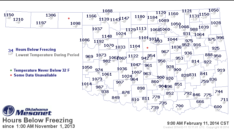
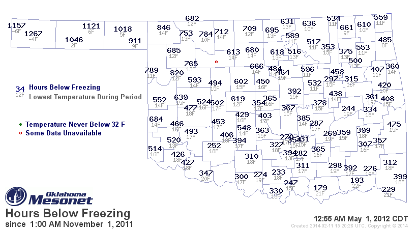
are maps of the hours below freezing from November 1-February 11 (at 9 a.m.)
for the last two years. You can see that this year has been an order of
magnitude worse for the below freezing metric, often doubling what we saw last
year in most areas.
Even last February, however, winter was about to hit the fan right about
Valentine's Day, and we've generally been cooler than normal ever since. Even
more interesting, we can look at the whole winter and then some back in 2011-12
and it won't come close to matching up. Here's the map fro November 1, 2011, all
the way out to May 1, 2012. Some places spent less than 200 hours below freezing,
and only got down to the low 20s all winter. Very few even got out of the teens!
So when we talk about this year's cold winter, we really mean it!
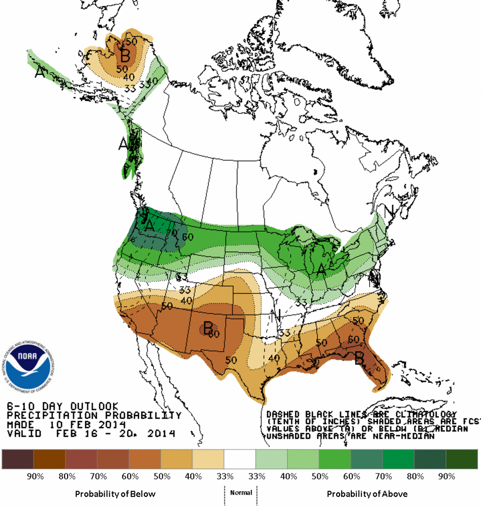
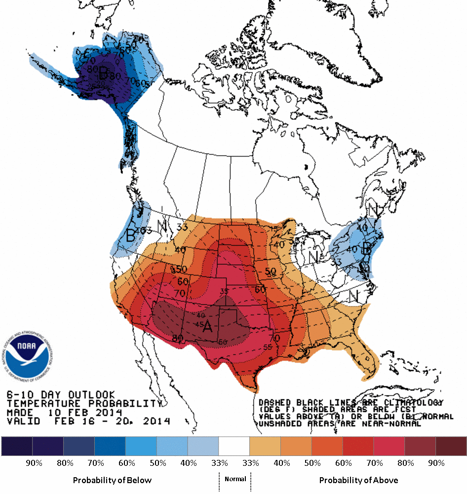
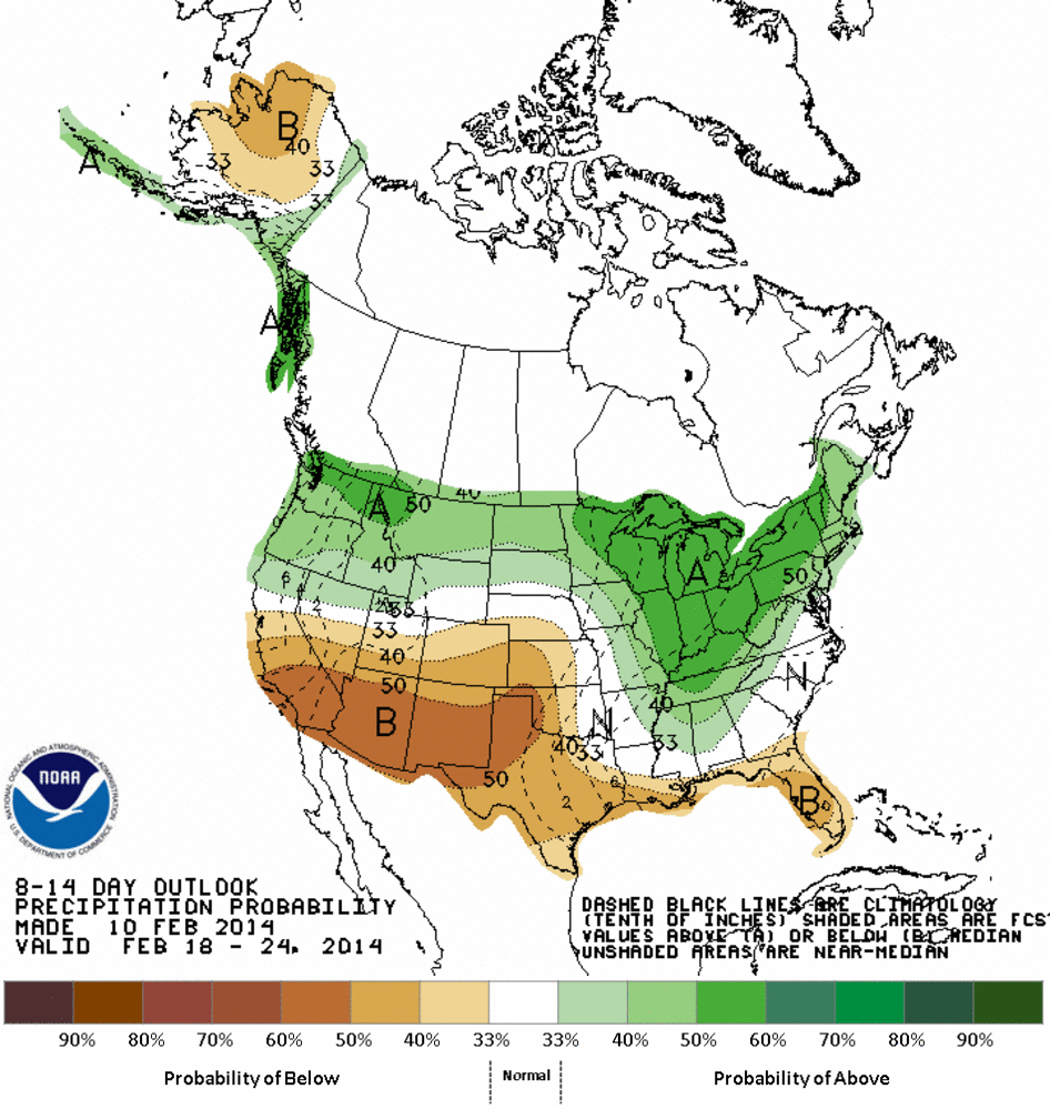
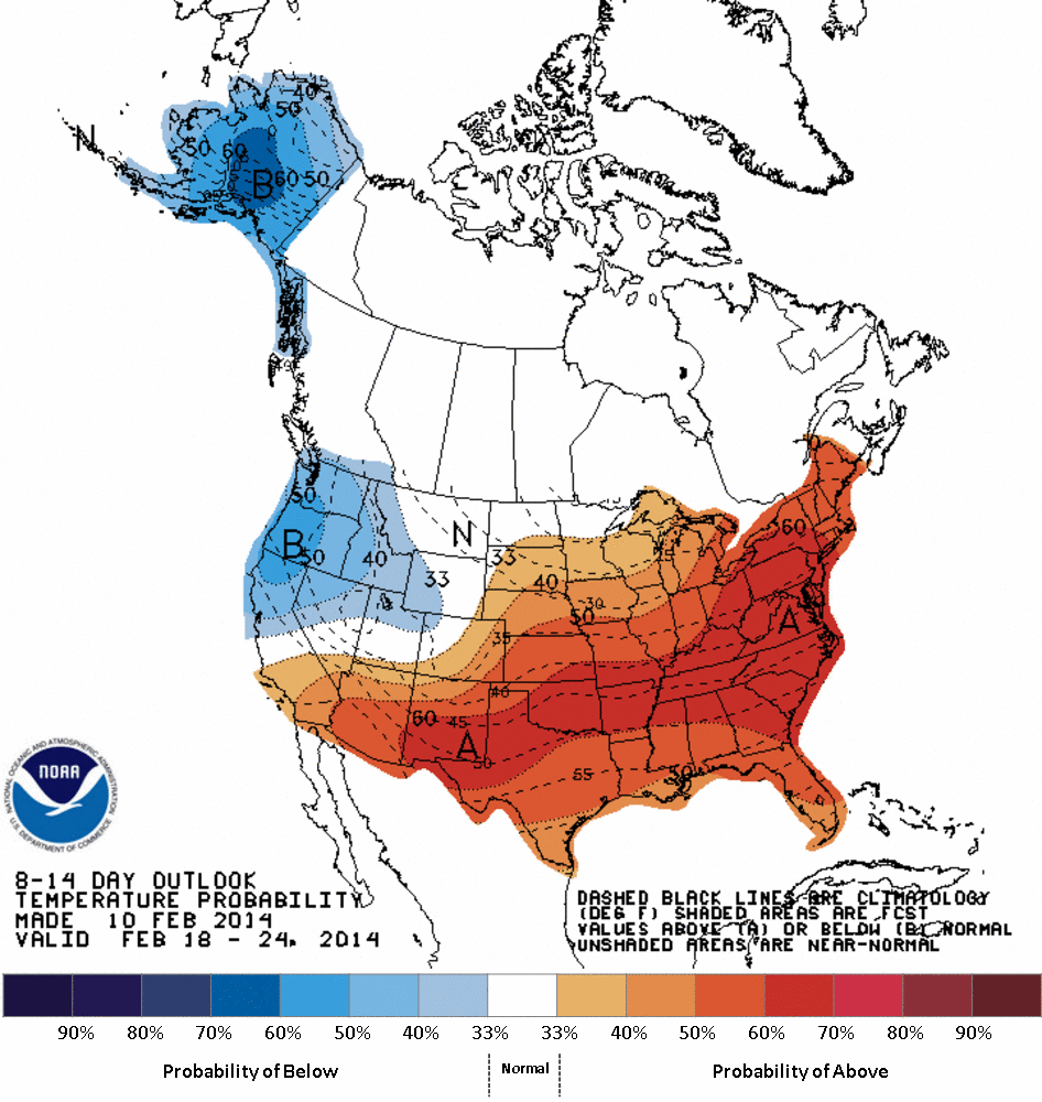
As far as the longer-range forecast, it appears the warmth might stick around
awhile, but it also looks to get dry again as well. Here are the 6-10 and 8-14
day outlooks from the CPC showing increased odds of above normal temps and below
normal precip for Oklahoma, at least out through the third week of February.
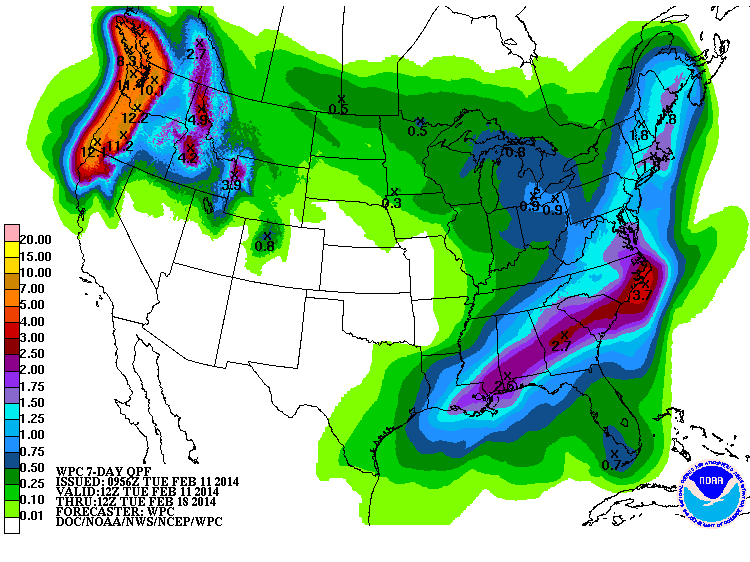
The next seven days should see an end to the moisture as well, so enjoy that
snow while you have it, or at least the moisture as it melts.
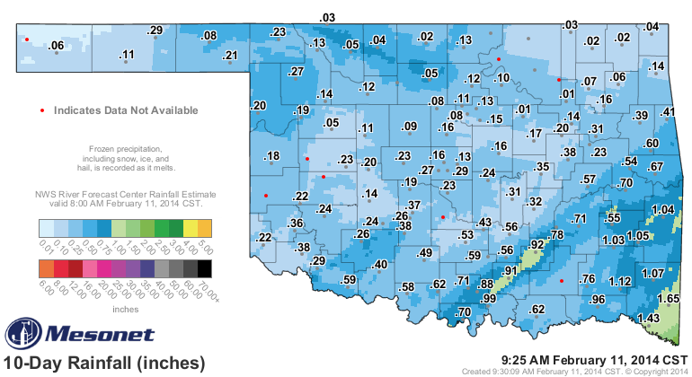
This is the sum total of what we have received over the last 10 days with this
multitude of winter storms. Unfortunately, despite all the slippery stuff, still
sorely lacking in moisture considering the drought conditions strengthening
across the northwestern half of the state.
A return to fire danger, like during January? Only time will tell.
Gary McManus
State Climatologist
Oklahoma Climatological Survey
(405) 325-2253
gmcmanus@mesonet.org
February 11 in Mesonet History
| Record | Value | Station | Year |
|---|---|---|---|
| Maximum Temperature | 99°F | MANG | 2017 |
| Minimum Temperature | -6°F | PRYO | 2011 |
| Maximum Rainfall | 1.27″ | VANO | 2008 |
Mesonet records begin in 1994.
Search by Date
If you're a bit off, don't worry, because just like horseshoes, “almost” counts on the Ticker website!