Ticker for February 6, 2014
MESONET TICKER ... MESONET TICKER ... MESONET TICKER ... MESONET TICKER ...
February 6, 2014 February 6, 2014 February 6, 2014 February 6, 2014
Anybody remember the drought?
Yeah yeah, another frigid day, another round of snow. Who can keep up? But yes,
it is snowing again, and it appears southwestern through central Oklahoma has
picked up another 1-3 inches of snow. For my purposes, it's much-needed moisture.
For school kids and kids-at-heart adults, it's Heaven. I'd be careful about going
out to play in it just yet, unless you can cover every single inch of your skin.
Check out the Mesonet temperature maps.
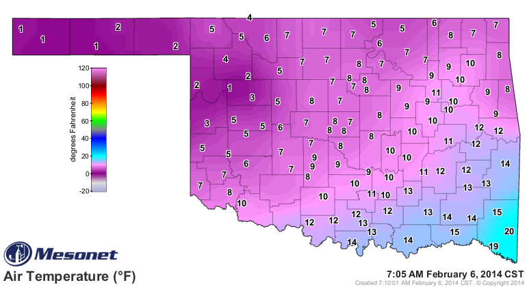
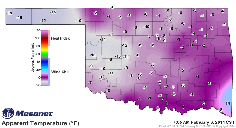
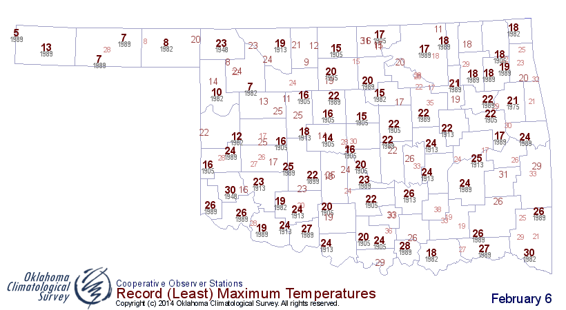
And it ain't exactly going to get tropical today, so don't expect much
improvement. In fact, highs like this today will be record-breaking is a lot of
areas for lowest maximum temperatures (for February 6s back in history). In some
cases, by quite a bit.
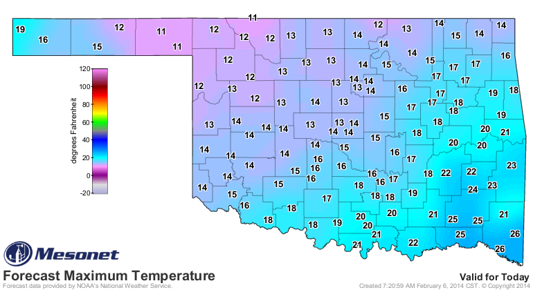
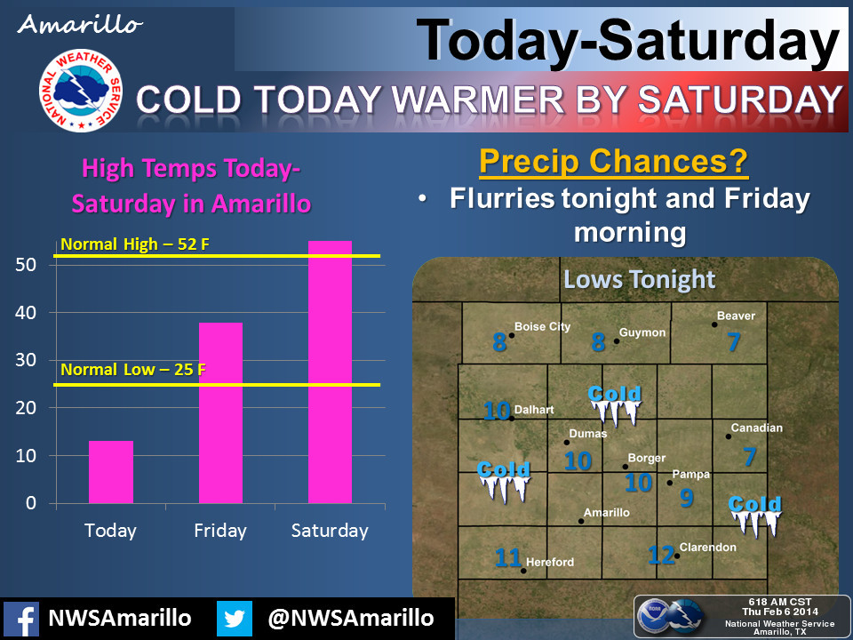
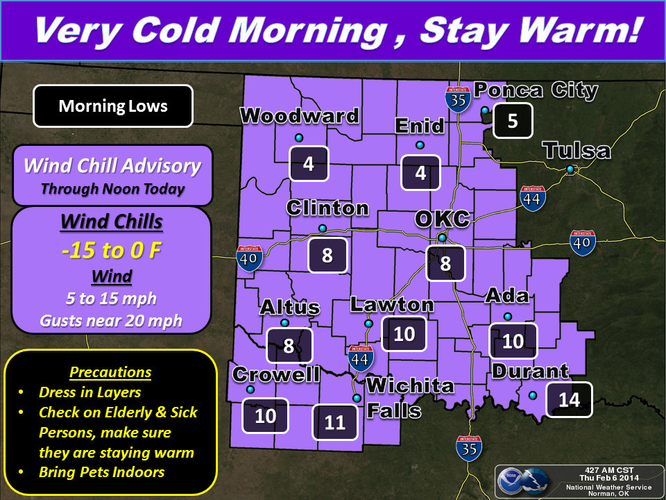
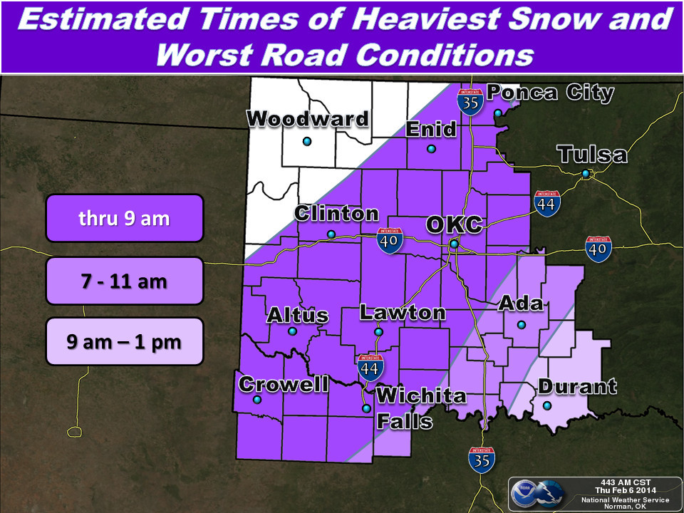
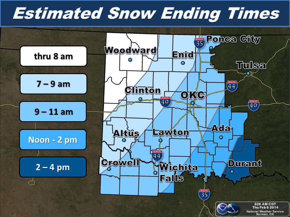
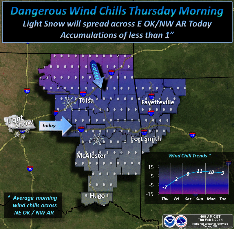
Here's how our local NWS offices see the day playing out. Have a look at the
following not-so-pretty pictures.
Now we HAVE to pay attention to this drought, because despite the snow, it
trudges on across the western half of the state. First, let's check out the
moisture we've gotten from these storm systems in the last few days. Remember,
the Mesonet has unheated rain gauges, so much of what has fallen is still
sitting in the gauge waiting to melt. Therefore, we'll rely on the estimates
from the River Forecast Center. The five-day map should capture it all. Keep
your sights trained on far western Oklahoma.
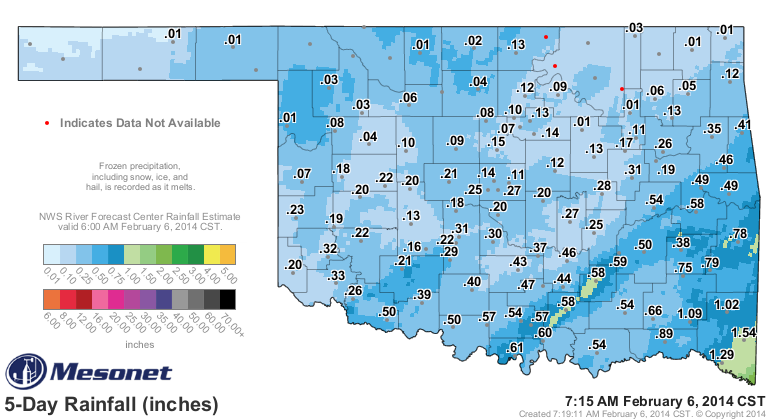
You can see some decent amounts of over an inch across south central and SE OK,
but most places, probably less than a quarter of an inch. Maybe as much as
three-quarters of an inch here and there. So not bad for five days in February.
However, looking at the BIG picture (i.e., the long-term rainfall, you can see
that this has merely been a drop in a very dry bucket for much of the state.
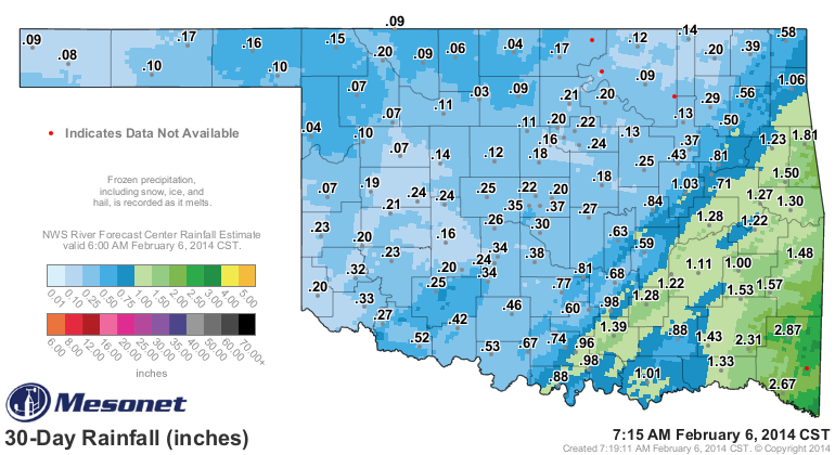
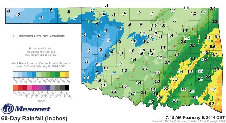
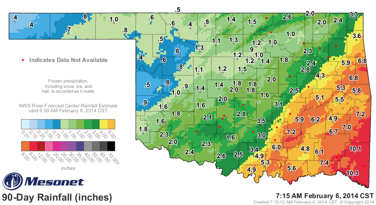
See that blueish (is that a word??) hole out across far western Oklahoma (and
the far western Panhandle)? Yep, that's basically an inch or less of rain over
the last 90 days. And frankly (or Gary-ly), it's not much better across most
of the northwestern half of the state. And remember, this is coming off a
January that saw a ton of extremely dry and windy days, with some very warm
ones thrown in to boot.
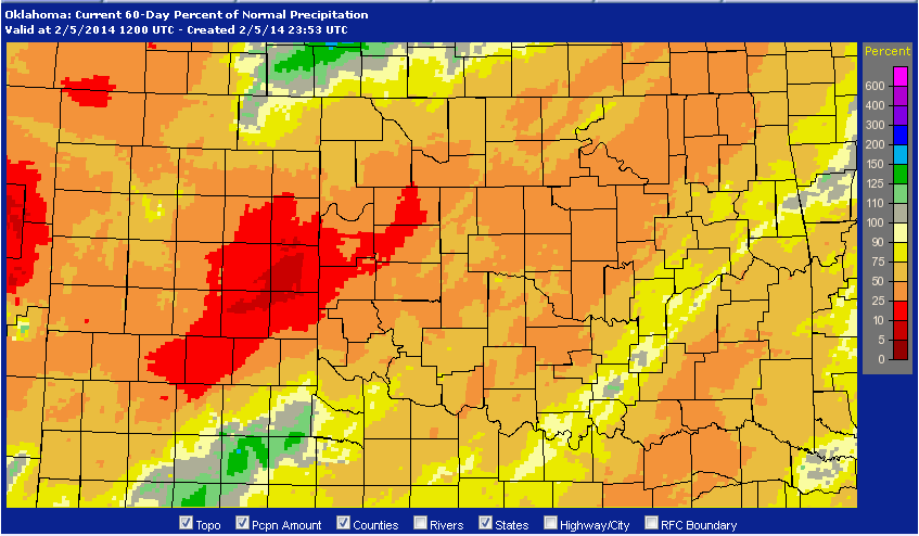
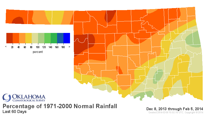
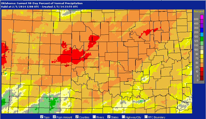
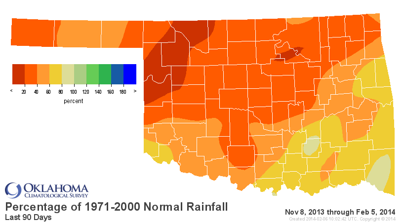
How does that look compared to normal? Well, again, it's not pretty. These from
the Mesonet are a bit off due to the lack of current melting, but I'll show you
a radar-derived departure from normal map as well. Not much difference ... all
show dry.
Oh, you're still here? Okay, what all this culminates in (FINALLY!) is the
new U.S. Drought Monitor map that shows increased severe-extreme (D2-D3) drought
across far western Oklahoma.
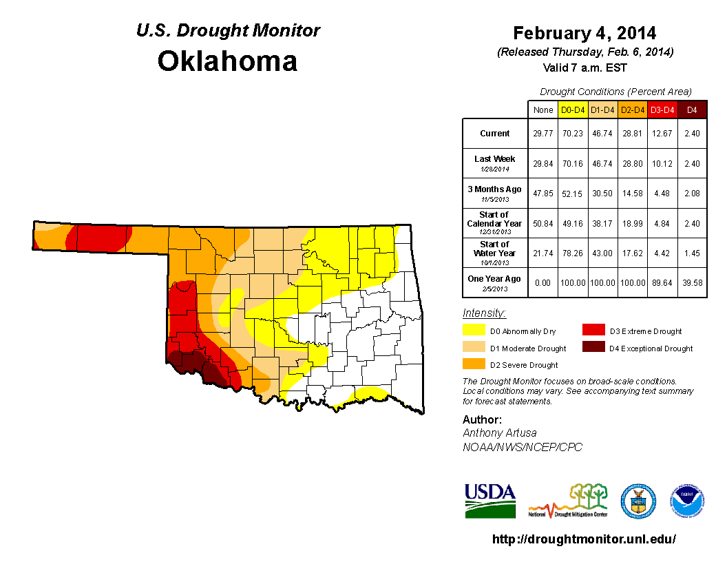
The amount of the state in extreme drought therefore jumped just a couple of
percent from 10.12 to 12.67 percent. It might not seem like much, but to the
folks out in Roger Mills County that sent us reports of "extreme" drought
conditions, it's an important sign that they are being heard.
Prospects for the next week or so? Well, there is another storm on its way for
early next week as well that could bring some moisture. And this 7-day precip
forecast map contains some of what fell today in it, but at least it shows
moisture chances continuing.
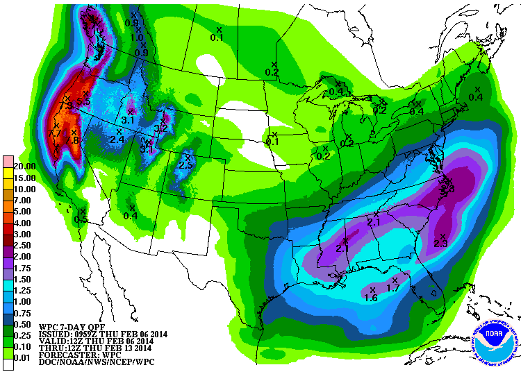
Again, not a lot across the worst drought areas in western Oklahoma, but let me
drop a pearl of wisdom on ya ... it's tough to improve drought WITHOUT it.
We'll call it a start. Hopefully it will eventually start falling as rain. Sorry
kids (and kids at heart).
Gary McManus
State Climatologist
Oklahoma Climatological Survey
(405) 325-2253
gmcmanus@mesonet.org
February 6 in Mesonet History
| Record | Value | Station | Year |
|---|---|---|---|
| Maximum Temperature | 84°F | BEAV | 2009 |
| Minimum Temperature | 0°F | CAMA | 2014 |
| Maximum Rainfall | 2.59 inches | PRES | 1999 |
Mesonet records begin in 1994.
Search by Date
If you're a bit off, don't worry, because just like horseshoes, “almost” counts on the Ticker website!