Ticker for February 4, 2014
MESONET TICKER ... MESONET TICKER ... MESONET TICKER ... MESONET TICKER ...
February 4, 2014 February 4, 2014 February 4, 2014 February 4, 2014
Dry Slot Madness
Northern Oklahoma got their snow, no doubt. In fact, it continues still. Some
locations are reporting as much as 5-6 inches, so it resembles Sunday's storm,
just flip-flopped across I-40. Folks a bit farther to the south expected maybe
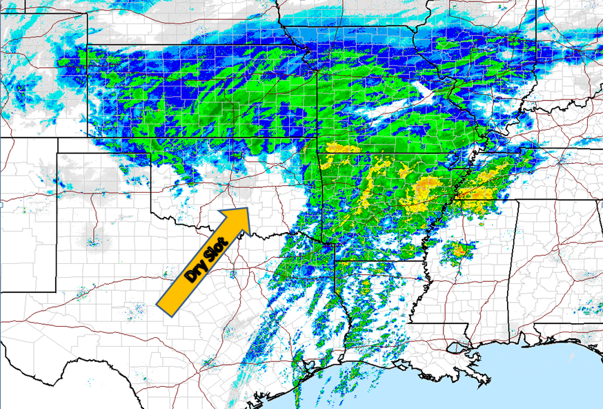
1-3 inches, but they got the dreaded dry slot instead. Check out this recent radar
loop to give you an idea of what I'm talking about. You can see lots of snow and
other things occurring along the northern third of the state, a wall of
moisture from NE OK down to the Gulf, and a "dry slot" of air where little to
no precipitation of any kind is occurring.
Dry slot, you say? Isn't that the excruciating condition one sometimes develops
after having wisdom teeth removed (I never got mine ... yeah, real shocker)? Well,
no, that's a dry socket. A dry slot is something just as painful, however, to
meteorologists of any sort of ability trying to forecast winter weather. And it's
even more painful to kids (and teachers) who wake up early in the morning
expecting a layer of white on the ground only to find nothing. As these storm
systems spin around their center of circulation, they will bring in a slot of
dry air in the mid-levels into that circulation. Eventually, this cornucopia of
moisture and dry air gets really wrapped up, and those folks that are under the
area where the moisture spins around that center can really get dumped on.
Others who get the dry slot are generally left wanting. Sometimes it can be
forecast if the models pick up on them correctly, but their timing and placement
can still be troublesome.
It's getting to be a bit late into the storm's stay over the state, but you can
still get a good glimpse of the overall circulation, the wrap-around moisture
around the center of circulation, but also that river of dry air that broke so
many hearts south of I-40 on this national radar loop from the NWS (by the time
you get around to seeing this, the storm might be off to the northeast).
http://radar.weather.gov/ridge/Conus/full_loop.php
Now that most of the shouting (and snowing) is over, we await the worst part
of the scenario ... the bone-chilling cold. You can see it poised to our north.
Well, I wish it was poised. It's actually plunging to the south.
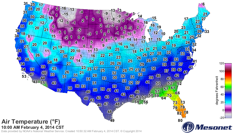
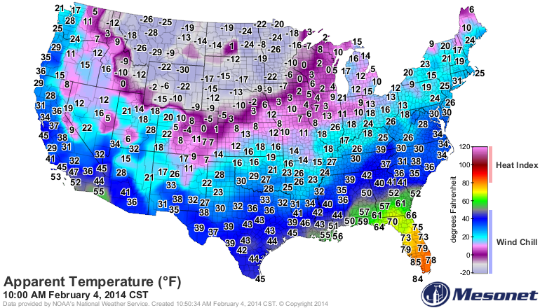
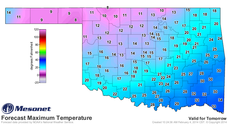
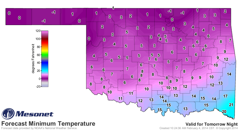
Are you ready? Are you ready for highs in the teens and lows close to zero?
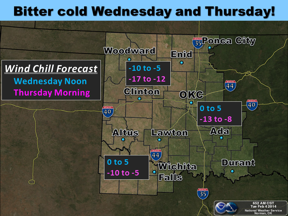
Are you ready for wind chills down in the negative teens?
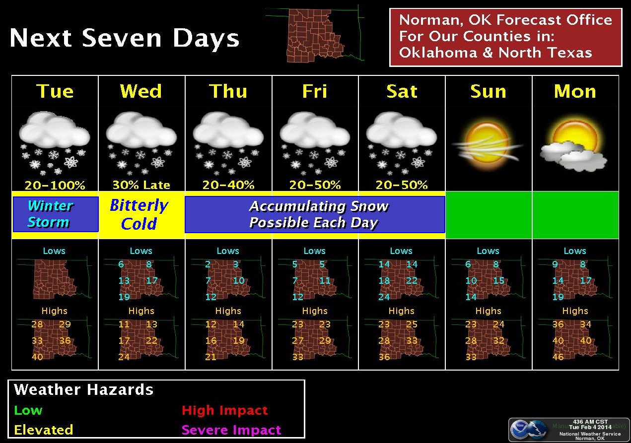
Are you ready for more snow?
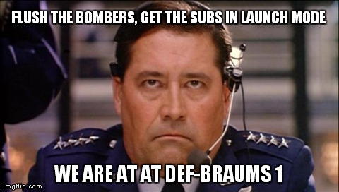
Can anybody ever really be ready for that? Yes, they can!
Gary McManus
State Climatologist
Oklahoma Climatological Survey
(405) 325-2253
gmcmanus@mesonet.org
February 4 in Mesonet History
| Record | Value | Station | Year |
|---|---|---|---|
| Maximum Temperature | 84°F | NEWP | 2008 |
| Minimum Temperature | -12°F | KENT | 2022 |
| Maximum Rainfall | 2.37″ | MTHE | 2020 |
Mesonet records begin in 1994.
Search by Date
If you're a bit off, don't worry, because just like horseshoes, “almost” counts on the Ticker website!