Ticker for February 3, 2014
MESONET TICKER ... MESONET TICKER ... MESONET TICKER ... MESONET TICKER ...
February 3, 2014 February 3, 2014 February 3, 2014 February 3, 2014
A bit about January, and still at DEF-BRAUM'S ONE!
Yes, I do have to include my January monthly summary. Given that it was one of the
most boring weather months in Oklahoma history, and all snow has broken loose
as we've gotten into February, it is indeed very anti-climatic (see what I did
there??). But, scroll down to the end for more on that dry and windy month (which
also describes my writing skills).
For now, though, we're still concentrated on that snow coming in tonight, and
tomorrow, and later this week, but also with what fell yesterday. When we're as
dry as we have been, every bit that falls is pretty important. Here are the
snow totals from the NWS offices. Looks like the far southwest had the highest
totals, as expected, although much of southern Oklahoma saw from 4-6 inches.
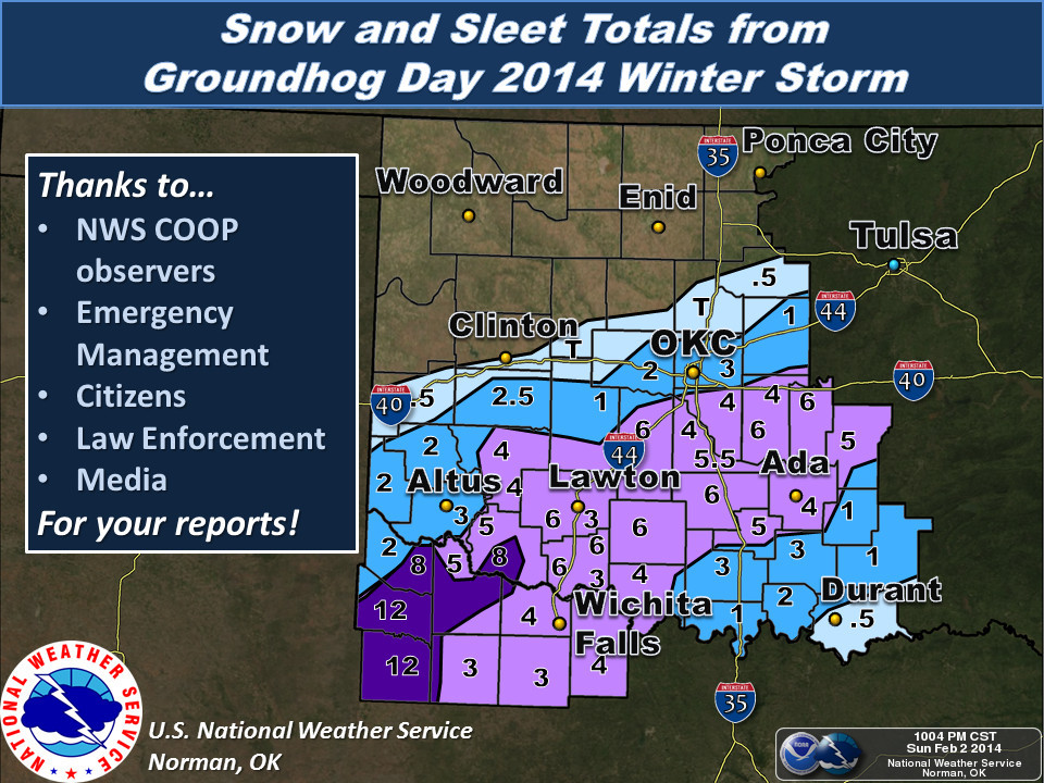
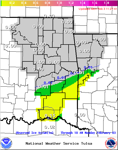
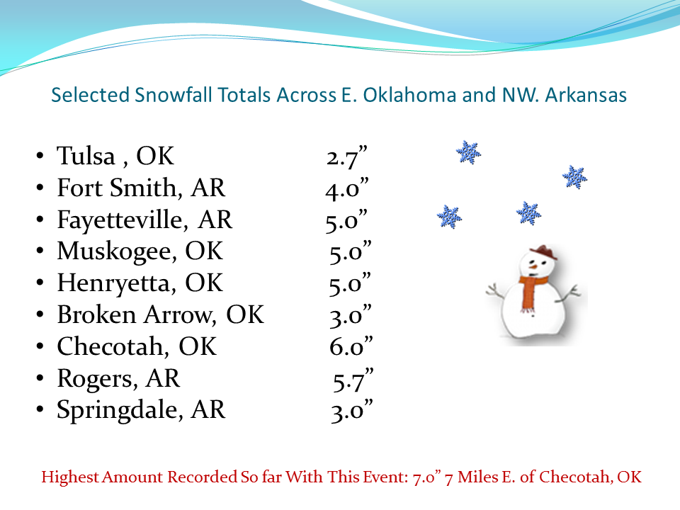
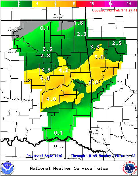
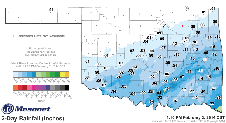
As far as the moisture contained within that snow ... not bad. We can see from
the NWS Arkansas-Red Basin River Forecast Center's amounts that SW OK maybe saw
from a half-inch to as many as three-quarters. Not bad for one snowfall.
Unfortunately, Jackson and Harmon counties and then to the north ... not so
much. The snow is still melting, so the Mesonet gauges won't register a lot
of it just yet.
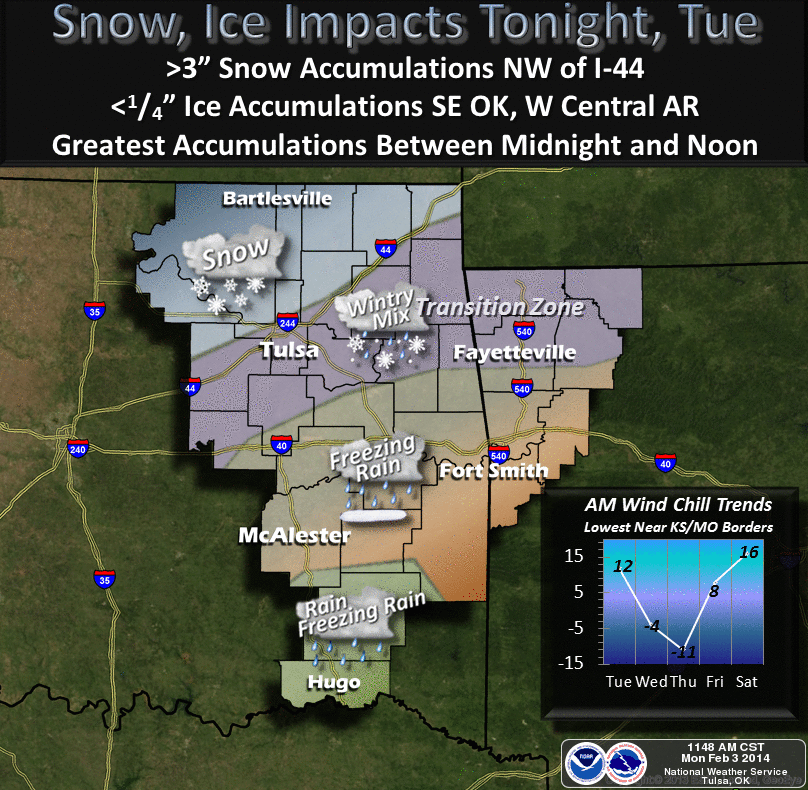
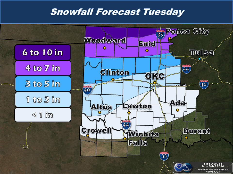
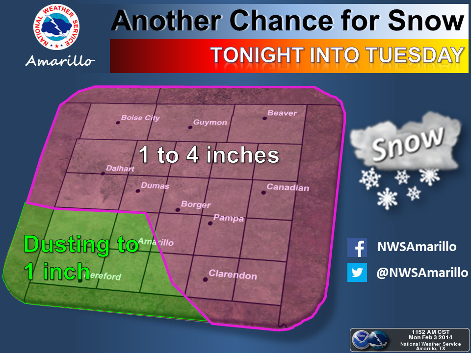
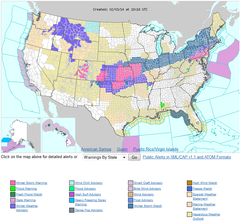
Now we focus on tonight's storm, which will last into tomorrow bringing heavy
snow to northern Oklahoma. A winter storm watch is calling for as much as 5-10
inches in some areas by late Tuesday afternoon. This is indeed another DEF-BRAUM'S
LEVEL ONE event! Here are how the local NWS offices are painting the picture
for us.
And it's not only the snow, but it's gonna get cold. Too cold. Like, I don't
even wanna get out and go to Braum's cold. Check out the highs for Wednesday,
and the lows on Thursday. And the forecast wind chills.
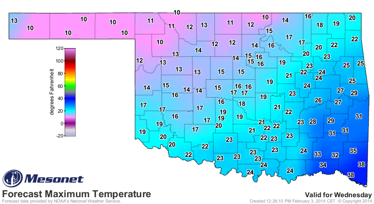
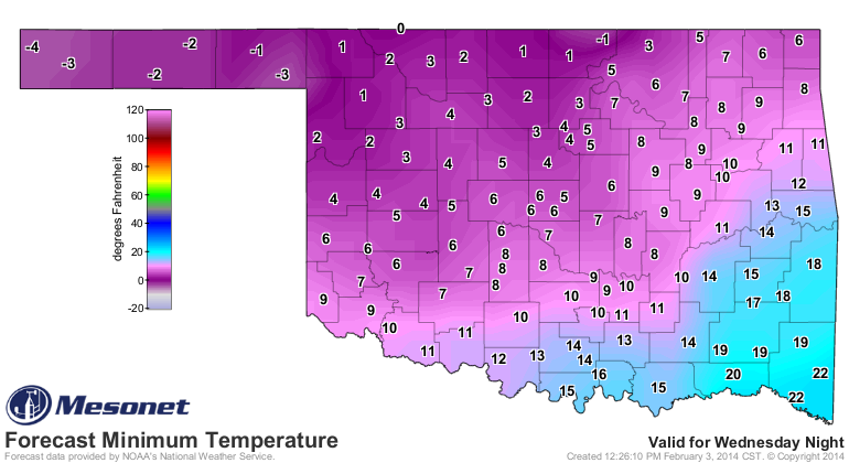
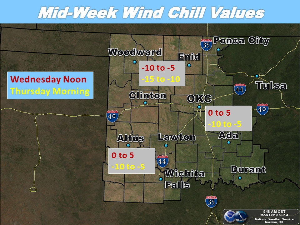
So again, that deserves the old DEF-BRAUM'S LEVEL ONE graphic if you're in
northern Oklahoma, just like southern Oklahoma had it on Sunday.

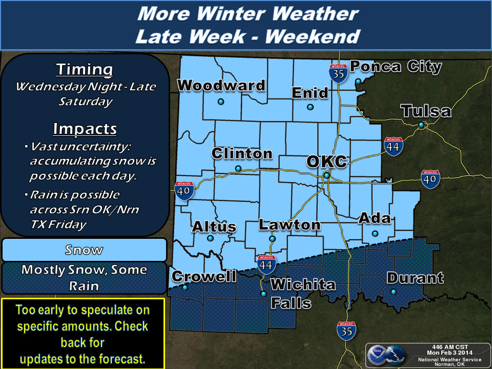
And then we have to worry about the next round, slated for Wednesday-Sunday.
Temperatures and snowfall amounts are just too uncertain right now to make a
forecast, so just be prepared for *SOMETHING* to happen, up to but not
necessarily including a zombie apocalypse.
This really resembles the type of weather we saw from late-January through
the first 10 days or so of February back in 2011. You remember that, right?
With the -31 degrees at Nowata on February 10, the -46 degree wind chill at
Medford that same day, and the new 24-hour snowfall record of 27 inches at
Spavinaw on February 8-9. Yeah, I've blocked it out too. Just remember, 7 days
after that -31 degrees, highs were in the 70s and 80s across the state.
A guy can dream, can't he? We might be south of 32 through early next week.
Okay, here's your info about January.
--------------------------------------------------------------------------------
Oklahoma Drought Expands During Dry January
February 3, 2014
Oklahoma became a weather battleground state during January. A large upper-level
ridge of high pressure entrenched over the western United States battled a deep
trough of low pressure to the east for supremacy over the state's weather. When
the ridge gained the upper hand, temperatures at times rose into the 60s and
70s. Several locations even managed to reach 80 degrees on January 12, the
highest temperature recorded during the month. A westward push by the trough
would result in another arctic blast and a plunge back to winter with highs
struggling out of the 20s. Nowata reached a teeth-chattering low of minus 12
degrees following one of those cold fronts on January 6, the lowest temperature
recorded by the Mesonet for the month. For those needing significant moisture,
however, there was very little variety as dry weather dominated both sides of
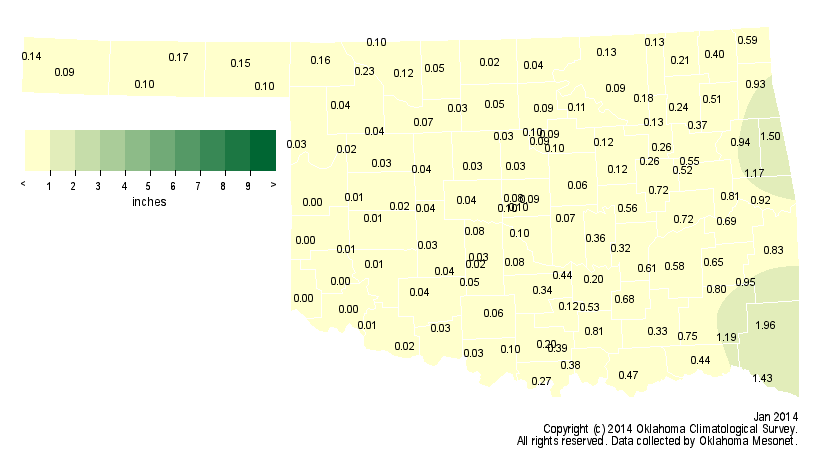
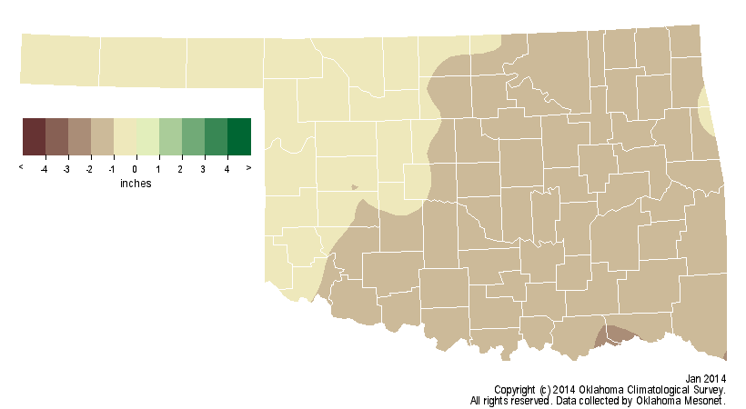
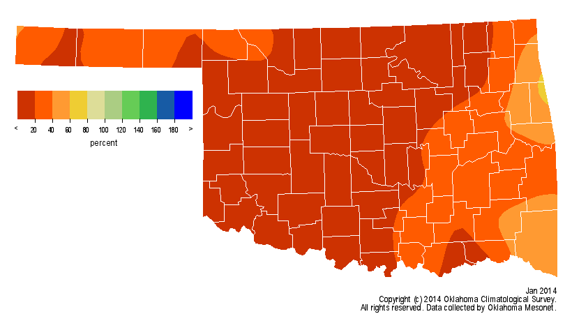
the skirmish. According to data from the Oklahoma Mesonet, the month finished
with a statewide average of 0.29 inches, 1.16 inches below normal to rank as
the eighth driest January since records began in 1895. Of the 120 Oklahoma
Mesonet stations, five reported no precipitation during the month, and another
56 ended with a tenth of an inch or less. Those stations left completely dry
during January were Altus, Cheyenne, Erick, Hollis and Mangum. The Mt. Herman
Mesonet site led the state with 1.95 inches.
Oklahoma City experienced its sixth driest January with 0.07 inches of
precipitation. Tulsa was not much better with only 0.13 inches, the fourth
driest January for that city. Complete monthly records for Oklahoma City date
back to 1891 and 1894 for Tulsa. Combined with a dry December, the statewide
average for the first two months of winter came up over 2 inches short for the
13th driest such period on record. That same stretch was also decidedly cold.
The statewide average temperature for December-January was 35.5 degrees, more
than 2 degrees below normal and the 21st coolest on record. January itself
was near normal at 36.2 degrees, the 49th coolest on record.
One of the impacts of the near constant northwesterly upper-level air flow over
the state was a loss of moist air return from the Gulf of Mexico. Without that
humidity, let alone any significant precipitation, wildfire danger often soared
in the face of dry air and strong winds. Those same conditions also quickened
the pace of drought intensification, something not normally seen during the
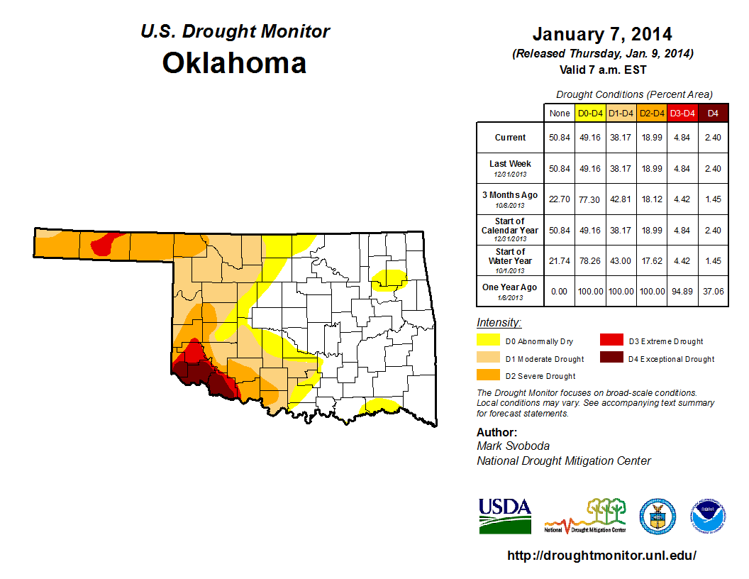
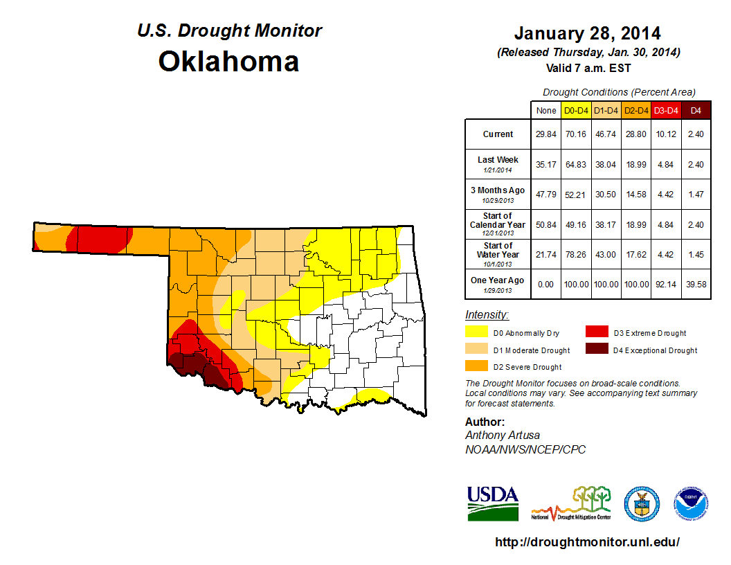
cool season. A bit more than 38 percent of the state was covered by at least
moderate drought at the beginning of the month according to the U.S. Drought
Monitor. At month's end, however, that area had increased to nearly 47 percent.
The most intense drought continued across southwestern Oklahoma and the
Panhandle, a persistence of impacts that dates back more than three years. Much
of the far southwest was considered in extreme-to-exceptional drought. Extreme
drought had also begun to spread outward from the Texas County area in the
Panhandle. The Drought Monitor?s intensity scale slides from moderate-severe-
extreme-exceptional, with exceptional being the worst classification.
Another visit from arctic air signaled a cold end to the month, and the frigid
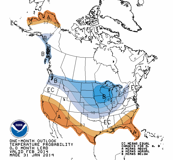
air was forecast to stretch well into the first week of February. The
temperature outlook for February from the National Weather Service's Climate
Prediction Center (CPC) indicated slightly elevated odds of below normal
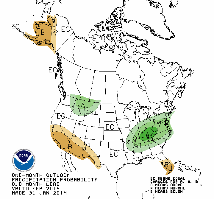
temperatures across the northern two-thirds of the state. The precipitation
outlook was noncommittal with equal chances of above-, below- and near-normal
moisture amounts during February.
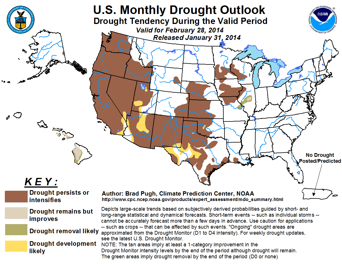
With those long-range outlooks in mind, CPC's U.S. Monthly Drought Outlook
called for the drought across western Oklahoma to persist or even intensify for
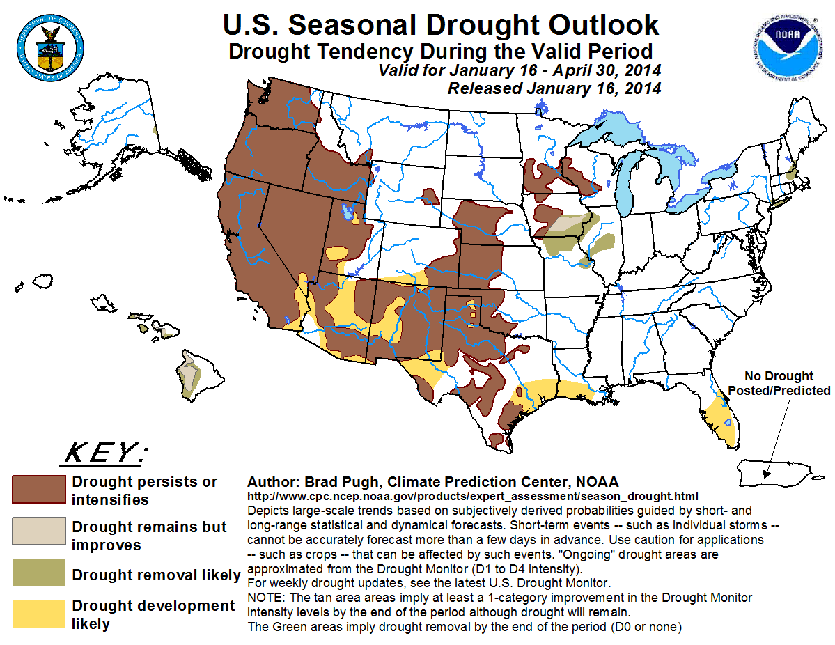
the month of February. The three-month U.S. Drought Outlook released in mid-
January also has the drought persisting or intensifying in the same area
through the end of April.
Gary McManus
State Climatologist
Oklahoma Climatological Survey
(405) 325-2253
gmcmanus@mesonet.org
February 3 in Mesonet History
| Record | Value | Station | Year |
|---|---|---|---|
| Maximum Temperature | 89°F | SEIL | 2025 |
| Minimum Temperature | -18°F | NOWA | 2011 |
| Maximum Rainfall | 2.76″ | SEIL | 2012 |
Mesonet records begin in 1994.
Search by Date
If you're a bit off, don't worry, because just like horseshoes, “almost” counts on the Ticker website!