Ticker for January 31, 2014
MESONET TICKER ... MESONET TICKER ... MESONET TICKER ... MESONET TICKER ...
January 31, 2014 January 31, 2014 January 31, 2014 January 31, 2014
Milk and bread ... bought!
SNOW-POCALYPSE-MAGEDDON 2014 (?) is still on course to hit the state from this
weekend on through late next week, promising varying amounts of snow and ice
(moisture, yayyyy!!) with at least three different storm systems. Storm amounts,
precip types and locations are still a bit iffy at this time, so be sure to keep
track of the latest forecasts with your local NWS office and/or your favorite
TV weatherperson. This is how the local NWS offices are seeing the mess, starting
tonight through early next week, at least.
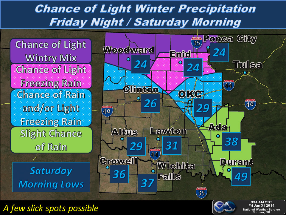
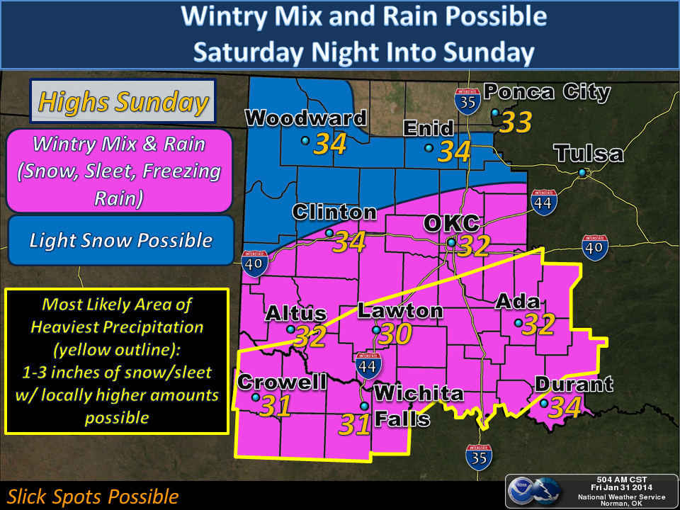
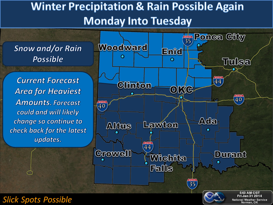
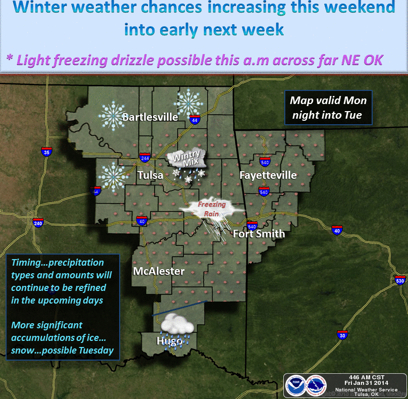
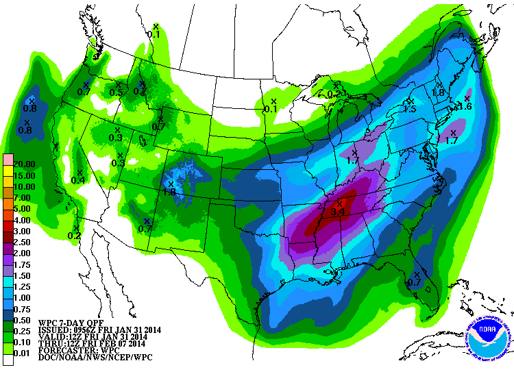
There will be a goodly amount of moisture for these storm systems to work with,
as evidenced by the 7-day rainfall forecast from the WPC. Notice that, as usual,
southeastern Oklahoma gets the bulk of the moisture. Drought-plagued western
Oklahoma gets up to a half-inch or so throughout the next 7 days (hey, better'n
nothing!). This is through next Friday morning (which could be mid-third-storm).
Due to the certainty of the uncertainty (or is it certainty of the uncertainty?),
we're going to go ahead and raise the BRAUM'S BREAD AND MILK EMERGENCY DEFCON
LEVEL to LEVEL THREE.

Why not higher, with the possibility of three storms? Because that's just what
people would expect us to do! And with three different storms, there will also
be three different lulls (counting the current lull ... and we all know just
how painful that can be) so plenty of time to barge your way into the line at
your local Braum's and grab that last loaf of milk and carton of bread.
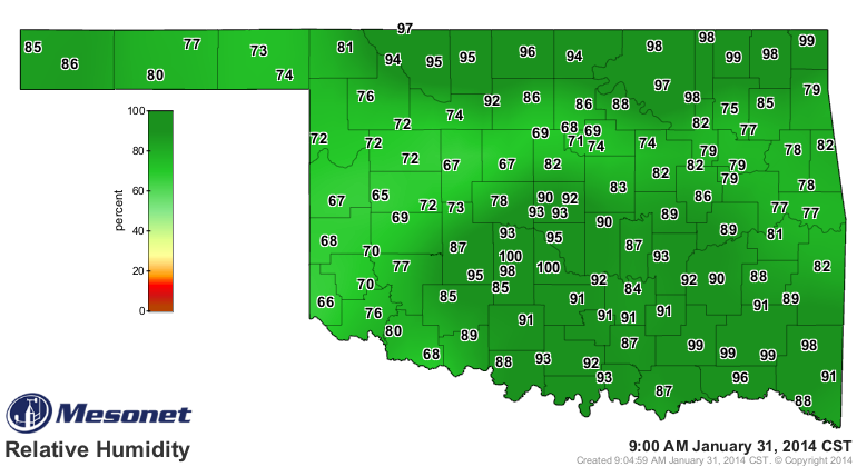
As for this morning, let's enjoy stepping outside without having cracks
immediately forming on your lips. Relative humidity readings on the Mesonet are
in the lovely green shades, quite a change from the last ... well, month for
the most part.
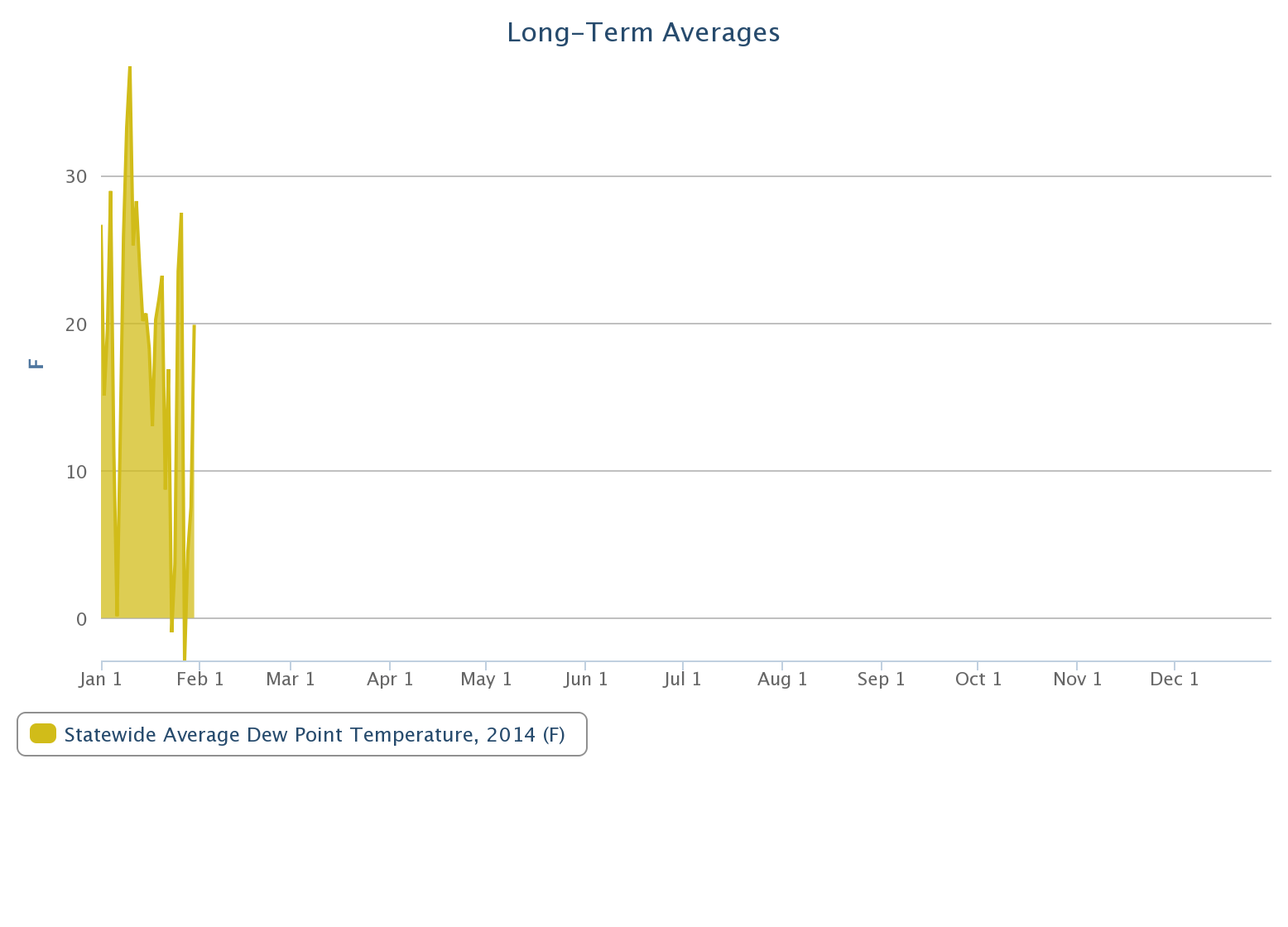
Just how bad was it this January, with our numerous days of high-to-extreme
wildfire danger? Well, one faithful Ticker reader went through all the statewide
average dewpoint time series from our long-term average site
http://www.mesonet.org/index.php/weather/mesonet_averages_graphs
and found that some of our driest days (again, based on statewide average) in
Mesonet history occurred this past week. Quoting Jacob (I'll add clarifying
remarks in parentheses):
"... yesterday's (January 27) statewide Mesonet average (dewpoint) of
-3.1?F beat the previous state record of -1.0?F set 21 January 2014,
which beat the previous record of -0.3?F on 2 February 2011. In
fourth place came 6 January 2014 with a statewide average of +0.1?F.
Yesterday's average relative humidity of 31.7% ranked as the lowest
since 2 August 2012 (31.1%). The lowest was 25.0% on 8 January 2006."
Here's the statewide average dewpoint graph he's talking about. Grab your
Carmex or Chap-Stick before clicking. Remember, on these averages it includes
the data throughout the day.
So we need the moisture. It might come with unwanted circumstances ... sleet,
freezing rain and snow can certainly cause major headaches (hi Atlanta!), but
how often do we get moisture under pristine circumstances here in Oklahoma?
We're Okies. We'll take the good with the bad and deal with it. Here's hoping
for lots of snow across western Oklahoma.
Gary McManus
State Climatologist
Oklahoma Climatological Survey
(405) 325-2253
gmcmanus@mesonet.org
January 31 in Mesonet History
| Record | Value | Station | Year |
|---|---|---|---|
| Maximum Temperature | 80°F | WAUR | 2018 |
| Minimum Temperature | 2°F | EVAX | 2023 |
| Maximum Rainfall | 3.45″ | CLOU | 2002 |
Mesonet records begin in 1994.
Search by Date
If you're a bit off, don't worry, because just like horseshoes, “almost” counts on the Ticker website!