Ticker for January 30, 2014
MESONET TICKER ... MESONET TICKER ... MESONET TICKER ... MESONET TICKER ...
January 30, 2014 January 30, 2014 January 30, 2014 January 30, 2014
A rare cool season surge of drought
Despite the fact we are staring SNOWMAGEDDON 2014!! in the face (please continue
to monitor local forecasts for the possibility of a minor winter storm instead),
we are still seeing dryness multiply in OKlahoma on the U.S. Drought Monitor map.
We're not really supposed to take upcoming precip into account when formulating
the map, so we're bound by what's been occurring over the last 30-90 days. So we
have some *decent* moisture on tap in the 7-day moisture forecast:
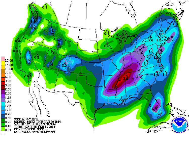
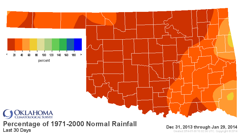
but we're also battling short- and long-term dry conditions:
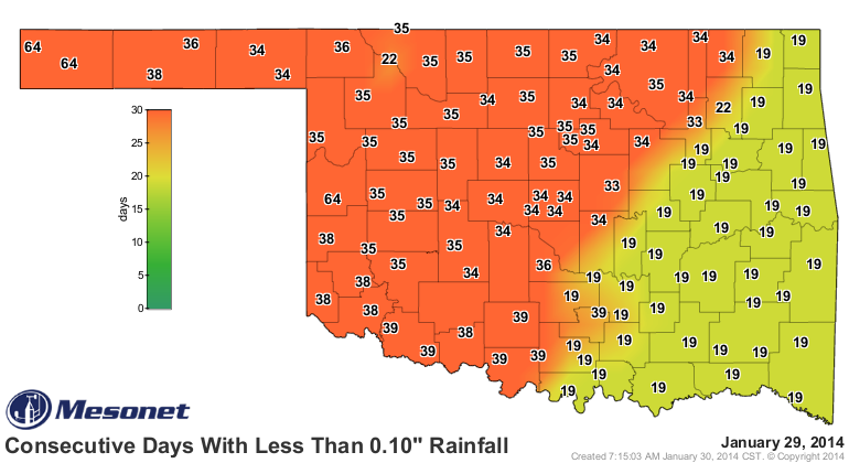
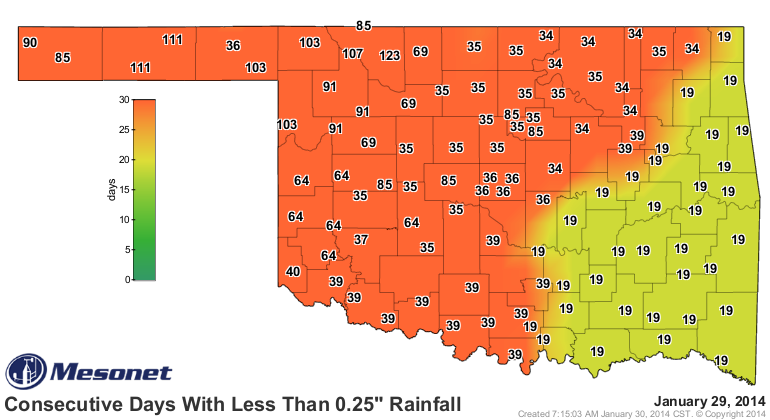
Last 30 days
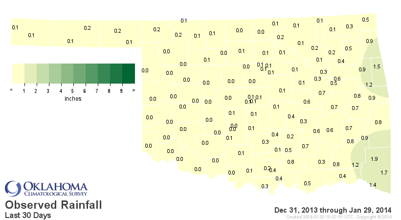
Last 90 days
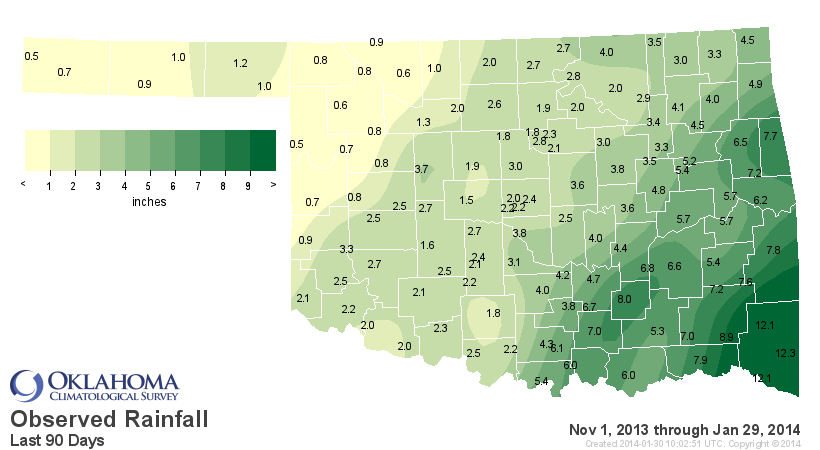
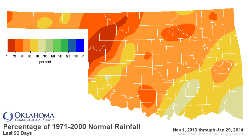
We're without a doubt headed for one of our ten driest Januaries on record,
which on one hand is REALLY dry, since that is normally our driest month
anyway. ON the other hand, it's not that big of a deal to have a dry January.
UNLESS ... you are dealing with pre-existing long-term drought, like we are.
Well, as Arnold Schwarzenegger said in "Conan the Destroyer" ... ENOUGH TALK!
Here's the latest U.S. Drought Monitor map.
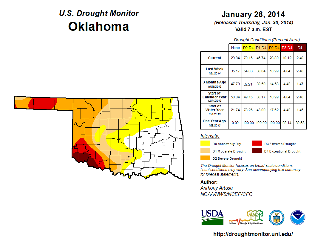
The same basic pattern we've seen for the last 3+ years continues to hold with
severe-exceptional (D2-D4) drought covering the western third of the state. But
we did see a jump in that moderate drought across north central Oklahoma down
to I-40.
The statistics table shows you that the percentage of the state in at least
moderate (D1) drought went from 38% last week to 48% this week, and the percent
covered by at least Severe (D2) drought rose from 19% to 29%. That might not
seem like much, but still fairly significant for the cool season. You can thank,
at least partially, all those dry/warm/windy days over the last month for
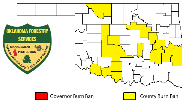
speeding up the drought intensification. That's the reason we have 23 Oklahoma
counties with burn bans enacted as well.
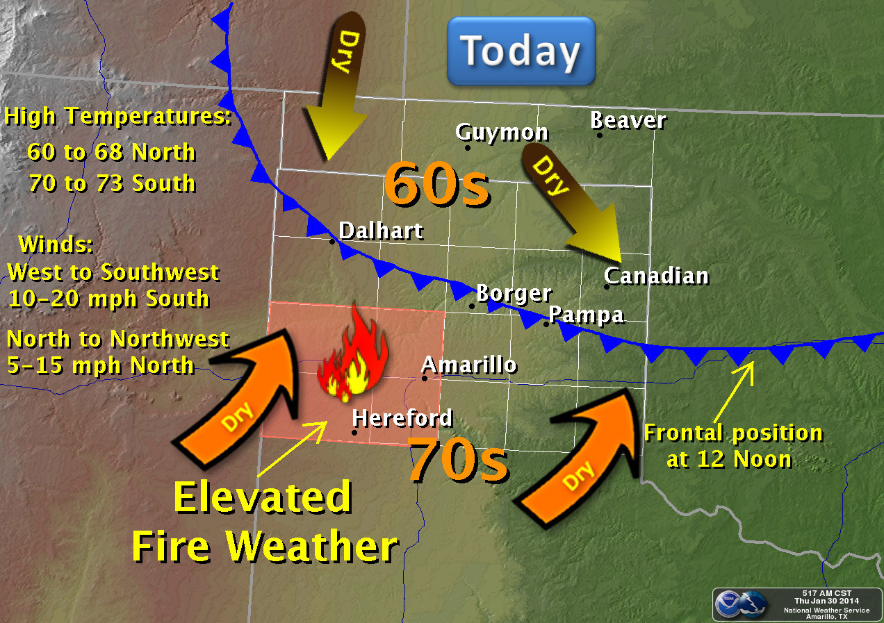
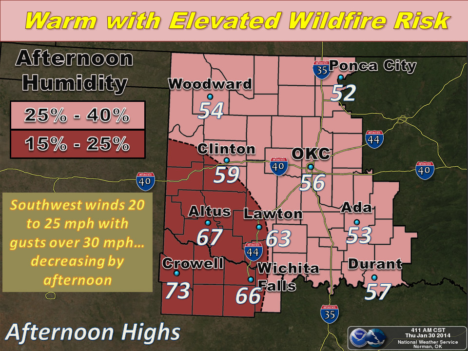
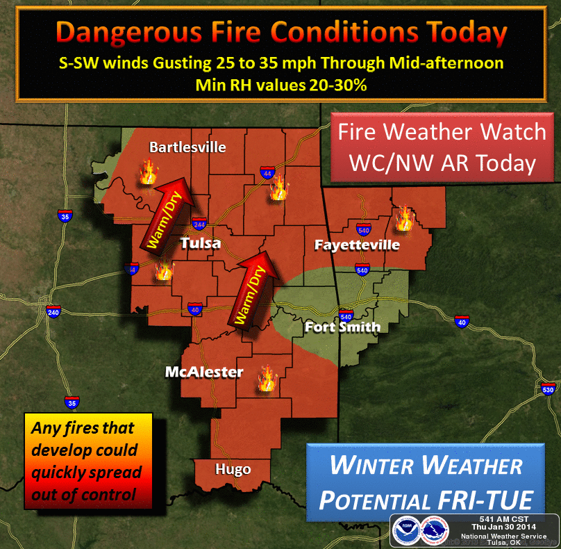
And we do have one final day this week of really nasty fire conditions, as shown
by our friends at the local NWS offices.
So the best we can do now is hope for some quick relief from this weekend's and
next week's storms. Too early to say right now exactly what track it's going to
take, so stay tuned to folks that know a lot more about it than me (which is
just about everybody).
Gary McManus
State Climatologist
Oklahoma Climatological Survey
(405) 325-2253
gmcmanus@mesonet.org
January 30 in Mesonet History
| Record | Value | Station | Year |
|---|---|---|---|
| Maximum Temperature | 85°F | HOLL | 2016 |
| Minimum Temperature | -3°F | HOOK | 2010 |
| Maximum Rainfall | 3.50″ | VALL | 2025 |
Mesonet records begin in 1994.
Search by Date
If you're a bit off, don't worry, because just like horseshoes, “almost” counts on the Ticker website!