Ticker for January 29, 2014
MESONET TICKER ... MESONET TICKER ... MESONET TICKER ... MESONET TICKER ...
January 29, 2014 January 29, 2014 January 29, 2014 January 29, 2014
Braum's ... are you ready?
As I lay underneath two blankets last night with sweat pants, a sweat shirt and
wool socks on, with a fever of 103 ("I'm hot blooded, I'm hot bloooooodedddd"
... kids, google), I thought "There has to be a better way to stay warm!" There
is. It's called summer! No such luck coming up anytime soon. In fact, it appears
we're gonna see a return of ALL of old man winter's tricks.
Although temperatures still plunged well below normal last night, a little warmer
start to the day over most areas signaled changes to come. Unfortunately, they
ain't gonna last (stupid winter). One of those changes is a good thing, however.
Let's dive in (don't forget the wetsuit).
Lows dropped down to near zero in the northwest (BUFFALO BUFFALO GO GO GO!!) and
the single-digits to teens elsewhere.
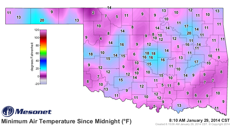
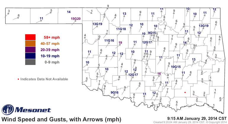
That's not spring territory, but we have already begun to warm up quite nicely,
well above where we were at this time yesterday thanks to some warming southerly
winds.
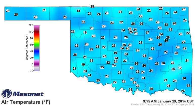
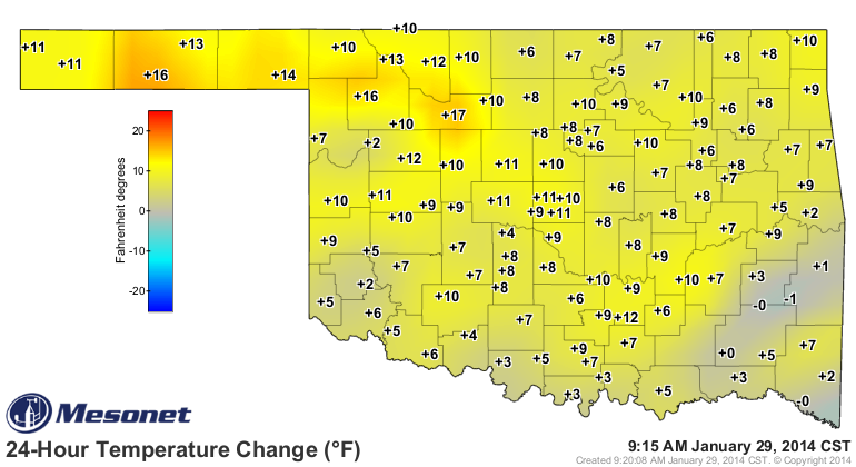
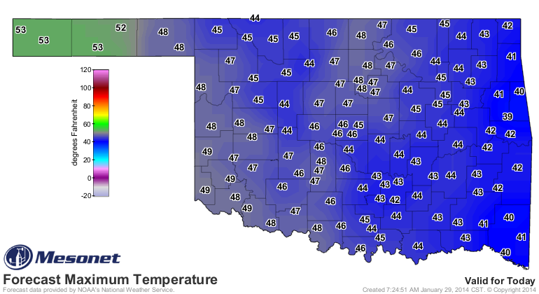
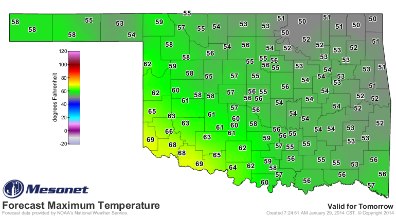
Annnnndddddd ... were headed into much warmer climes over the next couple of days
before we see another cold front (which you can see on Friday's map).
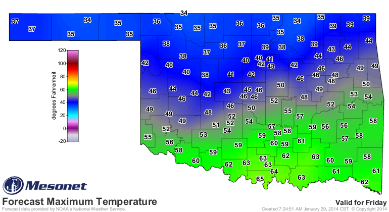
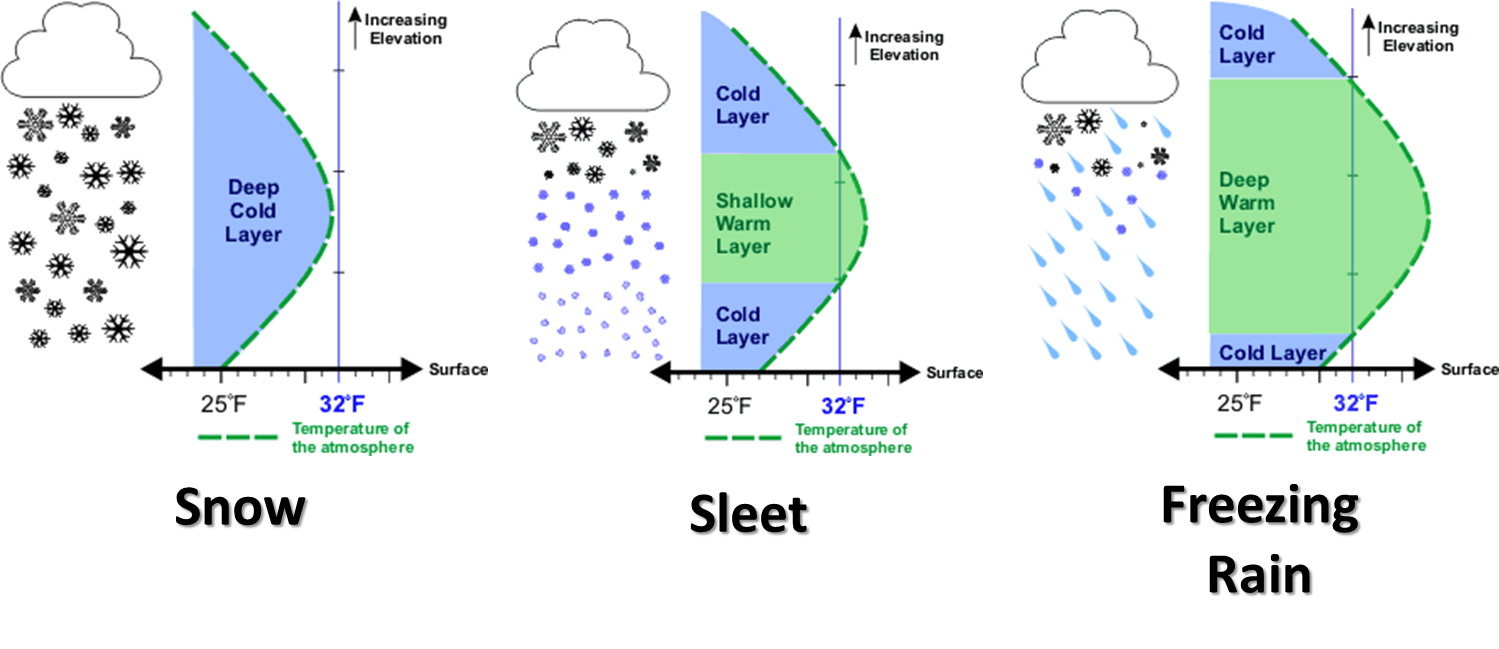
A fairly cold weekend then gives way to our more active weather pattern of next
week. You've probably heard about it already from the folks on TV, or social
media, or your local bread and milk dealer. Our friends at the Norman NWS
office give us a nice picture to set the scene.
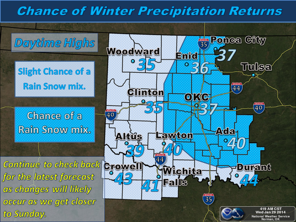
The big show appears to be set for a couple of days after that, however, with
rain and snow likely on Monday night into Tuesday. No word yet on the amounts,
exact precipitation types, or just how much panic should ensue. That will
become more clear the closer we get to next week, and even then we might not
know until it's actually happening (REMEMBER THIS GRAPHIC!!).
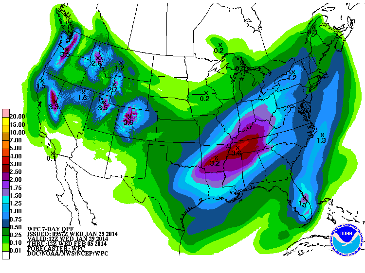
You can see the possibility of more significant precipitation in the next seven
days than most of the state has seen in well over a month now. I call this a
rain forecast, but in the case of frozen precip, this would be the liquid
equivalent. This is through Wednesday morning.
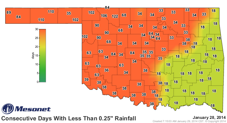
We still see that same old pattern of more moisture in the eastern part of the
state and lesser amounts in the west. That's actually called "climatology," but
that darker green of 0.25-0.50 inches would still be a nice bit of relief from
OKC to the west.
Here's what our friends at the Tulsa NWS office have to say about next week:
"THE THIRD AND MOST SIGNIFICANT PIECE OF SHORTWAVE ENERGY IS
FORECAST TO MOVE INTO THE SOUTHERN PLAINS TUESDAY ... INDICATIONS
STILL POINT TO THE POTENTIAL FOR A WINTER STORM DURING THIS TIME.
SNOW/SLEET/ICE ACCUMULATION REMAINS POSSIBLE WHICH COULD HAVE
IMPACTS...INCLUDING TRAVEL. STAY TUNED TO THE LATEST FORECASTS OF
THIS POTENTIAL WINTER STORM NEXT WEEK."
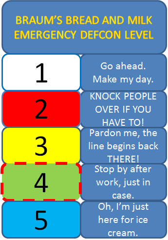
So for now, we're going to officially up the DEF-BRAUM'S level to a 4. Still
too far out to start inciting panic just yet. Plus, I need that Braum's line
clear for ice cream purchases. Fever relief, you know.
By the way, here's a health tip for all of you cold and flu sufferers out there.
If you have a fever of 103, DO NOT dress in sweats, wool socks and hide under
two layers of blankets. You'll either have your will in probate the next day,
or you'll need a good hosing off.
Always glad to help!
Gary McManus
State Climatologist
Oklahoma Climatological Survey
(405) 325-2253
gmcmanus@mesonet.org
January 29 in Mesonet History
| Record | Value | Station | Year |
|---|---|---|---|
| Maximum Temperature | 81°F | MANG | 2016 |
| Minimum Temperature | 2°F | BUFF | 2014 |
| Maximum Rainfall | 3.19″ | BREC | 1999 |
Mesonet records begin in 1994.
Search by Date
If you're a bit off, don't worry, because just like horseshoes, “almost” counts on the Ticker website!