Ticker for January 27, 2014
MESONET TICKER ... MESONET TICKER ... MESONET TICKER ... MESONET TICKER ...
January 27, 2014 January 27, 2014 January 27, 2014 January 27, 2014
"One."

As I watched my kids play at the playground yesterday, conversed with the other
parents, enjoyed the the spring-like weather, one thing did NOT occur. Nobody came
up to me and said "I sure hope we have another arctic blast with wind chills down
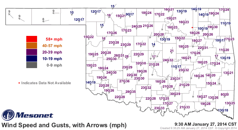
below zero again." Boy are they all disappointed this morning. Take a look at
yesterday's highs versus the temperatures right now, including the winds and how
far down that brings the current windchills.
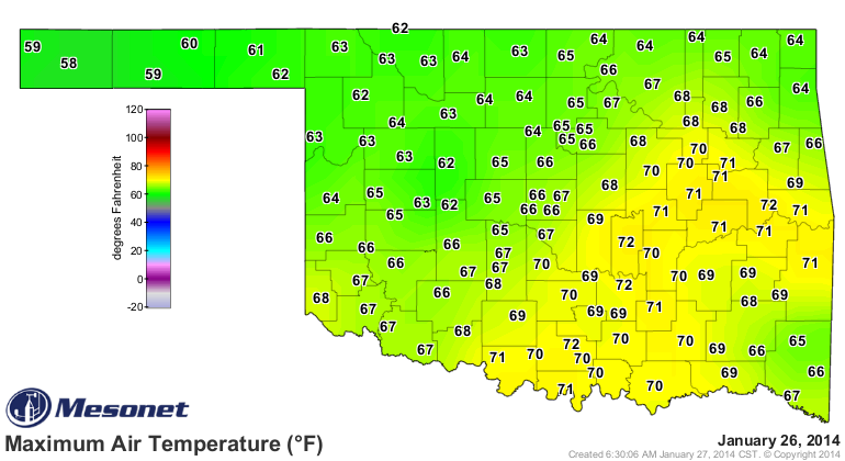
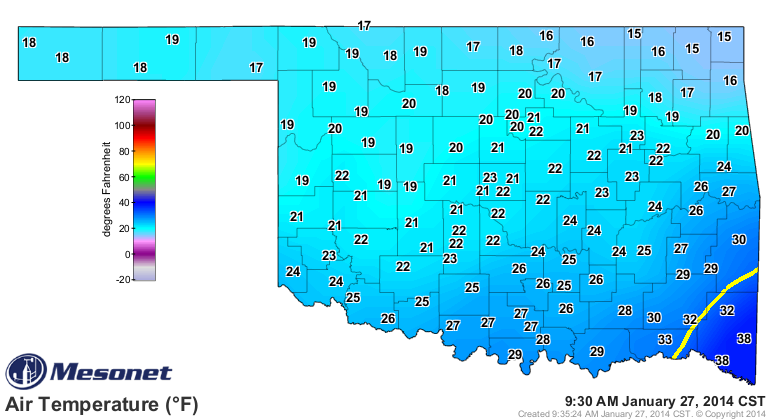
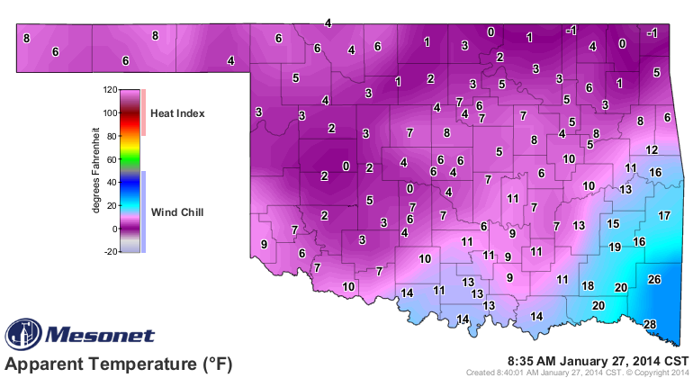
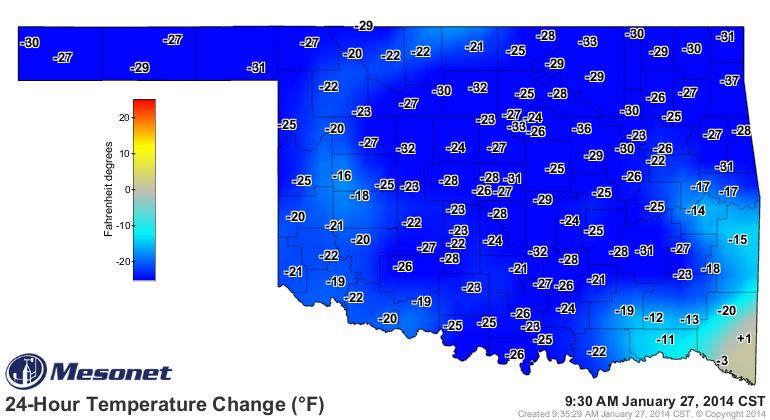
Heck, the 24-hour temperature change map says it all (congrats to Broken Bow for
being warmer now than at this time yesterday).
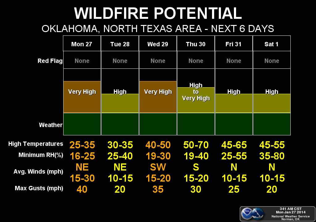
All this comes with another round of "very high" fire danger (in fact, I think
there are a few active fires in the state right now).
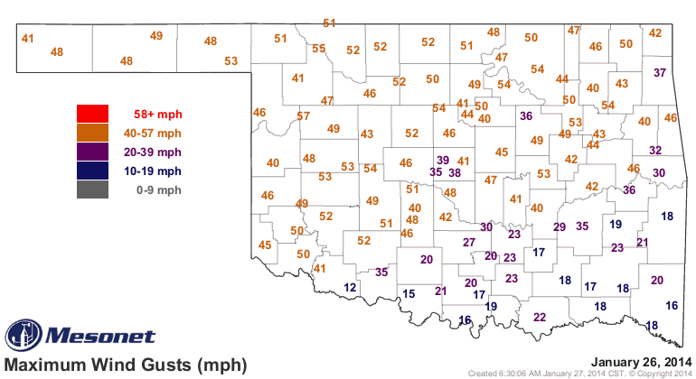
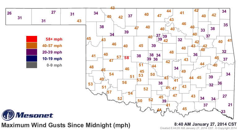
The front blasted through the state late last evening with winds gusts exceeding
severe limits at Hinton (58 mph). Most areas had gusts 40s and 50s, in fact.
There's actually the chance for a bit of snow tonight and tomorrow in the far
NW, but the rest of us are just going to get the deep freeze. Here's how the local
NWS offices see it.
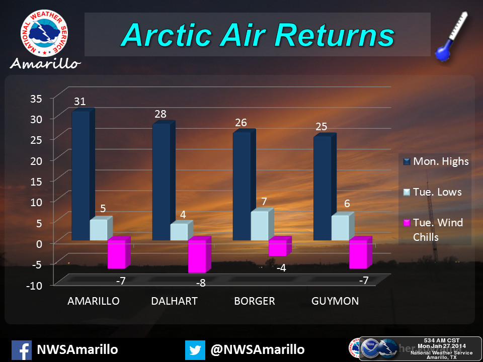
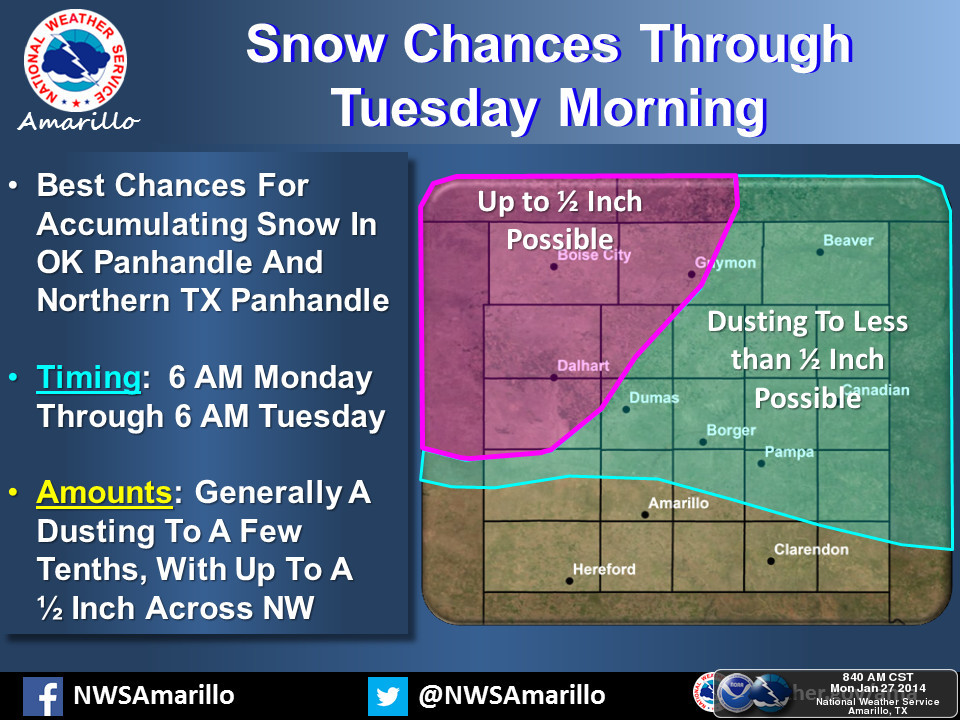
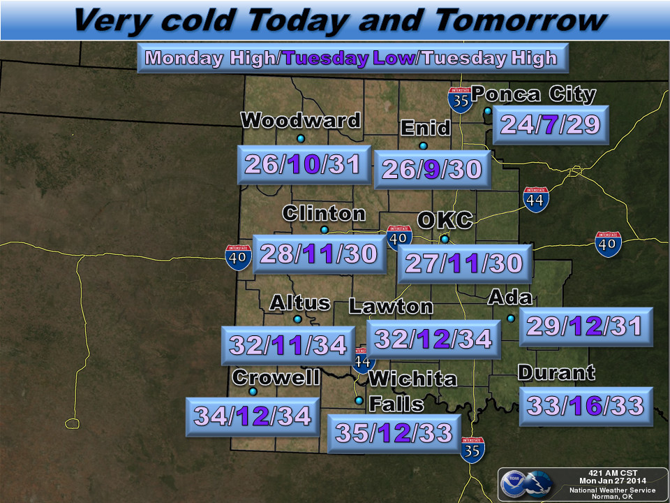
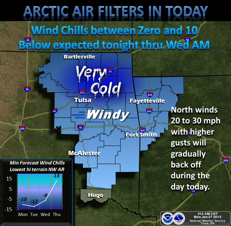
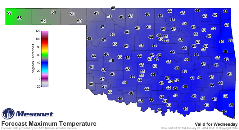
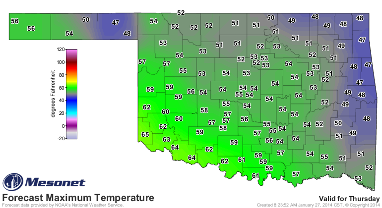
As has been customary for this January, just wait a couple of days and we'll see
nice weather again. We should be able to get some 40s and 50s in here on
Wednesday and Thursday.
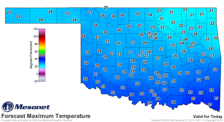
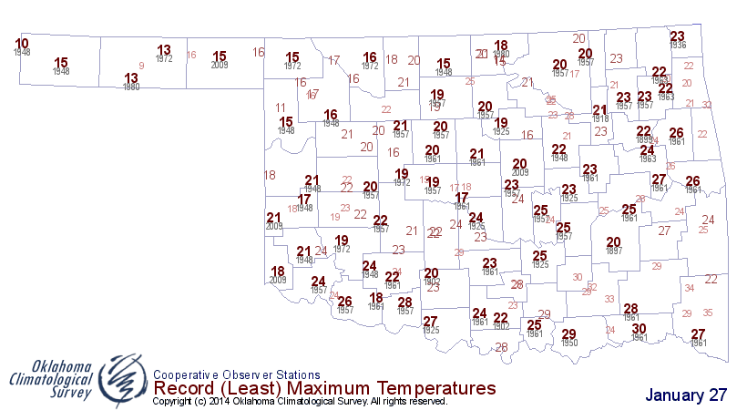
We can watch for some possible record-breaking high temperatures today in the
northeast part of the state. Unfortunately, not for being warm, but for how
cold they will remain.
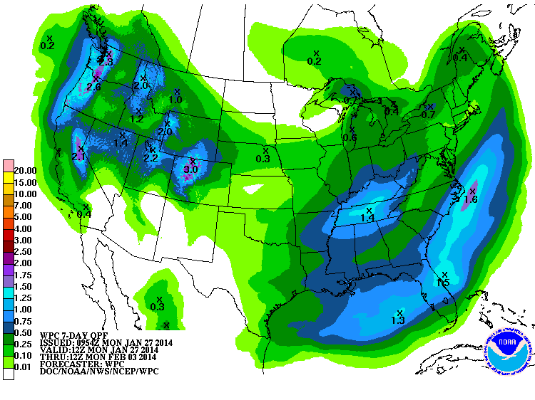
We are starting to see the possibility of a pattern change for after this week.
And by pattern change, I mean the possibility of some actual moisture for the
state. We are seeing just a big of green right now on the 7-day precip forecast
maps from WPC, so hopefully that will start to fill in more to the west
eventually.
You can see the possible pattern change on the 8-14 day outlook maps from CPC.
Keep in mind, however, that these probability maps are usually strictly
computer generated on the weekends (meaning they've had no fine-tuning from
human forecasters). However, when the weather pattern changes start to look this
big, the possibility of "fine tuning" them out are diminished.
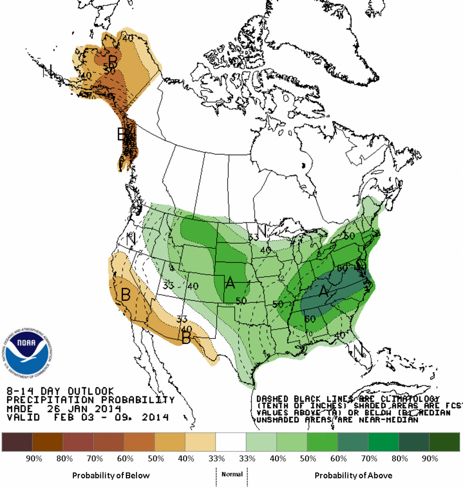
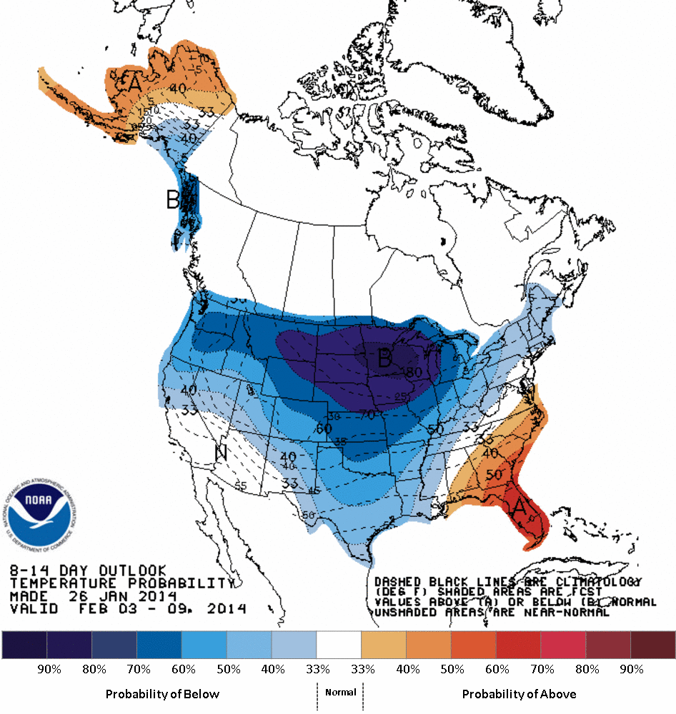
As you can see, the CPC outlooks show increased odds for below normal temperatures
and above normal precipitation over the Feb. 3-9 time frame (in general). Looks
to be signalling another big arctic air intrusion from the north with maybe
a south-diving storm system. We'll wait and see if they survive the afore-
mentioned "fine tuning" in this afternoon's maps. And wait and see if it starts
showing up on the latter parts of the 7-day forecasts later this week, of
course. However, don't expect a drought buster. Above normal precipitation for
the last week of January is not necessarily a deluge since we are in the driest
part of the year.
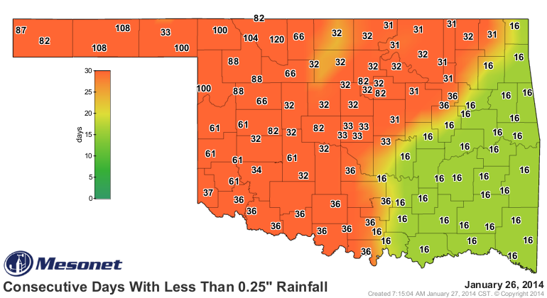
The cold is no big deal, I reckon. We've seen several of these cold air barrages
this winter season already. But to have that upper-level ridge break down in the
west and perhaps let a storm system or two drive through, that's one we haven't
seen for awhile (especially in NW Oklahoma). Here's the map to prove it.
Gary McManus
State Climatologist
Oklahoma Climatological Survey
(405) 325-2253
gmcmanus@mesonet.org
January 27 in Mesonet History
| Record | Value | Station | Year |
|---|---|---|---|
| Maximum Temperature | 84°F | ALV2 | 2015 |
| Minimum Temperature | 0°F | KENT | 2009 |
| Maximum Rainfall | 3.39″ | SALL | 2009 |
Mesonet records begin in 1994.
Search by Date
If you're a bit off, don't worry, because just like horseshoes, “almost” counts on the Ticker website!