Ticker for January 23, 2014
MESONET TICKER ... MESONET TICKER ... MESONET TICKER ... MESONET TICKER ...
January 23, 2014 January 23, 2014 January 23, 2014 January 23, 2014
Freeze dried

Another day, another cold front. I don't need to tell you it's cold outside, but
in case your still in bed under your warm covers, here's what's waiting for ya
if you venture out.
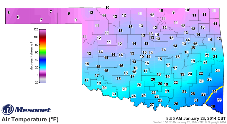
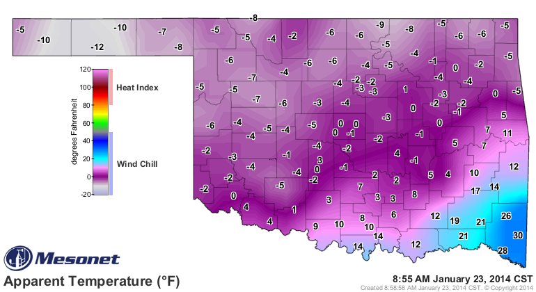
Don't worry though. It's going to get really warm this afternoon ... maybe all the
way up to the low 20s!
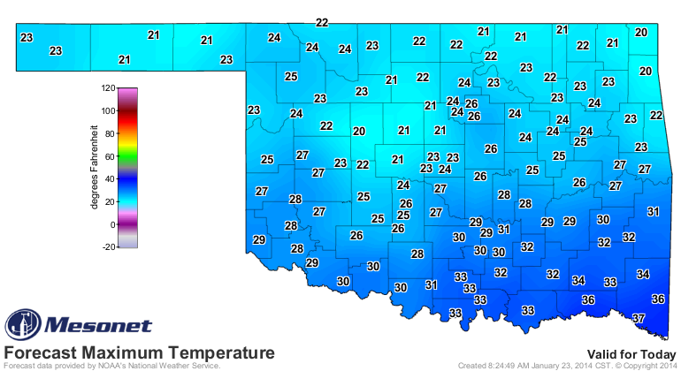
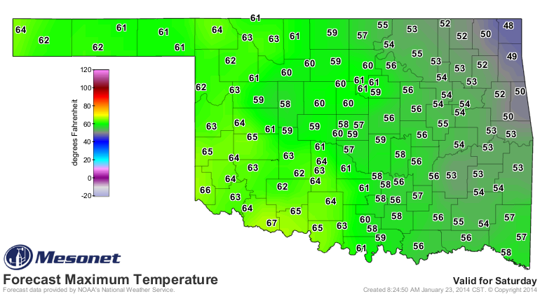
I'm not sure I could imply more sarcasm there, but in all seriousness, at least
this cold snap won't hang around long. In a couple of days, we'll see 50s and 60s
again, just in time for the weekend.
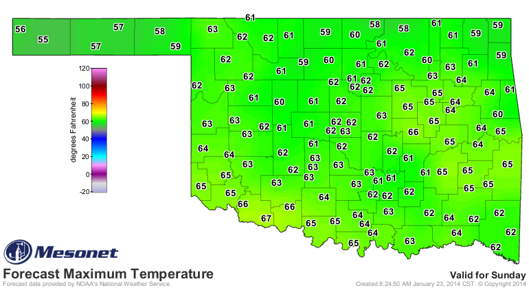
As we talked about the other day, this is what you can expect with that big
ridge of high pressure over the western US pushing that jet stream far to the
north, and the large dip to the east of us bringing the arctic air south. As the
middle ground, we'll sometimes be under the influence of the ridge, and
sometimes on the wrong side of the dip (trough, if you will).
Now that's fine and dandy if you like a bit of variety in your temperatures, but
the problem is there is no variety in the moisture. We are still seeing the air
between here and the Gulf get regularly scoured of all moisture with no return
of the moist air allowed. That means it's drying out, at times a bit more
quickly than we'd like during the cool season. All those days with the low
humidity, strong winds and above normal temperatures are having an impact. Now
I'm going to show you the new Drought Monitor map, but it doesn't *quite*
reflect the drought picture in the state.
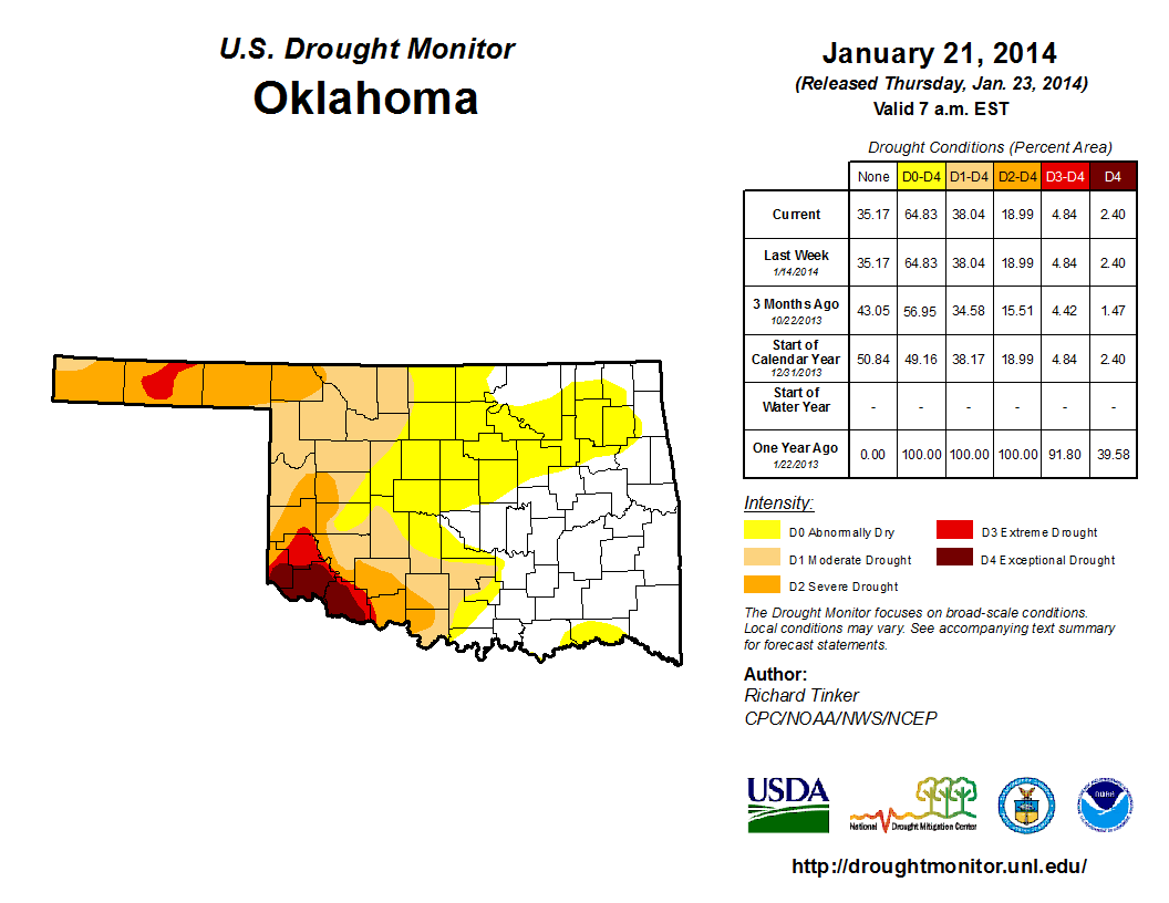
Notice from the statistics table that there were no changes. Well, that has
more to do with the big snowstorm to our east than our reluctance (or the
Federal author's) to make any changes. The snowstorm shut down Washington D.C.
and also the current week's author's ability to get to work. So a quick handoff
was made but that also made it a bit too difficult to make any changes. So, long
story made a bit longer, watch next week for changes in the DM map (and not for
the better).
The Mesonet maps tell the story. I like this one, the number of days that each
Mesonet station has gone without at least a quarter-inch of rain (or snow/ice
melt equivalent).
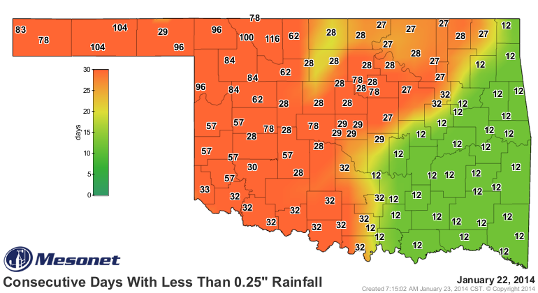
116 days, Alva ... very impressive! Notice that quite a few stations across the
western third of the state are at or above 50 days, and the farther northwest
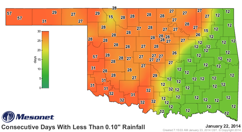
you go, the higher the numbers go. The tenth-inch map is a bit prettier, but
it shows similar bad news for the western half of the state, with a bit of
bleed-over into NE Oklahoma.
All I can say is we're lucky we're not in the warm season (wait, did I REALLY
just say that???) or we'd see an explosion of drought intensity across much of
the state. Still, we will see drought continue to slowly intensify even though
the water stress is minimized. On those warm, dry and windy days, however, it
does kick up a notch.
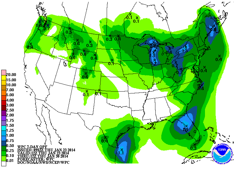
The next 7 days are still showing very little moisture for the state. Good luck
with that tenth of an inch, Boise City!
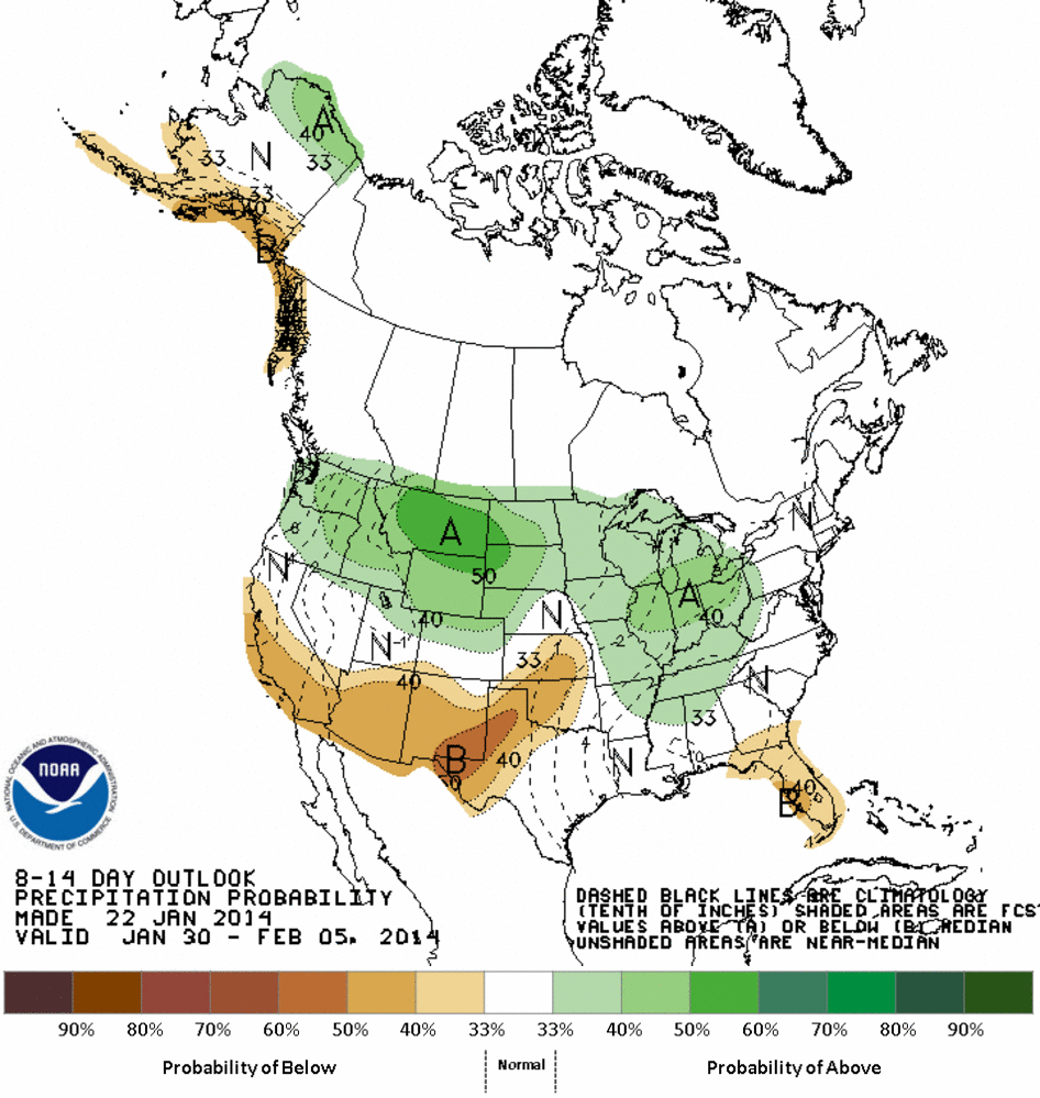
Farther out into the first week of February, we're still seeing the impacts of
that ridge to the west and our battleground state problems with increased odds
of below normal precip and a mixed bag of temperatures.
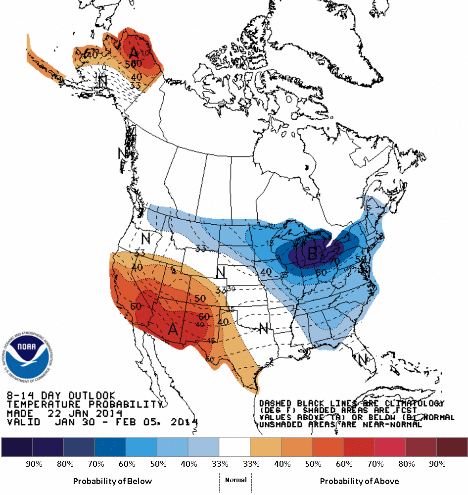
Those outlooks could very well mean two days with highs in the 20s and 30s and
two other days with highs in the 50s and 60s, just like we're seeing now. Just
depends on where that dividing line between the ridge and trough moves.
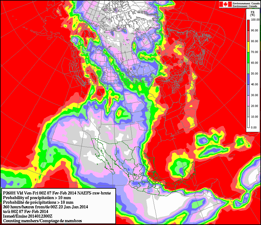
The Canadian forecast model of precipitation probabilities helps to confirm
the bleak picture, showing minimal odds of seeing total accumulations between
today and February 7 of an inch of rainfall over that 16 day period.
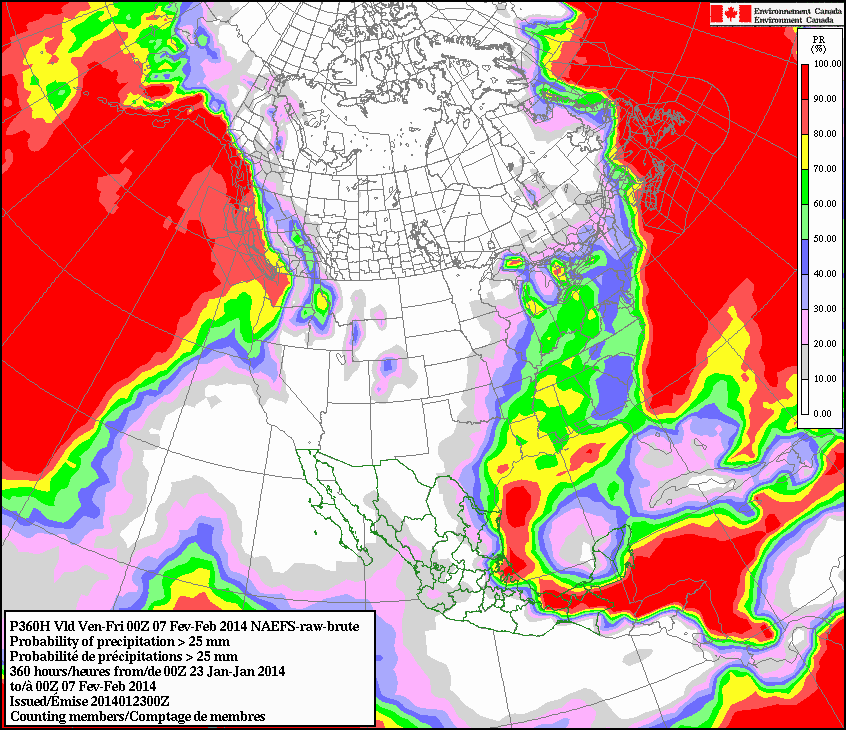
Chances of at least 4/10ths of an inch? A bit better. Start building the Ark now.
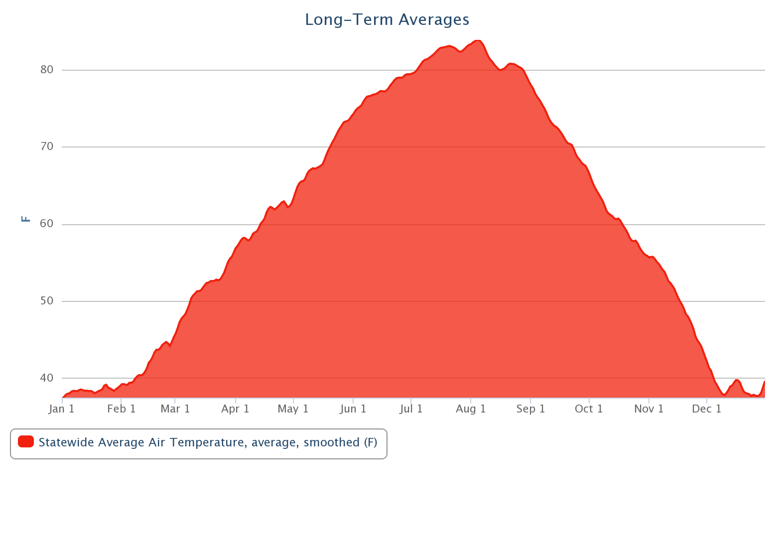
Regarding the cold weather ... never fear. It's almost February. As the
long-term statewide average temperature graph from the Mesonet (1999-2013) shows,
that's when we start our long climb to the glorious heat of summer.
Gary McManus
State Climatologist
Oklahoma Climatological Survey
(405) 325-2253
gmcmanus@mesonet.org
Let's start with tomorrow, shall we?
January 23 in Mesonet History
| Record | Value | Station | Year |
|---|---|---|---|
| Maximum Temperature | 78°F | WEBB | 2002 |
| Minimum Temperature | -3°F | HOOK | 2014 |
| Maximum Rainfall | 1.90″ | STIG | 2002 |
Mesonet records begin in 1994.
Search by Date
If you're a bit off, don't worry, because just like horseshoes, “almost” counts on the Ticker website!