Ticker for January 21, 2014
MESONET TICKER ... MESONET TICKER ... MESONET TICKER ... MESONET TICKER ...
January 21, 2014 January 21, 2014 January 21, 2014 January 21, 2014
January doldrums
This extended weather pattern in which we've been entrenched is downright boring,
and trust me, I know boring! I'm a climatologist. The large upper-level ridge
covering the western half of the country leaves us high and dry, sometimes warm
... sometimes cold. We go from being under the influence of the warmer air to the
west of the ridge's eastern boundary, but also suffer a few cold fronts that
bring down that arctic air to the east. In all, however, it keeps us in
northwesterly flow a lot, with the air between here and the Gulf completely shut
off to any moisture. Those slow-moving (heck, a fast-mover would be nice now)
upper-level low pressure systems that approach from the west and kick up nice
southerly moist flow for awhile are traveling up and over the ridge far to our
north. All we get are dry cold fronts, strong southwesterly to northerly winds,
and fire danger. And a few nice days thrown in (it's easier if you like 45 mph
winds from either the SW or NW).
In other words, we can some days like yesterday (I know it was windy after the
front ... deal with it, we're Okies!)
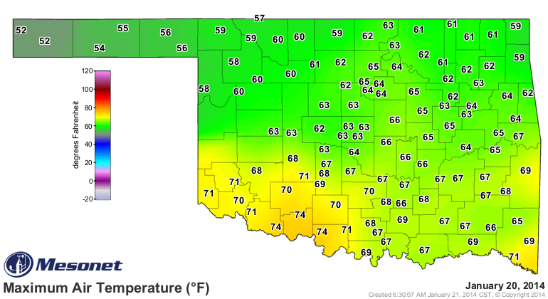
and turn right around and have a day like today.
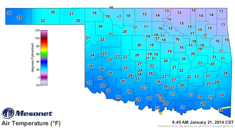
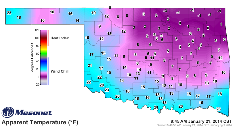
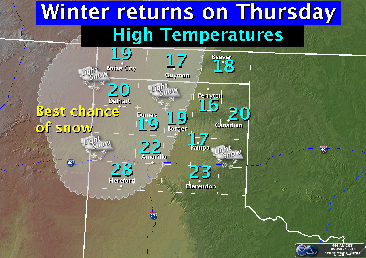
And the worst day is yet to come. Thursday looks like a real doozy.
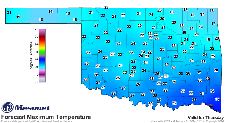
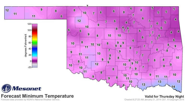
And then right back to seasonable-and-above for Friday and Saturday afternoon.
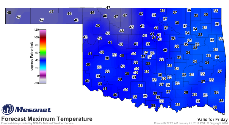
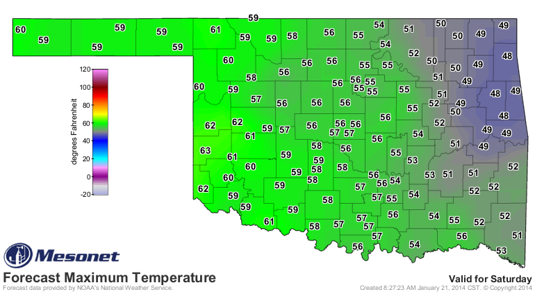
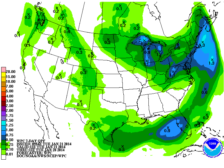
Through all of that, however, there will be very little chance for precip, other
than the odd chance of a bit of snow out in the Panhandle. Here's the rather sad
looking 7-day moisture forecast from the WPC.
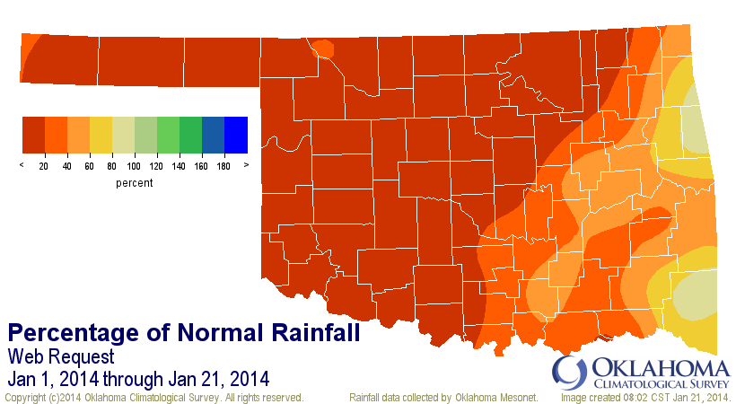
As I mentioned last week, January is going to go down as one of the driest in
history, probably (at least in the top-10 driest, mostly likely). So far, the
month has only had a statewide average of 0.28". Now granted, that's only 0.72"
below normal for the month's first 21 days, but we've also dealt with a lot of
above normal temperatures and wind ... both of which tend to accelerate drought
intensification.
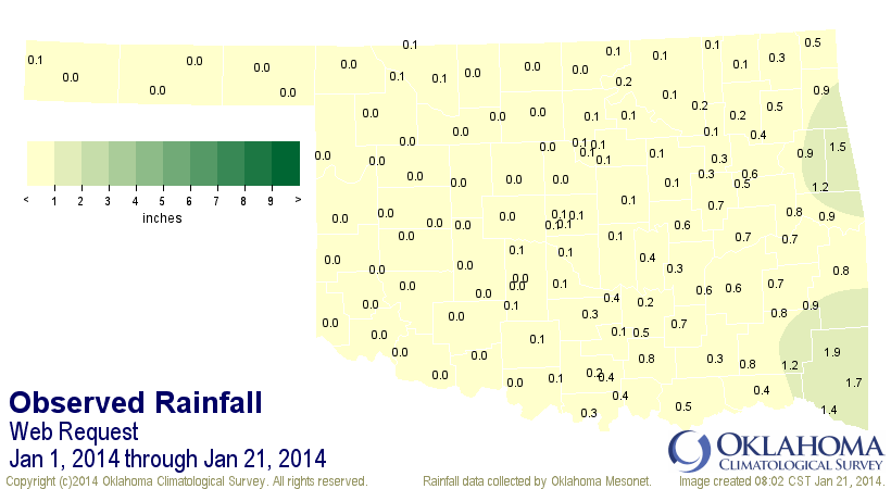
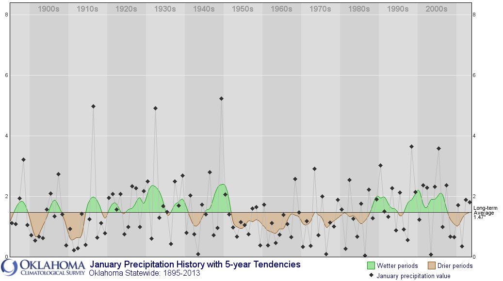
Buffalo once again tops the lowest amounts with 0.0 inches. That it is tied with
about 30 other stations doesn't matter ... Buffalo wins all tie-breakers! Don't
panic over the dry January just yet. As you can see from the historical graph
below, we have had a LOT of dry Januaries. Heck, even "normal" for January
could be considered dry.
The statewide average temperature for the first 20 days of the month has been
1.1 degrees above normal at 38.0 degrees. The average highs are where most of
that is shown at 51.7 degrees, 3 degrees above the normal of 48.7 degrees.
Morning lows are actually below normal for the month by about 0.8 degrees. At
least on a statewide average basis. Individual spots will have their own
idiosyncrasies.
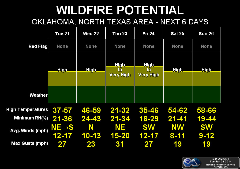
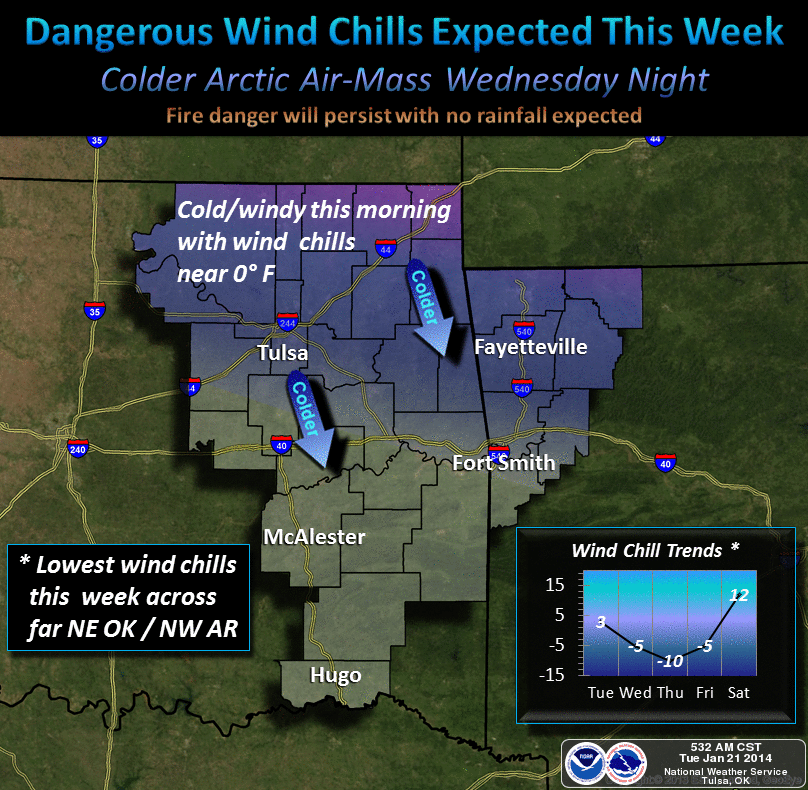
So the low humidity and strong winds are going to continue to create high fire
danger conditions across the state (Tulsa throws in some info about low wind
chills that I'm trying to put out of my mind).
And if you're wondering why I chose the "Young Frankenstein" picture over a
classic Boris Karloff "Frankenstein" version ... my friend Abby Normal told
me to.
Gary McManus
State Climatologist
Oklahoma Climatological Survey
(405) 325-2253
gmcmanus@mesonet.org
January 21 in Mesonet History
| Record | Value | Station | Year |
|---|---|---|---|
| Maximum Temperature | 78°F | WOOD | 2005 |
| Minimum Temperature | -17°F | BEAV | 2025 |
| Maximum Rainfall | 3.48″ | CLOU | 2018 |
Mesonet records begin in 1994.
Search by Date
If you're a bit off, don't worry, because just like horseshoes, “almost” counts on the Ticker website!