Ticker for November 21, 2013
MESONET TICKER ... MESONET TICKER ... MESONET TICKER ... MESONET TICKER ...
November 21, 2013 November 21, 2013 November 21, 2013 November 21, 2013
ICE-MAGEDDON!

With a vicious winter blitzkrieg from the north, Mother Nature has made her
intentions well known, and the hordes of cold air are rapidly overrunning the
state's winter defenses. The advance is well through the Panhandle and now stands
poised to pounce on the rest of the state throughout the day.
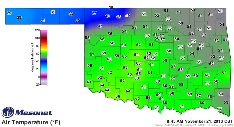
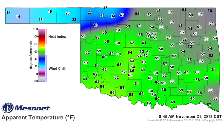
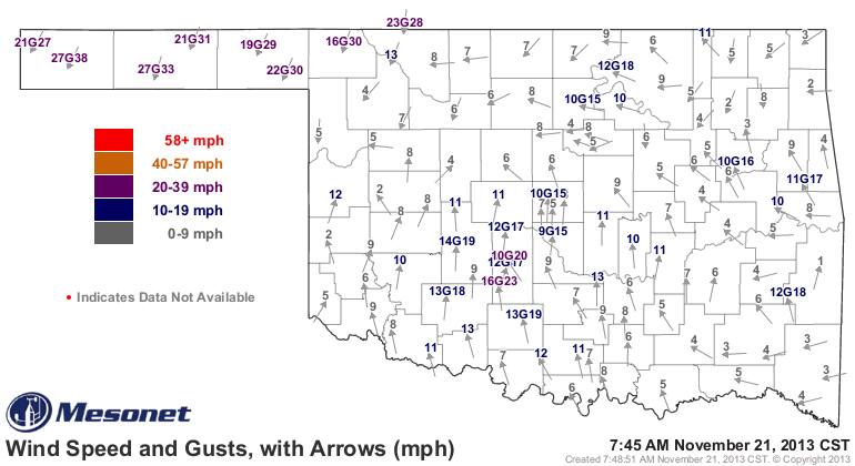
Air temperatures have dropped to near freezing in the Panhandle and northwest
and wind chills are now in the teens and 20s, fueled by the cold air and
northerly winds gusting to more than 30 mph.
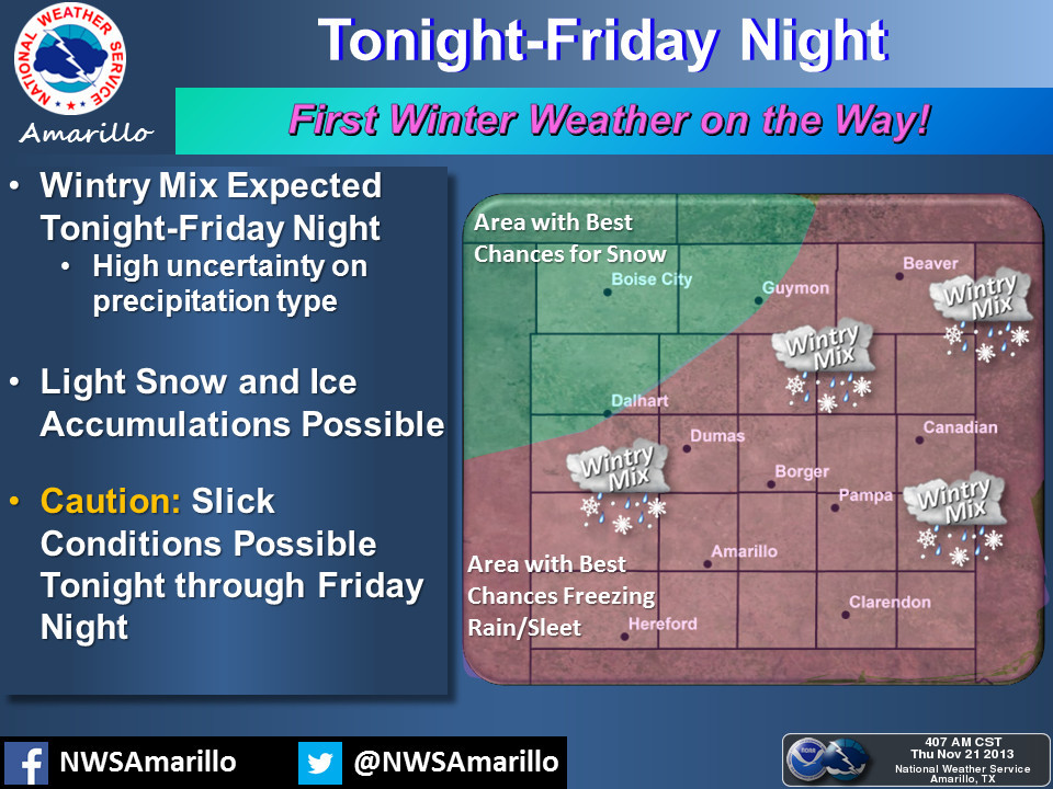
Once again we turn to our Federal Defense Forces at the local NWS offices to give
us a tactical update on the enemy's movements for the rest of the weekend. The
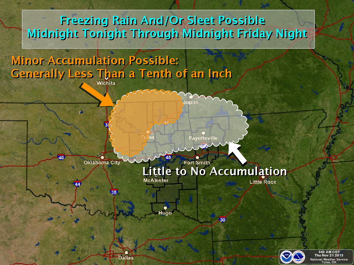
enemy's worst weapon, freezing rain, has yet to be unleashed, but forward scouts
(computer models) are indicating those forces should move into the state later
tonight.
Amarillo Defense Forces
Norman Command Central
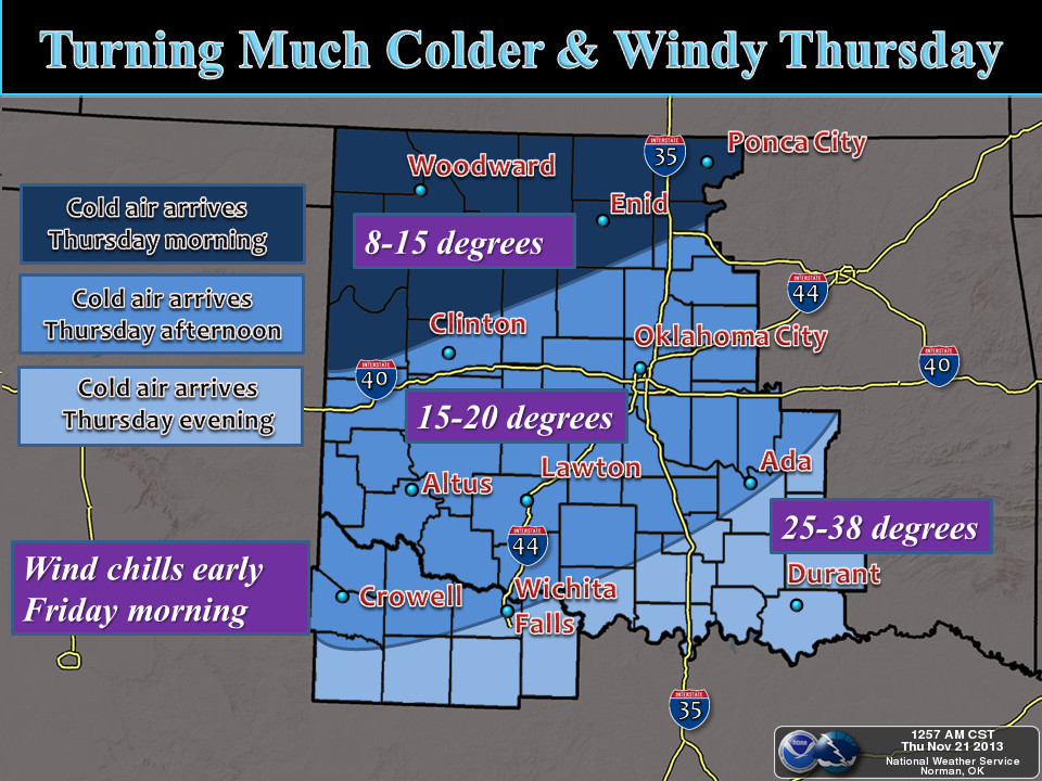
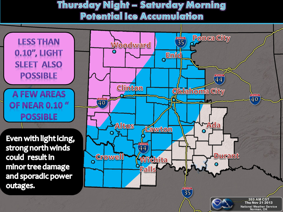
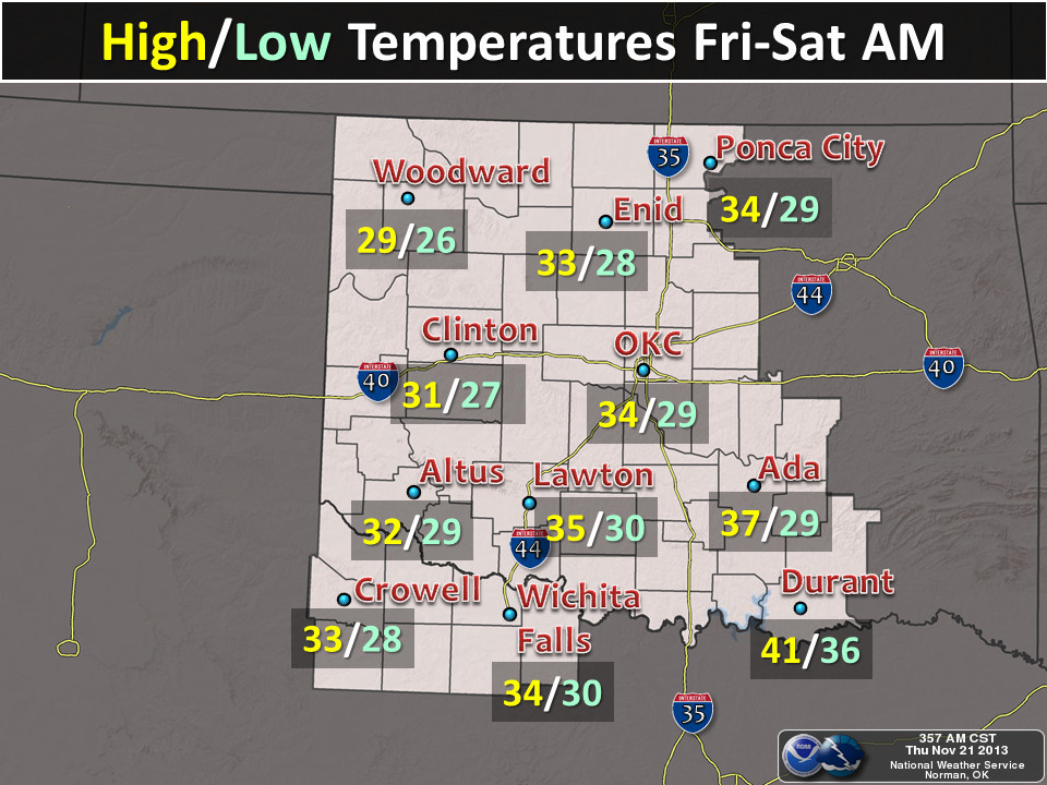
Tulsa Defense Initiative
Shreveport East Texas Militia Headquarters
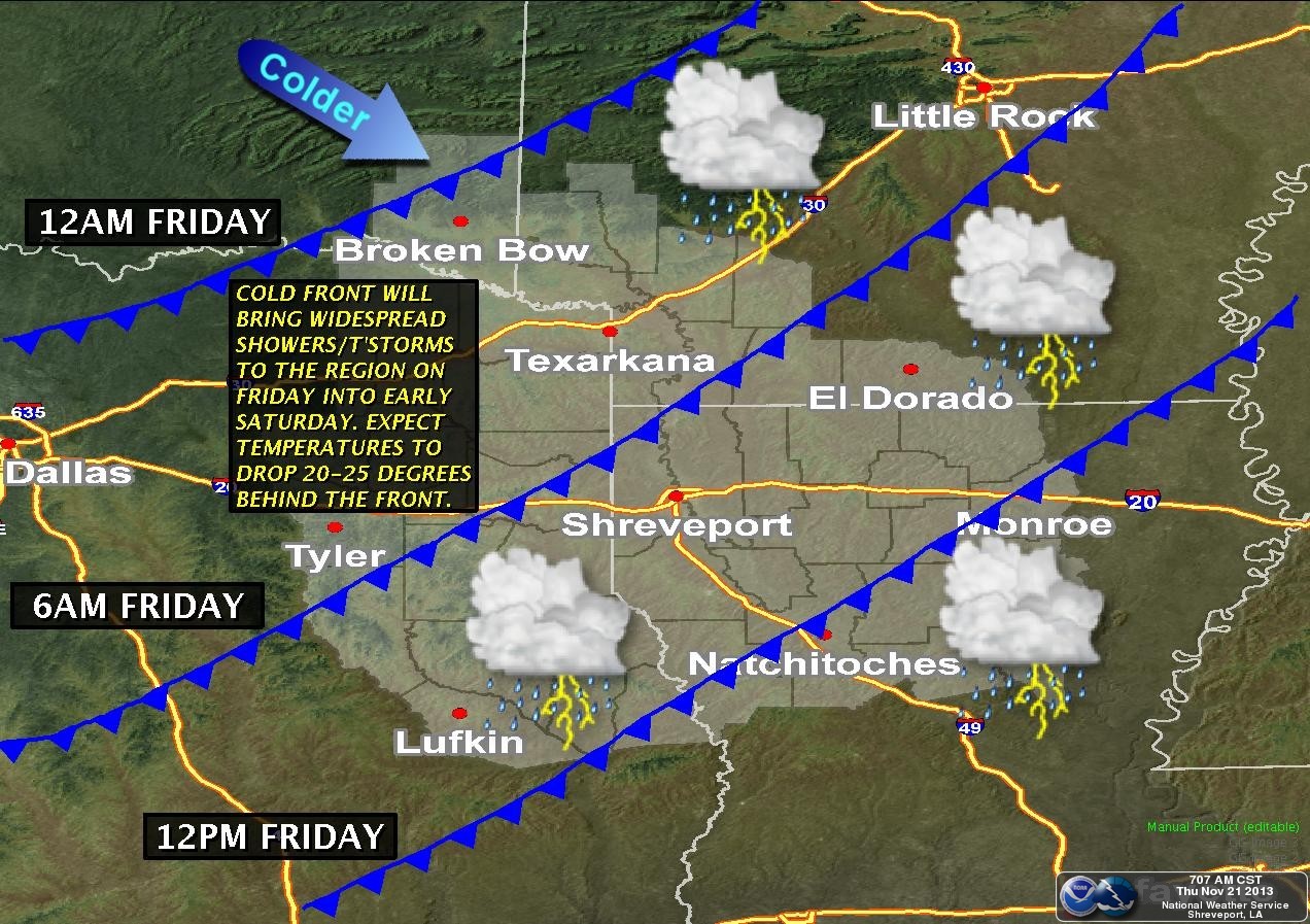
Now from what I can tell, the freezing rain is not supposed to be too heavy,
but as we all know, a little bit goes a long way. With winds expected to be
gusting to over 40 mph after the front, the enemy could be going for our power
lines, in addition to our power lines and bridges. Check out the forecast
meteogram for OKC over the next 48 hours or so.
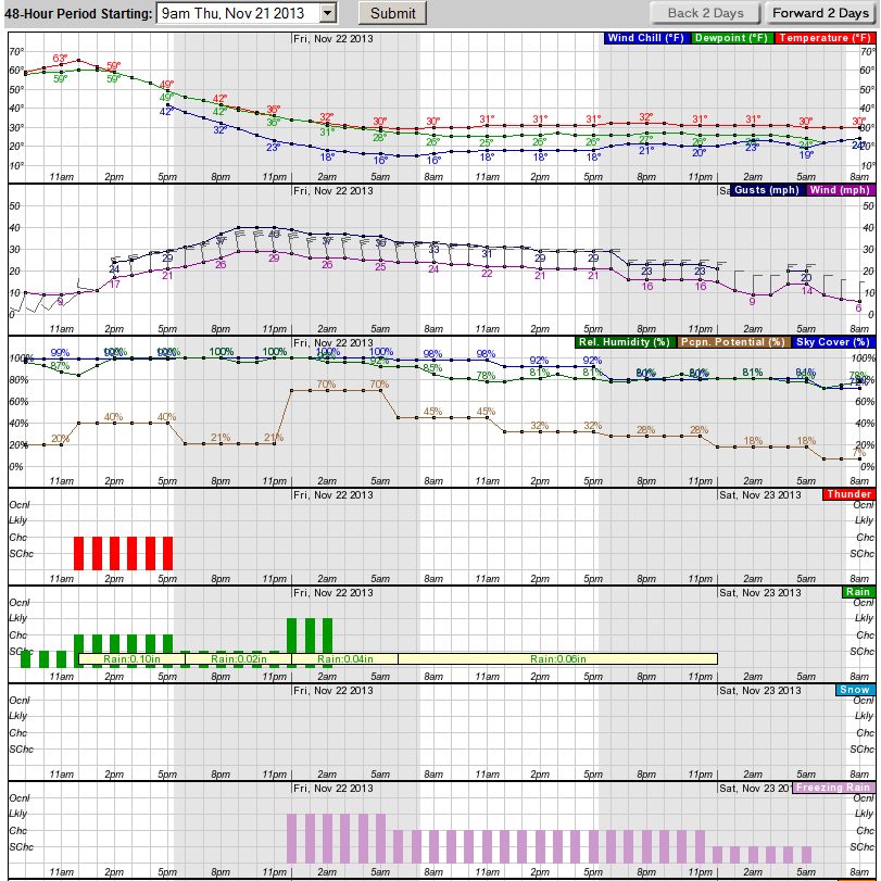
Here we see the enemy clashing with OKC forces about noon and completely
overrunning them by evening with temperatures falling below freezing by
midnight. Winds will gust from 25-40 mph overnight, and win chills will drop
into the teens. The freezing rain starts around midnight or so.
A second attack on Sunday looks imminent as well, with Mother Nature throwing
more snow and sleet at us through early Monday. From the Norman Commander:
"THE NEXT CHALLENGE IN THE FORECAST WILL BE THE PROGRESSION OF A
CLOSED LOW MOVING OVER THE SW U.S. SUN. SOLUTIONS SUGGEST AT
LEAST A NORTHERN BRANCH OF THE LOW MOVING CLOSER TO OUR NECK OF
THE WOODS WITH THIS SYSTEM. CONFIDENCE IS INCREASING THAT
SNOW/SLEET AND RAIN WILL ACCOMPANY THIS FEATURE SUNDAY THROUGH AT
LEAST MONDAY. WILL CONTINUE TO INCREASE CHANCES AND MENTION
SNOW...ALTHOUGH AMOUNTS ARE STILL UNCLEAR."
From the Tulsa General Command:
"AFTER A QUIET SATURDAY...PRECIP CHANCES WILL RAMP UP QUICKER THAN
PREVIOUS FORECAST ON SUNDAY AS THE UPPER LOW IN THE SOUTHWEST
WASTES NO TIME IN OPENING UP AND EJECTING. THE LATEST TEMP
PROFILES FROM THE GFS/ECMWF DO NOT SHOW AS STRONG A WARM LAYER IN
ADVANCE OF THIS SYSTEM OVER OUR REGION...AND WET BULBING WILL
LIKELY HELP WINTER PRECIP CHANCES AT ONSET. THUS...I HAVE MORE
SLEET/SNOW IN THE GRIDS FOR SUNDAY/SUNDAY NIGHT AND EARLY MONDAY
WITH SOME ACCUMULATION."
With so much uncertainty from our winter defense forces, be prepared for
anything. In that regard, we are officially moving our BREAD AND MILK EMERGENCY
LEVEL TO DEFCON 2: KNOCK PEOPLE OVER IF YOU HAVE TO!

The forces in southwestern Oklahoma have turned Vichy on us. With drought
having oozed across their Maginot Line three years ago, collaborations with
Mother Nature were inevitable. Altus Defense Leader Lloyd Colston declared:
"Hey, we need the moisture!"
If only he realized the treachery of our great enemy. Returns on their
cooperation are beginning to look bleak.
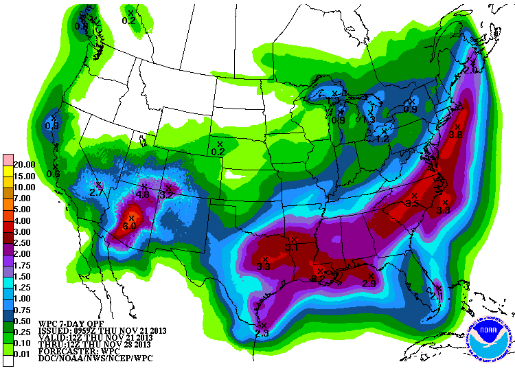
That half-inch or so of moisture will help, but will have little effect on the
oozing drought hazard.
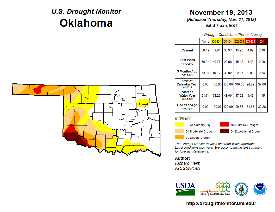
Extreme-Exceptional drought advanced once again to the east, and now covers much
of Tillman County in addition to Jackson and southern Harmon counties. We also
saw drought advance north into Roger Mills County with reports of soil moisture
losses in that area. More than 30 percent of the state continues to deal with
drought, with an additional 19 percent or so teetering on the edge with
Abnormally Dry conditions.
The fight for those folks through February does not look good according to the
Climate Defense Command at the Climate Prediction Center. The latest U.S.
Seasonal Drought Outlook valid for today through the end of February calls for
drought to persist and possibly intensify across western Oklahoma, with some
development even likely across that area where it does not exist at the
moment.
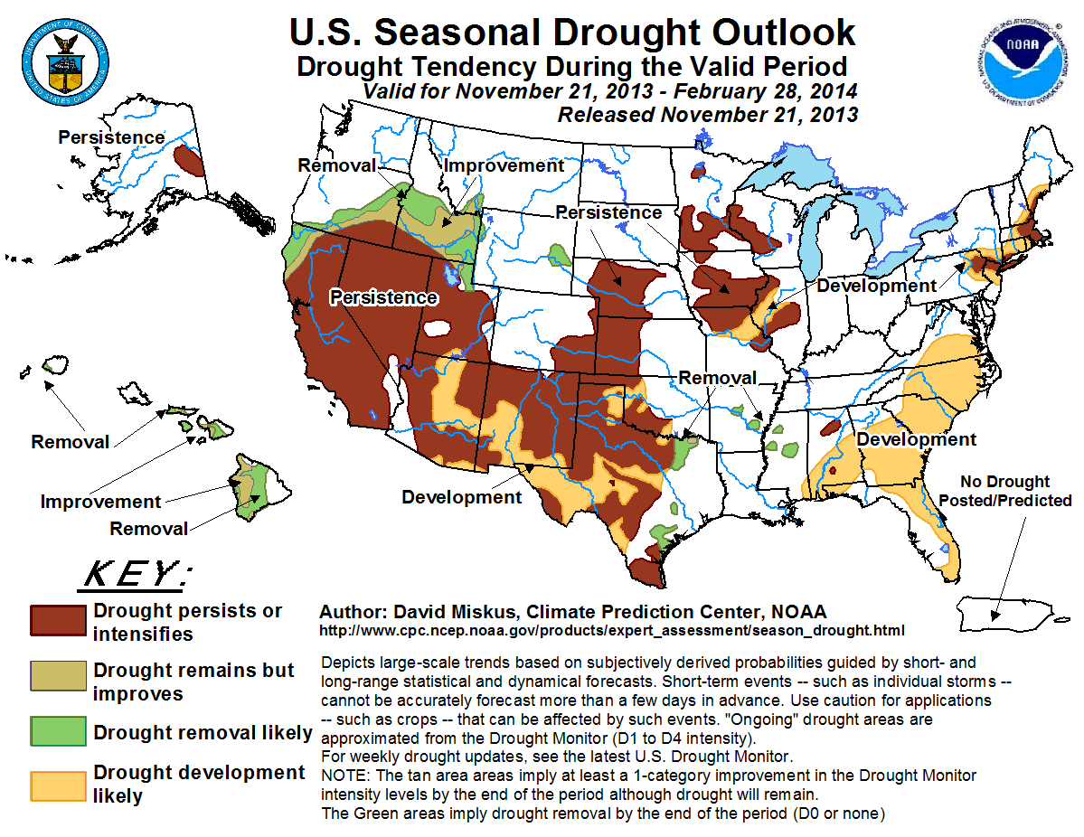
At least the troops across the eastern half of the state are expected to repel
the advancing drought menace through winter. Godspeed to all of those engaged
in the moisture battle.
I'll end with this: We can?t be consumed by our petty differences anymore...
warm weather vs. cold weather lovers. We will be united in our common interests.
Perhaps it?s fate that today is the 21st of November, and you will once again
be fighting for our freedom. Not from tyranny, oppression, or persecution, but
from being cold. We are fighting for our right to be warm. To be able to wear a
light jacket in November. And should we win the day, the 21st of November will
no longer be known as... ummmmm, the 21st of November, but as the day the state
declared in one voice: ?We will not go quietly into the night! We?re going to
live on! We?re going to have highs in the 60s! Today we celebrate our
Independence Day!?
Gary McManus
Lieutenant Commander, State Climate Defense Forces
Oklahoma Climate Strategic Command
(405) 325-2253
gmcmanus@mesonet.org
November 21 in Mesonet History
| Record | Value | Station | Year |
|---|---|---|---|
| Maximum Temperature | 82°F | WAUR | 2010 |
| Minimum Temperature | 11°F | KENT | 2022 |
| Maximum Rainfall | 4.52″ | TALI | 2011 |
Mesonet records begin in 1994.
Search by Date
If you're a bit off, don't worry, because just like horseshoes, “almost” counts on the Ticker website!