Ticker for November 25, 2013
MESONET TICKER ... MESONET TICKER ... MESONET TICKER ... MESONET TICKER ...
November 25, 2013 November 25, 2013 November 25, 2013 November 25, 2013
Into each life ...
a little snow must fall. And in the case of southwestern Oklahoma, it was more
than a little! In fact, if some of the amounts verify, it was possibly the
heaviest snowfall on record for November 24 (previous, and possibly still the
champion, was 10 inches from Kenton back in 1940). I have seen some localized
amounts of greater than a foot, including 13 inches near Vinson in Harmon
County. Here are some snowfall total maps from the NWS offices in Norman and
Amarillo (sleet's in there as well).
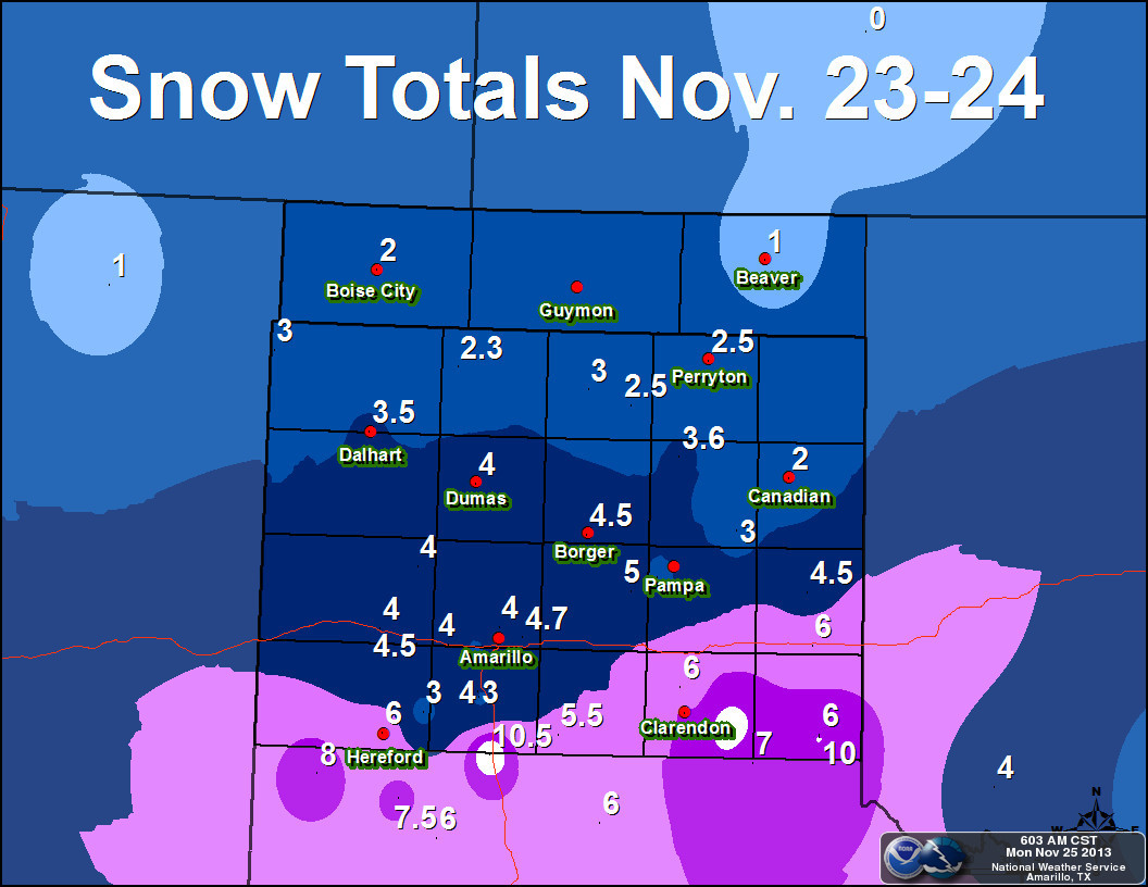
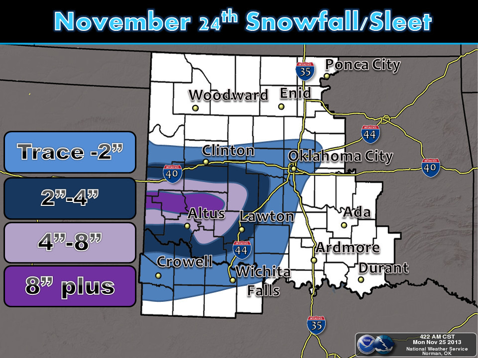
So a good 4-12 inches fell across that broad area. The NWS COOPerative observer
at Altus Dam recorded 10 inches of snowfall for another two-digit total. The
COOP observer at Willow recorded 8 inches, which melted down to 0.79 inches of
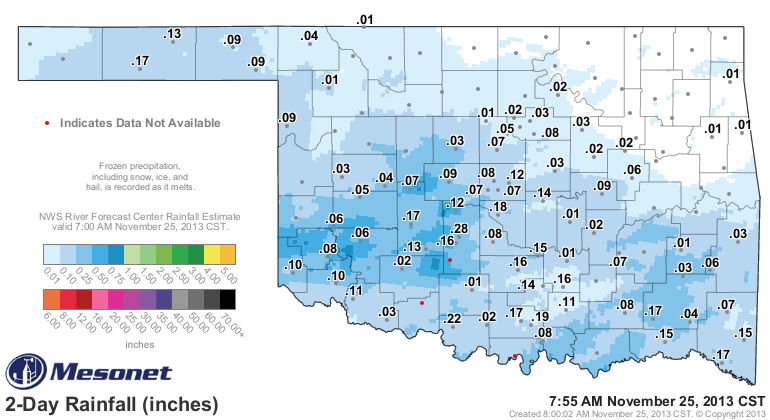
liquid-equivalent precipitation. The Oklahoma Mesonet rain gauges are not heated,
so it will take a good day above freezing to finally melt what's in its tipping
bucket gauges and register it as liquid, but we can still see the radar estimated
totals. Looks like most of Oklahoma saw less than a half-inch of liquid from
this system, but the southwest did see from a half-inch to around an inch in
areas.
That's obviously not a drought-breaker, but that snow will sit on top of the
ground and melt to liquid, which will slowly percolate into the soils. That's
why snow and ice is so good for moistening up those soils. Now all we need is
a good 3-4 inch rain and we can get a good runoff (that's not appearing just
yet, unfortunately).
Our snow totals got robbed here in central Oklahoma by a nose of warm air at
the mid-levels (and we all know just how painful that can be). The NWS-Norman
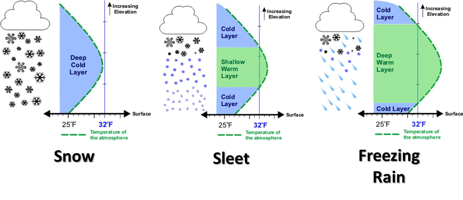
office gave a pretty good lesson as to why it's so difficult to forecast winter
precipitation types since the vertical air temperature profile can be so
important. Here's that diagram showing the differing vertical air profiles and
what the resulting winter precipitation type will be. Southwestern Oklahoma
had the deep cold layer while further to the northeast, the warm air left us
with sleet and freezing rain.
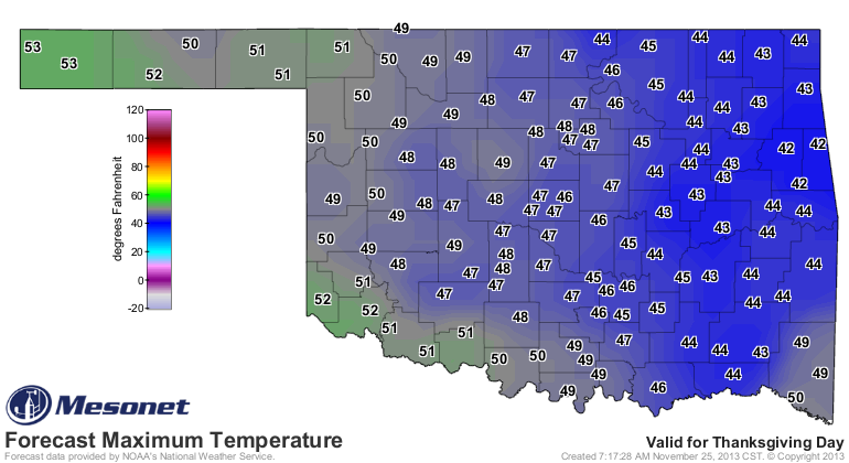
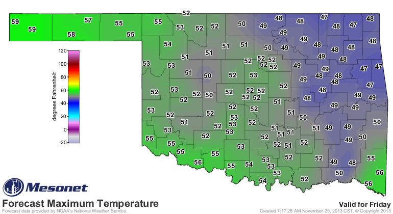
Now we await a slow warm-up over the next several days through Thanksgiving, so
no travel problems look imminent.
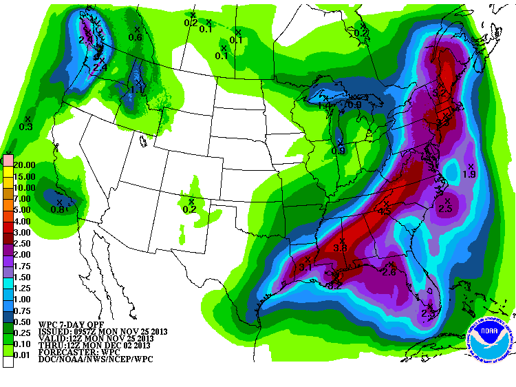
There does appear to be another storm system headed this way for late in the
weekend. It's just starting to show up on the rainfall forecasts.
So as long as we can get past the freezing drizzle (freezing rain in the SE)
today, it looks like clear sailing through the Thanksgiving holiday. That rush
at Braum's should be for a different reason now.
Safe travels!
Gary McManus
Associate State Climatologist
Oklahoma Climatological Survey
(405) 325-2253
gmcmanus@mesonet.org
November 25 in Mesonet History
| Record | Value | Station | Year |
|---|---|---|---|
| Maximum Temperature | 78°F | WAUR | 2012 |
| Minimum Temperature | 6°F | HOOK | 2023 |
| Maximum Rainfall | 1.59 inches | EUFA | 2010 |
Mesonet records begin in 1994.
Search by Date
If you're a bit off, don't worry, because just like horseshoes, “almost” counts on the Ticker website!