Ticker for November 20, 2013
MESONET TICKER ... MESONET TICKER ... MESONET TICKER ... MESONET TICKER ...
November 20, 2013 November 20, 2013 November 20, 2013 November 20, 2013
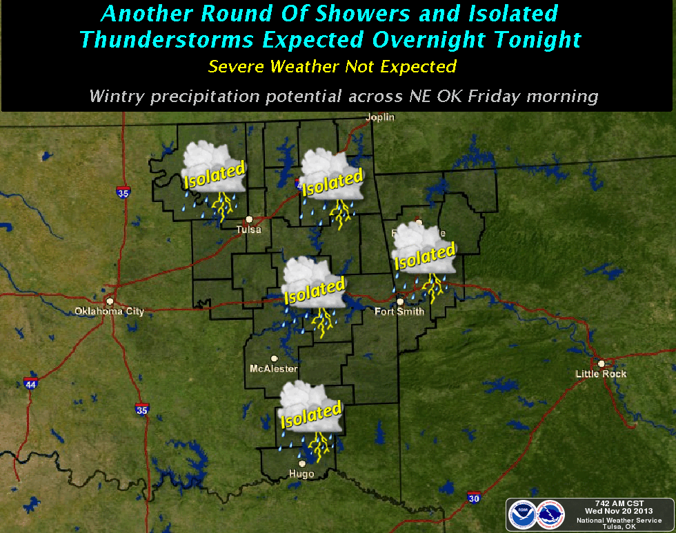
One Route 44 November, extra ice
A Sonic reference? Will Braum's ever forgive me (still waiting on that free ice
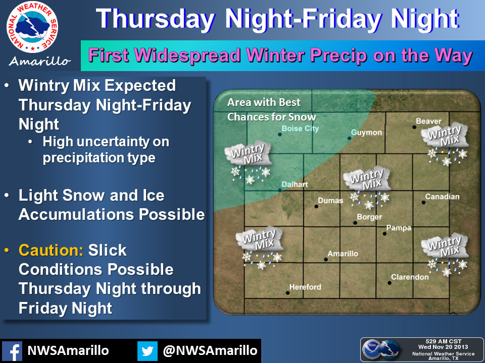
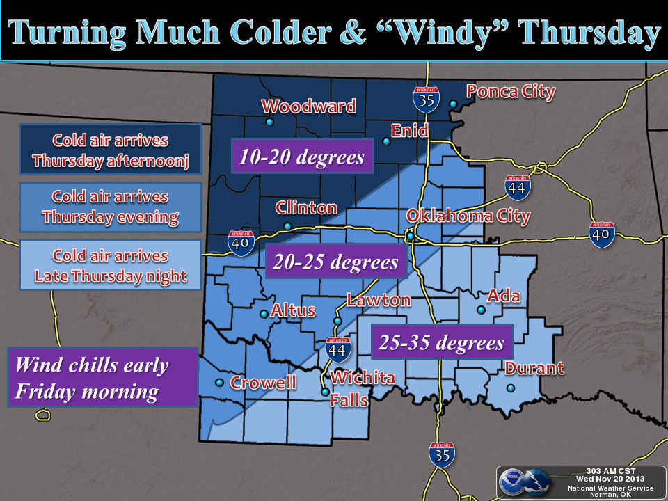
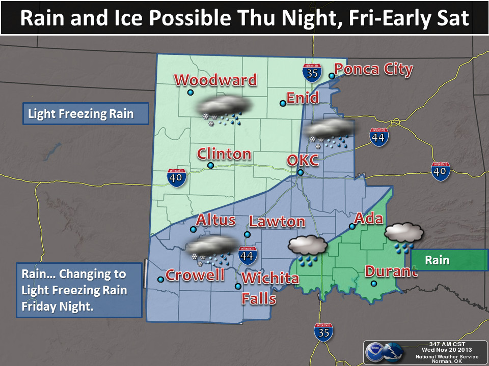
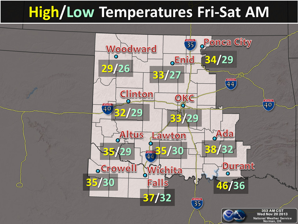
cream)? It does appear a significant portion of Oklahoma will see some frozen
precipitation from the approaching storm system that's going to usher in a blast
of arctic air. Again, I turn to our fine friends at the local NWS offices to
show us in pictures.
Here's a bit of a preview for next week from the Norman NWS forecaster this
morning (their yelling, not mine):
"TEMPS WILL STRUGGLE TO CLIMB INTO THE 40S THROUGH THIS
WEEKEND...WITH THE COLDEST MORNING LOWS EXPECTED SUNDAY UNDER A
SFC RIDGE. THE NEXT CHANCE FOR WINTRY PRECIP WILL BE LATE MONDAY
THROUGH TUESDAY AS A CUTOFF LOW FINALLY MAKES IT OUT OF THE SW AND
SOME WHERE OVER THE SOUTHERN PLAINS. WILL CONTINUE TO SLOWLY
INCREASE (CHANCES OF PRECIPITATION) WITH THIS FEATURE WITH CURRENT
PRECIP TYPES APPEARING TO BE SNOW AND SLEET."
Argh! More snow and sleet. What's up with Mother Nature, doesn't she know
it's ... uh, late November? Okay, my bad. But this precipitation in whatever
form it comes in is looking more and more important. If you haven't been
paying attention to the rainfall totals, it's suddenly gotten pretty dry across
the state. And it has been warm and windy, so we've been losing that topsoil
moisture pretty rapidly. Check out the rainfall maps for the last 30 days, and
then the forecast for the next 7 days. If you're from SW Oklahoma or the
Panhandle, just skip right on over this.
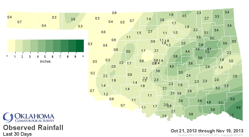
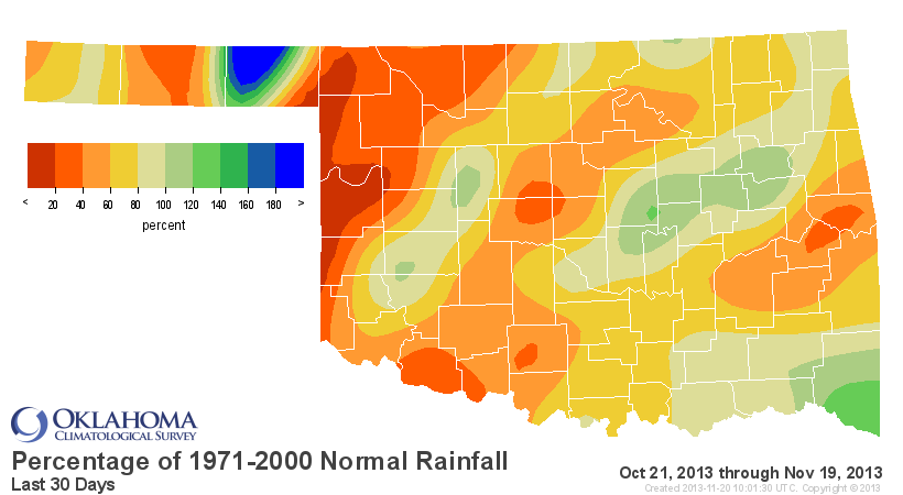
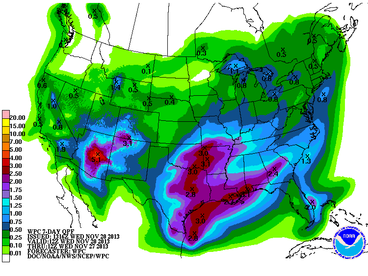
Doesn't look much like a drought-buster for western Oklahoma, but it's
definitely looking like a drought-preventer across eastern parts of the state.
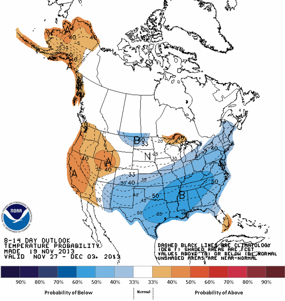
The cold weather looks like it will stick around for even longer, at least in
the general sense. Maybe a warm day or night will sneak its way in there, but
the 8-14 day temperature probability map from CPC shows increased odds of
below normal temperatures for the Nov. 27-Dec. 3 time frame.
Yes, winter is here, and it looks like it's going to hang around. A veritable
nightmare, I tell ya. And such a shame, because we had a really nice run for
awhile earlier in the month. November is going to finish cold ... really cold.
Not just the end of the month, but also the month as a whole. Oh well, there's
always December to look forward to ... BAH HUMBUG!
Gary McManus
Associate State Climatologist
Oklahoma Climatological Survey
(405) 325-2253
gmcmanus@mesonet.org
November 20 in Mesonet History
| Record | Value | Station | Year |
|---|---|---|---|
| Maximum Temperature | 85°F | ARNE | 2007 |
| Minimum Temperature | 11°F | BEAV | 2022 |
| Maximum Rainfall | 4.05″ | SMIT | 2025 |
Mesonet records begin in 1994.
Search by Date
If you're a bit off, don't worry, because just like horseshoes, “almost” counts on the Ticker website!