Ticker for November 19, 2013
MESONET TICKER ... MESONET TICKER ... MESONET TICKER ... MESONET TICKER ...
November 19, 2013 November 19, 2013 November 19, 2013 November 19, 2013
What the!!
It's just weird. Each week another cold front blasts in from the north, each
successively stronger and colder than the last one. It's as if the northern
hemisphere is beginning to tilt away from the sun or something. Where are the
research studies on that! Whatever it is, I don't like it. Can we get our tilt
back from a few months ago? Yes, here comes our strongest front of the year
(uncanny, ain't it??). I'll let our local NWS offices give you the story in
pictures. Tulsa's talking fire, Amarillo and Norman are talking ice. Fire and
Ice...very catchy!
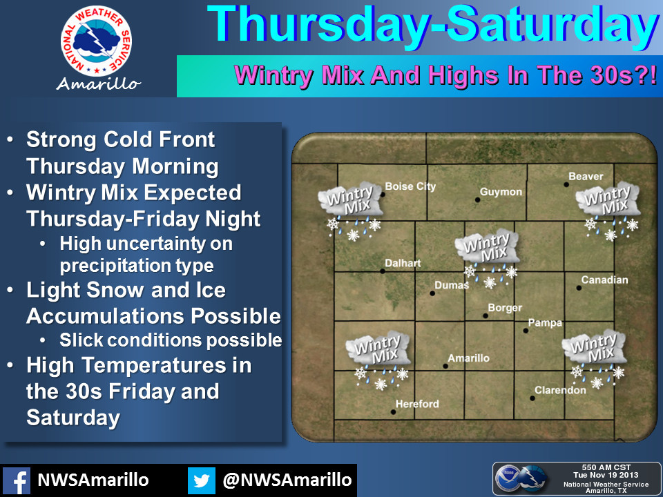
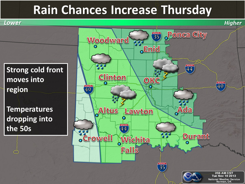
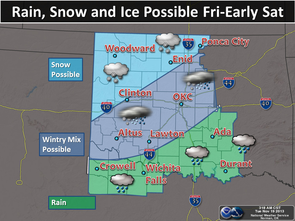
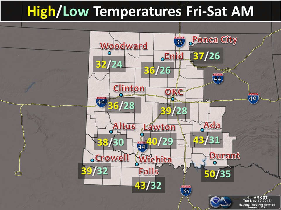
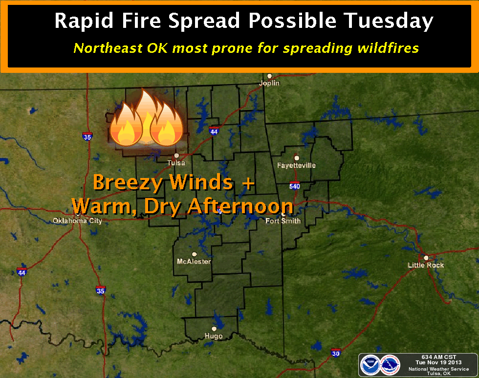
That's for this weekend, then we have another wintry visitor for next week as
well, apparently. The big danger for this storm is the possibility of freezing
rain. Road surfaces, especially bridges and overpasses, will be able to freeze
pretty quickly after the precipitation starts. Something to watch out for Friday
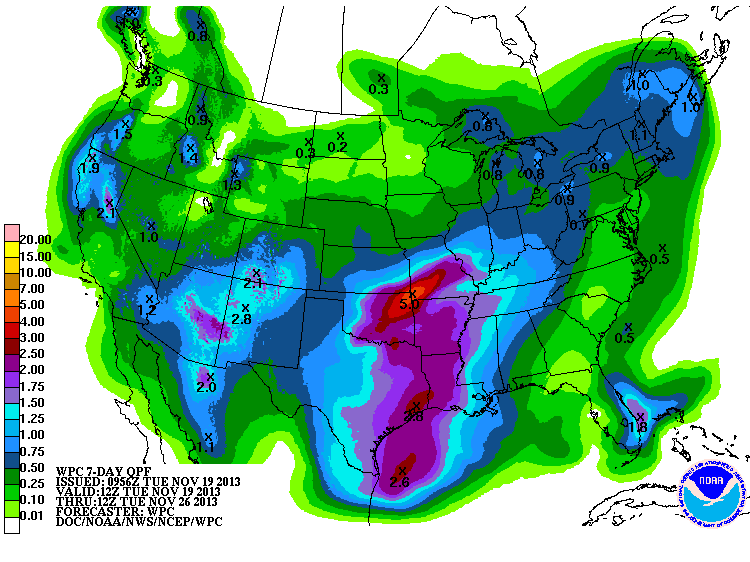
night into Saturday morning. The amount of precipitation possible continues to
go up as we add moisture from the cutoff low that is expected to travel over the
area early next week. The WPC says as much as 5 inches across the far NE. I
doubt that occurs, but some generous moisture amounts appear possible across
much of the state.
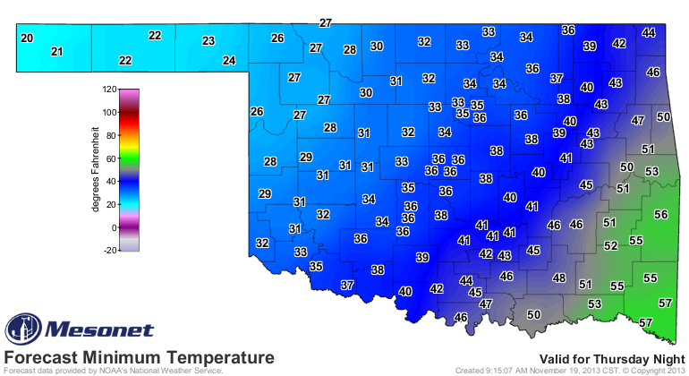
The worst part is still the temperature. Check out the NWS forecast temps for
the weekend. BRRR!!!
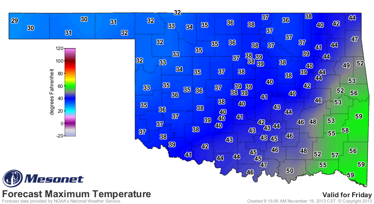
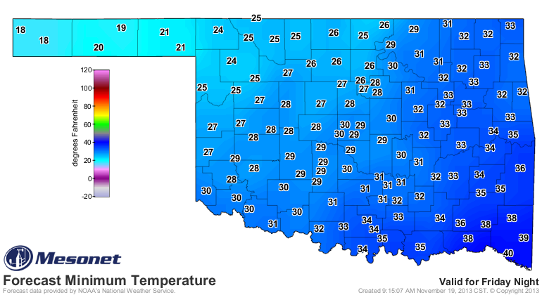
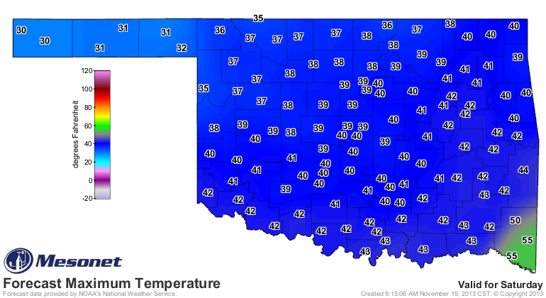
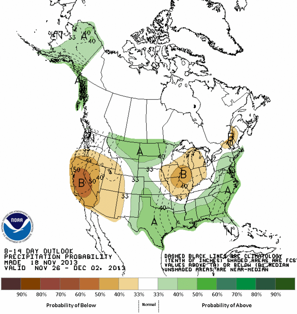
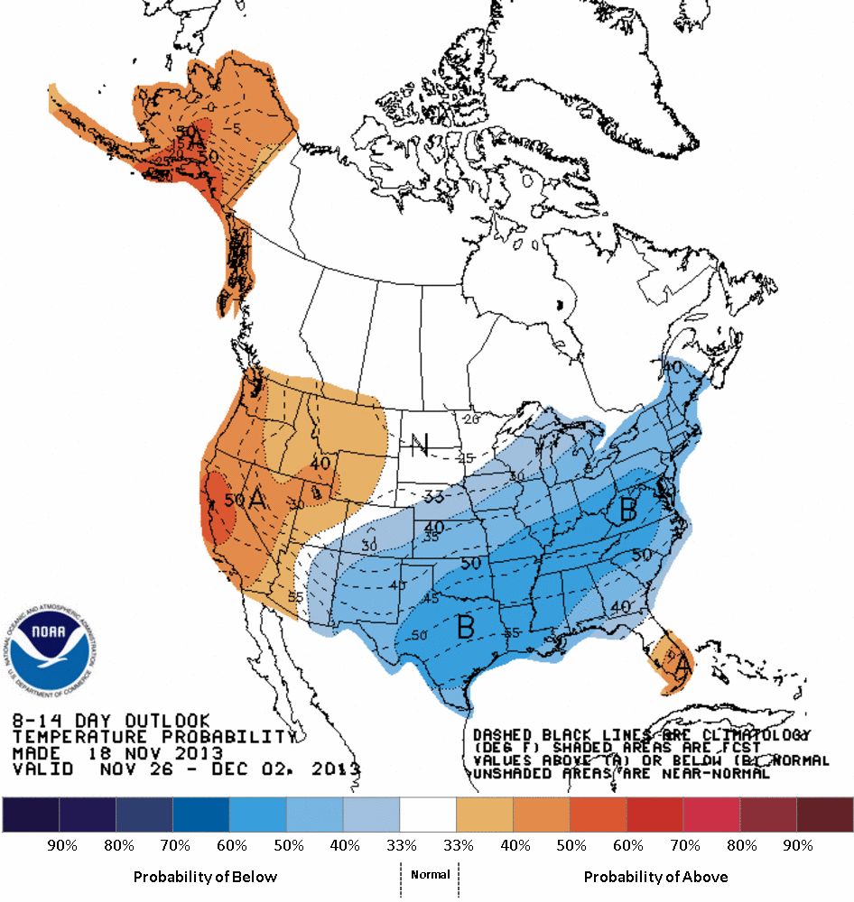
And CPC feels this could possibly last through the rest of the month (at least
in general). Their outlook maps for the Nov. 26-Dec. 2 period show increased
odds of below normal temperatures and above normal precipitation.
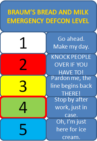
Not to worry just yet, but for folks in northern Oklahoma ... you're looking
at a Braum's Bread and Milk Emergency DEFCON Level of 4 or so. You know, just
stop by after work. No biggie.
Gary McManus
Associate State Climatologist
Oklahoma Climatological Survey
(405) 325-2253
gmcmanus@mesonet.org
November 19 in Mesonet History
| Record | Value | Station | Year |
|---|---|---|---|
| Maximum Temperature | 86°F | GOOD | 2020 |
| Minimum Temperature | 6°F | KENT | 2022 |
| Maximum Rainfall | 3.26″ | KING | 1994 |
Mesonet records begin in 1994.
Search by Date
If you're a bit off, don't worry, because just like horseshoes, “almost” counts on the Ticker website!