Ticker for November 14, 2013
MESONET TICKER ... MESONET TICKER ... MESONET TICKER ... MESONET TICKER ...
November 14, 2013 November 14, 2013 November 14, 2013 November 14, 2013
Drought a'coming and a'going
The newest U.S. Drought Monitor map has a few changes on it, thanks to last weeks
rainfall, but nothing substantial. In a nutshell, we saw a bit more reduction in
central Oklahoma and a bit more intensification in the far northwest. This is the
rainfall (and lack thereof) we had to work with for this week's map.
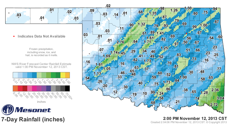
So you can see where we had a bit of a drought reduction across the northwestern
edge of central Oklahoma.
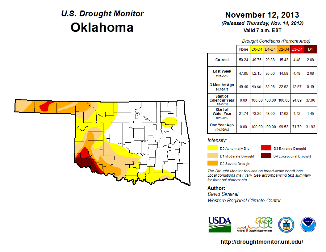
That now leaves us with about 30% of the state in drought (D1-D4), and 50%
without any designation whatsoever (i.e., no D0-Abnormally Dry designation, itself
not considered drought). And it's a far cray from one year ago, when we had 100%
of the state still in at least severe drought (with 72% in extreme or
exceptional).
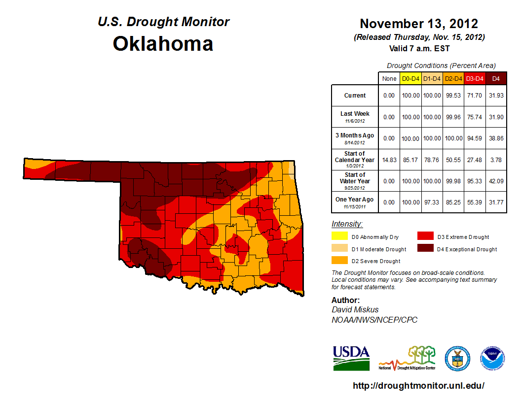
Recall at that time we were in the midst of our driest May-December on record,
dating back to 1895. We have started to dry out just a bit again, but not enough
to warrant any concerns just yet. Those concerns are confined to areas that
have been in drought continuously for the previous three years, unfortunately.
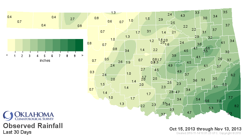
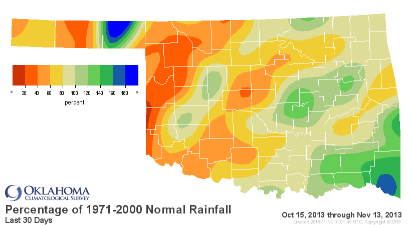
Check out the Mesonet rainfall maps for just the last 30 days. Lots of red out
west!
Not much help on the horizon just yet, as depicted here by the 7-day rainfall
forecast.
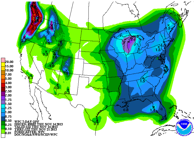
Rain, snow, ice ... folks out west will take just about anything now!
Gary McManus
Associate State Climatologist
Oklahoma Climatological Survey
(405) 325-2253
gmcmanus@mesonet.org
November 14 in Mesonet History
| Record | Value | Station | Year |
|---|---|---|---|
| Maximum Temperature | 89°F | GRA2 | 2025 |
| Minimum Temperature | 11°F | OILT | 2018 |
| Maximum Rainfall | 4.93″ | CLAY | 1994 |
Mesonet records begin in 1994.
Search by Date
If you're a bit off, don't worry, because just like horseshoes, “almost” counts on the Ticker website!