Ticker for November 12, 2013
MESONET TICKER ... MESONET TICKER ... MESONET TICKER ... MESONET TICKER ...
November 12, 2013 November 12, 2013 November 12, 2013 November 12, 2013
Cold Wind Index
While walking into work this morning (uphill both ways), bracing myself against
the face-numbing wind and cold, an idea struck me ... why not combine the wind
and cold into some sort of index? This would be the physiological response of my
skin to the combination of high winds and low temperatures. It would be what I
call the "Cold Wind Index" or CWI. This would represent the apparent temperature
rather than the ... wait, I'm now being told there is already such an index
described as "Wind Chill." Okay, so I missed on that one, but I'll bet there are
no readily-accessible calculations of such an index anywhere to be ... wait, I'm
now being told the Oklahoma Mesonet has such maps readily available.
Well fine! Let's take a look at 'em. We'll start with the current so-called "Wind
Chill" map (what a lame name, nowhere close to as cool as the CWI!), and then
look at the lowest wind chills we've seen today. All from the Mesonet.
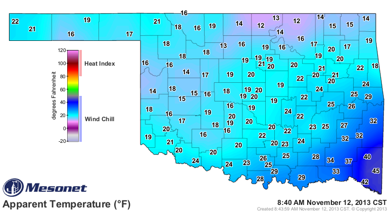
This is a calculation based off the current air temperatures and wind speeds:
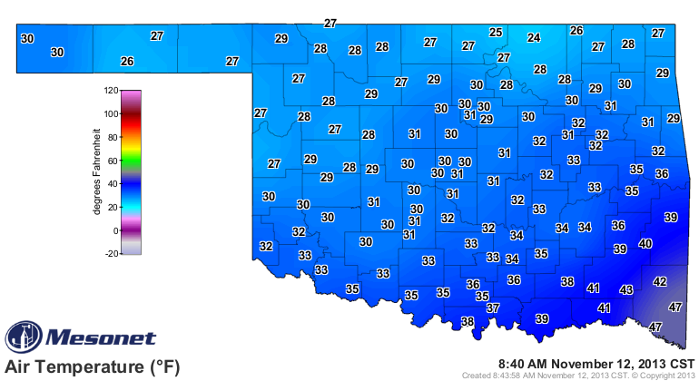
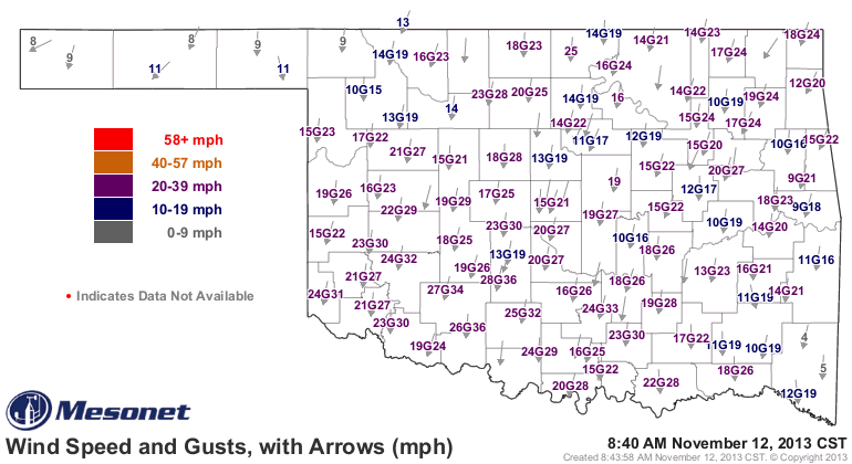
Yikes! Wind chills in the teens and lower 20s over most of the state ... and
the current air temperature map isn't too much better. Now let's look at the
lowest wind chills (at least since midnight).
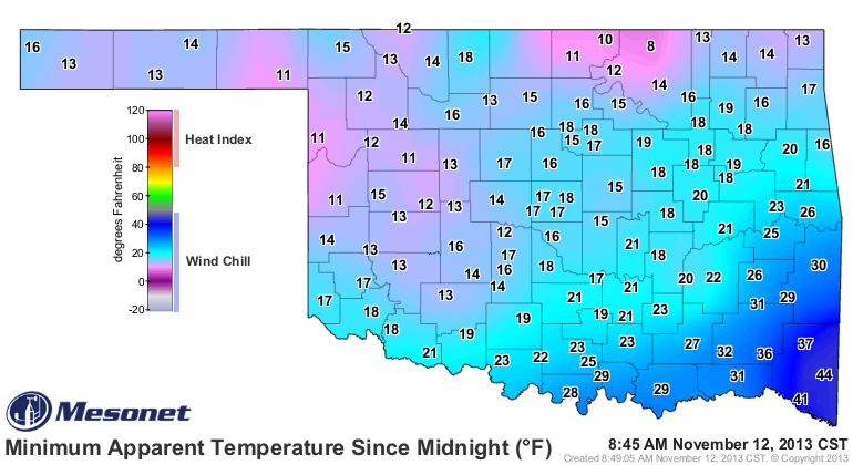
Looks like we've reached the lowest at Foraker up in Osage County at 8 degrees.
Can I go ahead and say "NO THANKS!"?
Those lows of 22 degrees out in the Panhandle aren't the coldest air we've seen
this season ... Kenton hit 20 degrees on Nov. 6. However, that wind chill of
8 degrees calculated at Foraker is the lowest we've seen since the stations
in the Panhandle hit that mark or below way back on April 24.
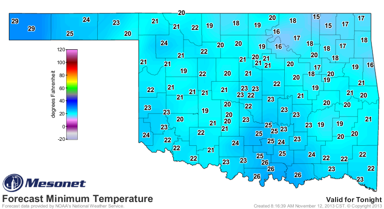
I do think we'll go below Kenton's lowest minimum temperature of 20 degrees
somewhere in the state tonight ... probably up in the northeast somewhere. That
area is closest to the cold dome of high pressure that plunged into the state
from the north. The forecast lows for tonight appear to be headed that way, at
least.
The winds should not be as fierce tomorrow morning, so maybe the Foraker's wind
chill mark will remain safe.
Well, now that I've been beaten to the punch on the Cold Wind Index, I had best
start on another endeavor. I'm a summer guy, so I'm thinking about something
to do with heat and humidity, maybe. I'll call it the "Sweatin' Don't Help
Index," or SDHI for short.
Remember, you heard it here first!
Gary McManus
Associate State Climatologist
Oklahoma Climatological Survey
(405) 325-2253
gmcmanus@mesonet.org
November 12 in Mesonet History
| Record | Value | Station | Year |
|---|---|---|---|
| Maximum Temperature | 86°F | BURN | 2005 |
| Minimum Temperature | -4°F | EVAX | 2019 |
| Maximum Rainfall | 2.72″ | SEIL | 2010 |
Mesonet records begin in 1994.
Search by Date
If you're a bit off, don't worry, because just like horseshoes, “almost” counts on the Ticker website!