Ticker for November 7, 2013
MESONET TICKER ... MESONET TICKER ... MESONET TICKER ... MESONET TICKER ...
November 7, 2013 November 7, 2013 November 7, 2013 November 7, 2013
You freeze yet? Snow next week? Dry where you are? Like answering questions?
Well, with last night's clear skies and light winds, that allowed most of the
state to see at least a frost, and a significant part to see a freeze. Check out
the low temperature map from the Mesonet, and also the number of hours below
freezing since our first freeze in early October and also over the last couple of
days.
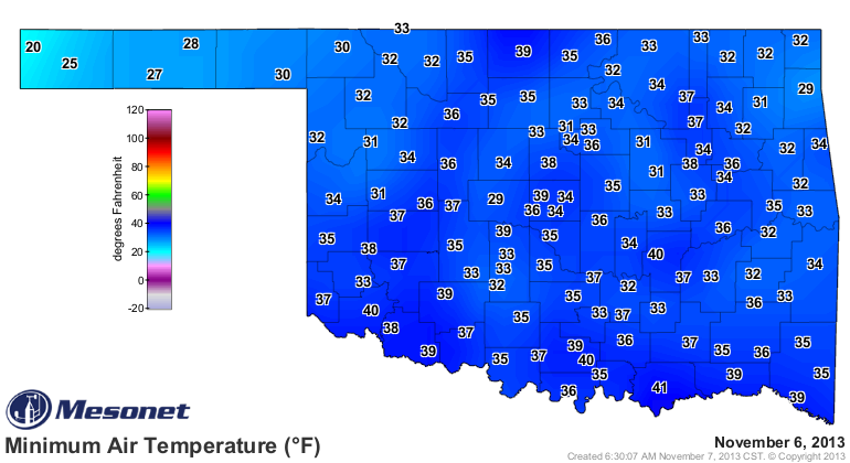
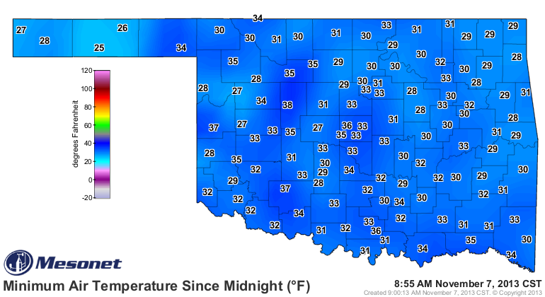
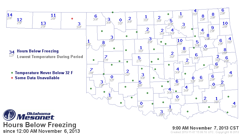
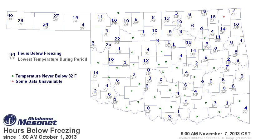
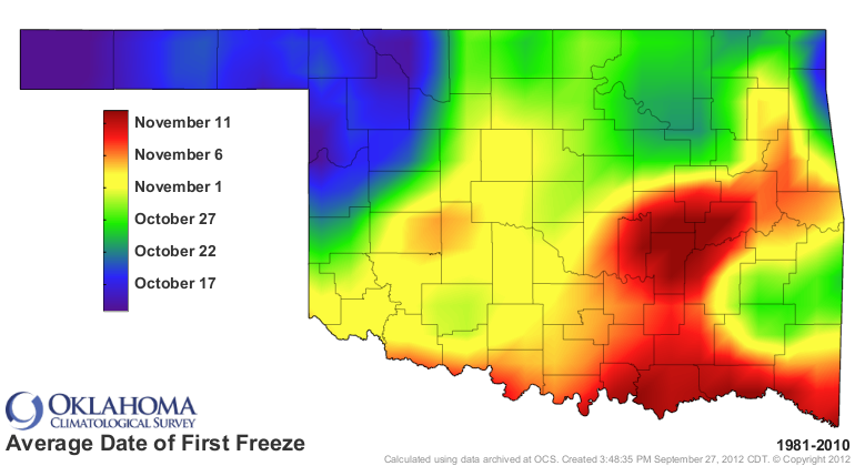
This shows us that most of the state has reached the 32-degree mark during the
fall thus far. Nothing too unusual here, very close to our average first freeze
date across the entire state. Maybe a week early or so down south and over east.
In fact, probably a bit past the average date in some areas.
The big news making the rounds in the weather circles for next week is the
possibility of even colder air hitting us next week sometime. A few climate
models (trust me, they are not runway worthy) are even giving us the possibility
of snow next week. The most crazy of which is the European model (favored by
many a forecaster) giving us 10 inches of snow next week.
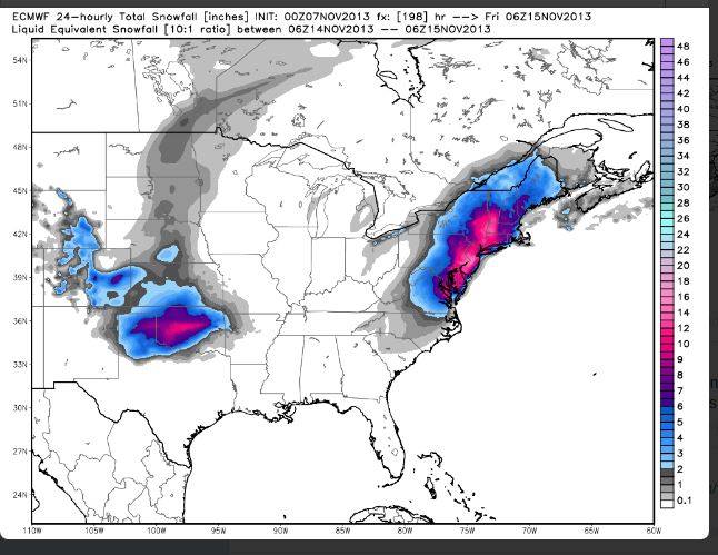
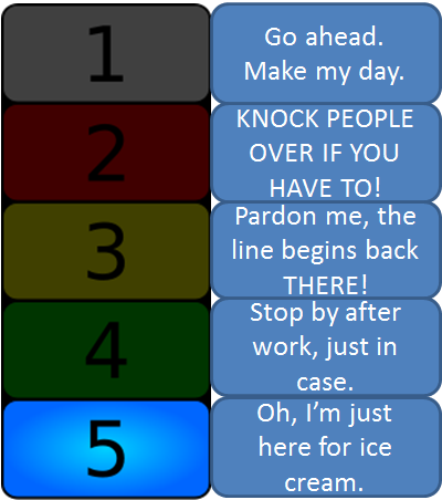
Please note that I am only posting that for entertainment purposes ... wayyyyy
too early to go nuts on that just yet, so there will be no implementation of
the Braum's Bread and Milk Emergency Broadcasting System just yet! I would
say we're still at DEF-BRAUM'S LEVEL 5. Stay tuned, however. Craziness abounds
with Oklahoma weather the last decade or so!
The chances for some really cold air look more reasonable, however. I just
can't tell you how excited I am at the prospect of more cold air. I might
schedule a few root canals in celebration!
--------------------------------------------------------------------------------
New Drought Monitor map
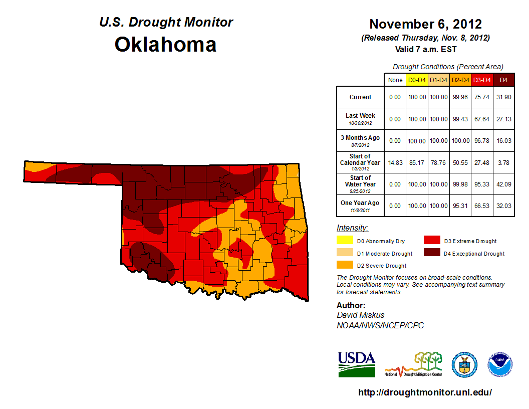
The newest drought monitor map reflects changes due to the last couple of rain
events, and the lack of rain events, in differing parts of the state.
This is gonna hurt, southwest, so get yer band-aids ready!
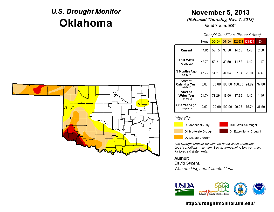
So the biggest news in this map is the expansion of D4-Exceptional drought into
Harmon County in far southwestern Oklahoma. We already detailed how that area
has seen its driest last three years on record, and recent rains haven't helped
much.
As bad as that looks, I still have to think it's better than last year at this
same time, however (trying to turn lemons into silk purses here...work with
me!).
But you can definitely see how the periods of relief we have had starting in
February, interspersed with a couple of periods of intensification, have really
resulted in the present drought map. We'll go back to January for kicks.
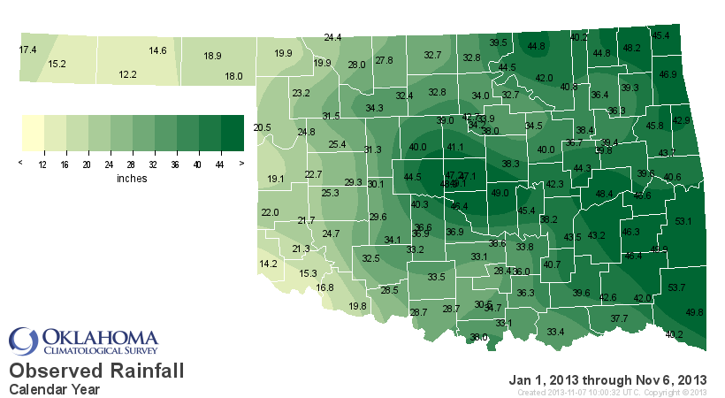
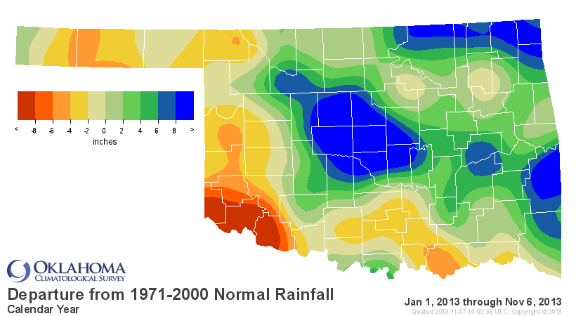
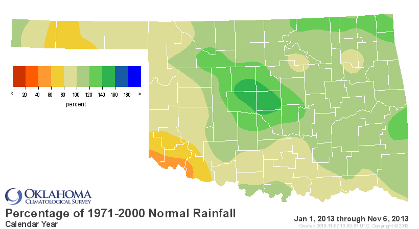
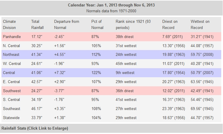
The statewide average since January 1 is 33.8 inches, about 1.4 inches above
normal. Of course, that's a bit better than the Panhandle and southwest, and
a bit (or a lot) worse than places like central Oklahoma, where it's been
crazy-wet.
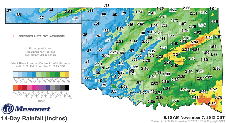
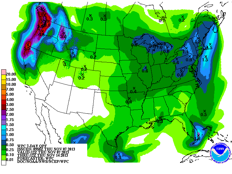
Next week's storm system (be it rain or snow) is just starting to register on
the 7-day rain total forecasts map. Nothing major just yet, but still a long
ways off, so just a hint.
Remember, our mantra needs to be "NOSNOW NOSNOW NOSNOW!" Come on, you really
want to be waiting in line at Braum's for bread and milk next week, then
before Thanksgiving??
Gary McManus
Associate State Climatologist
Oklahoma Climatological Survey
(405) 325-2253
gmcmanus@mesonet.org
November 7 in Mesonet History
| Record | Value | Station | Year |
|---|---|---|---|
| Maximum Temperature | 95°F | HOLL | 2023 |
| Minimum Temperature | 18°F | BEAV | 2003 |
| Maximum Rainfall | 5.03″ | ELRE | 2011 |
Mesonet records begin in 1994.
Search by Date
If you're a bit off, don't worry, because just like horseshoes, “almost” counts on the Ticker website!