Ticker for November 6, 2013
MESONET TICKER ... MESONET TICKER ... MESONET TICKER ... MESONET TICKER ...
November 6, 2013   November 6, 2013   November 6, 2013   November 6, 2013


You're welcome, Hollis

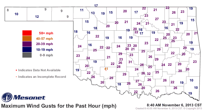
As I stepped out of my car this morning, buffeted by winds gusting up to 20-30 mph


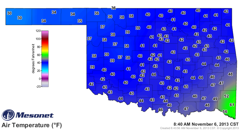
and the air temperatures barely into the 40s


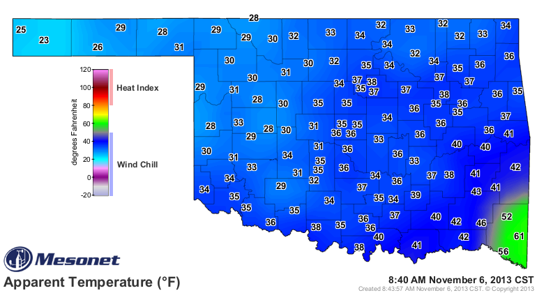
causing wind chills in the 30s


I thought "there has to be a better way!" And then I remembered ... there is!

It's called "summer." Alas, I have a few more months to go before we return to
those glorious 90s and 100s, so my only choice is to hunker down until February,
April, May or June (Oklahoma's variable weather is wonderful, ain't it?) when
those types of readings return.

So while I consider this cold front an idiot, it did bring a healthy dose of
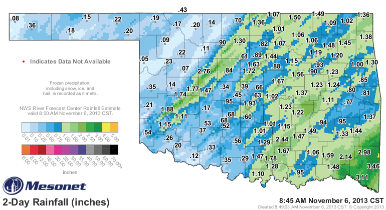
rain (sometimes sideways rain, but rain nevertheless) across many parts of the
state. Those totals include a half of an inch at Hollis, which I had just
lamented was getting treated like Altus' west-headed step-child despite having
received less rain than its bigger eastern neighbor.


The southeast was the big winner as has been the norm lately (and in general,
climatologically) with totals of more than 3 inches in some areas. However,
there was an area of 1-3 inches along a narrow band from Mangum all the way
north through north central Oklahoma. And our home base here in Norman received
nearly 2 inches.

Altus? Sorry, you were stuck with about a quarter-inch. Not much help there. So
despite the 0.25-0.50 inch amounts last night, drought did not improve along
those far southwestern counties too much (foreshadowing tomorrow's U.S. Drought
Monitor map??).

Here's the thing about Hollis' precipitation totals over the last 2.8 years
or so (January 2011-November 6, 2013) ... they're probably the lowest such period
on record for that little town. They've now had 44.84 inches since January 1,
2011. Check out the monthly totals below (2011 is pretty painful):

-***-
Year  Jan   Feb   Mar   Apr   May   Jun   Jul   Aug   Sep   Oct   Nov   Dec   Annual
2011  0.14  0.26  0.03 	0.09  1.71  0.45  0.11  0.23  0.50  2.94  2.90  1.46   10.82
2012  0.06  0.69  3.39 	4.14  1.33  4.51  0.03 	2.32  2.70  0.02  0.06 	0.47   19.72
2013  1.09  2.48  0.28 	1.06  1.60  2.59  1.89 	1.18  0.55  0.90  0.68	 M     13.62
-****-

Normal for a year in Hollis is 26.5 inches, and normal For January-November is
about 25 inches, so Hollis is approximately 33 inches below normal over the
last 35 months. Looking back at all the other previous 36-month, January-December
totals for Harmon County (the best data we have is from Vinsok, OK, in northern
Harmon County), the driest on record came from 1969-1971 with a total of 53.37
inches.

There's a lot of handwaving there, necessary because of missing data, but the
crux of the story is that southwestern Oklahoma, especially the counties of
Harmon, Jackson and Tillman, have had a miserable three years. While the eastern
two-thirds of the state has had intermittent significant drought since late-fall
2010, the western third of the state has been really hurting. Again, especially
southwestern Oklahoma AND much of the Panhandle.

I know that the totals weren't so great the last couple of days down that
way, but it won't be the last rain we see this year.

I hope.

Gary McManus
Associate State Climatologist
Oklahoma Climatological Survey
(405) 325-2253
gmcmanus@mesonet.org
November 6 in Mesonet History
| Record | Value | Station | Year |
|---|---|---|---|
| Maximum Temperature | 89°F | BUFF | 2009 |
| Minimum Temperature | 19°F | GOOD | 2003 |
| Maximum Rainfall | 6.25″ | RING | 2011 |
Mesonet records begin in 1994.
Search by Date
If you're a bit off, don't worry, because just like horseshoes, “almost” counts on the Ticker website!