Ticker for October 31, 2013
MESONET TICKER ... MESONET TICKER ... MESONET TICKER ... MESONET TICKER ...
October 31, 2013 October 31, 2013 October 31, 2013 October 31, 2013
And Erick stands alone
Okay, the big storm system that promised to dump 3-5 inches of rain has almost
exited the state. There are still a few showers and storms brushing the far
northern and eastern edges of Oklahoma. And while it did dump 3-5 inches in a
few areas, it was definitely not as widespread as hoped for.
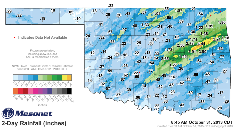
The 3-5 inch amounts were confined to a narrow band from near Okemah up through
southern Delaware County. But, every single Mesonet site received a bit of
rainfall except for Erick down in Beckham County. I guess they were jealous
of Altus always bringing up the rear so they stole the spotlight! And speaking
of Altus, they received nearly an inch with a 0.92 reading, which is wonderful
news for those folks. That brings their total for the month up to a whopping 1.4
inches.
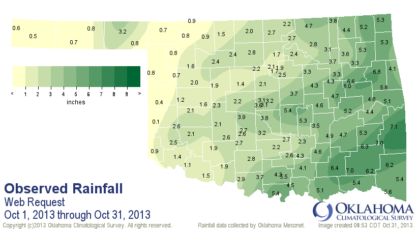
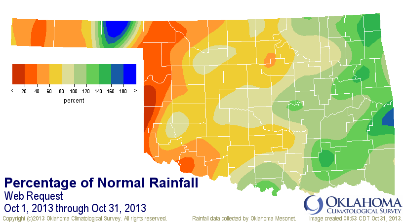
The statewide average for October, which is nearly finished save for those few
showers left rotating around the upper-level low as it pulls off to the northeast,
is now up to 3.13 inches, only a bit below normal with a deficit of 0.26 inches.
Oddly enough, that's the 47th wettest October since 1895. And for a non-oddity,
western Oklahoma once again ended up on the dry side from less than 20% to
80% of normal and eastern Oklahoma had the surplus from 120%-180% of normal.
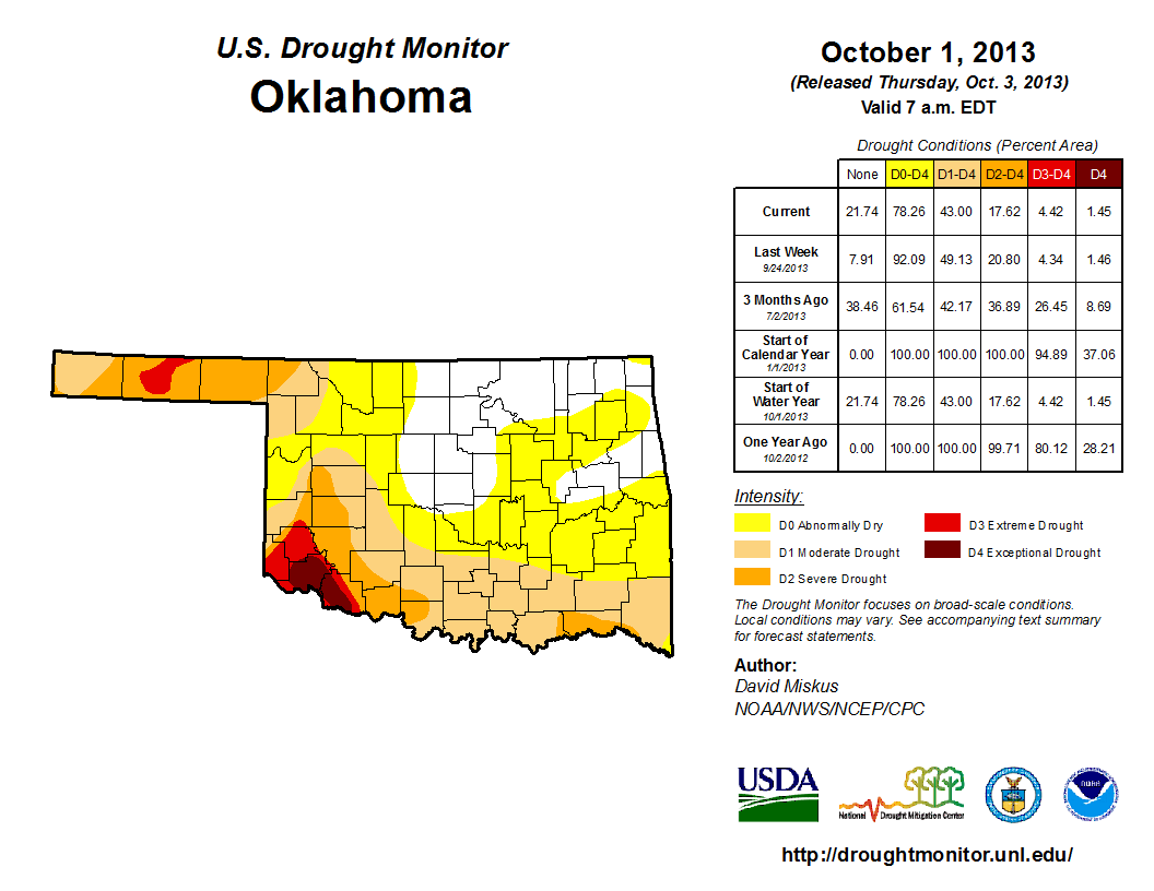
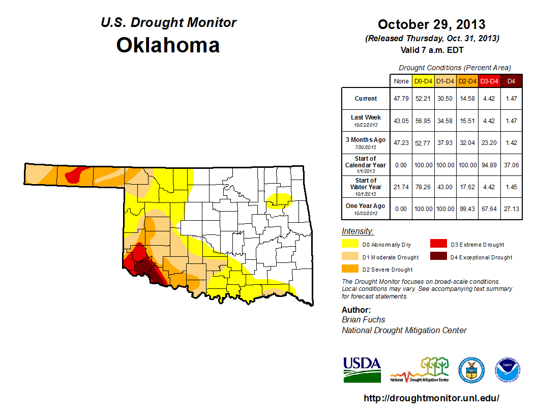
So naturally, we saw continued drought relief in eastern Oklahoma and very
little across western Oklahoma. Check out the U.S. Drought Monitor maps from
October 1 and then the latest map released this morning. Quite a difference
from eastern Oklahoma (especially in the southeast) over the course of the
month.
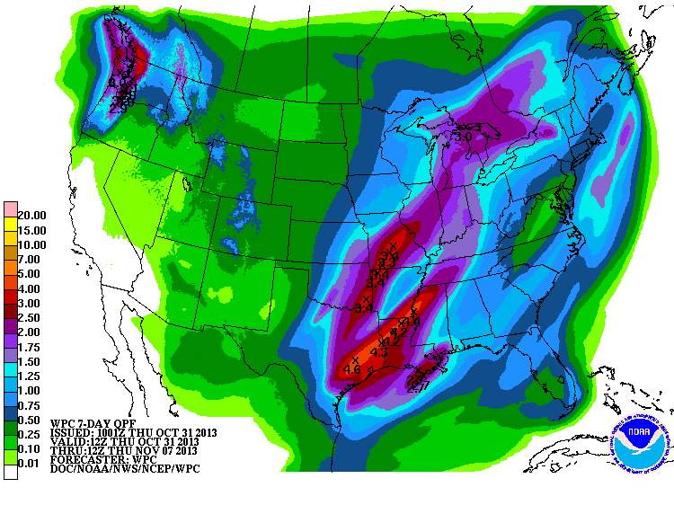
I know the month turned out to be a bit of a disappointment to western Oklahoma,
but all hope is not lost! There is another storm system on its way for the
possibility of an early-week rain event next week. Check out the 7-day rainfall
forecast from the WPC.
So this was a bit of a dud in some ways, but as we've said many times, every
little bit counts. Although Erick's little bit doesn't really count at all, I
guess.
Gary McManus
Associate State Climatologist
Oklahoma Climatological Survey
(405) 325-2253
gmcmanus@mesonet.org
October 31 in Mesonet History
| Record | Value | Station | Year |
|---|---|---|---|
| Maximum Temperature | 92°F | BEAV | 2016 |
| Minimum Temperature | 0°F | KENT | 2019 |
| Maximum Rainfall | 4.64″ | KING | 1998 |
Mesonet records begin in 1994.
Search by Date
If you're a bit off, don't worry, because just like horseshoes, “almost” counts on the Ticker website!