Ticker for October 29, 2013
MESONET TICKER ... MESONET TICKER ... MESONET TICKER ... MESONET TICKER ...
October 29, 2013 October 29, 2013 October 29, 2013 October 29, 2013
Beware dewpoints in the mid-60s during October
Mid-60 dewpoints in Oklahoma, in a transition month like October? Uh oh, that
generally means SOMETHING is going to happen. You know there will be a storm
system and a front arriving sometime, or those southerly moisture-laden winds
probably wouldn't be occurring.

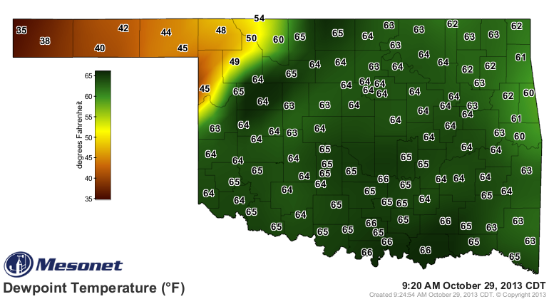
Oklahoma's had its share of flooding in October, often times due to the the
mixture of a tropical system interacting with a stalled front. We may not have
that setup working now, but the risk of flooding across eastern Oklahoma is
definitely on the upswing. Check out these 5-day forecast rainfall totals across
eastern Oklahoma.
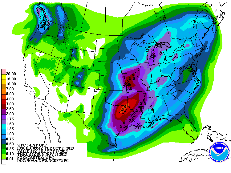
Yowsa! That's a large area of 3-4 inch rainfall amounts being thrown down there,
and that's on top of some pretty good rains over the last week or so that have
started to whittle away at the remnants of flash drought conditions.
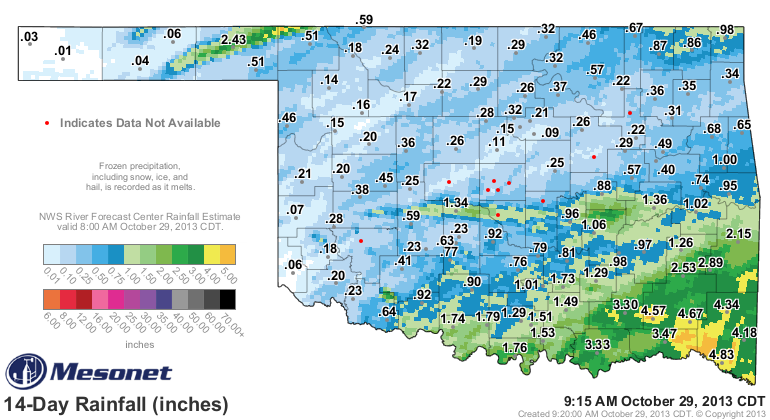
Some of that rain you see on that map fell over the last few nights, so let's
single that out as well.
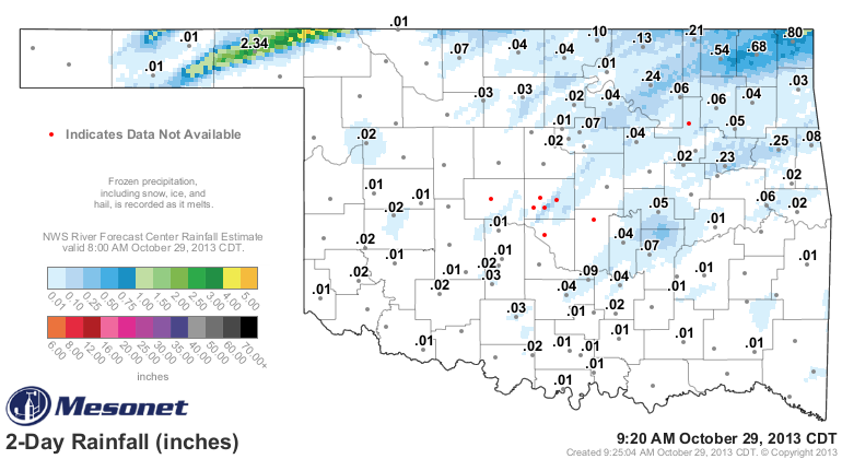
A very nice streak of 1-3 inches fell across a narrow strip of Texas County into
far northwestern Harper County (home of the best place in the Universe, Buffalo,
Oklahoma). We won't see widespread drought relief with that, but it helps those
folks where it did fall. Unfortunately, as is oft the case, that rain came with
some unfortunate impacts. Hail up to 1.75 inches, flash flooding and winds up
to 70 mph were reported along that path.
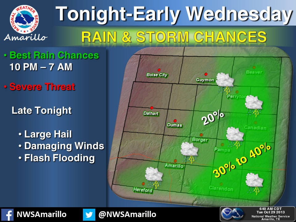
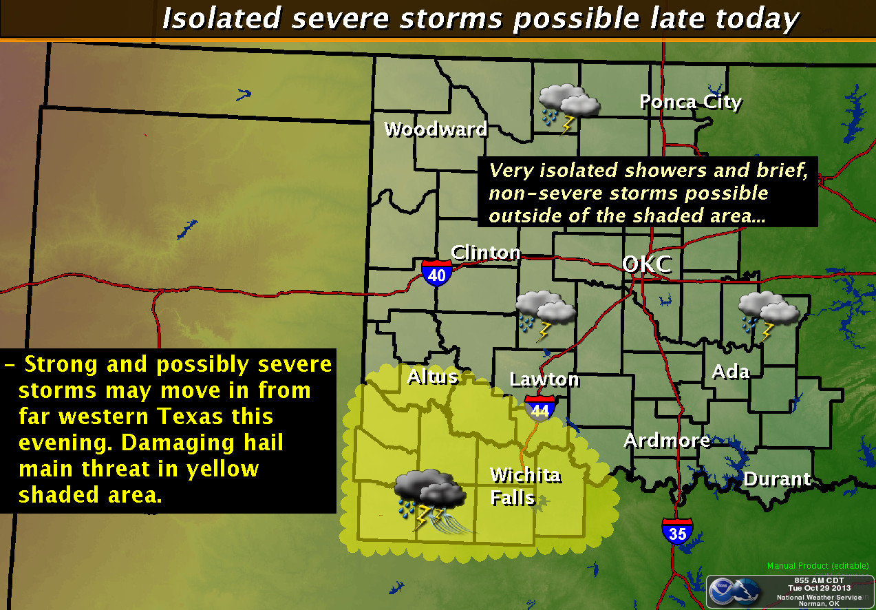
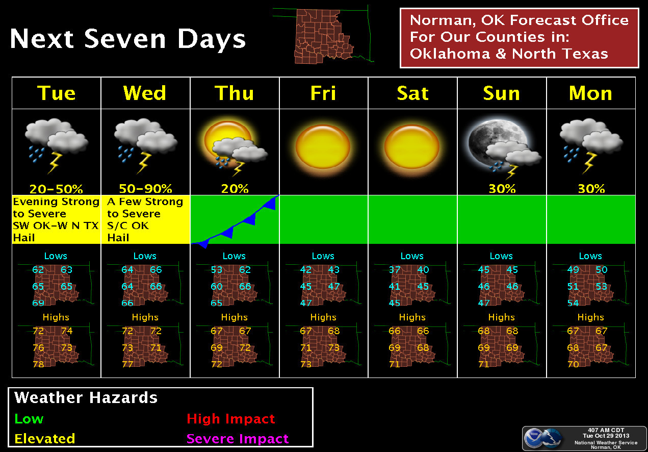
Here's how the local NWS offices see the weather over the next couple of days
shaping up.
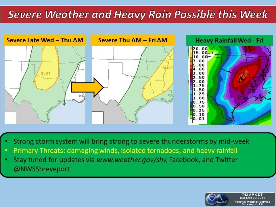
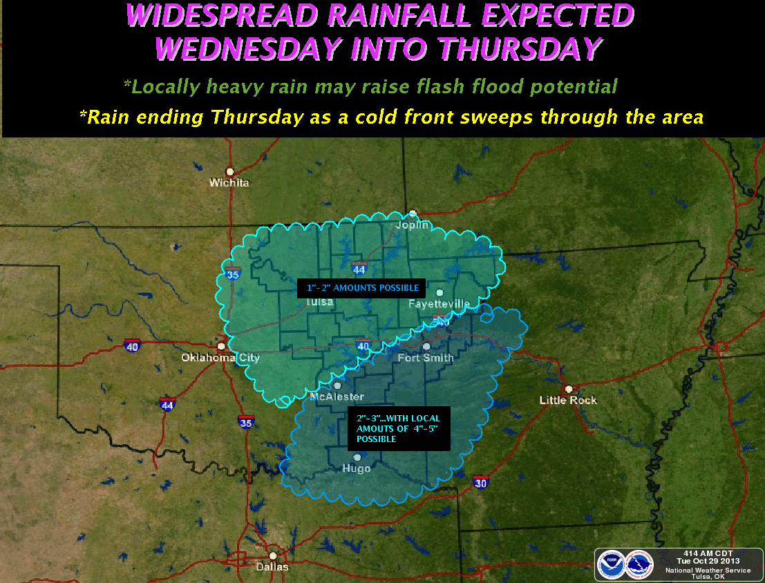
You'll see that graphic from Shreveport mentions the possibility of tornadoes,
but from what I can glean (and we all know just how painful a good gleaning is),
the biggest threat will be hail and heavy rains. BUT, anytime you have severe
weather in Oklahoma, the possibility of a tornado or 50 (just kidding) should
be in the back of your mind.
Hopefully we can get some of this rainfall into southwestern Oklahoma, and also
a bit more in the Panhandle.
Hopefully we can get some of this rainfall into southwestern Oklahoma, and also
a bit more in the Panhandle.
Yeah, I meant to type that twice. I have been saying it almost every Ticker for
the last three years, so I thought I'd go ahead and put tomorrow's plea in to
save myself the trouble.
Sorry Altus! But hope remains alive. Remember, it ain't over till the mid-60
dewpoints sing.
Gary McManus
Associate State Climatologist
Oklahoma Climatological Survey
(405) 325-2253
gmcmanus@mesonet.org
October 29 in Mesonet History
| Record | Value | Station | Year |
|---|---|---|---|
| Maximum Temperature | 94°F | BUFF | 2016 |
| Minimum Temperature | 13°F | BEAV | 2019 |
| Maximum Rainfall | 2.84″ | PAWN | 2009 |
Mesonet records begin in 1994.
Search by Date
If you're a bit off, don't worry, because just like horseshoes, “almost” counts on the Ticker website!