Ticker for November 1, 2013
MESONET TICKER ... MESONET TICKER ... MESONET TICKER ... MESONET TICKER ...
November 1, 2013 November 1, 2013 November 1, 2013 November 1, 2013
October summary ... smiles in the east, frowns in the west
Eastern Oklahoma saw plenty of rain during October, putting the halt to a
blossoming flash drought in that part of the state. Unfortunately for drought-
plagued western Oklahoma, Mother Nature was not quite so generous. Rainfall totals
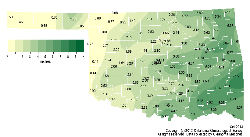
recorded by the Oklahoma Mesonet during October ranged from 7.15 inches at Wister
in LeFlore County to a paltry 0.14 inches at Erick in Beckham County. That sort of
disparity, while a bit exaggerated, spelled out the month's precipitation fortunes
for the two sides of the state. The surplus in the east and the deficit in the
west did manage to even things out with an average total across the state of 3.13
inches.
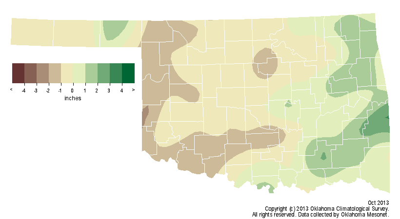
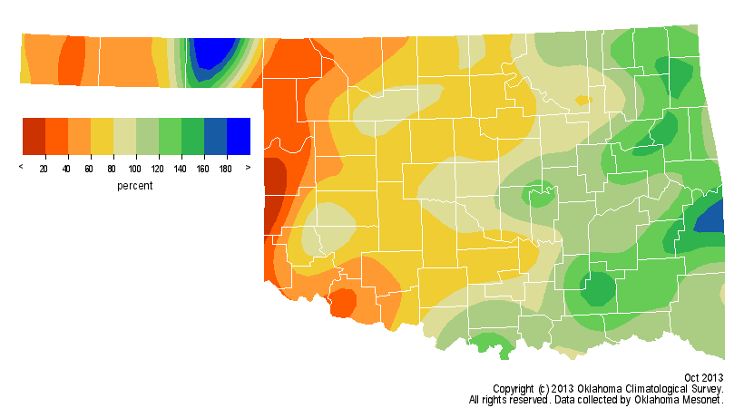
That ranks October as the 47th wettest since records began in 1895, but still
amounts to a deficit of about a third of an inch. To punctuate the disparity
between the east and west, southeastern Oklahoma experienced its 20th wettest
October on record and west central Oklahoma suffered through its 35th driest.
The January-October period was the 31st wettest across the state with a
statewide average of 33.65 inches, 1.82 inches above normal. Central Oklahoma
stands out during that time frame with an average of 41.86 inches, 8.69 inches
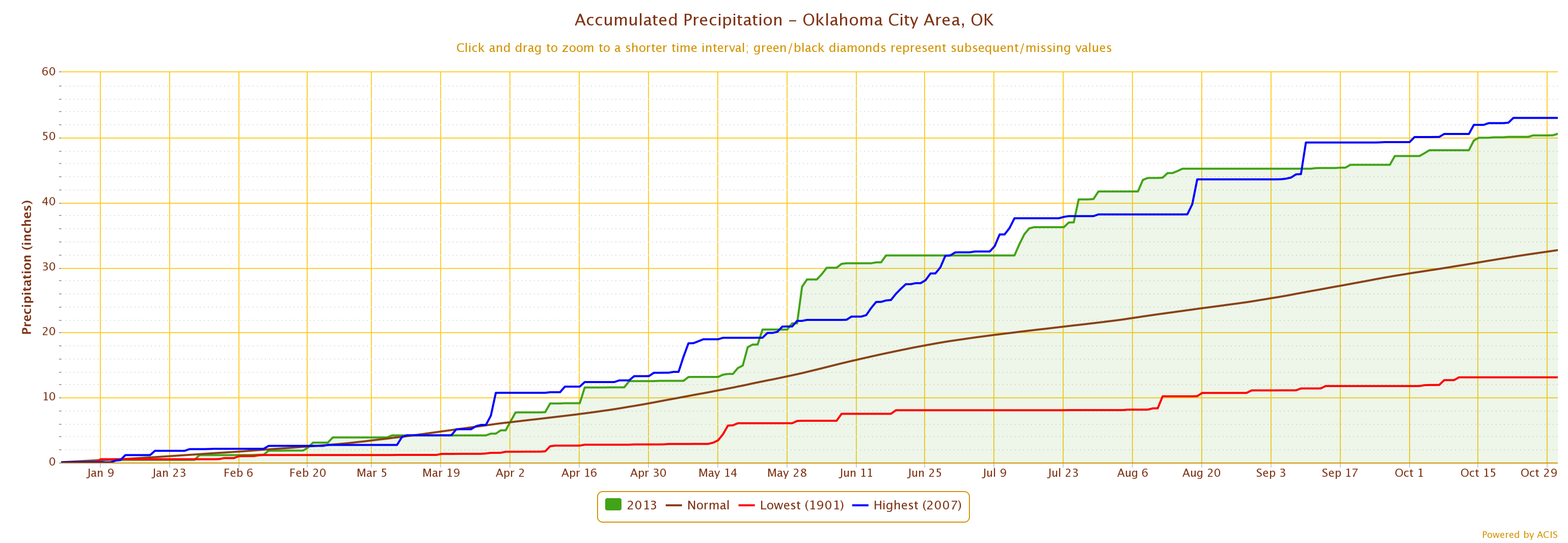
above normal to rank as the eighth wettest on record. Oklahoma City's
January-October total of 50.55 inches is its second highest on record, dating
back to 1891, after recording 3.42 inches during October. Oklahoma City's
record total of 52.99 inches for January-October occurred in 2007.
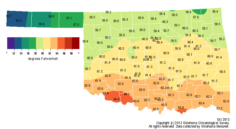
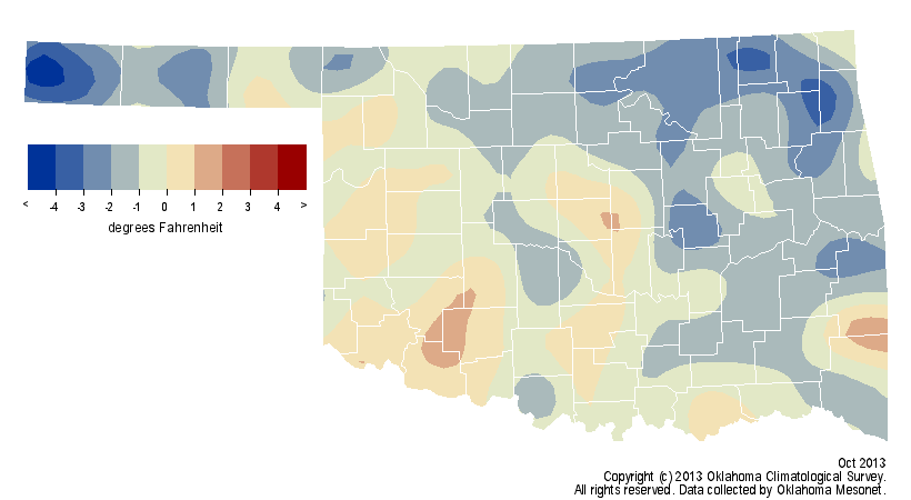
Temperatures began the month on the hot side, but a series of cool fronts
brought the statewide average back below normal by the end of the month. The
month finished as the 38th coolest October on record with an average
temperature of 60.5 degrees, nearly a degree below normal.
The state's first freeze struck in the Panhandle on October 6. Kenton dropped
to 27 degrees on that date, and Boise City and Goodwell also reached the
freezing mark. By the end of the month, most of the northwestern half of the
state had seen a freeze.
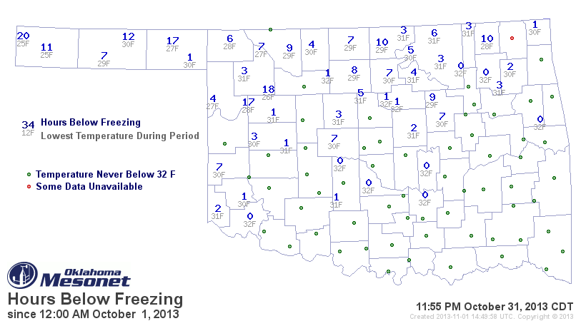
The Mesonet's lowest recorded temperature for October was 25 degrees at Kenton
on the 18th and then again at Boise City on the 19th. The highest temperature
of 96 degrees was reported at Hollis on the fourth. The year was still on track
to finish slightly below normal. The statewide average temperature for the
January-October period was 62.5 degrees, 0.3 degrees below normal and the 50th
coolest on record.
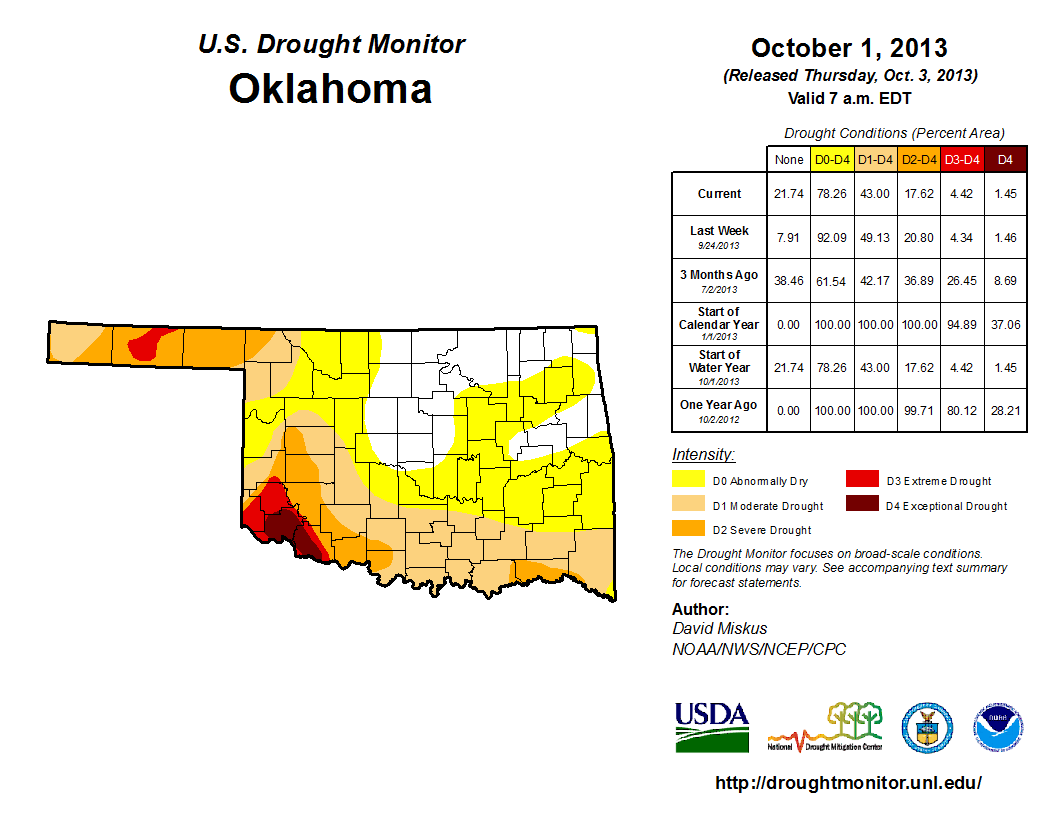
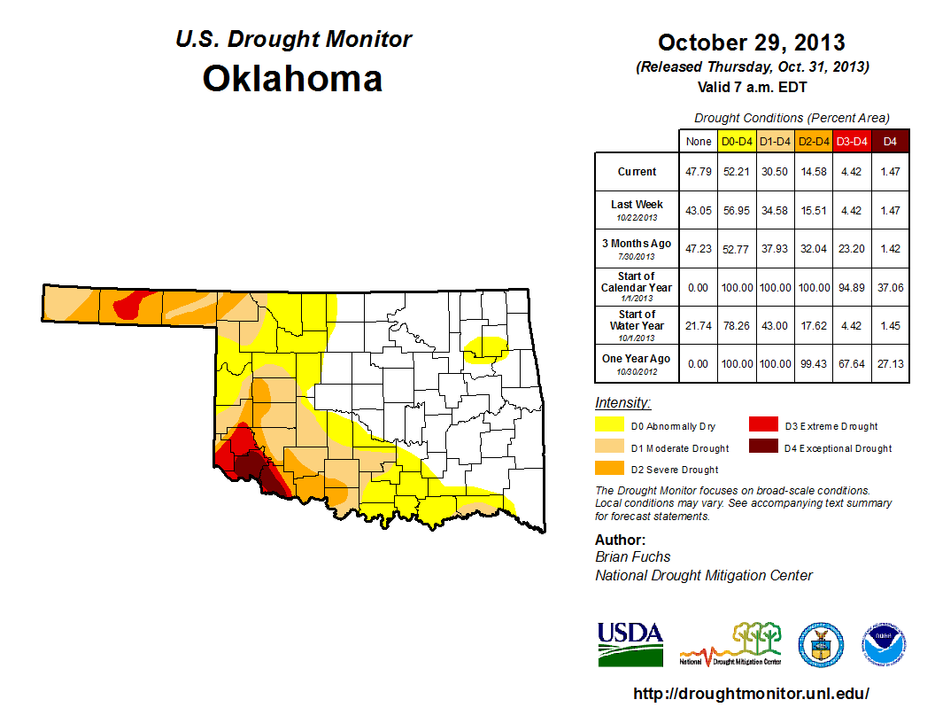
The percentage of the state impacted by drought dropped from 43 percent to 31
percent during October according to the U.S. Drought Monitor. Most of that
reduction occurred across southeastern Oklahoma, as expected from their
generous rainfall totals. Nearly 15 percent of the state remained in at least
severe drought, with most of that showing up in the Panhandle and southwestern
Oklahoma. Exceptional drought, the Drought Monitor's worst category, still
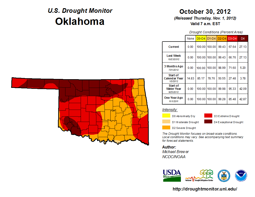
covered most of Jackson and Tillman counties in far southwestern Oklahoma. At
the end of October last year, virtually the entire state was mired in at least
severe drought. At that point, Oklahoma was in the midst of its driest May-
December on record.
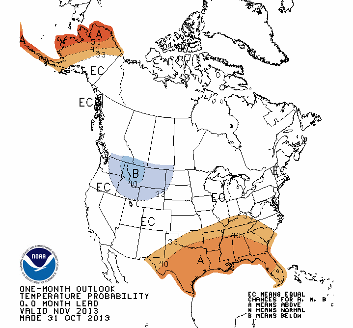
The November temperature outlook from the National Weather Service's Climate
Prediction Center (CPC) calls for increased odds of above normal temperatures
across all areas of the state except the far northwest and Panhandle.
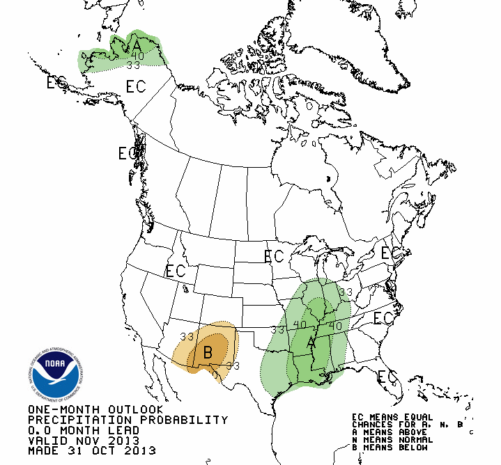
The precipitation outlook finds increased odds for above normal precipitation
across the eastern half. No forecast is indicated for other areas of the state
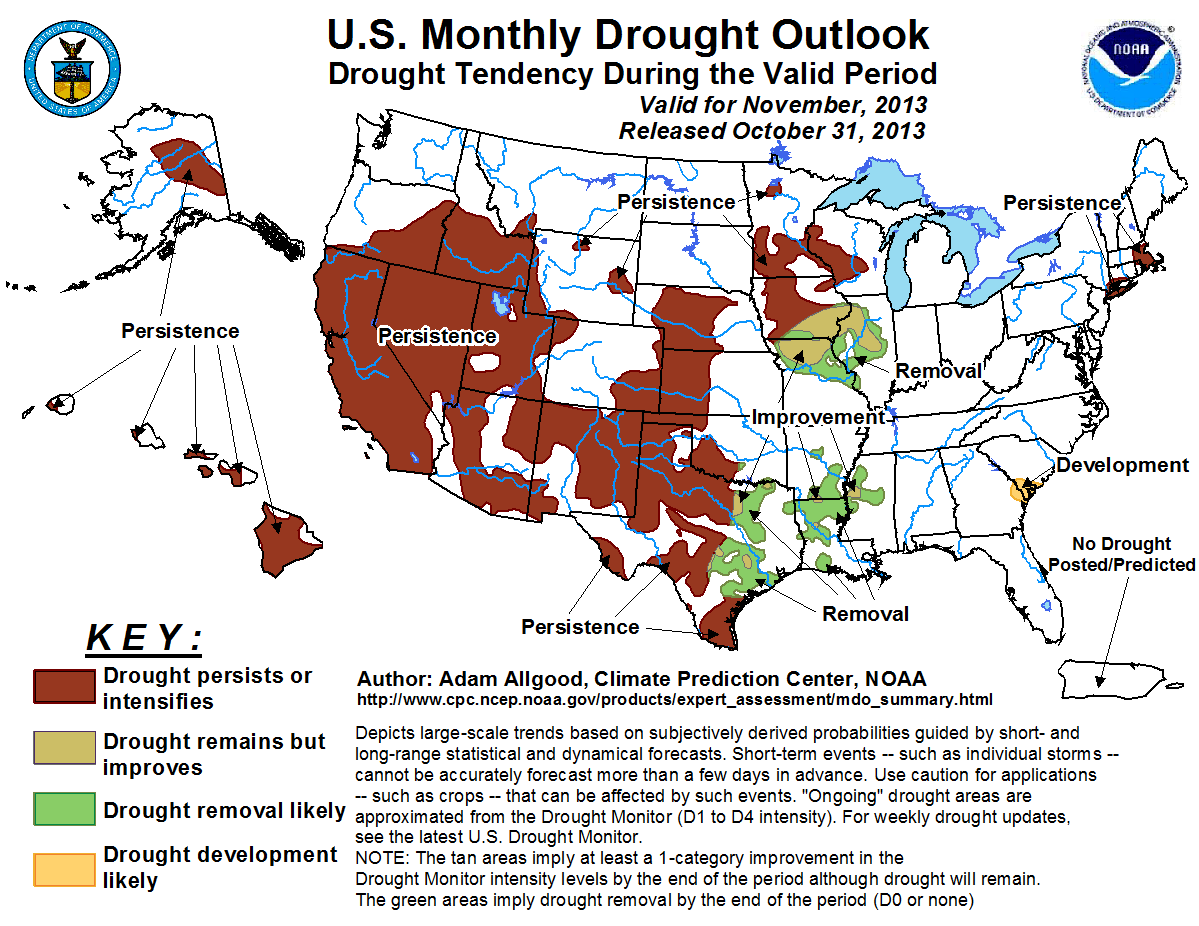
in either outlook. Due to information in those outlooks, the latest U.S.
Monthly Drought Outlook from CPC for the month of November sees drought
persisting across those areas in western Oklahoma where it exists today, but no
expectations of development across eastern Oklahoma.
Gary McManus
Associate State Climatologist
Oklahoma Climatological Survey
(405) 325-2253
gmcmanus@mesonet.org
November 1 in Mesonet History
| Record | Value | Station | Year |
|---|---|---|---|
| Maximum Temperature | 90°F | ALTU | 2001 |
| Minimum Temperature | 16°F | VINI | 2023 |
| Maximum Rainfall | 3.65″ | NEWK | 1998 |
Mesonet records begin in 1994.
Search by Date
If you're a bit off, don't worry, because just like horseshoes, “almost” counts on the Ticker website!