Ticker for October 25, 2013
MESONET TICKER ... MESONET TICKER ... MESONET TICKER ... MESONET TICKER ...
October 25, 2013   October 25, 2013   October 25, 2013   October 25, 2013


Rain still in the forecast, but...

Unlike the view I get in the mirror, Halloween is looking less and less scary as
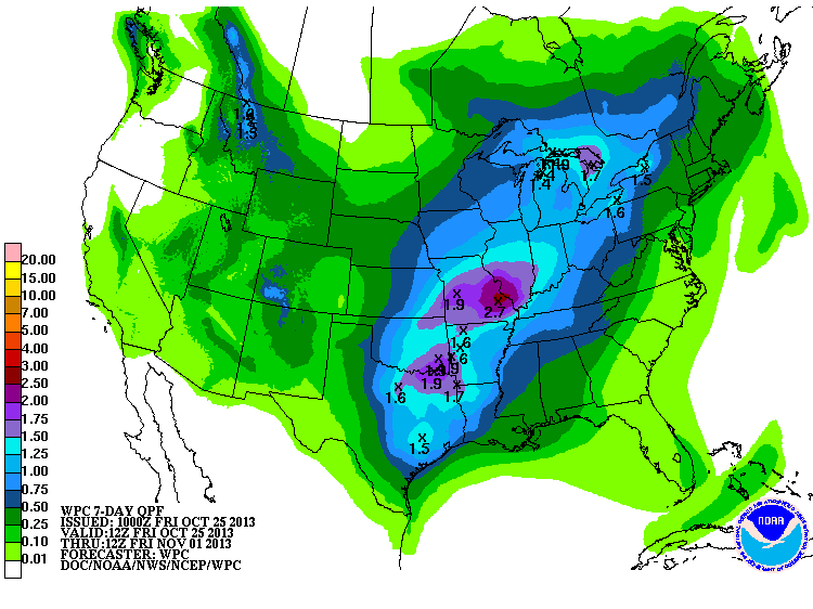
the forecast models go forward. The 7-day forecast totals still show an inch or
two across much of the eastern half of Oklahoma (sorry, places-that-need-it-most)
counting this weekend's and next week's storm systems.


But at least at this point, it's looking less likely we'll have a major blast of
cold air to go along with it. It probably won't be a balmy 75 degrees, but it
won't be snowing or icing either. Probably (see what I did there?). At least both
the Tulsa and Norman NWS offices are going with a warmer forecast than previously
feared.

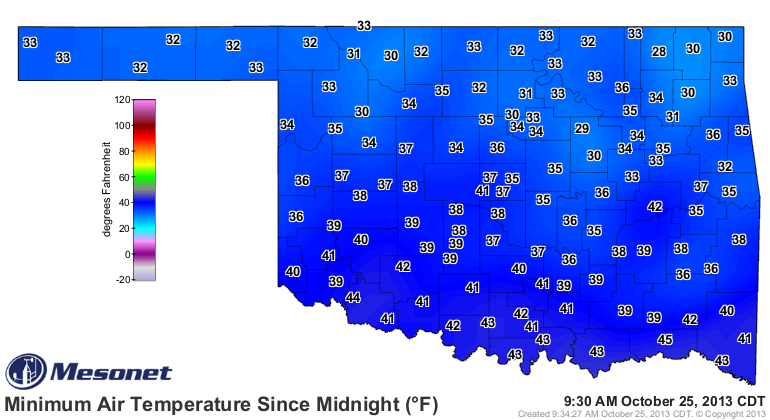
Speaking of cold weather (maybe it was yesterday, or Monday), it got pretty chilly
last night with more of the state headed towards the freezing mark. Check out the
lows from the Mesonet this morning.


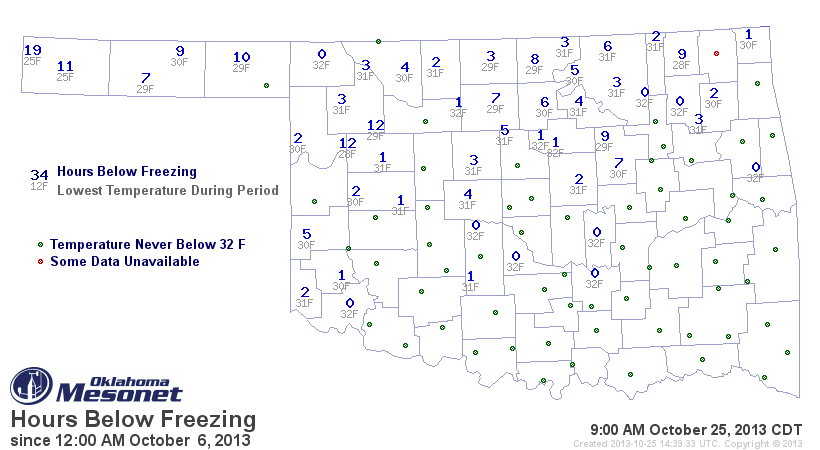
This hours below freezing map from the Mesonet shows who's been under the
freezing line the longest, and who has yet to hit the skids just yet. It starts
on October 6 when we saw our first freezing readings in the Panhandle to 9am
this morning.


What we see is that the far western Panhandle has had a hard freeze, down to
25 degrees for a bit, while other parts of the state have seen their time
below freezing to be quite fleeting. Not bad as we approach November.

Keep tuned to those forecasts ... they can get scary in a hurry this time of the
year!

Gary McManus
Associate State Climatologist
Oklahoma Climatological Survey
(405) 325-2253
gmcmanus@mesonet.org
October 25 in Mesonet History
| Record | Value | Station | Year |
|---|---|---|---|
| Maximum Temperature | 93°F | MANG | 2014 |
| Minimum Temperature | 18°F | KENT | 2019 |
| Maximum Rainfall | 3.91″ | MCAL | 2023 |
Mesonet records begin in 1994.
Search by Date
If you're a bit off, don't worry, because just like horseshoes, “almost” counts on the Ticker website!