Ticker for October 16, 2013
MESONET TICKER ... MESONET TICKER ... MESONET TICKER ... MESONET TICKER ...
October 16, 2013 October 16, 2013 October 16, 2013 October 16, 2013
The final tally
It kept raining across southern Oklahoma last night, at least east of Love County.
And raining. And raining. So much that we ended up with widespread areas of
3-5 inches of rainfall, mainly from Love County (think Burneyville) across to
LeFlore County (Wister, Talihina).
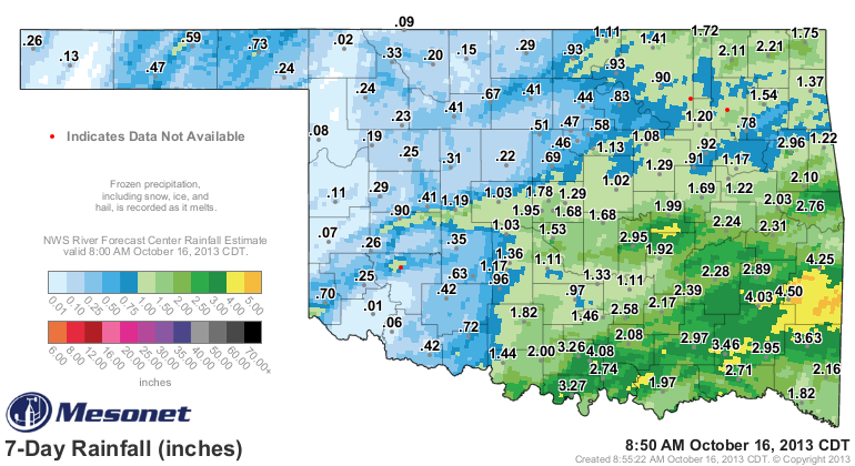
Across western Oklahoma, a real dud, and not of the milk variety that will be
passed out to trick-or-treaters in a couple of weeks (which will also mysteriously
disappear from my kids' candy sacks late that night!). There is rain falling
across northwestern Oklahoma, but this ain't the drought-busting variety of
precip that the southeast saw over the last few days.
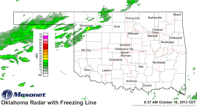
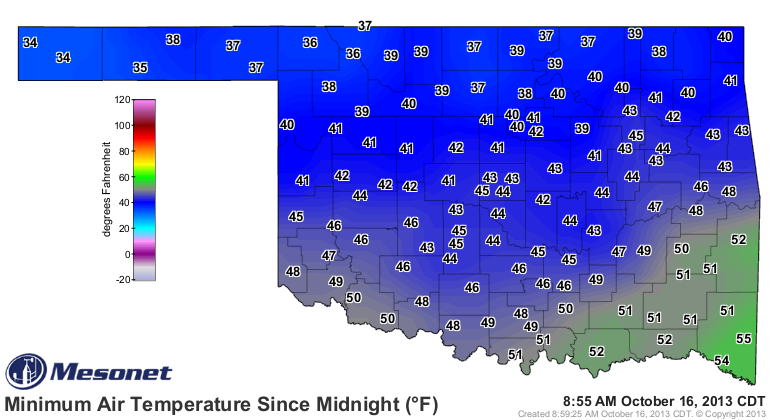
Who knows, maybe Buffalo can break the two-hundredths barrier today. Nobody froze
last night (at least not on the thermometer, but I was definitely freezing when
I stepped outside this morning).
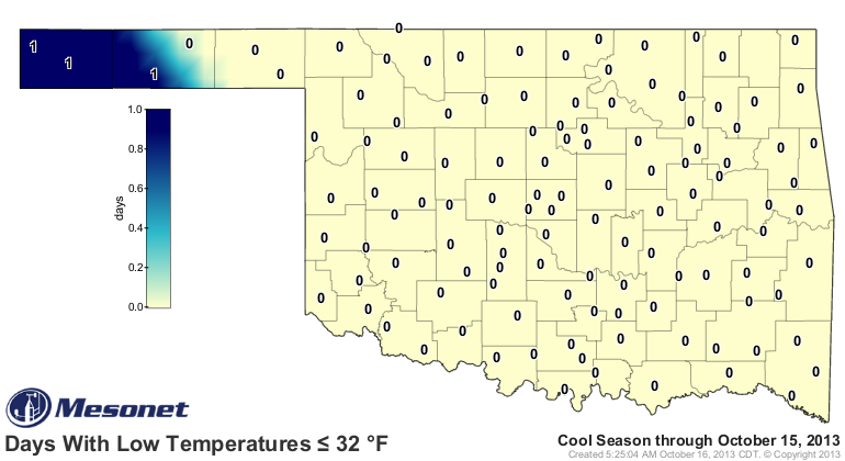
And so far, only three stations across the state have hit the freezing mark
this cool season, so anywhere east of Goodwell is still waiting. Not a shock
considering the average date of first freeze map shows we're still within the
margins of error there. We're getting close, though!
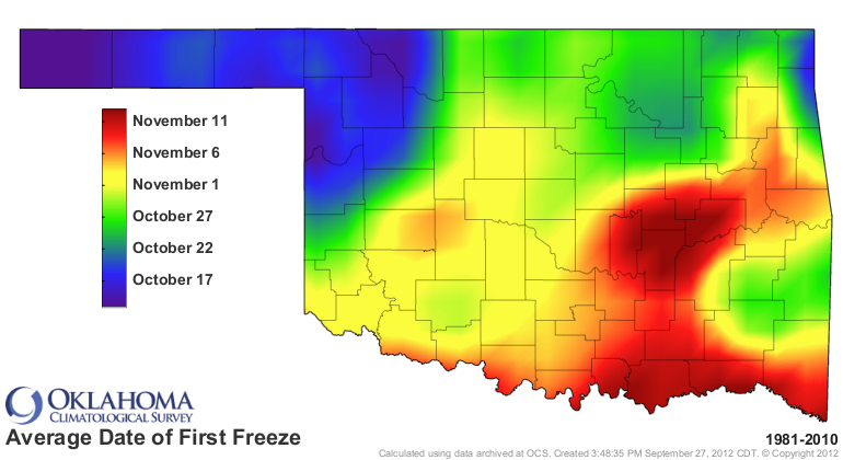
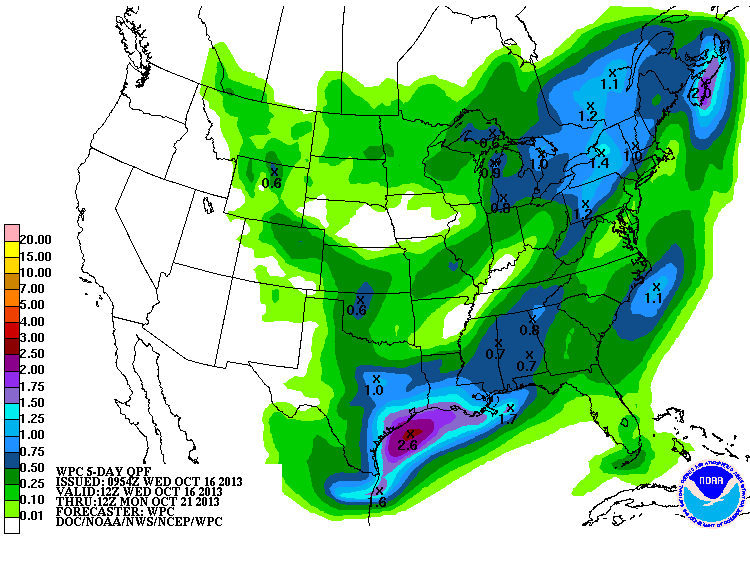
So what we're gonna be left with is somewhat seasonable weather for mid-October,
if not a little on the cool side. In other words, some of those glorious fall
days the Southern Plains are famous for. There's still a bit of rain to be had
with a cold front on Friday (in addition to whatever falls today). Doesn't
look like much, though.
For a final tally going back to when we started to dry out again down south
across the southern half of the state, Aug. 18, we can see how much progress
has been made ... especially across the southeastern quarter.
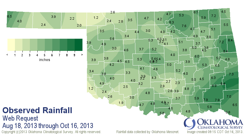
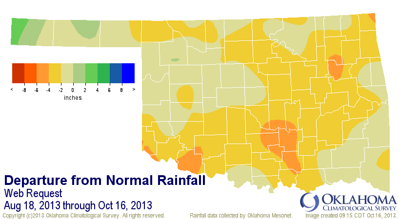
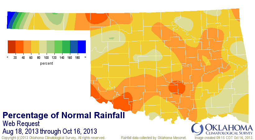
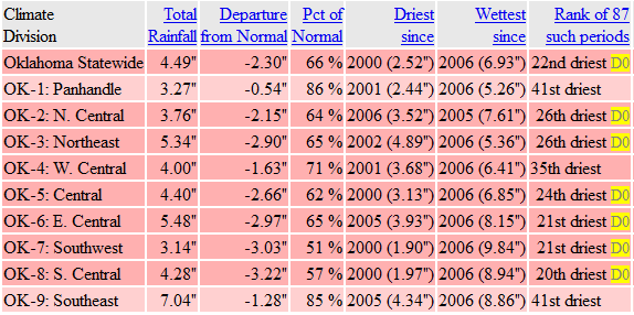
Our statewide average fro that time is 4.5", 2.3" below normal (22nd driest
Aug 18-Oct16 since 1921). So pretty dry across the entire state, but much
better than it was before this last system.
Right now it's a race between Buffalo and Hollis to see who can look the most
pitiful since both are at 1.2" since Aug. 18. I'll have to make sure Hollis
wins somehow.
Gary McManus
Associate State Climatologist
Oklahoma Climatological Survey
(405) 325-2253
gmcmanus@mesonet.org
October 16 in Mesonet History
| Record | Value | Station | Year |
|---|---|---|---|
| Maximum Temperature | 102°F | SLAP | 2016 |
| Minimum Temperature | 24°F | SEIL | 2024 |
| Maximum Rainfall | 3.54″ | HOLL | 1994 |
Mesonet records begin in 1994.
Search by Date
If you're a bit off, don't worry, because just like horseshoes, “almost” counts on the Ticker website!