Ticker for October 17, 2013
MESONET TICKER ... MESONET TICKER ... MESONET TICKER ... MESONET TICKER ...
October 17, 2013 October 17, 2013 October 17, 2013 October 17, 2013
Bye bye drought!
Well, some of it at least. If you leave from Love County to the east, you saw a
reduction of drought from the latest rainfall we had to work with. Note also that
this map doesn't reflect all the relief that occurred (since once again, we only
get to consider rainfall through Tuesday morning ... and a BUNCH of rainfall
fell in the southeast after Tuesday morning).
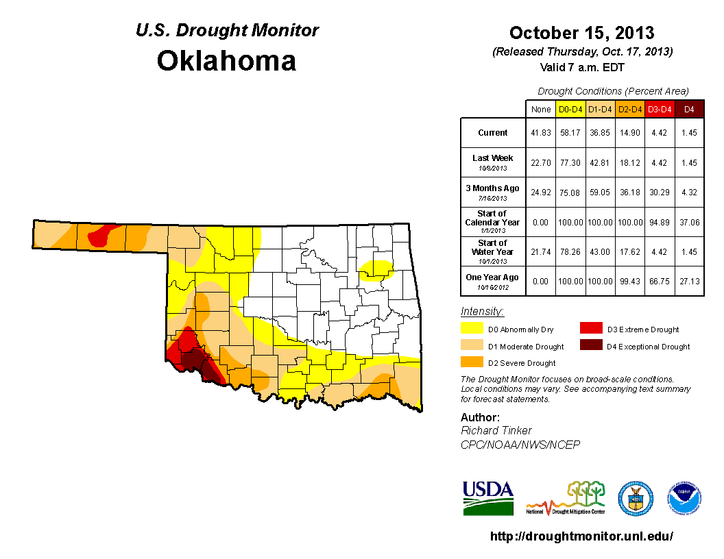
Check it out ... this is the Mesonet rainfall map we had to work with for this
week's Drought Monitor:
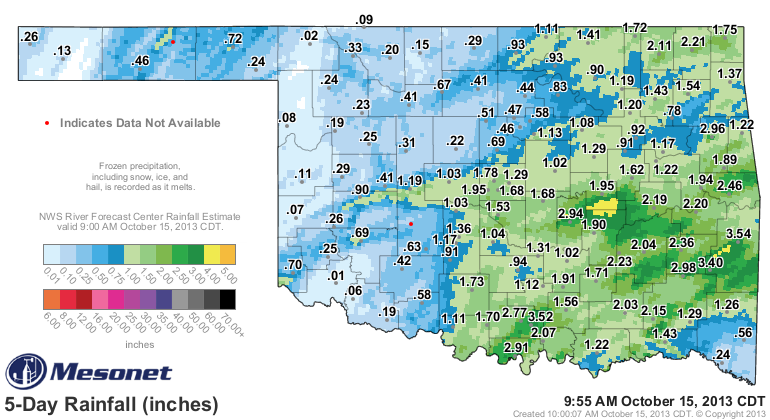
And this is what we ended up with.
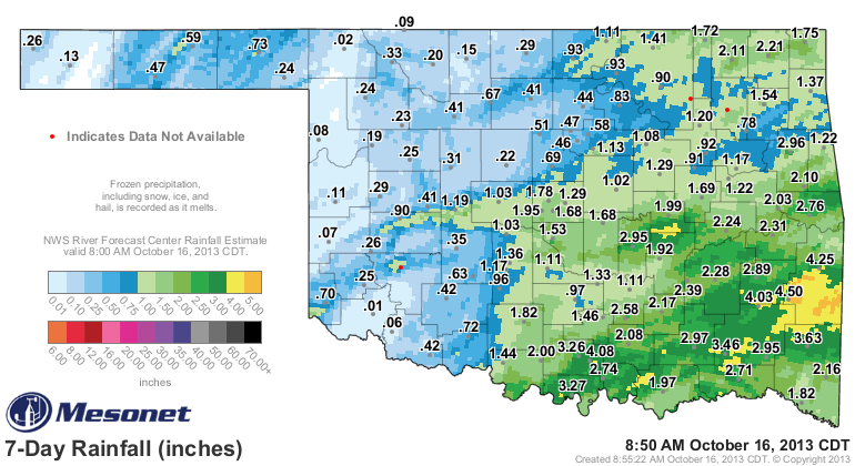
Long story unable to be told shorter since I'm a blowhard, we should see even
more relief next week down in the southeast due to rains that fell after the
Tuesday morning deadline.
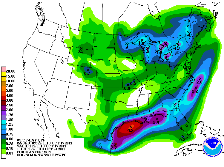
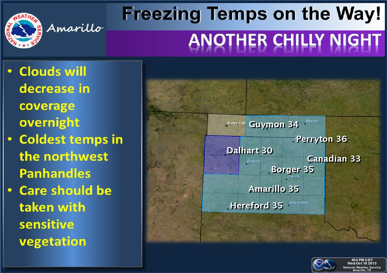
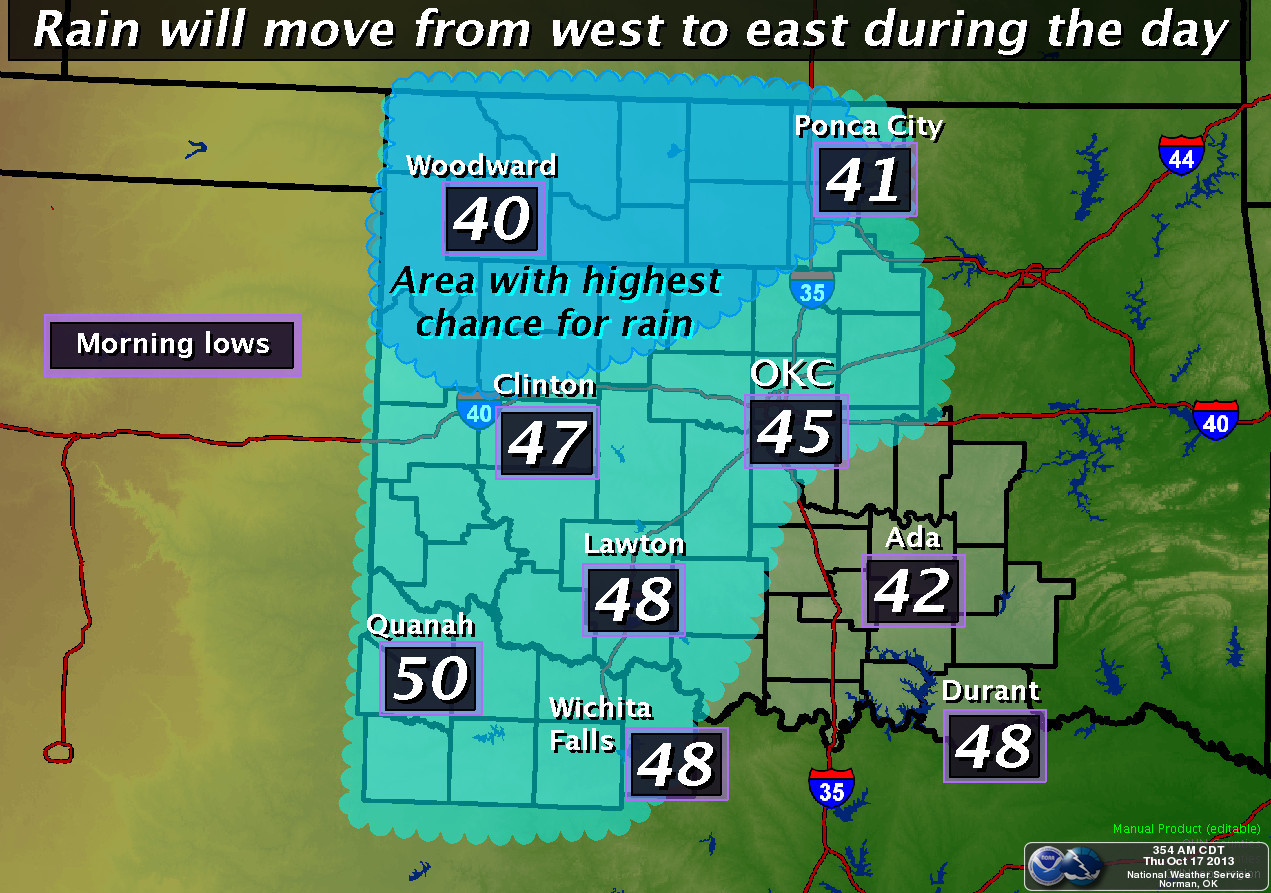
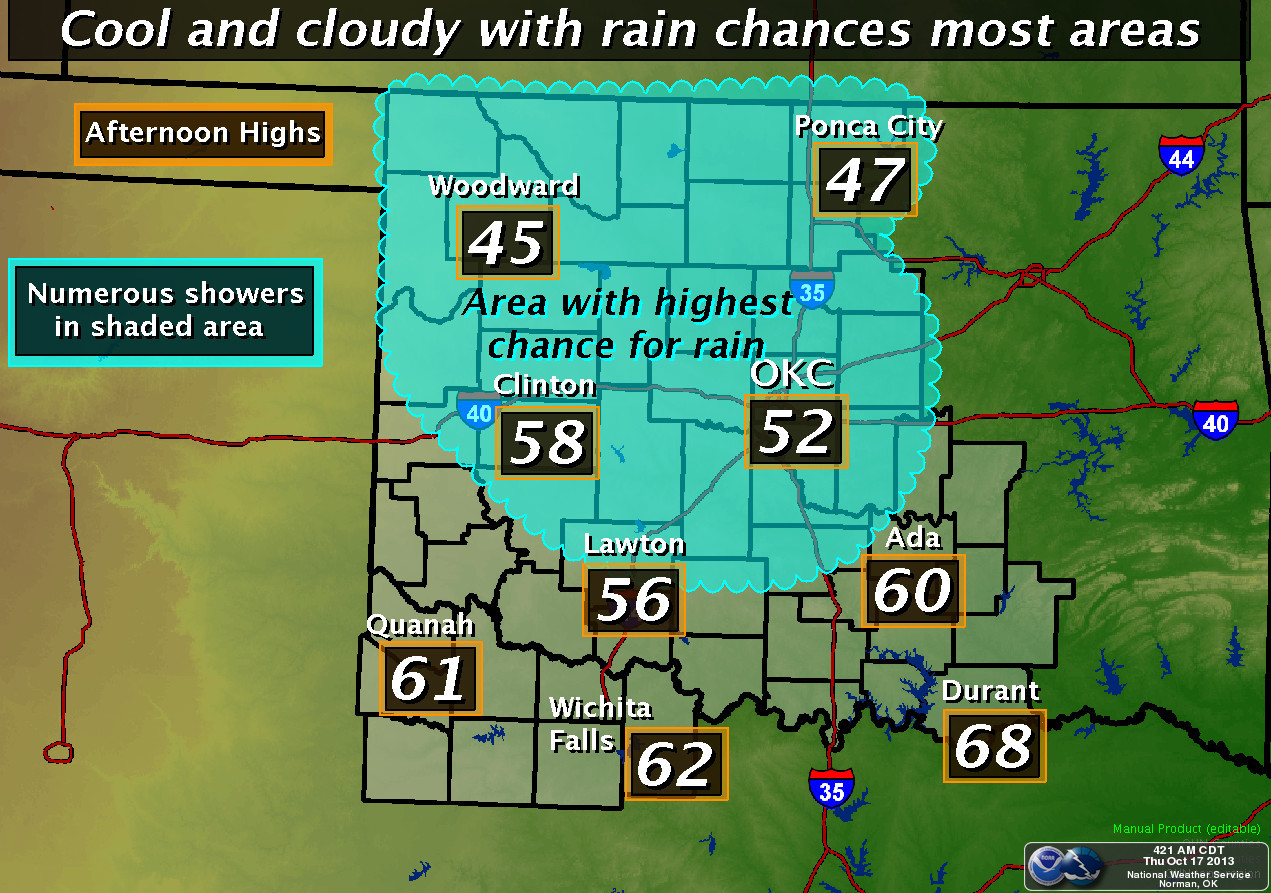
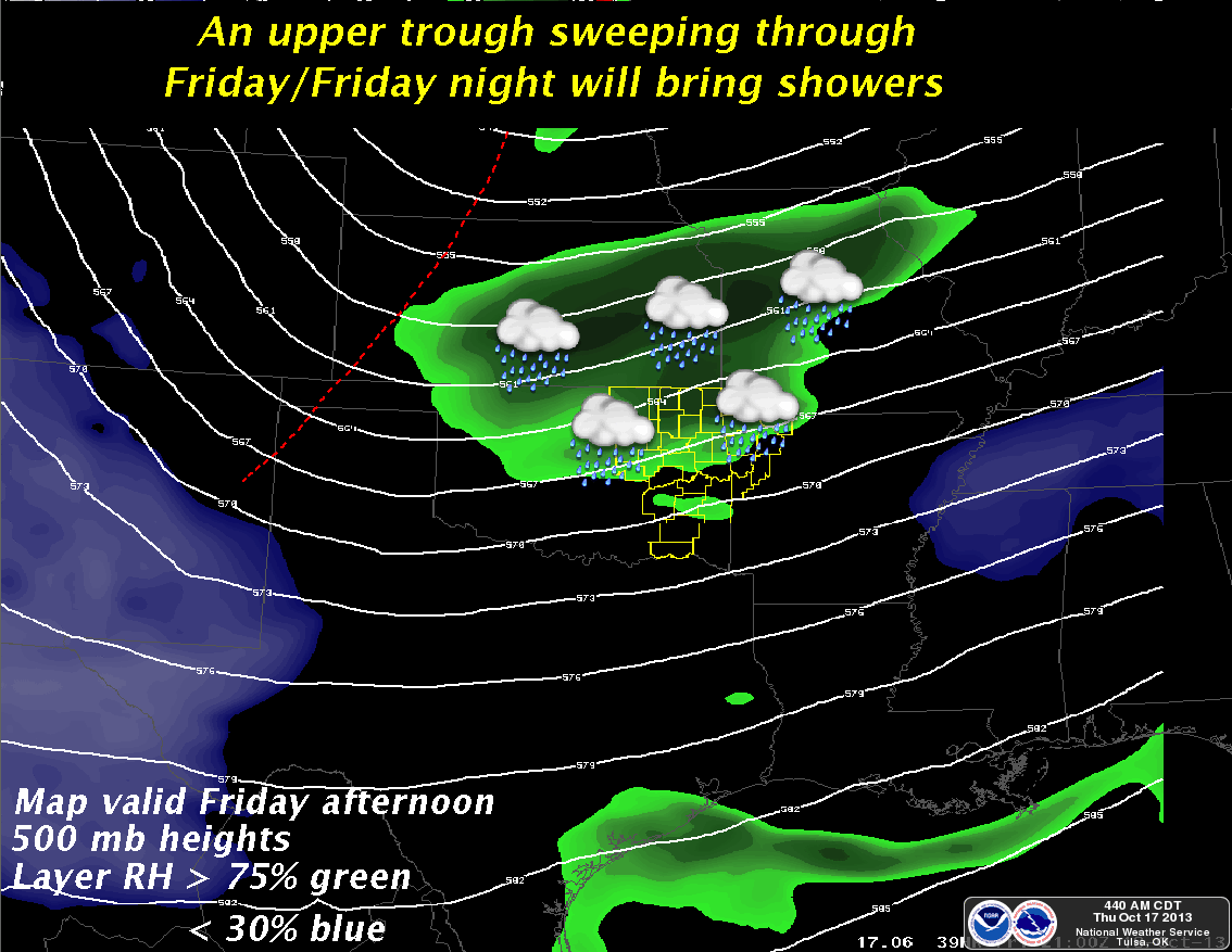
Now we await another smaller-but-wet system tomorrow that might help the
northwest out. But watch out, that area of the state is liable to finally see
their first freeze. Here's the 7-day rainfall forecast along with the latest
views from our local NWS offices. It ain't a lot of rain, but it IS rain.
Let's take a longer view. Here's what the CPC has thrown out there for the
November-January time frame. These are probability maps, as I've screamed at
you many times, and merely indicate increased odds of above or below normal
temps and precip (and in the case of the dreaded Equal Chances-EC, no forecast
at all).
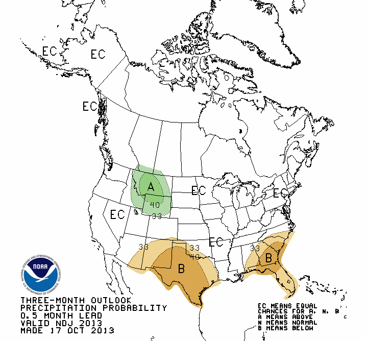
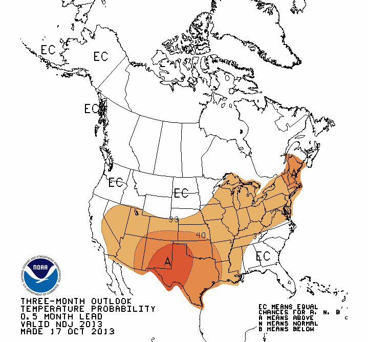
Rats! Odds of above normal temps for the entire state, and increased chances
of dry weather across the southwestern half or so. Slightly increased odds, but
increased nonetheless. That's the bad news. The good news is these outlooks are
not quite as skillful during the winter without the presence of El Nino or La
Nina, and the equatorial pacific is currently pointing towards neutral conditions.
Now, with that pessimistic outlook combined with the fact we're headed into
our driest part of the year, that gives us a U.S. Seasonal Drought Outlook that
sees that drought persisting across parts of southern and western Oklahoma.
More good news! It might be the driest time of the year, but it's also the
coolest part of the year (Winter...hello??), so we will see the least amount
of water stress. Therefore, no development of drought is expected either. If
we get close to normal precip in the least, that will build off of what was
replenished this summer.
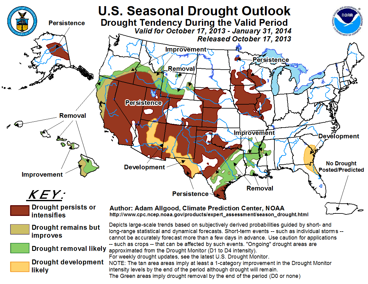
So there you have it ... I'm fairly certain all will work out the way it's
supposed to and we will so no drought development or relief through January.
It's "supposed to" happen that way, right?
Gary McManus
Associate State Climatologist
Oklahoma Climatological Survey
(405) 325-2253
gmcmanus@mesonet.org
October 17 in Mesonet History
| Record | Value | Station | Year |
|---|---|---|---|
| Maximum Temperature | 102°F | BUFF | 2016 |
| Minimum Temperature | 26°F | WIST | 2024 |
| Maximum Rainfall | 3.88″ | NEWK | 2007 |
Mesonet records begin in 1994.
Search by Date
If you're a bit off, don't worry, because just like horseshoes, “almost” counts on the Ticker website!