Ticker for October 15, 2013
MESONET TICKER ... MESONET TICKER ... MESONET TICKER ... MESONET TICKER ...
October 15, 2013 October 15, 2013 October 15, 2013 October 15, 2013
Really, Altus??
A hundredth of an inch? You are in a drought emergency and you throw up the
rain-shield for the entire event and only get a hundredth of an inch? That's
unforgivable! I also see Buffalo managed to snag a relatively whopping total of
two hundredths.
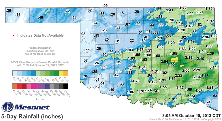
You two slackers need to get with the program! Oh, Buffalo, I could never stay
mad at you (looking sternly at Altus). All kidding aside, this is horrible news
for Altus and those other parts of western Oklahoma that recorded the more meager
totals of a quarter inch or less. Somewhat expected, I guess, but it definitely
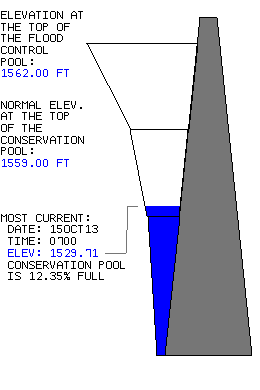
looked a bit more promising last week. So what else is new? Some water did fall
to the north of Altus in the Altus-Lugert watershed, but I'm afraid it did little
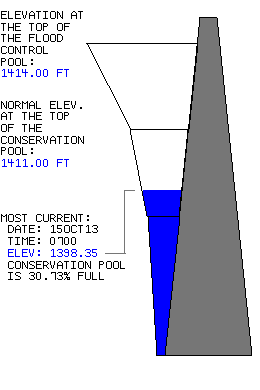
good and Altus still sits at 12% (or so) of normal. Tom Steed hangs in there at
a dismal 31%.
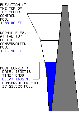
Canton got no help with less than a half of an inch in their watershed all
the way up through Ft. Supply Lake, so they're still looking rather pitiful
as well at around 21%.
Now areas to the east received the best totals (shocker!), and that's very
inconsiderate of them considering they need it the least. Well, that's not fair.
Everybody needs rain, right? But it would sure be nice to get some of those 2-4
inch rainfall amounts about 200 miles west, like the area around Bowlegs. They
came in with 2.94 inches. ANNNNNDDDDD, it's still raining down that way to the
southeast.
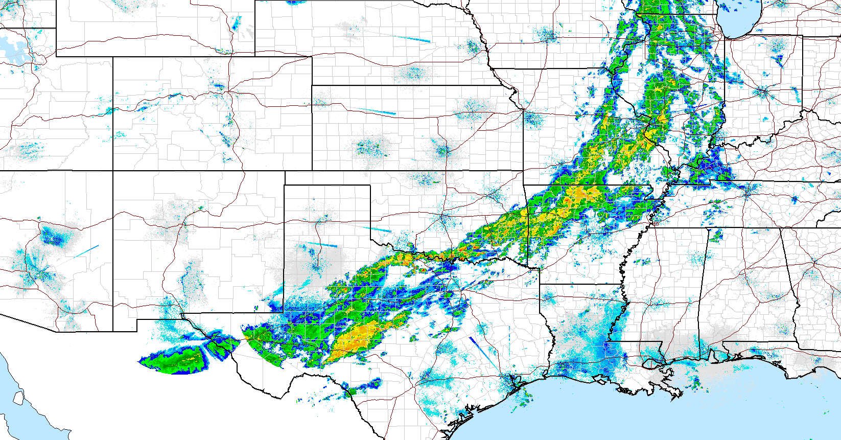
In the longer term, places like Buffalo and Altus are looking extremely dry.
Buffalo has only had 1.3 inches of rain in the last 60 days. Things look a
bit better for Buffalo out to 90 days with 8.7 inches, but the Altus area still
looks pretty bad with 2.5-4.0 inches. And that's why those areas up in the
northwest are still in severe-extreme drought, and down in the southwest the
ante remains from extreme-exceptional.
Unfortunately, that looks like its it for the most part for western Oklahoma
from this current system.
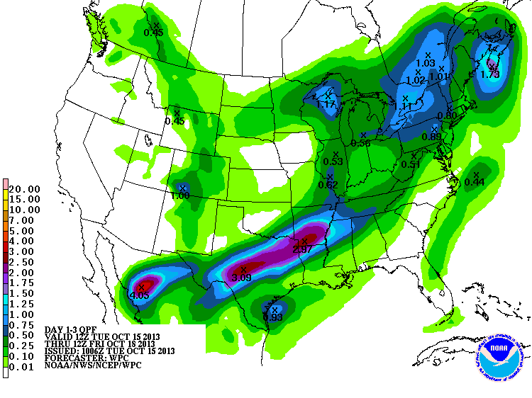
Maybe some better chances a few more days away (fingers and eyes crossed!), but
nothing that looks like a drought-buster.
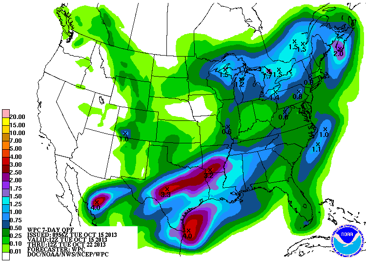
About all we can do now as the rain slowly clears the state is enjoy (if you're
one of THOSE types) this blustery, fall day.
Oh bother.
Gary McManus
Associate State Climatologist
Oklahoma Climatological Survey
(405) 325-2253
gmcmanus@mesonet.org
October 15 in Mesonet History
| Record | Value | Station | Year |
|---|---|---|---|
| Maximum Temperature | 97°F | TIPT | 2015 |
| Minimum Temperature | 26°F | EVAX | 2018 |
| Maximum Rainfall | 5.41 inches | WALT | 2006 |
Mesonet records begin in 1994.
Search by Date
If you're a bit off, don't worry, because just like horseshoes, “almost” counts on the Ticker website!