Ticker for October 3, 2013
MESONET TICKER ... MESONET TICKER ... MESONET TICKER ... MESONET TICKER ...
October 3, 2013 October 3, 2013 October 3, 2013 October 3, 2013
Negotiatoins with Mother Nature continue
WHAT DO WANT? RAIN!
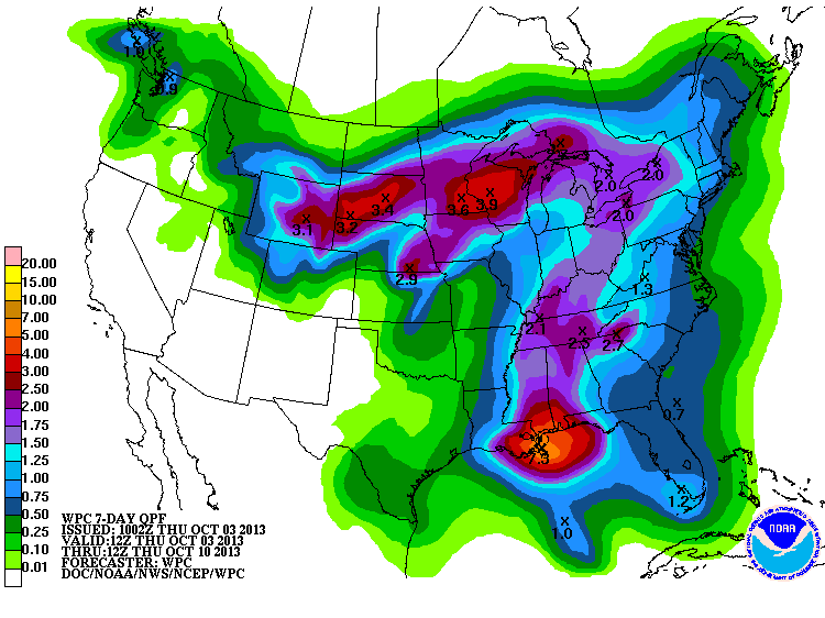
WHEN DO WANT IT? NOT THIS WEEKEND! Uh oh, that's going to be a sticking point.
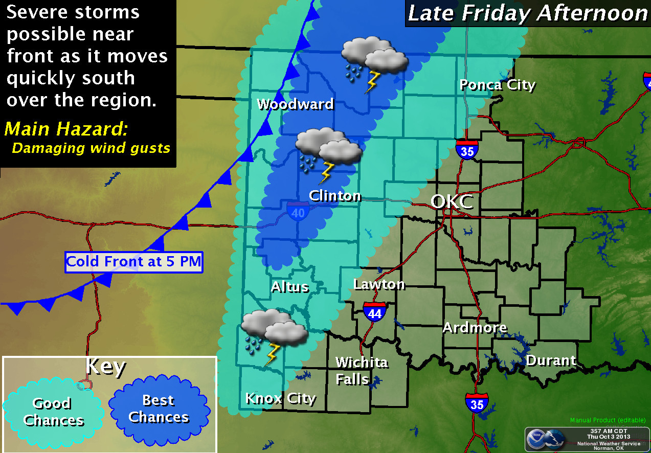
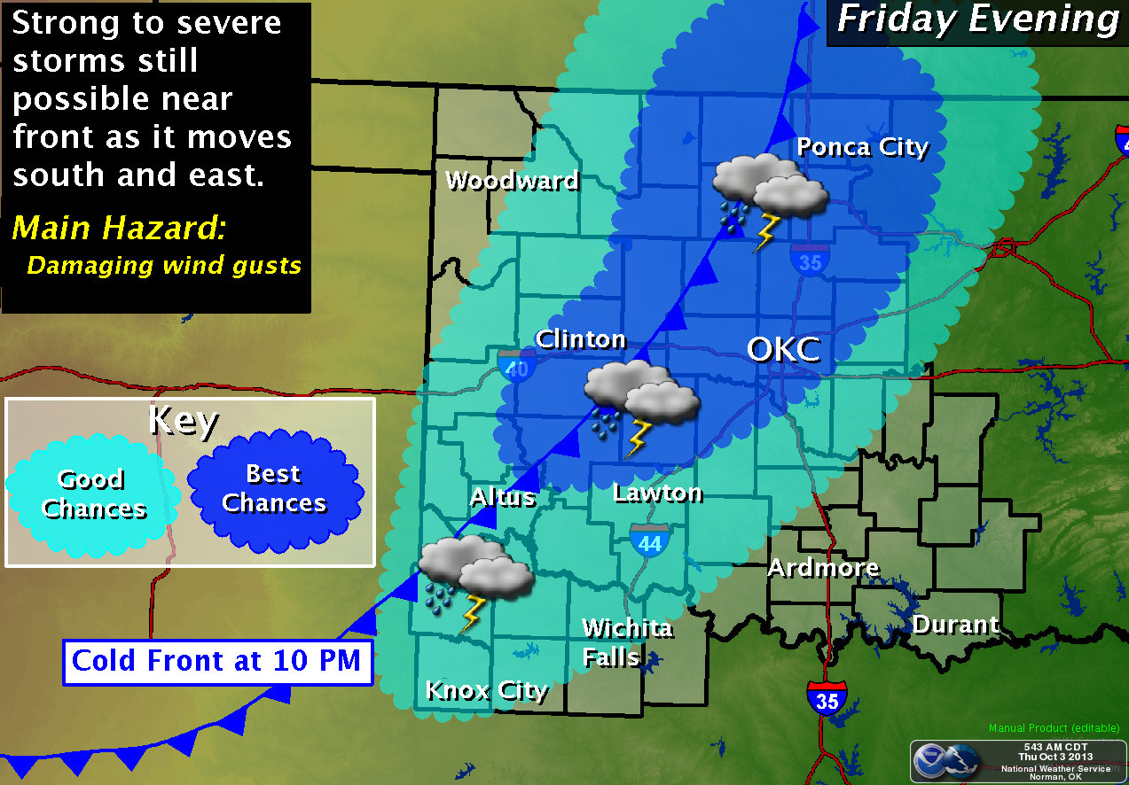
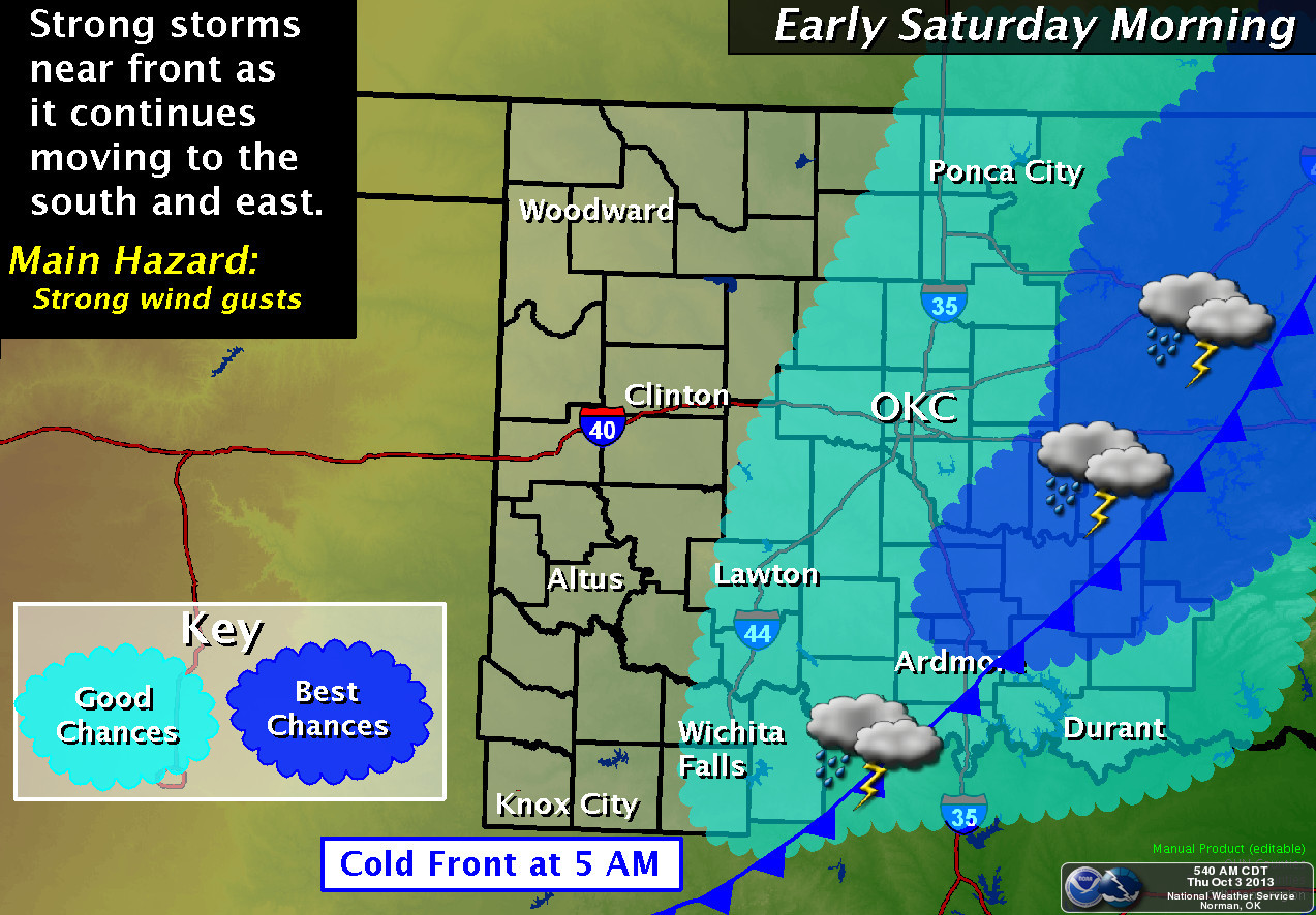
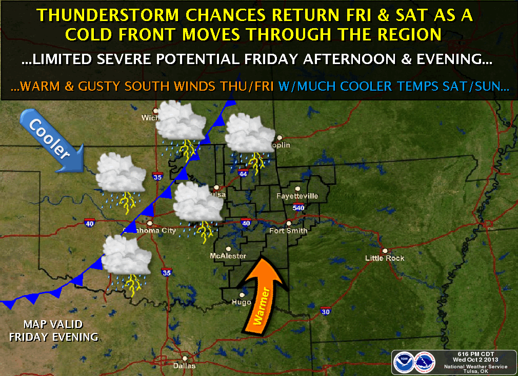
WHAT DO WE NOT WANT? TORNADOES!
That one I think Mother Nature will give in on as the severe potential looks
confined largely to hail and strong winds (again, though, severe storms in
Oklahoma are very uncooperative). At least from what I have seen from our fine
working-for-free friends at the local NWS offices and the Storm Prediction
Center, the tornado threat is quite low. However, those folks going to any
Friday night activities, such as high school football games or cat herding
contests should be alert for the approach of severe weather to those areas, as
well as the potential to get drenched. You ever see a herd of wet cats? It
ain't a pretty sight.
The atmosphere is primed with moisture, as can be seen on the current Mesonet
dewpoint maps.
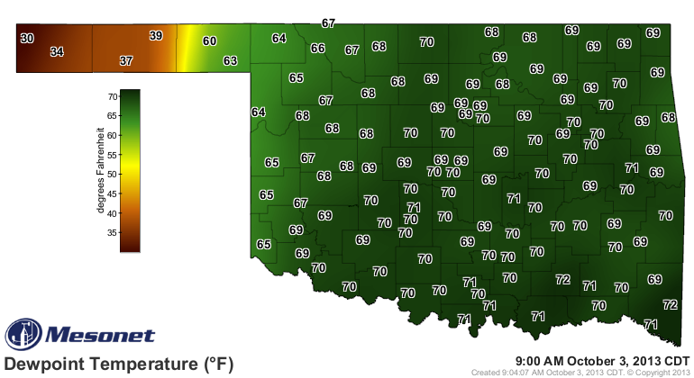
This is what women refer to as "bad hair" conditions. I know the three I have
on top of my head just won't stay down. But you can see the presence of the
dry air out west across the Panhandle in the form of a dryline. As the main
storm system and front move across, that will drag that dryline through as
well. That might be the trigger point for some storms.
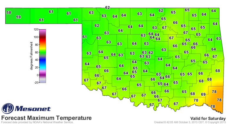
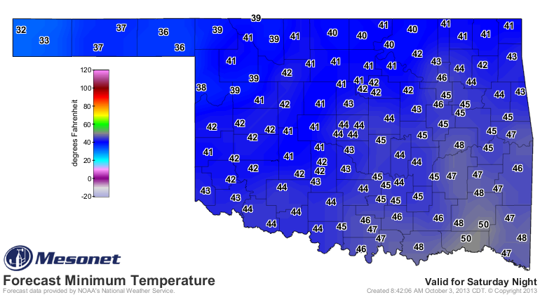
After that, get ready for a windy, cool weekend. Look for highs in the 60s on
Saturday after the front moves through with temperatures dropping into the
40s and 50s as the sun goes down. And then it appears we will have a good chance
at our first freezing weather of the year out in the western Panhandle.
After that, expect temperatures to quickly jump back into the 70s and 80s next
week, and then another storm system looks possible for late next week. That
starts to show up on the CPC 8-14 day outlooks (October 10-16). Remember, these
maps show the odds of above- or below- or near-normal conditions, not actual
anomaly amounts.
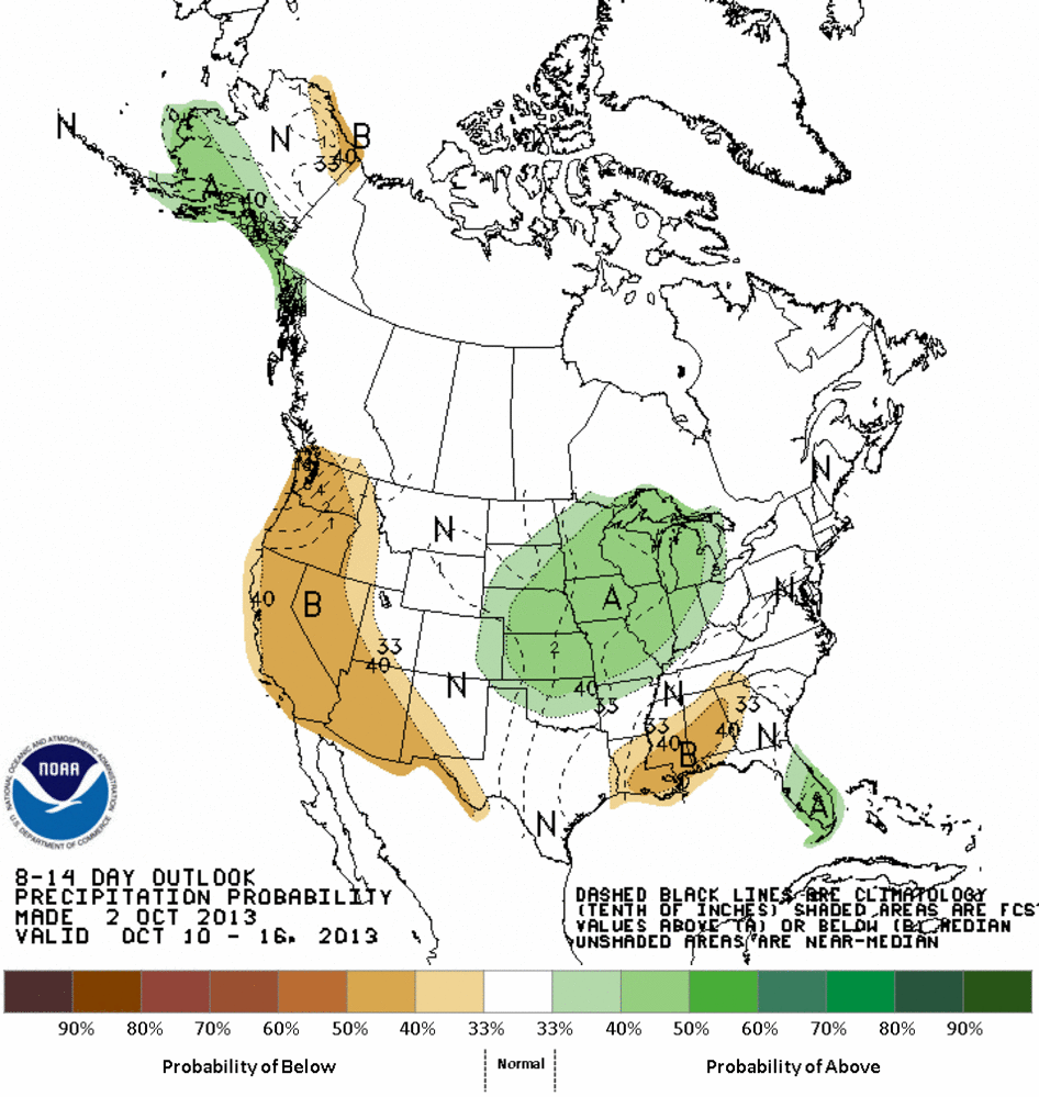
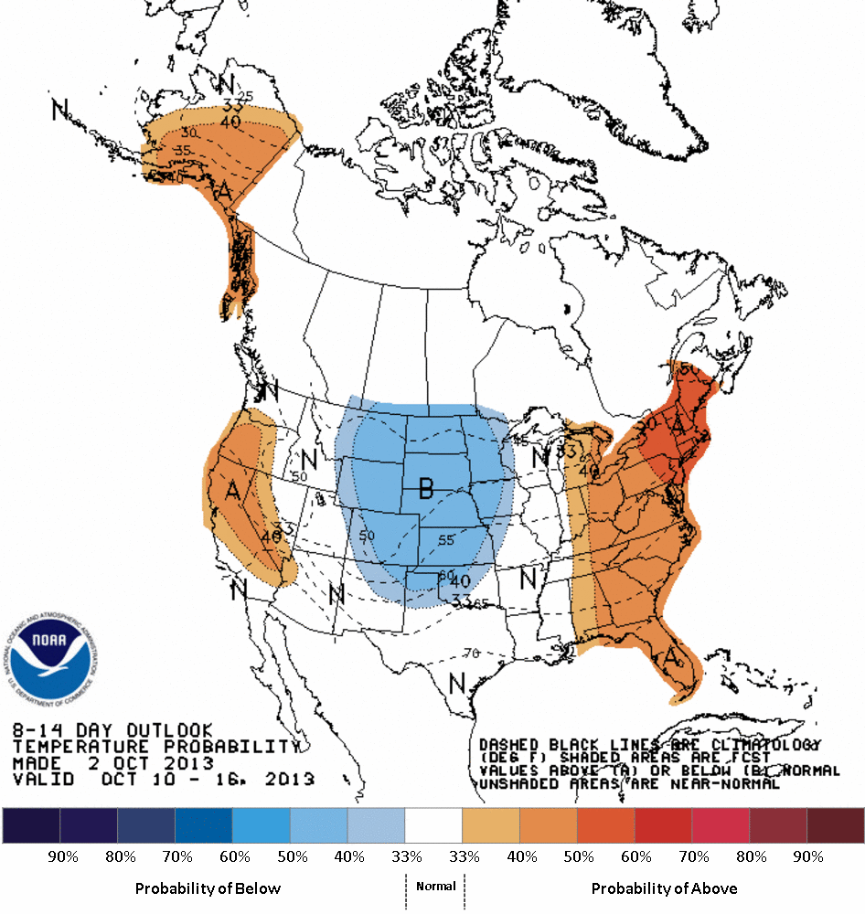
Now the severe weather is never welcome, but it does give us a chance to get
some more beneficial moisture in here, and keep up the momentum of drought
relief seen on this week's map. By the way, the U.S. Drought Monitor is now
under a different look, so we will have to get used to some changes here. The
statistics comparison is now on a separate graphic.
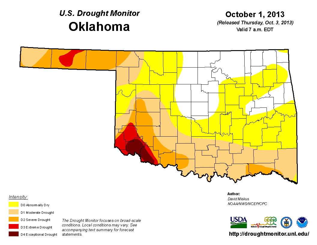

So the rains of last week did improve conditions across some broad areas. We
went from 92% of the state in at least abnormally dry (D0-D4) conditions to
only 78% this week. Most of that loss was in the abnormally dry category, and
actual drought coverage only decreased from 49% to 43%. But we'll take it. Still,
that's about where we were three months ago when 42% of the state was in drought
(but at least only 62% of the state was in at least abnormally dry conditions.
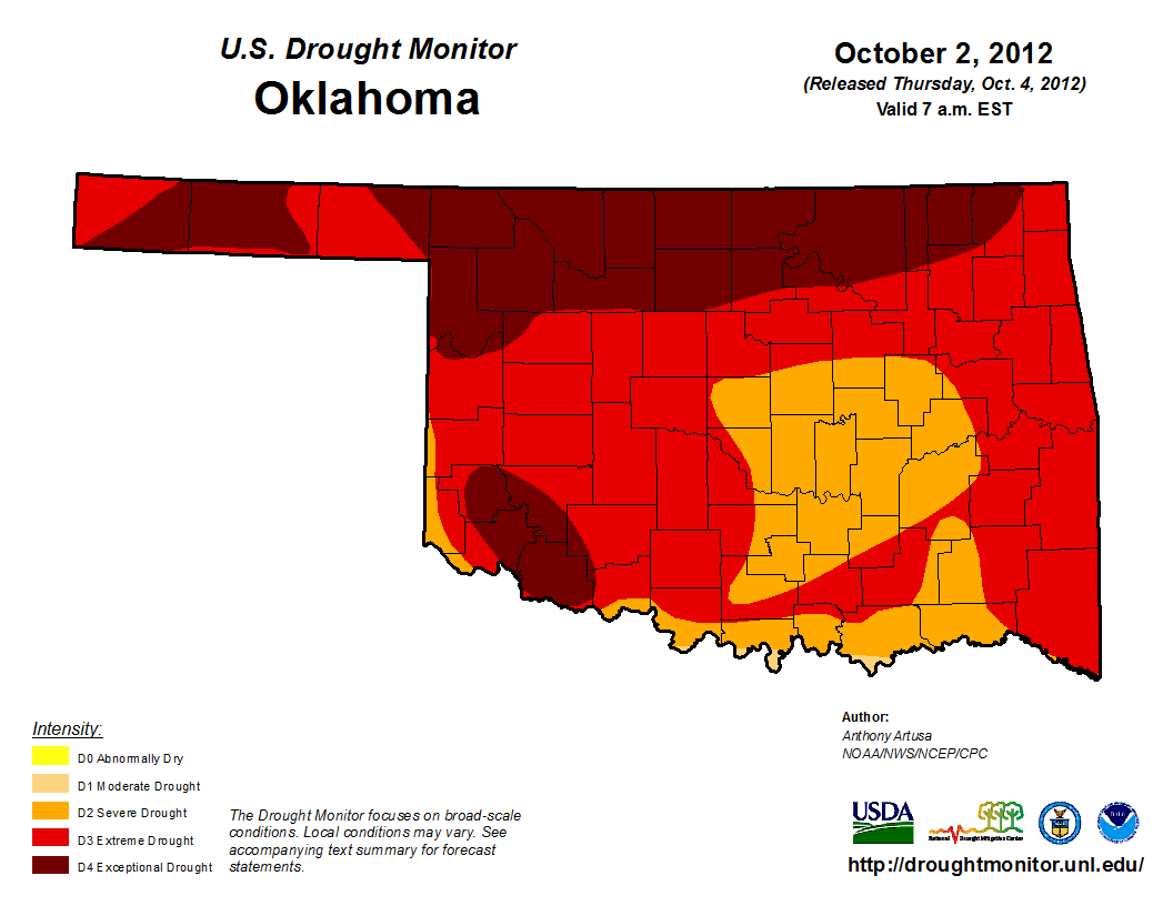
A year ago, we were in the midst of our warmest year on record, and also our
driest May-December on record, so a vastly different experience for much of the
state (we see you, Altus and Goodwell!).
Okay, back to discussions with Mother Nature. She's still not over that "Parkay
vs. Margarine" joke I made earlier this year. But at least we're talking.
Gary McManus
Associate State Climatologist
Oklahoma Climatological Survey
(405) 325-2253
gmcmanus@mesonet.org
October 3 in Mesonet History
| Record | Value | Station | Year |
|---|---|---|---|
| Maximum Temperature | 106°F | HOLL | 2000 |
| Minimum Temperature | 31°F | OILT | 2010 |
| Maximum Rainfall | 4.11″ | WOOD | 2019 |
Mesonet records begin in 1994.
Search by Date
If you're a bit off, don't worry, because just like horseshoes, “almost” counts on the Ticker website!