Ticker for October 2, 2013
MESONET TICKER ... MESONET TICKER ... MESONET TICKER ... MESONET TICKER ...
October 2, 2013 October 2, 2013 October 2, 2013 October 2, 2013
Springtober?
Having just gone through a very warm Sumtember, the gray skies and warm minimum
temps have a distinct taste of spring, no? Actually, we get these days in the
fall every year as we oscillate back and forth from the end of summer and the
beginning of fall. But the weather we've seen the last couple of days is more
synonymous with spring (plus, Octfall, Falltober, etc. just don't make sense).
Lows this morning reflect the return of moisture from the Gulf of Mexico, as does
the layer of low clouds covering much of the state.
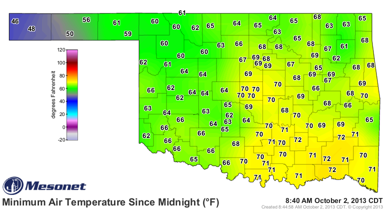
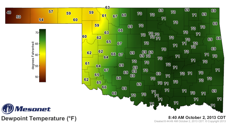
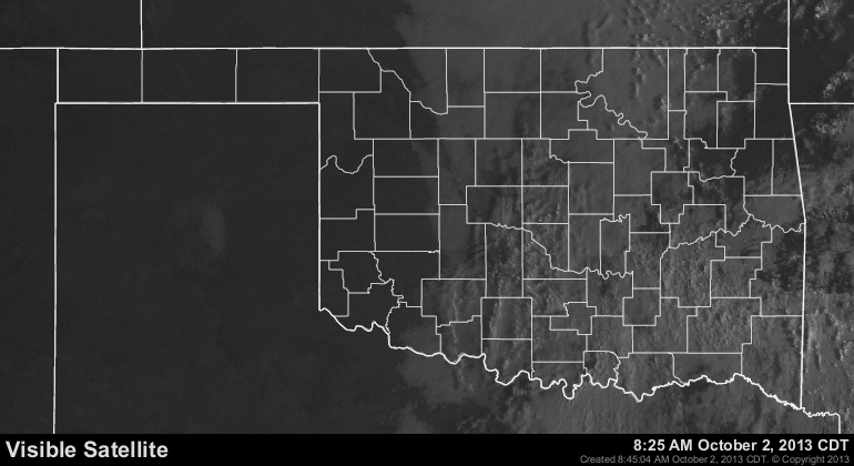
Those lows across the eastern half of the state in the upper 60s and low 70s are
from 10-15 degrees above normal, just like yesterday's high temperatures.
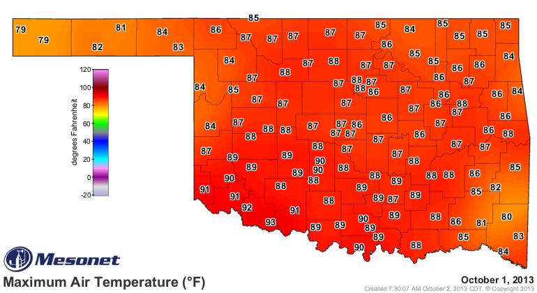
When you have this much moisture in the air in Oklahoma, and this much daytime
heating, eventually, something is going to happen. Friday we'll see a strong
cold front associated with an upper storm system move across the state which
should kick off a round of severe weather. Here's how our local NWS offices
(working for free at the moment, by the way) see the scenario shaping up.
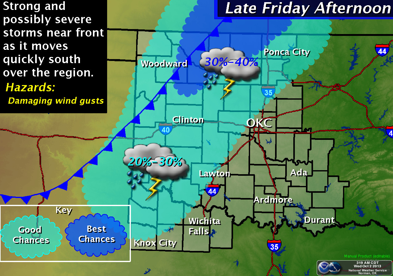
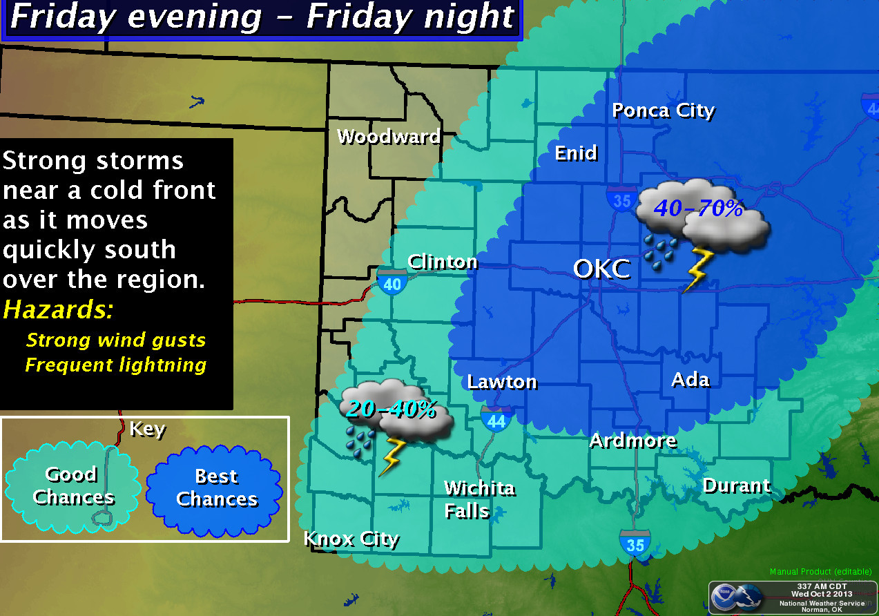
Tulsa focuses on chances of storms across their area this afternoon.
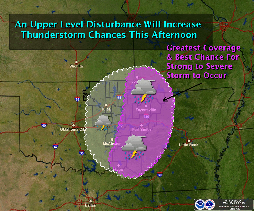
No mention of a tornado threat in those graphics, although I've heard the TV
folks mention it. It's best to remember that anytime there is severe weather
in Oklahoma, there could be a spin-up or two (or 60) to go along with it.
Speaking of tornadoes, the latest count for the year I have seen is up to 77,
although I think that total might be at least up to 78 with another tornado
added by the Tulsa NWS office on July 24 three miles west of Wagoner, rated
at EF-1 intensity. Sixty-one of those tornadoes occurred during May. The average
annual total for the year since 1950 is 55.
Let's hope we don't add to that total this weekend, but we do need the rain
once again. This one looks to be a bit lesser than last week's drenching some
of the state received, and eastern Oklahoma looks to be the big winner this
time.
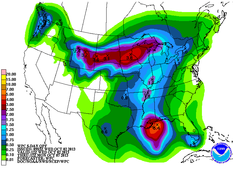
In the meantime, enjoy Springtober (nearly Sumtober) temperatures until the
big cooldown this weekend.
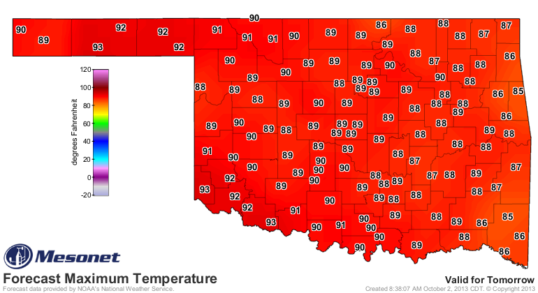
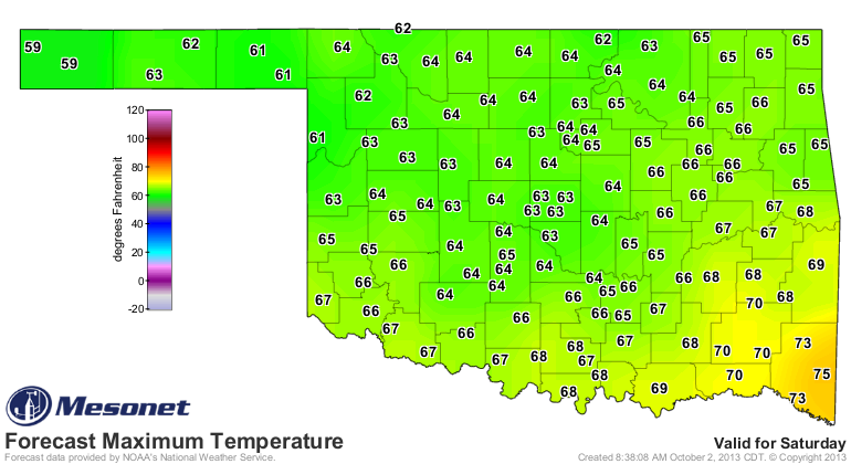
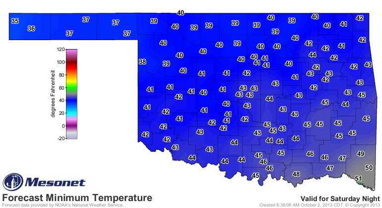
Who knows, maybe after that we'll have ... October?
Gary McManus
Associate State Climatologist
Oklahoma Climatological Survey
(405) 325-2253
gmcmanus@mesonet.org
October 2 in Mesonet History
| Record | Value | Station | Year |
|---|---|---|---|
| Maximum Temperature | 103°F | TIPT | 2000 |
| Minimum Temperature | 28°F | BOIS | 2009 |
| Maximum Rainfall | 4.76″ | CHER | 2002 |
Mesonet records begin in 1994.
Search by Date
If you're a bit off, don't worry, because just like horseshoes, “almost” counts on the Ticker website!