Ticker for September 17, 2013
MESONET TICKER ... MESONET TICKER ... MESONET TICKER ... MESONET TICKER ...
September 17, 2013 September 17, 2013 September 17, 2013 September 17, 2013
Long time no Tick
Sorry, drought talks have kept me off the circuit for a bit. Plus, I've been
working on my music, thinking about getting the band back together. That last
part is a figment of my imagination, much like my hair, but it sounds good. A lot
has happened since last Thursday. Mainly ... rain. Check out the totals in the
western Oklahoma Panhandle over the last seven days, especially.
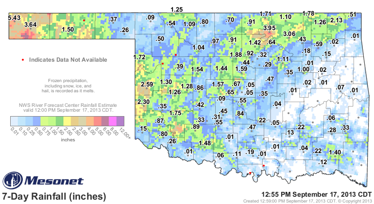
5.43 inches at Kenton? Are you kidding me? And the radar estimates are even
greater in places. They have to be as happy as pigs in slop out that way (or
alternatively, people who got lots of rain where it has been really dry ... throw
that one in for the literalists). We also see some very nice 2-4 inch totals
up around Osage County, an d 2-3 inch amounts across the west central region.
Even Jackson and Kiowa counties got into the act with some isolated 2-3 inch
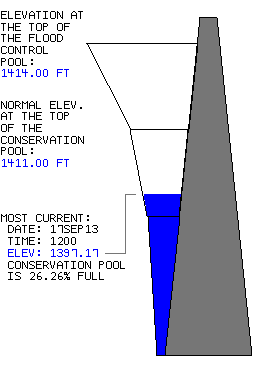
amounts. Lake Tom Steed went from 25% of capacity to a whopping 26% of capacity.
Break out the yachts!
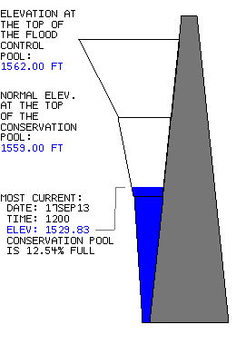
Lake Altus-Lugert is still putting along at 12.5 percent of capacity.
And we won't even mention Canton, since those nerves are still a bit raw (okay,
Canton is at 22% of capacity ... I'll rub some dirt on that one later and walk
it off).
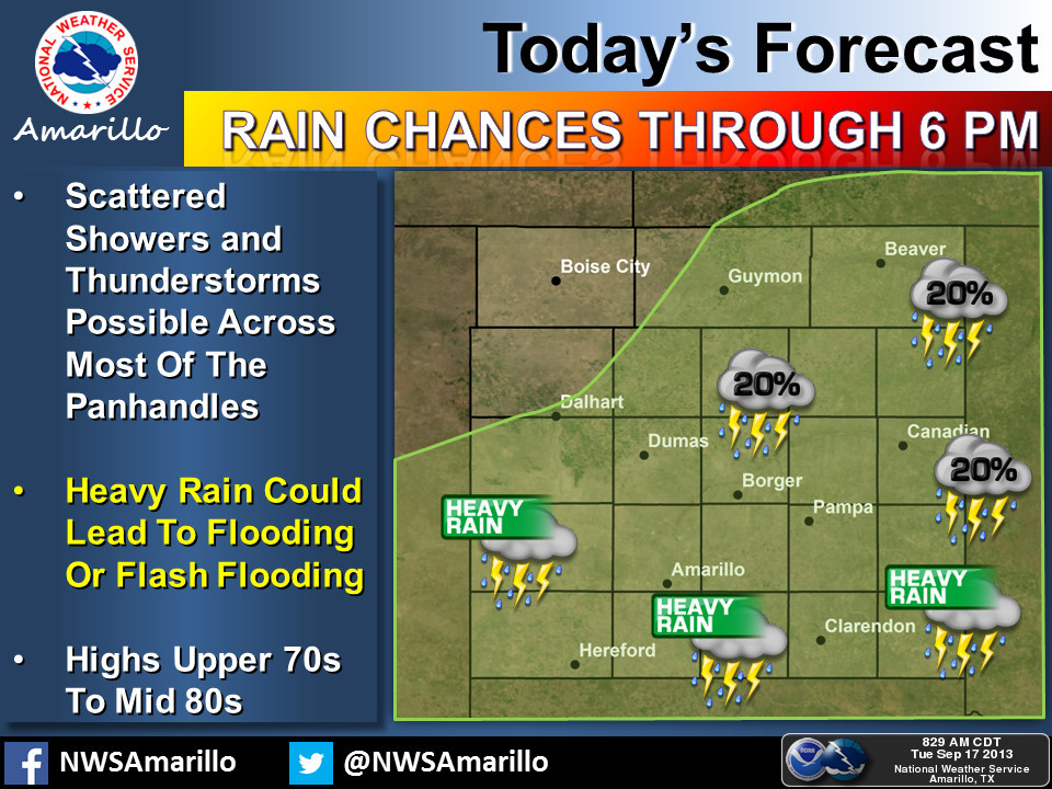
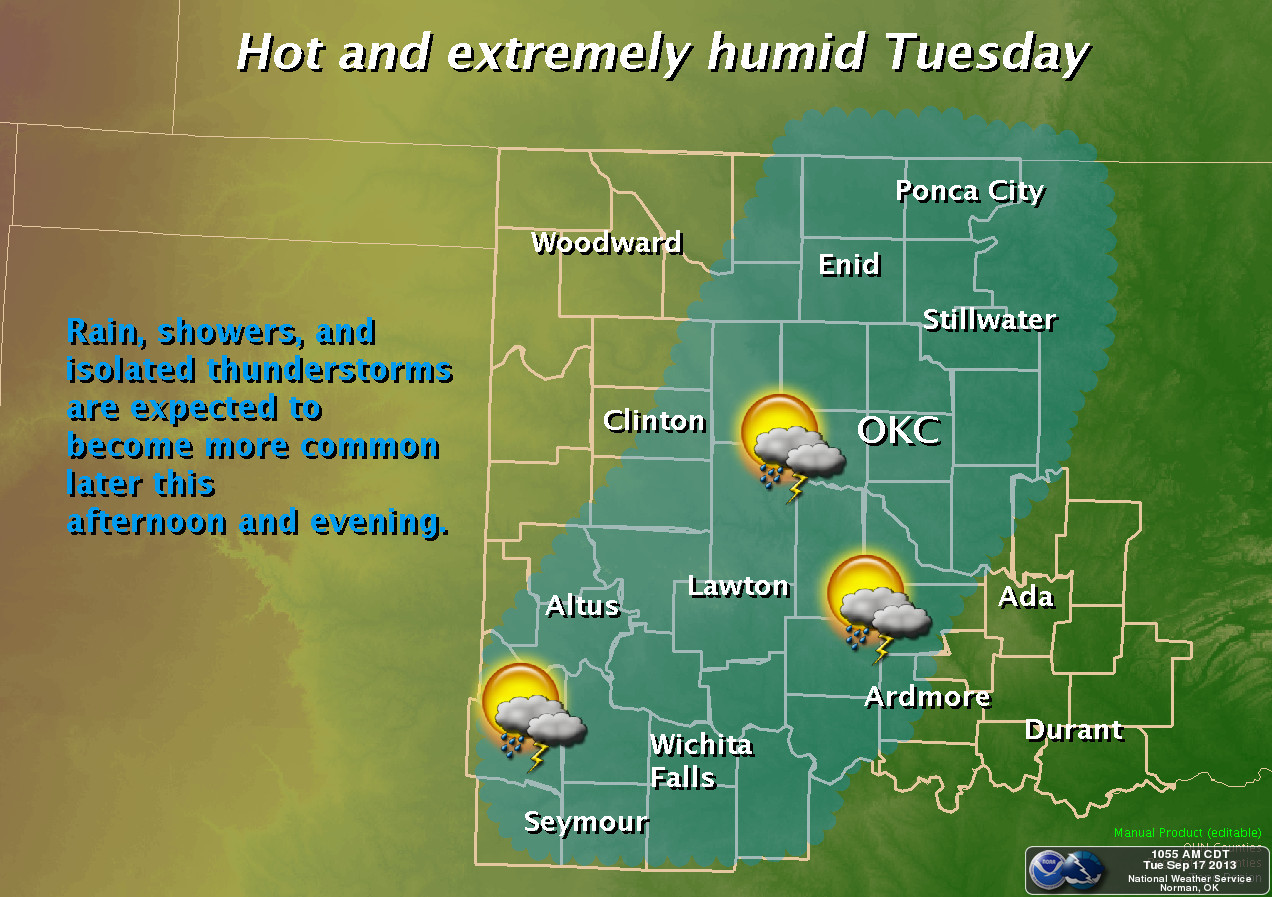
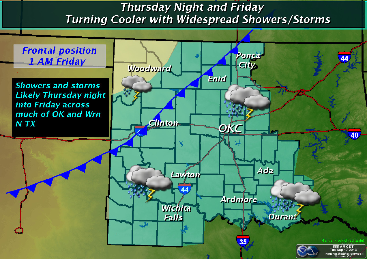
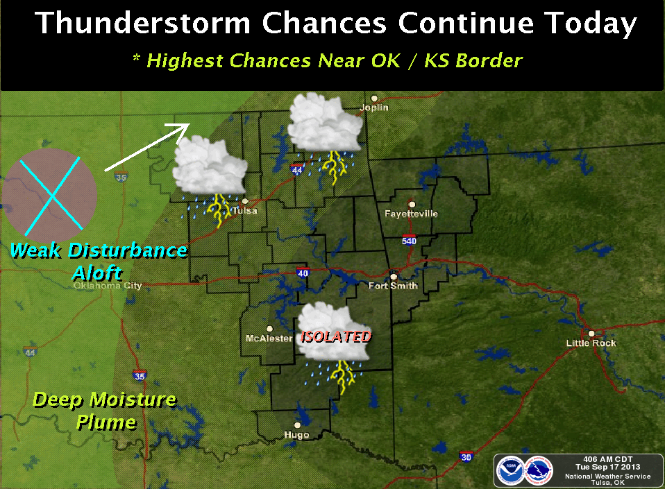
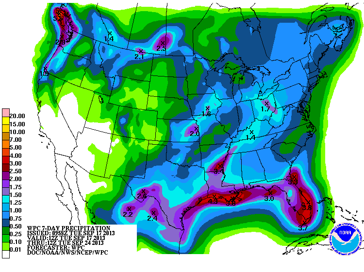
And the best part is there appears to be more rain on the way. Check out the
graphicasts from the local NWS offices for more info, and the 7-day rainfall
forecast totals.
Obviously we're going to see some changes on this week's Drought Monitor map
due to the rains we have seen through 7am this morning, but some of the other
parts of the state haven't been so lucky. And viewed through the prism of our
magical August 18th cutoff date, the state still looks fairly dry.
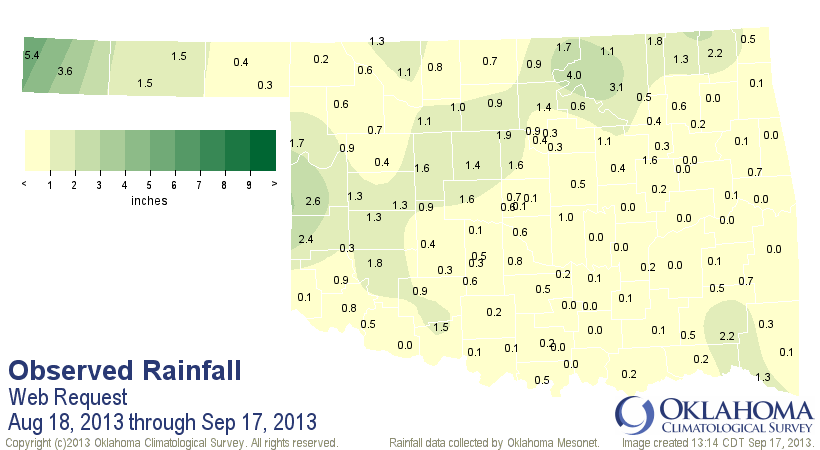
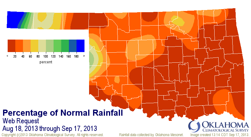
That's a statewide average of 0.83", 2.56" below normal...still the 2nd driest
such period since 1921. So we need that 7-day rainfall forecast to come through.
So there's a bit of hope, and maybe even more next week. We're talking rain,
not my musical career.
Gary McManus
Associate State Climatologist
Oklahoma Climatological Survey
(405) 325-2253
gmcmanus@mesonet.org
September 17 in Mesonet History
| Record | Value | Station | Year |
|---|---|---|---|
| Maximum Temperature | 105°F | GRAN | 1997 |
| Minimum Temperature | 37°F | BOIS | 2006 |
| Maximum Rainfall | 4.15″ | APAC | 2006 |
Mesonet records begin in 1994.
Search by Date
If you're a bit off, don't worry, because just like horseshoes, “almost” counts on the Ticker website!