Ticker for September 12, 2013
MESONET TICKER ... MESONET TICKER ... MESONET TICKER ... MESONET TICKER ...
September 12, 2013 September 12, 2013 September 12, 2013 September 12, 2013
Oklahoma's gone yeller
Normally those would be fighting words, but in this case, we're talking D0
(Abnormally Dry) on the latest U.S. Drought Monitor map.
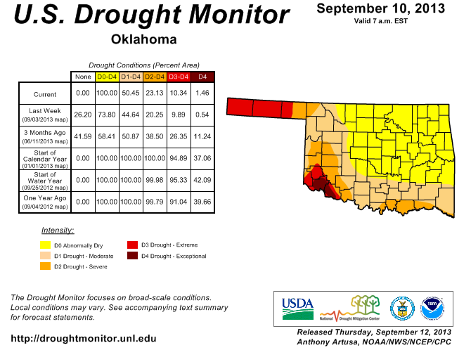
So Oklahoma has gone from 73.8% of the state under D0-D4 designation to 100% in
one week. So this is the epitome of a flash drought situation. Even though D0
is not an indication of drought, it's the precursor to drought and with the
heat and cutoff of all precipitation ... well, the direction the state has been
heading is obvious. The amount of the state in actual drought only rose from
44.6% to 50.5%, so not to drastic there. We did see that D4 Exceptional drought
expand farther into Jackson County, where horrible conditions still exist,
including a water supply emergency with Lake Altus down to 12% of capacity and
Lake Tom Steed at 24%.
The reasons again are obvious, but here are the rainfall statistics since the
state's last good rainfall on August 17. Strike that! There were really good rains
in the Panhandle over the last 24 hours, so I'll show the 24-hour rainfall map
first.
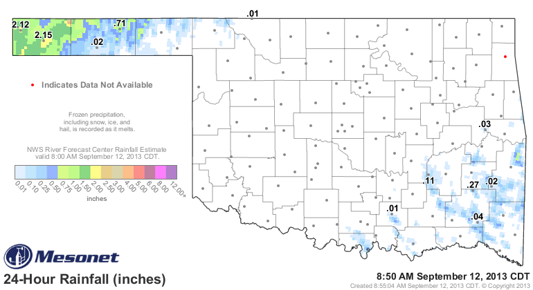
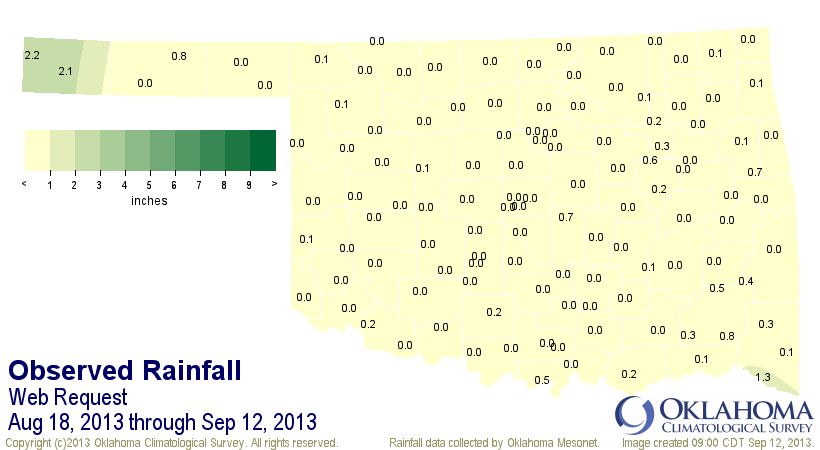
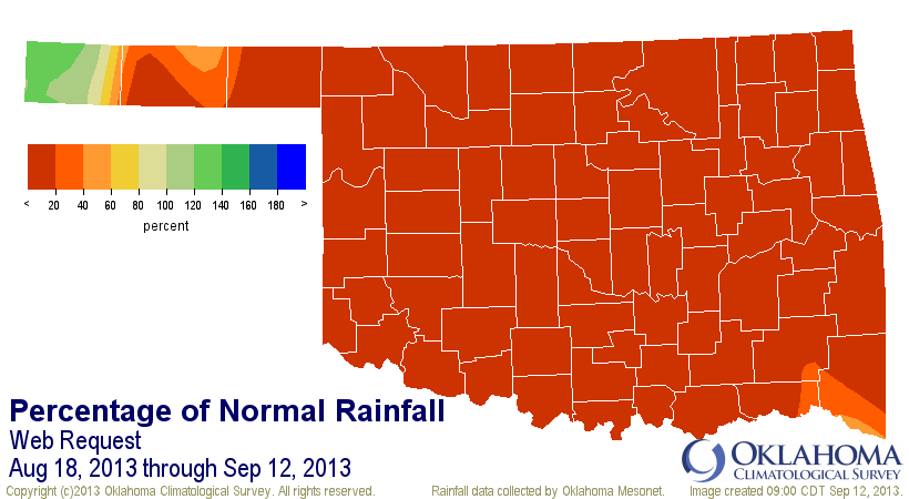
The western Panhandle adds a nice green touch to those maps, at least, although
the statewide average is still a paltry 0.15", 2.61" below normal. It did raise
the total to the 2nd wettest such period since 1921, however, so that's a win.
In the "it could be worse" department, we can see the difference in the state's
vegetation at this point in the season from the past three years (2011, 2012
and 2013). These are images from the Mesonet's OK-Fire program depicting the
relative greenness of our state's vegetation from space. Basically, if you see
green, it's nice vegetation. If you see the reds and oranges, it's not so good.
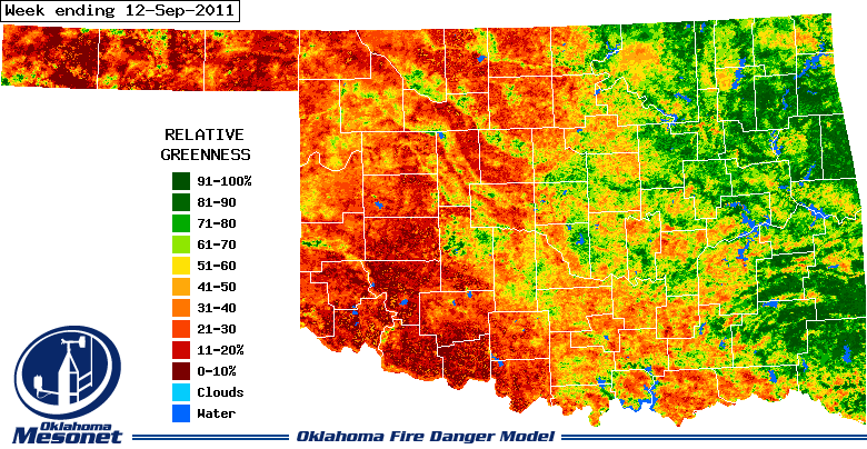
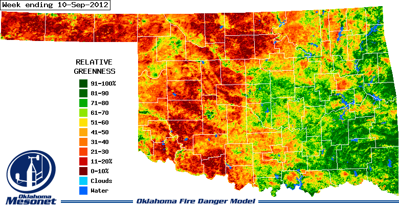
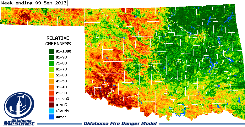
A few things to notice ... western Oklahoma looks horrible in September 2011 and
2012, but there are at least some splashes of green here and there this year.
And for this year, the northeastern quarter or so of the state looks fairly
green. In all three images, however, southwestern Oklahoma looks pretty nasty.
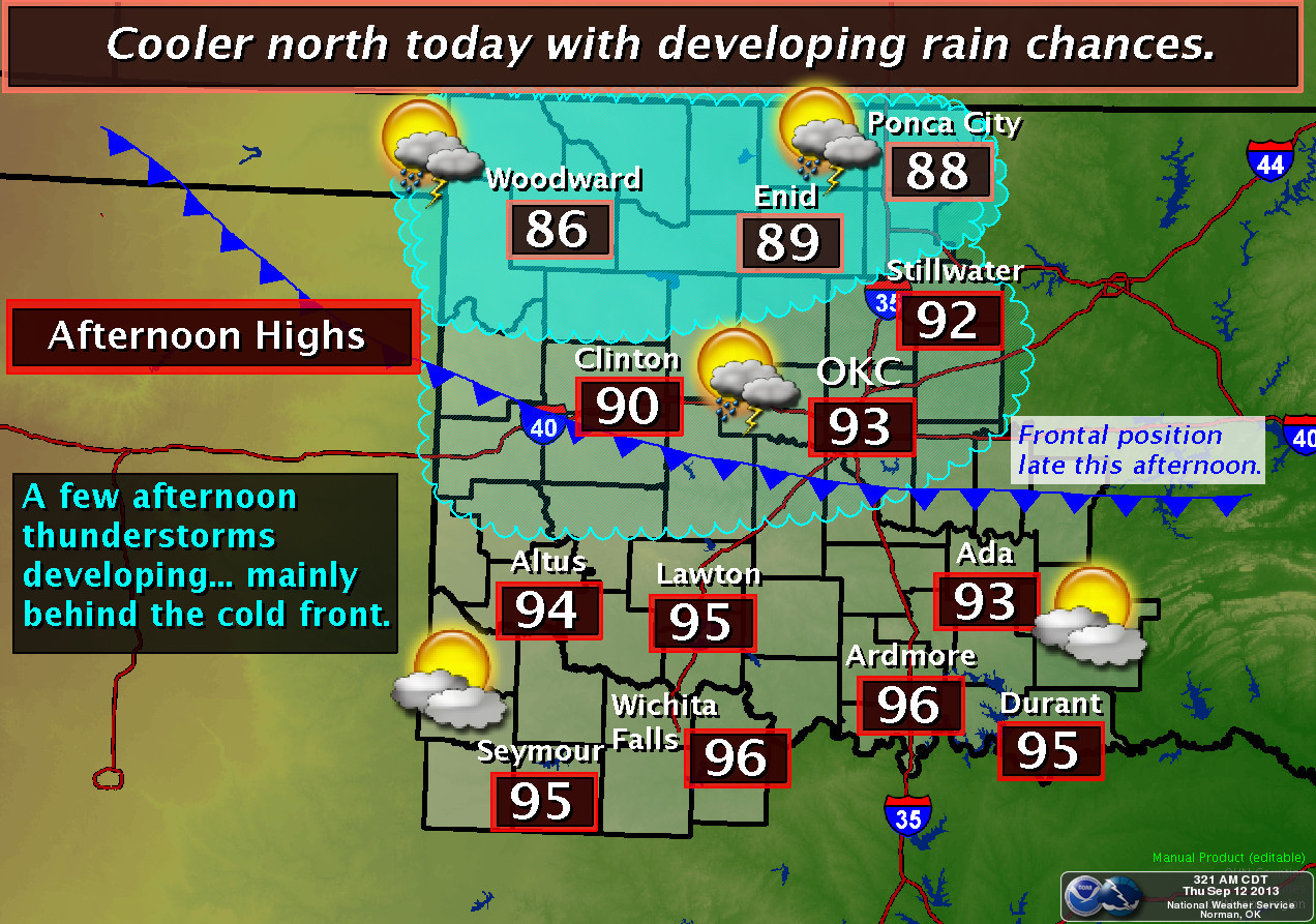
The statewide average temperature since August 18 has been 80.8 degrees, which
is 2.5 degrees above normal. The average high across the state over that
period was 94.2 degrees, 3.5 degrees above normal. So obviously we need this
current cool front that has entered the state to take some stress off of the
soil moisture and reservoirs/farm ponds (and us poor humans!).
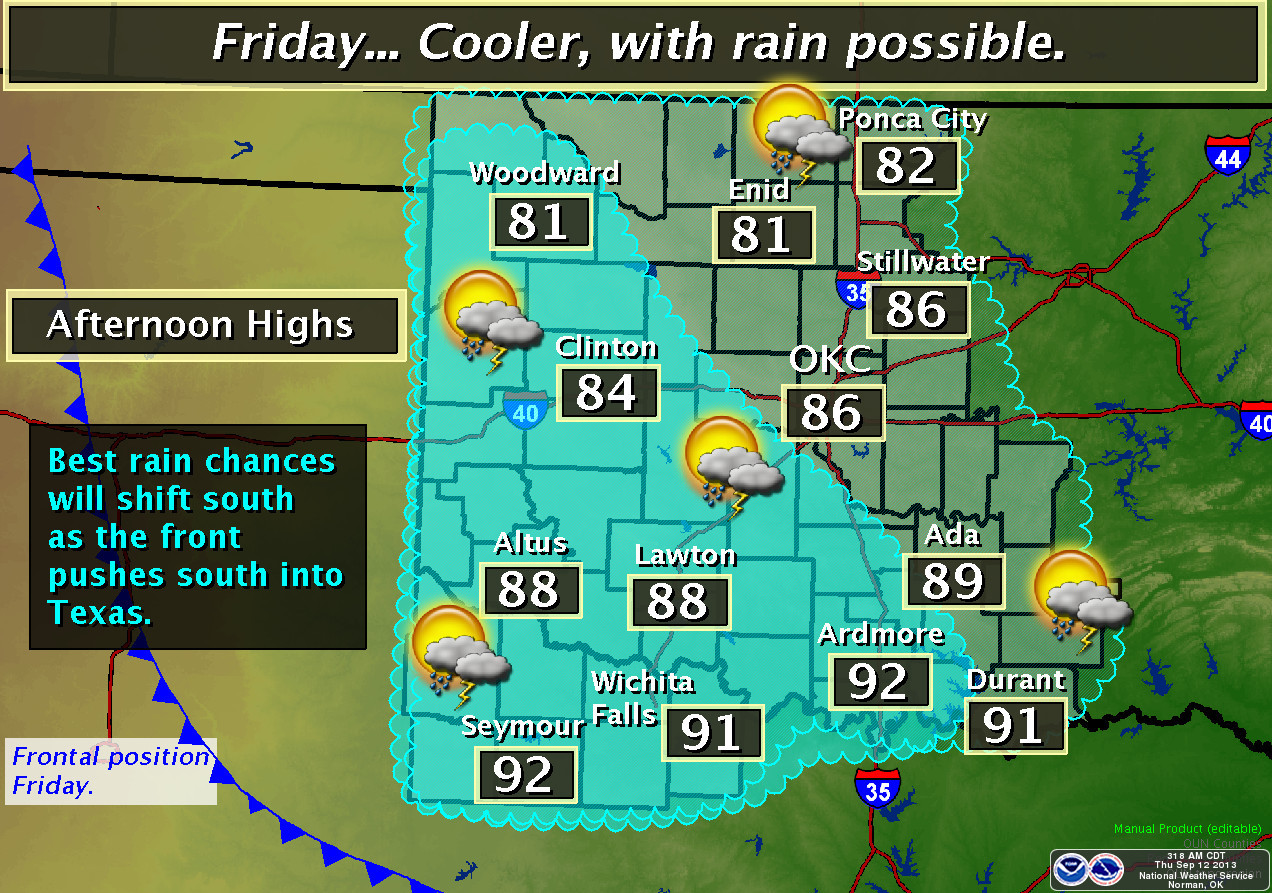
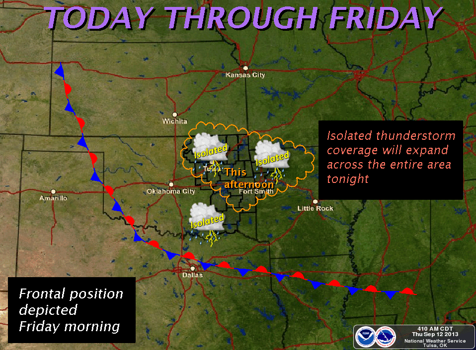
Our local NWS offices show us where that front will be later on, and how it
might bring us some much-needed rain!
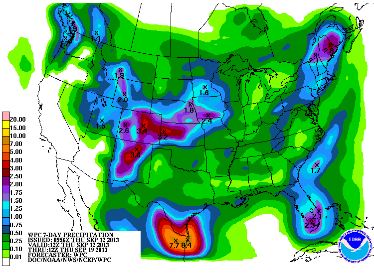
The latest 7-day rainfall forecast totals look "okay" for the most part, but
the far northwest appears to be in line for the best soaking.
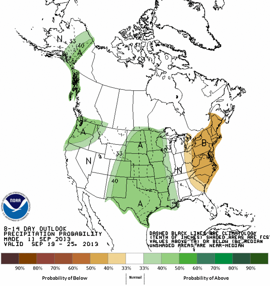
And CPC has the area painted with increased odds of above normal rainfall for
the Sept. 19-25 period, with increased odds of above normal temperatures as
well.
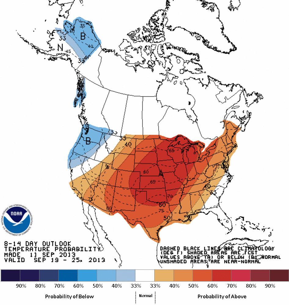
So it's a good news/bad news situation. Hopefully, the bad news is all in the
past and the good news is awaiting us.
Gary McManus
Associate State Climatologist
Oklahoma Climatological Survey
(405) 325-2253
gmcmanus@mesonet.org
September 12 in Mesonet History
| Record | Value | Station | Year |
|---|---|---|---|
| Maximum Temperature | 105°F | ALTU | 2011 |
| Minimum Temperature | 40°F | BOIS | 2014 |
| Maximum Rainfall | 9.13″ | FAIR | 2008 |
Mesonet records begin in 1994.
Search by Date
If you're a bit off, don't worry, because just like horseshoes, “almost” counts on the Ticker website!