Ticker for September 19, 2013
MESONET TICKER ... MESONET TICKER ... MESONET TICKER ... MESONET TICKER ...
September 19, 2013 September 19, 2013 September 19, 2013 September 19, 2013
Just (not) in the nick of time
Okay, here we go again ... talking about a new U.S. Drought Monitor map that
will probably be out of date already by tomorrow. But, that's how it goes in the
weather bidness. Mother Nature works on her own schedule. So let's take a look at
that map and see how it changed this week, given that we actually saw some rain
over the last 10 days.
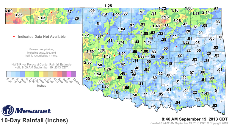
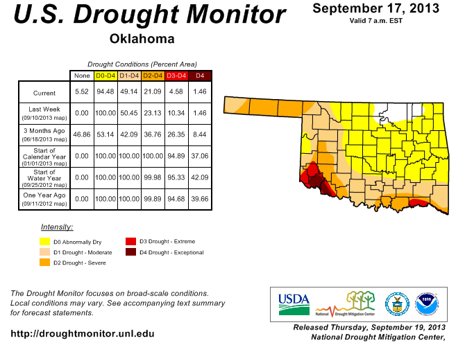
Obviously, with about a half a year's worth of rain falling in Cimarron County,
they were going to see improvements. Their D1-Moderate drought rating covering
part of the county has not been seen out that way since the June 26, 2012, map.
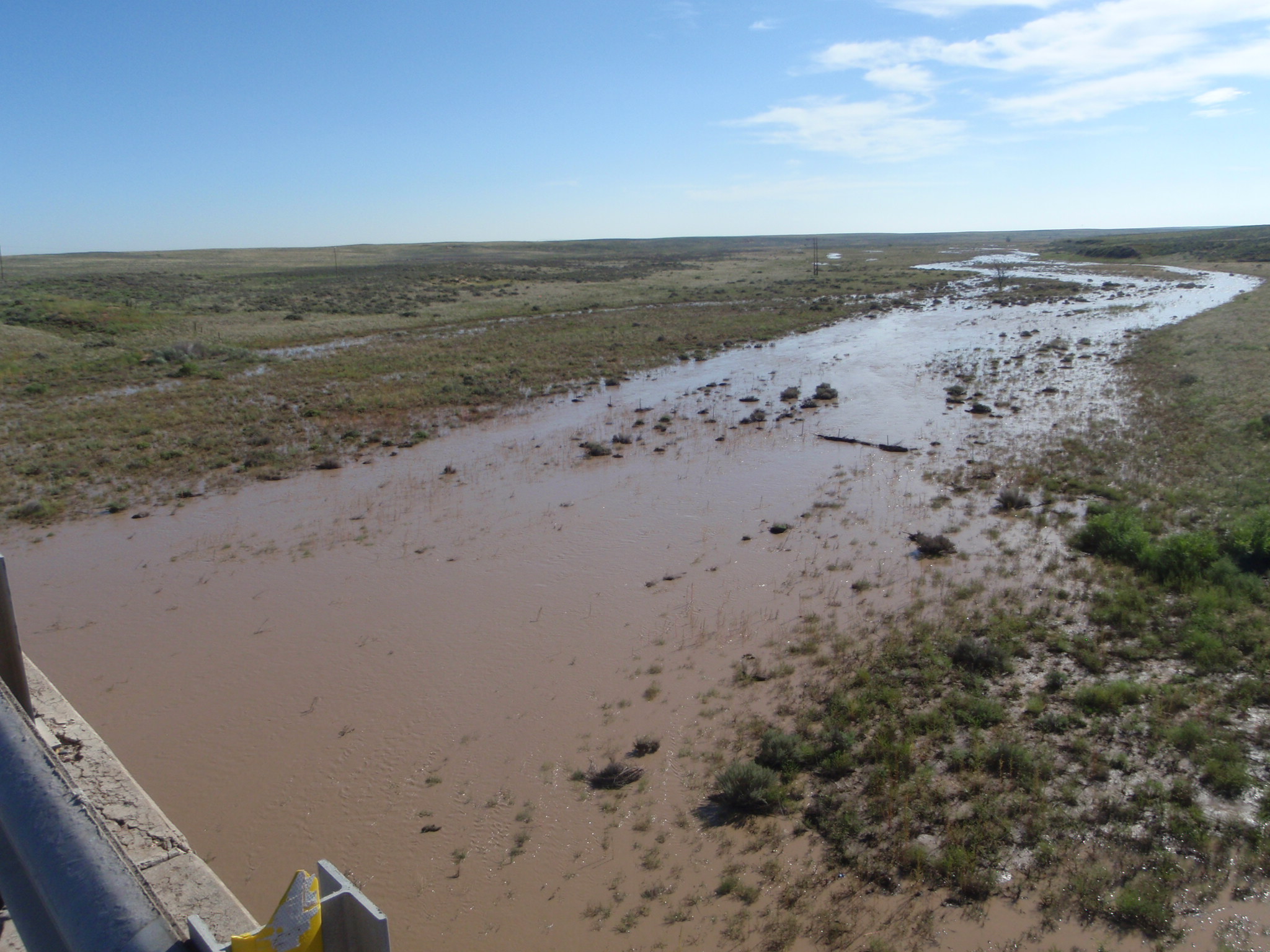
The folks at the Cimarron County Conservation District even sent us some pics
of the Beaver River with running water in it from out west of Boise City ... a
rare sight indeed! While it's difficult to pinpoint, locals say it ran a little
bit in July of this year, a little bit in 2010, and then none since 1976.
We also saw some D0-Abnormally Dry yellowness come back to west central Oklahoma,
where 2-3 inches of rain fell. Then there were the 3-4 inch amounts up in Osage
County that earned them a white color (no dry designation at all). That's all
the good news on this map. Now for the bad news ... thanks to continued lack of
rain, we saw D3-Extreme drought enter back into southeastern Oklahoma in
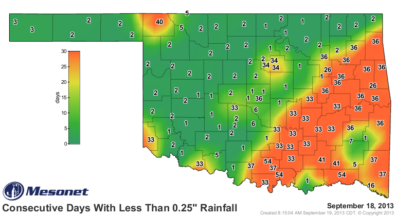
Choctaw County. The rainfall maps since August 1 tell the story down that
way, as well as across all of southern Oklahoma. In fact, it's been as many as
54 days since that area has seen at least a quarter-inch of rain in a single
day.
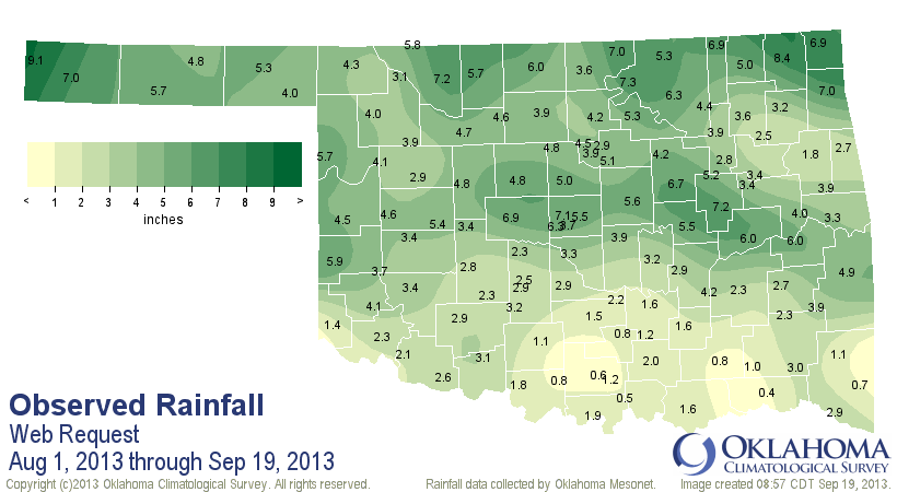
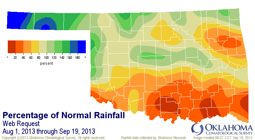
A very strange map. Kenton in the far western Panhandle has seen 9.1 inches of
rain, while Hugo in the southeast has seen 4 tenths. But all of southern
Oklahoma is down from 2-6 inches, as well as up into the northeast. The
Panhandle has seen it's 12th wettest Aug. 1-Sept. 19 since 1921 with an average
total of 5.74 inches, 2.05 inches above normal. Meanwhile, southeastern
and south central Oklahoma experienced their 5th driest with averages of 1.32
inches and 2.29 inches (3.88 inches and 3.27 inches below normal), respectively.
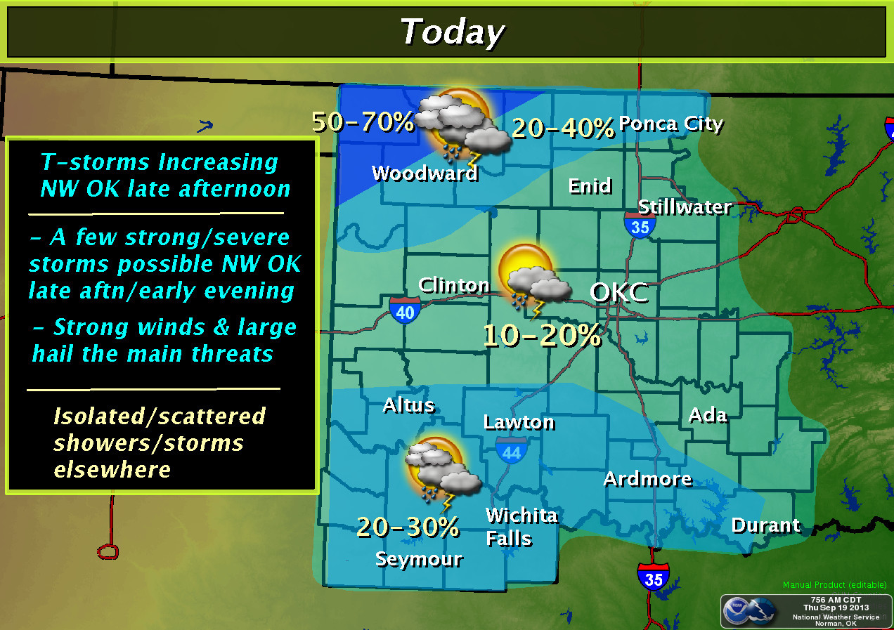
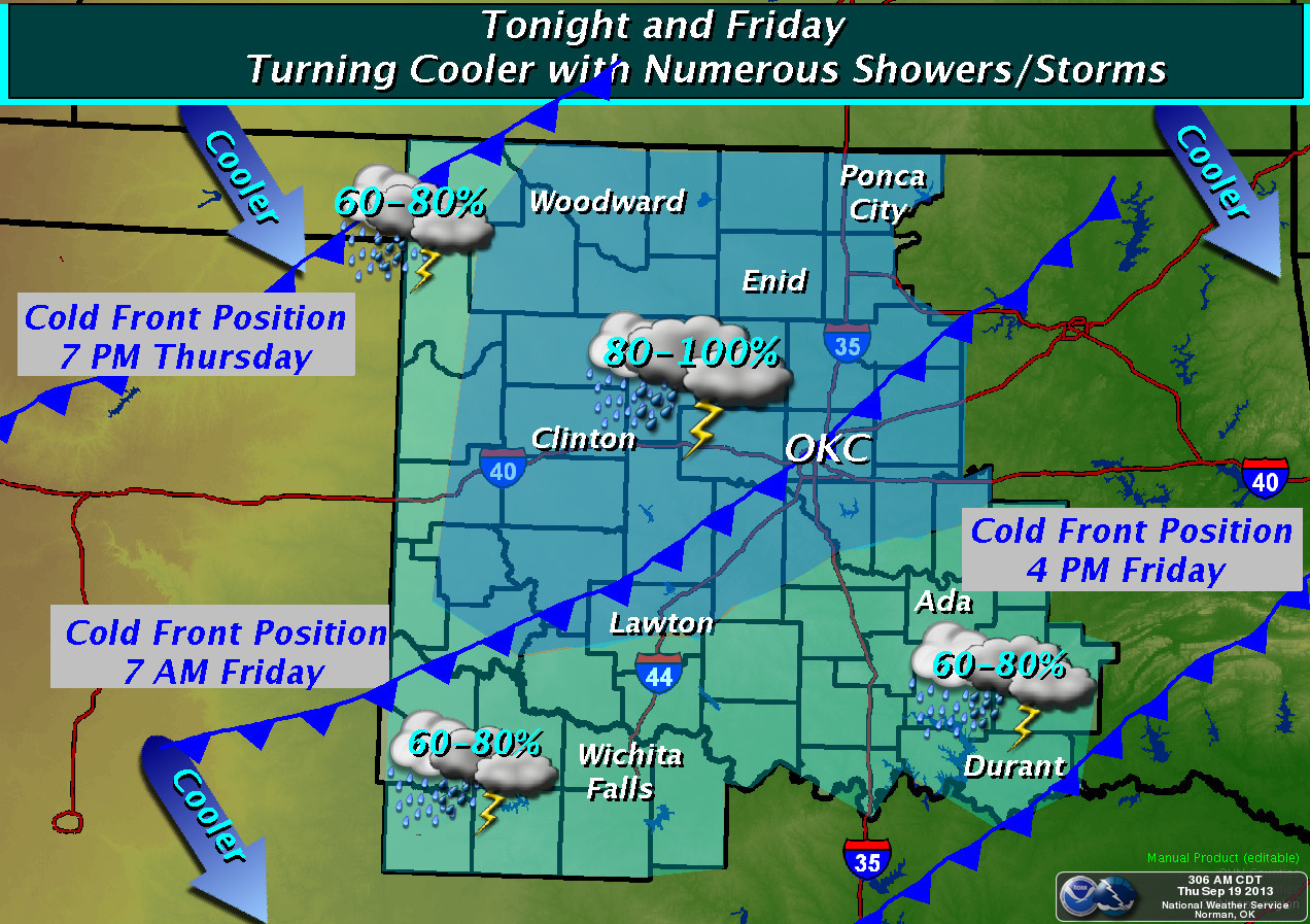
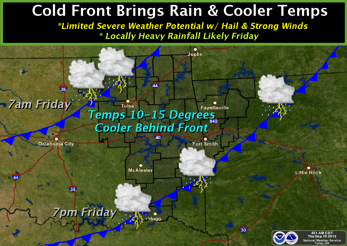
Let's talk good news now. A rather strong cool front will blast through the
state today and tonight, bringing us a chance of rain and also cooler weather
for the weekend. Here's how the local NWS offices see it playing out.
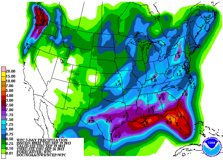
And here's the forecast rainfall totals for this event (next 7 days, actually).
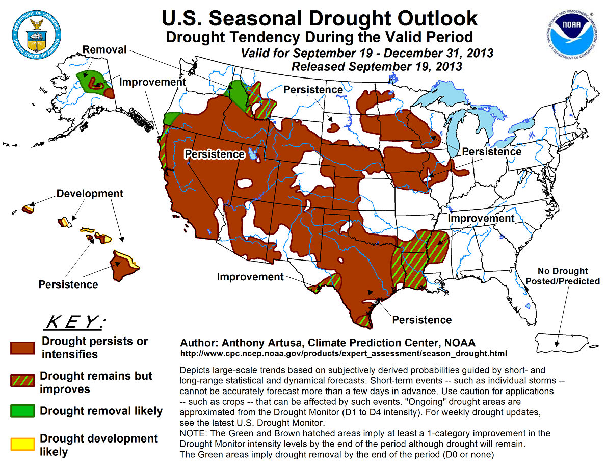
The latest U.S. Seasonal Drought Outlook for the Sept. 19-Dec. 31 period doesn't
seem to give the drought areas in Oklahoma much hope, with drought persisting
across the area through that period
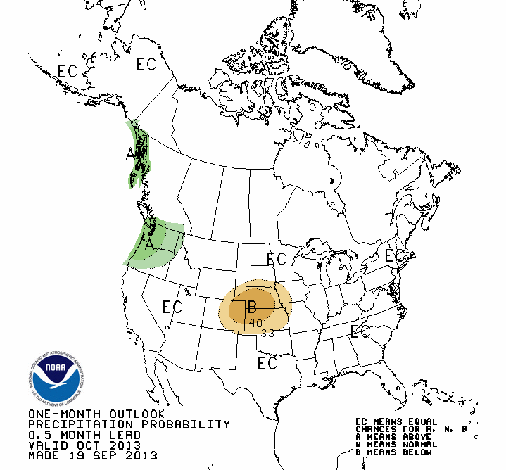
This would not be good news, of course, but the latest seasonal outlooks for
precipitation and temperature from CPC don't give reason for optimism either.
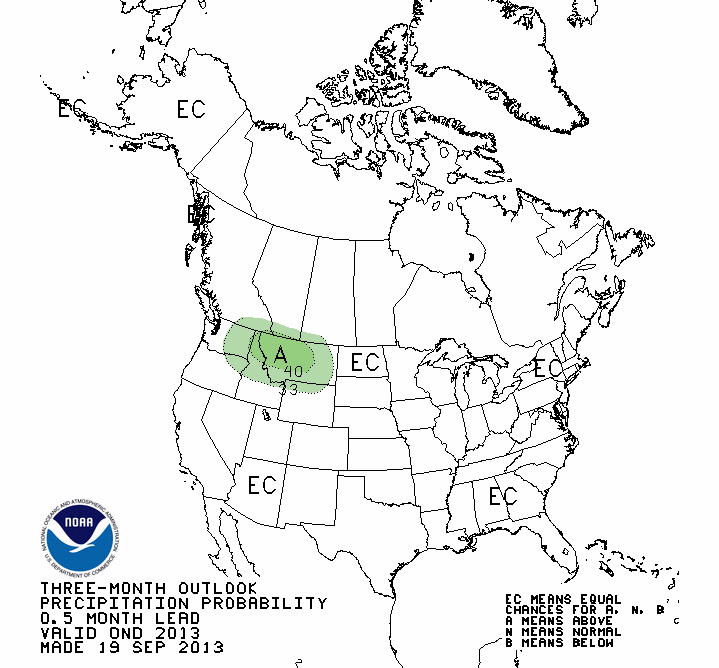
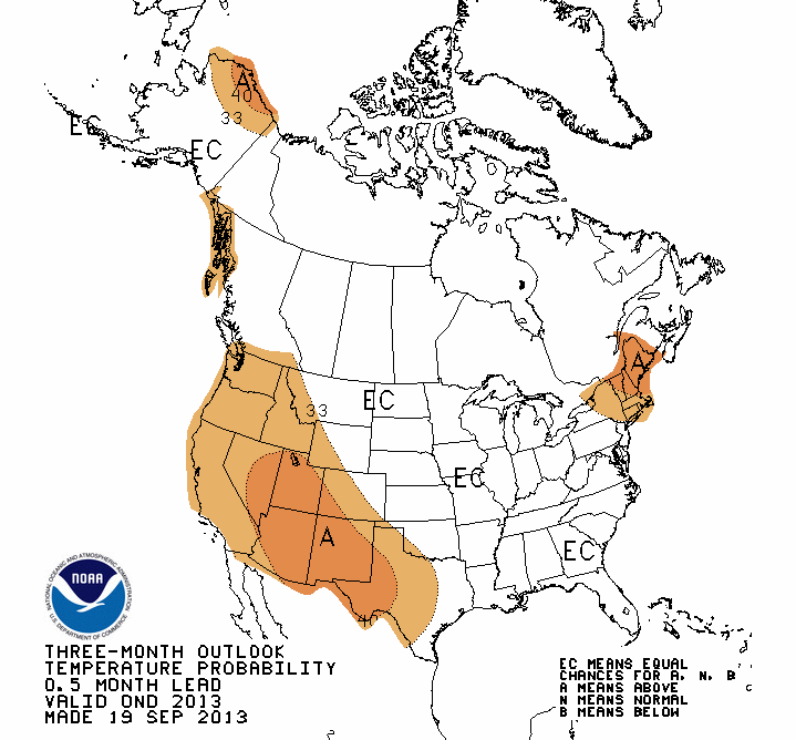
Those shows increased odds of above normal temperatures across southwestern
Oklahoma, but for everywhere else, the dreaded "EC" (equal chances) applies.
Equal Chances means the forecaster saw no basis to tilt the odds towards
above-, below- or near-normal values. In other words, a punt. AND ONCE AGAIN,
THAT DOES NOT MEAN THEY ARE FORECASTING NEAR-NORMAL CONDITIONS!
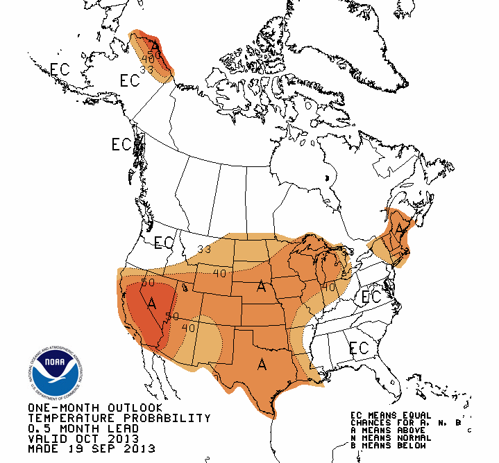
The monthly outlooks for October look warm, with no clue on the precip side.
So the news is bad, then it's good, then possibly bad or possibly good. What
more could you ask for? How about this ... it's going to rain tonight and be
cooler this weekend. Live in the present, where happiness reigns!
Gary McManus
Associate State Climatologist
Oklahoma Climatological Survey
(405) 325-2253
gmcmanus@mesonet.org
September 19 in Mesonet History
| Record | Value | Station | Year |
|---|---|---|---|
| Maximum Temperature | 105°F | SEIL | 2024 |
| Minimum Temperature | 33°F | BEAV | 2003 |
| Maximum Rainfall | 4.19″ | BBOW | 2002 |
Mesonet records begin in 1994.
Search by Date
If you're a bit off, don't worry, because just like horseshoes, “almost” counts on the Ticker website!