Ticker for September 2, 2013
MESONET TICKER ... MESONET TICKER ... MESONET TICKER ... MESONET TICKER ...
September 2, 2013 September 2, 2013 September 2, 2013 September 2, 2013
The Two Faces of August
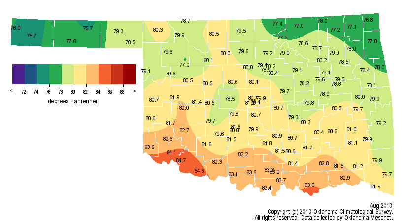
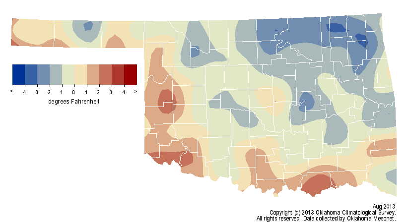
The unusually mild and wet conditions of July continued into August for a couple
of weeks, but summer returned with a vengeance to finish out the month. The rains
disappeared after week two, and then a summer-like heat wave arrived during the
final week. Despite that late heat, the month still managed to finish a tad on the
cool side overall. According to preliminary data from the Oklahoma Mesonet, the
statewide average temperature was 80.1 degrees. 0.3 degrees below normal and the
49th coolest August since records began in 1895.
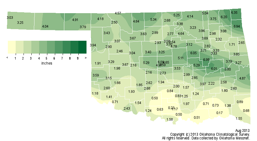
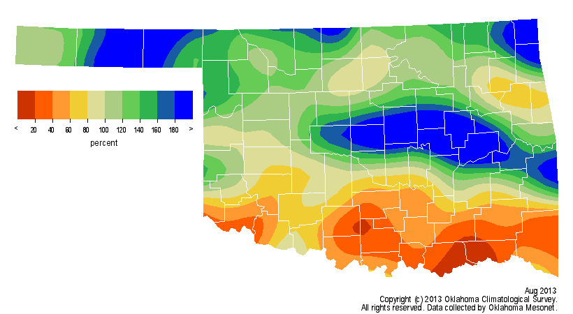
The abundant rainfall during the first two weeks of the month, mainly across the
northern two-thirds of Oklahoma, pushed the statewide average into the surplus
territory at 3.04 inches, about a quarter-inch above normal. That ranks the month
as the 51st wettest August on record. The southern third of the state missed out
on the bountiful moisture and finished from 20-80 percent of normal for the month.
Hugo and Newport finished with less than a quarter-inch of rainfall for the
month, and many other locations across southern Oklahoma saw less than an inch.
The northern two-thirds of the state recorded more generous totals with
numerous amounts between 5-7 inches.
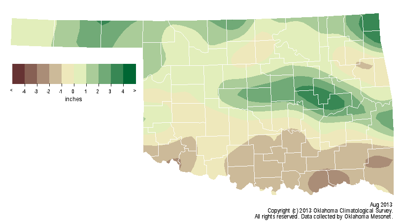
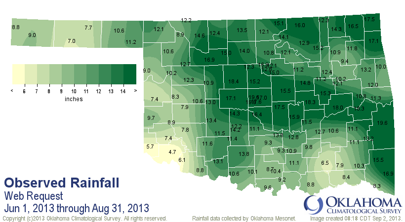
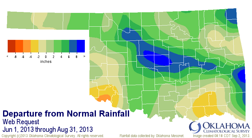
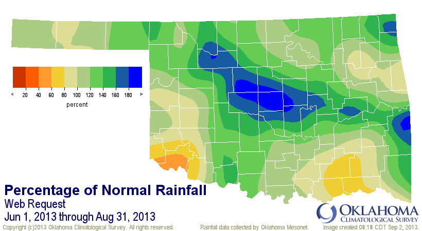
The climatological summer (June-August) had two distinct rainy periods that
vaulted it up the wet side of the rankings ? the first half of June and then
mid-July through mid-August. The statewide average for the summer finished at
12.50 inches, 2.73 inches above normal to rank as the 24th wettest on record.
Oklahoma City's official measurement site at Will Rogers recorded 18.15 inches
of rain from June through August to finish with its sixth wettest summer season
on record. Oklahoma City records date back to 1891. Its January-August total of
45.19 inches ranks as the wettest in the city's history. In contrast, the
Mesonet site at Altus recorded a paltry 4.7 inches of rain during the summer
and an equally depressing 11.5 inches for the first nine months of the year.
Only the Mesonet stations in the western Panhandle recorded less from January
through August.
Summer Rainfall
January-August Rainfall
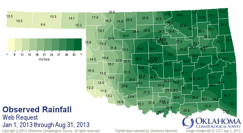
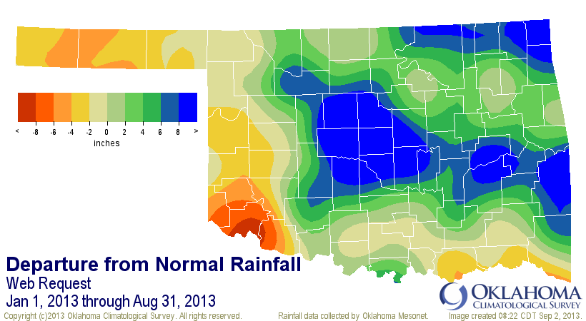
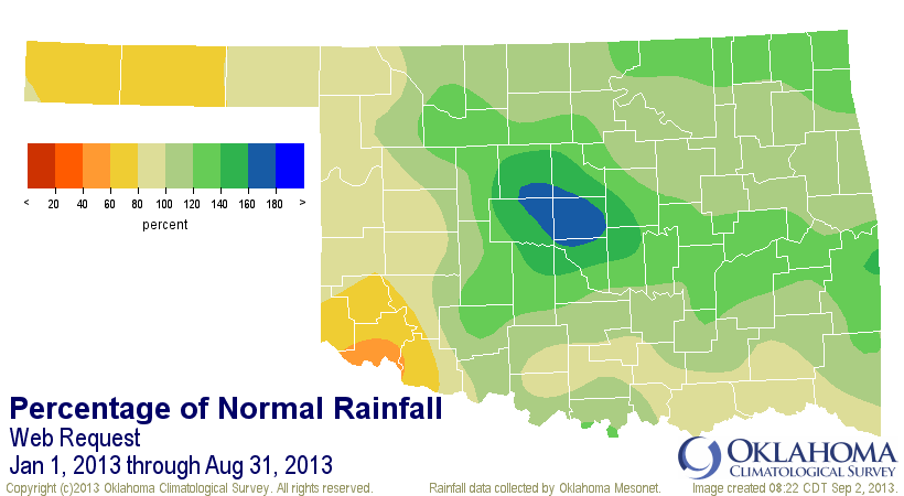
The return to a more summer-like rainfall pattern the last two weeks of the
month put the brakes on any continued drought relief, and actually reversed it
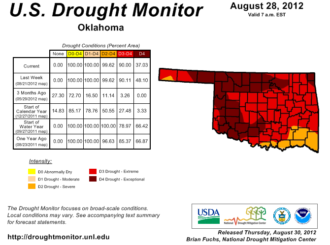
across parts of the state. The U.S. Drought Monitor report released on August
28 indicated that 38 percent of the state was suffering from at least moderate
drought, up from 33 percent the previous week. Most of that increase came from
southern Oklahoma.
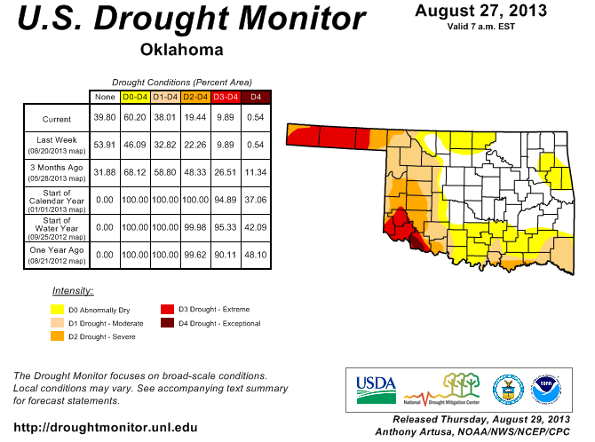
It is still a vastly different story than one year ago in late August when 100
percent of the state was entrenched in drought, including 90 percent in the
extreme to exceptional categories, the two worst possible on the Monitor's
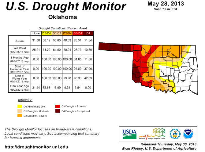
intensity scale. Still, the summer rains allowed for great strides. As much as
59 percent of the state was experiencing drought at the end of May. The Drought
Monitor's worst two categories, severe and exceptional, dropped from 27 percent
at the end of May to 10 percent at the end of August.
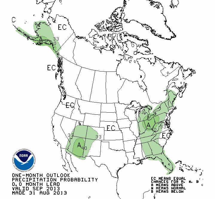
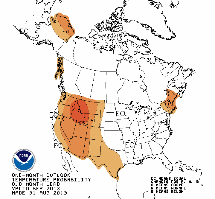
The September outlooks from the National Weather Service's Climate Prediction
Center (CPC) give equal chances for above-, below- or near-normal temperatures
and rainfall for all of Oklahoma.
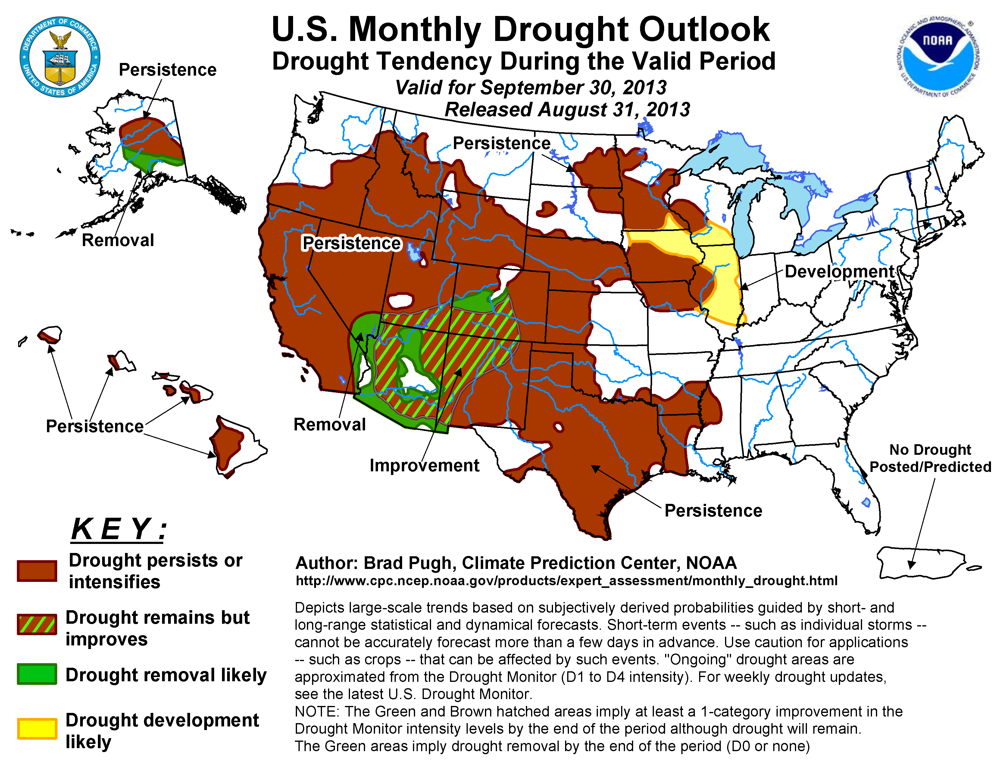
The U.S. Monthly Drought Outlook for September shows drought persisting across
all areas of Oklahoma where it currently exists, although no new areas of
drought development are expected by CPC.
The latest odds continue to favor neutral conditions in the equatorial pacific
waters for the second straight cool season, so the development of either El
Ni?o or La Ni?a appears unlikely at this time.
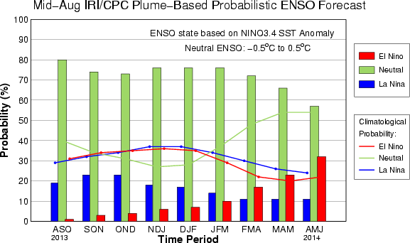
La Ni?a favors warmer and drier weather during the cool season across the
southern third of the United States, including Oklahoma, while El Ni?o favors
wetter and cooler conditions. Neutral conditions tilt the odds more towards
normal with perhaps more variability. The La Ni?a episodes of 2010-11 and
2011-12 helped fuel the dry and warm weather that was so persistent through
that period.
Gary McManus
Associate State Climatologist
Oklahoma Climatological Survey
(405) 325-2253
gmcmanus@mesonet.org
September 2 in Mesonet History
| Record | Value | Station | Year |
|---|---|---|---|
| Maximum Temperature | 111°F | TALI | 2000 |
| Minimum Temperature | 49°F | BOIS | 2006 |
| Maximum Rainfall | 2.86″ | CHAN | 2014 |
Mesonet records begin in 1994.
Search by Date
If you're a bit off, don't worry, because just like horseshoes, “almost” counts on the Ticker website!