Ticker for August 26, 2013
MESONET TICKER ... MESONET TICKER ... MESONET TICKER ... MESONET TICKER ...
August 26, 2013 August 26, 2013 August 26, 2013 August 26, 2013
So THIS is August!
I almost had forgotten what it was supposed to be like. And this is the worst
looking 7-day rainfall map that we've seen in quite awhile.
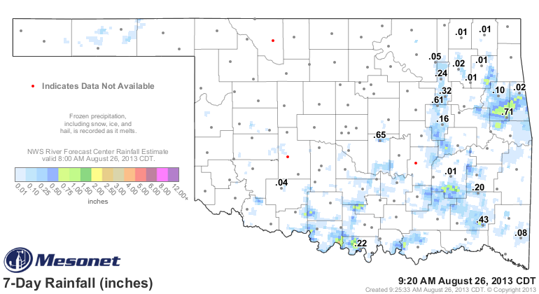
Congrats to Medicine Park. I'll be that 4 hundredths was quite a soaker! The next
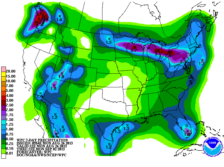
7 days don't look much better, either. This pattern is a clear indicator of
that heat dome being parked right over our part of the world.
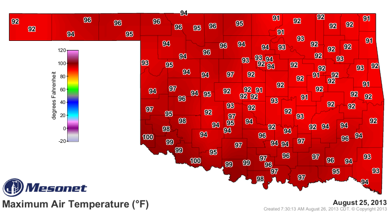
The high temperatures are beginning to show it as well. We have started to reach
triple-digits down in the far southwest again, and upper 90s are starting to
spread.
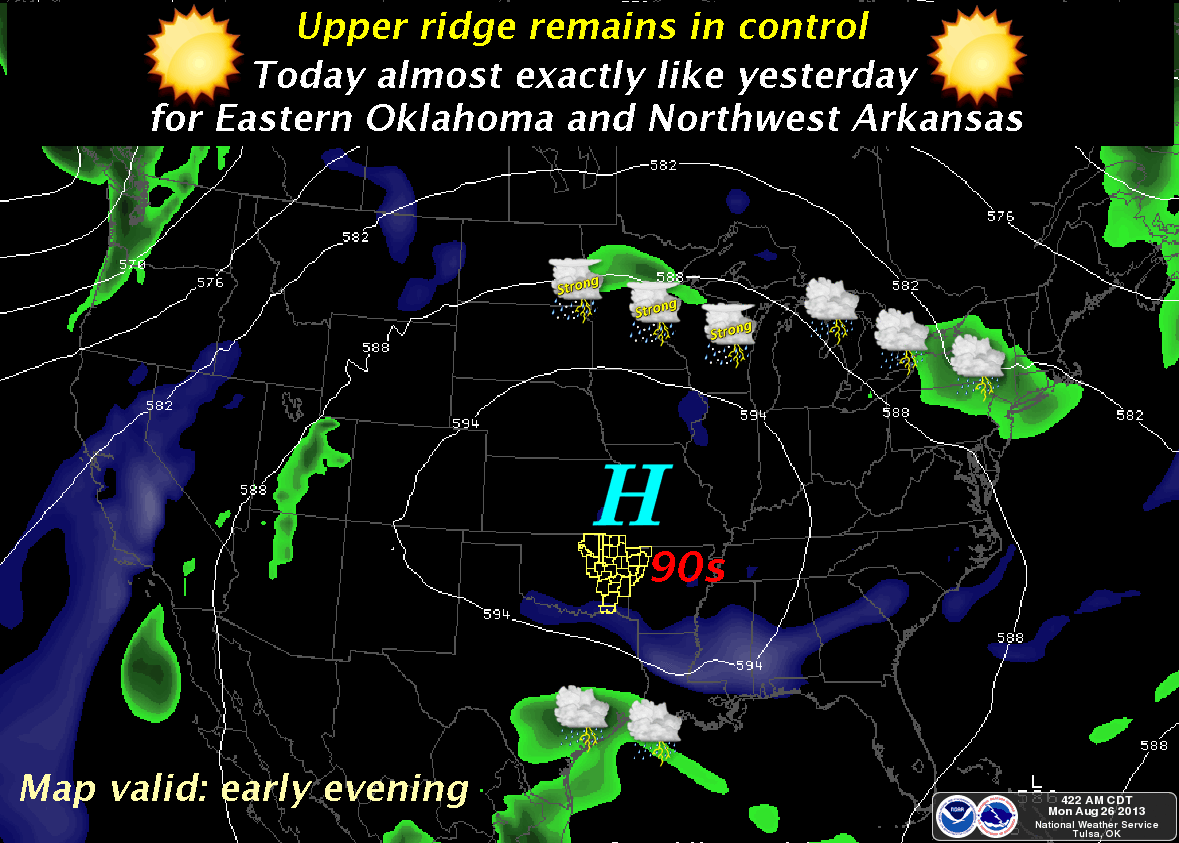
The Tulsa NWS office has an excellent graphic showing exactly what's going on
as that upper ridge of high pressure sits and spins over us.
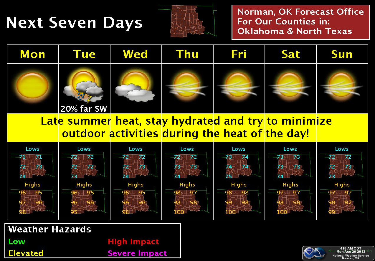
NWS-Norman shows that other than a slight chance for showers in the far SW
tomorrow, it will be more of the same for the next week. Temperatures are not
out of control, but they're still a bit above normal (and a LOT above what we
saw earlier in the month).
Now this is not-so-good news for much of the state, but it's absolutely horrible
news for those areas still plagued by significant drought. We might see some
yellowing of the vegetation come back, and if the conditions set up right, maybe
some fire danger as well if the dry pattern continues for too long.
In the meantime, the soils are starting to dry back out a bit, so it's important
that we see some more rain in the next month in time for planting season. Still
plenty of time before that, and Mother Nature has been coming through most of
the time (and for most of the state), so I'm not too worried. Yet.
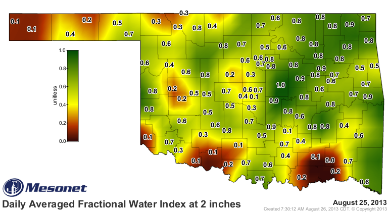
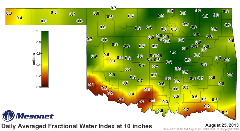
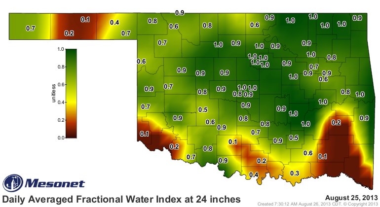
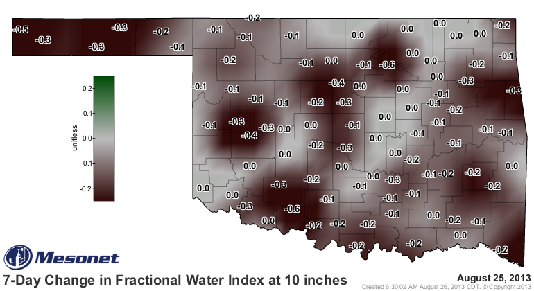
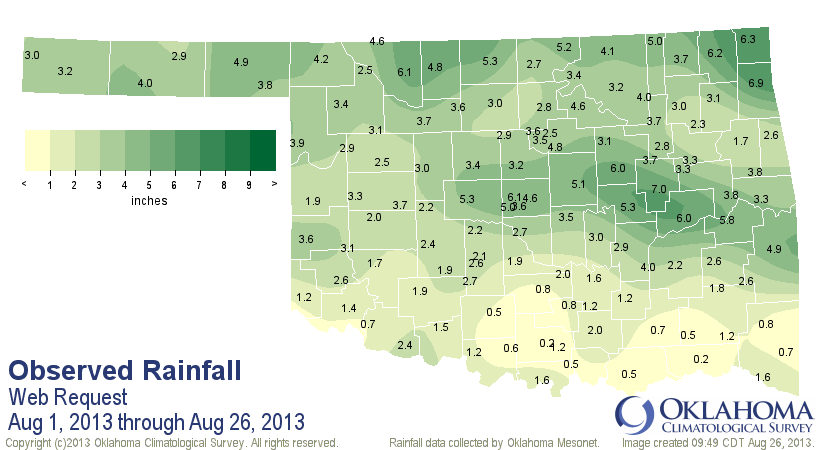
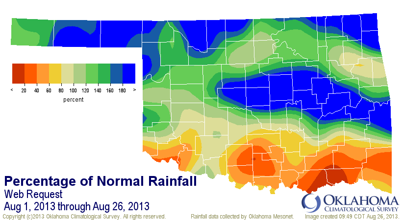
Even with this dry spell, August is still about 0.7" above normal for the month
thus far with a statewide average of 3.03". Now unfortunately, the southern
parts of the state are still below normal, so the statewide average cannot
explain everything.
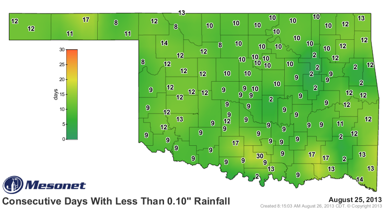
Lastly, it's also been awhile since we've seen our "days without" maps looking
like this. Probably back to early July. These maps are not that unusual for
August or summer, but they are unusual for THIS August and THIS summer.
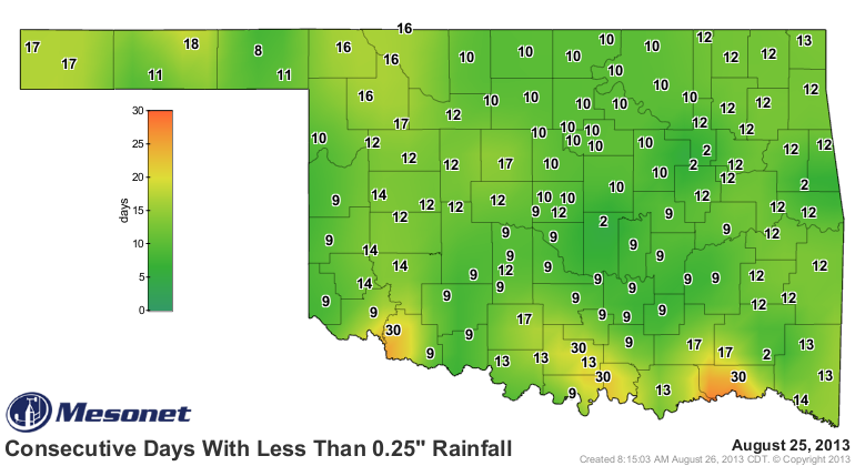
Hey, at least you're mowing is slowing down, right??
Gary McManus
Associate State Climatologist
Oklahoma Climatological Survey
(405) 325-2253
gmcmanus@mesonet.org
August 26 in Mesonet History
| Record | Value | Station | Year |
|---|---|---|---|
| Maximum Temperature | 110°F | WAUR | 2023 |
| Minimum Temperature | 46°F | SEIL | 2010 |
| Maximum Rainfall | 5.24″ | BROK | 2020 |
Mesonet records begin in 1994.
Search by Date
If you're a bit off, don't worry, because just like horseshoes, “almost” counts on the Ticker website!