Ticker for August 23, 2013
MESONET TICKER ... MESONET TICKER ... MESONET TICKER ... MESONET TICKER ...
August 23, 2013 August 23, 2013 August 23, 2013 August 23, 2013
It'ssssssssss herrrrrrrrrrrrrre!!
Sorry, I was staring into the TV last night waiting for the Star Spangled Banner
to play and then the snow to come on (or at least a test pattern ... look it up,
it used to happen that way back when we only had 4 channels). I thought maybe
the Poltergeists would have some word on what to expect in the coming weeks in
the way of rain. Well, all I got was an infomercial on hair replacement (how did
they know??). No Star Spangled Banner and no snow, so we'll just have to go with
those ghouls at the NWS, the imps at CPC and other various sources. I say these
things in jest, but it's kind of a scary forecast to end the summer.
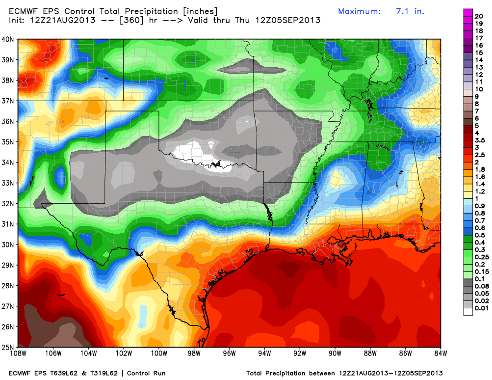
Let's start with a long long lonnnnng range precipitation forecast from friend and
colleague Victor Murphy at the NWS Southern Region Headquarters in Ft. Worth.
This particular model forecast shows the accumulated precip for the next 360
hours, all the way out to the morning of Sept. 5. The view I see is NOT GOOD for
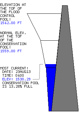
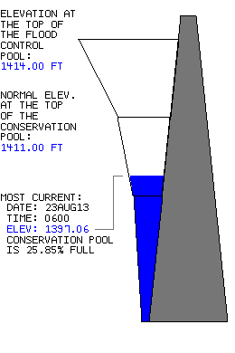
southern Oklahoma, especially those folks in Altus that are dealing with a bona
fide water emergency as Tom Steed Reservoir drops perilously low (not to mention
the pathetic shape of Lake Altus Lugert).
If you talk to folks down in the SW part of the state and up through the
Panhandle, they will tell you they feel a bit neglected and "in this on their
own" in dealing with this drought.
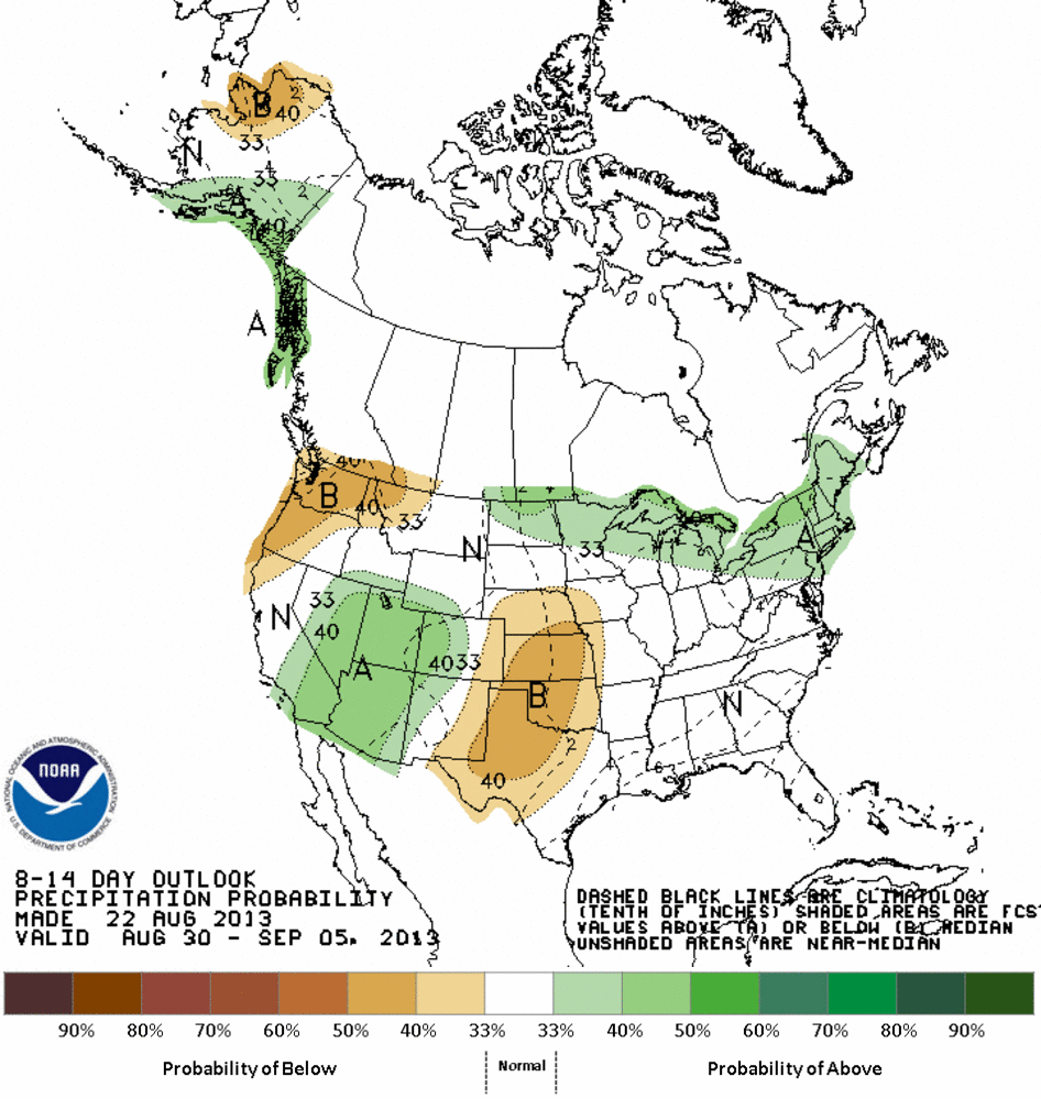
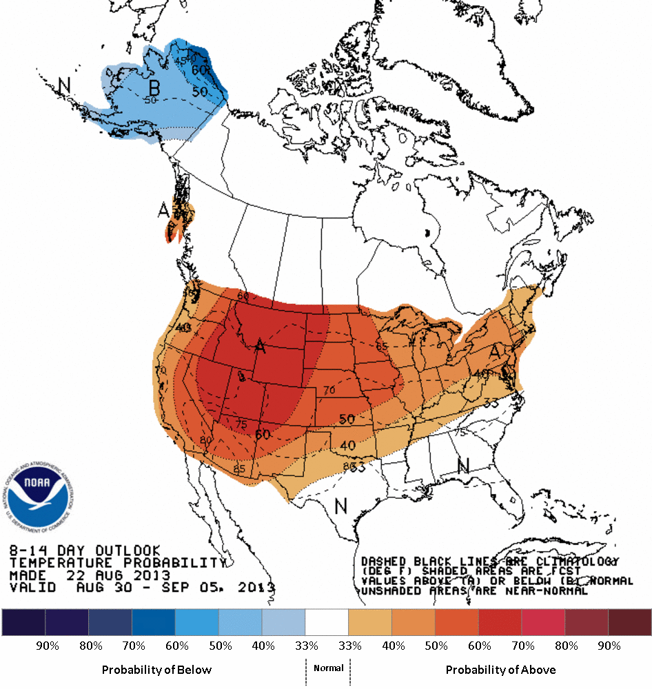
Here's the view from the CPC for days 8-14 (Aug. 30-Sept. 5) ... increased odds
of above normal temps and below normal precipitation. That may work for some
of the water-logged areas of the state, but not for far southern and western
Oklahoma.
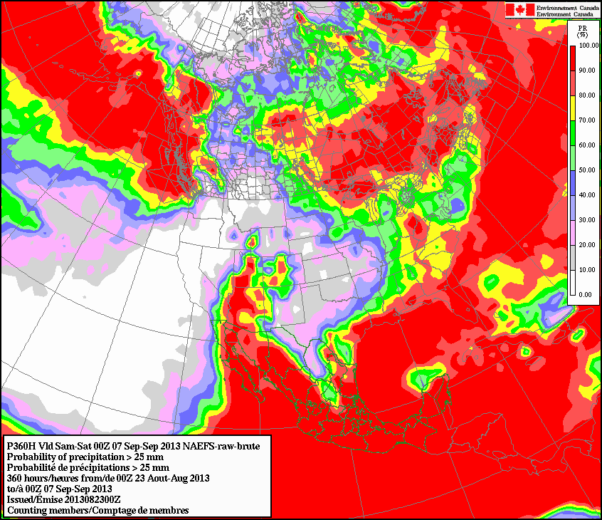
Heck, even the Canadian model is leaving us with little chance of seeing at
least 25 mm (about an inch) of rain through the evening of Sept. 6. Take off,
eh!
There are still good news nuggets despite the ill-favored model forecasts.
1. Model forecasts out to 360 hours are like a visit to Disney ... Fantasyland!
2. MOST of the state has had enough precip to withstand a return to summer for
a couple of weeks.
3. Most lakes across the state are full, which is ahead of where they would
normally be at this time.
4. I can get my hair back!!
So despite a return to summer, it's not all bad. If you're in Altus watching
the diminishing levels of your water supply, it's downright terrifying, however.
Gary McManus
Associate State Climatologist
Oklahoma Climatological Survey
(405) 325-2253
gmcmanus@mesonet.org
August 23 in Mesonet History
| Record | Value | Station | Year |
|---|---|---|---|
| Maximum Temperature | 113°F | ALTU | 2024 |
| Minimum Temperature | 52°F | NOWA | 2009 |
| Maximum Rainfall | 5.40″ | BEAV | 2019 |
Mesonet records begin in 1994.
Search by Date
If you're a bit off, don't worry, because just like horseshoes, “almost” counts on the Ticker website!