Ticker for August 22, 2013
MESONET TICKER ... MESONET TICKER ... MESONET TICKER ... MESONET TICKER ...
August 22, 2013 August 22, 2013 August 22, 2013 August 22, 2013
Southwestern OK still not with the program
Well, another week and another change in the U.S. Drought Monitor map. This might
be the last improvements on the map we see unless we get more rain sometime soon,
Regardless, we did see an increase in the amount of the state where no drought
or dry conditions are prevalent, 54% compared to last weeks' 49%.
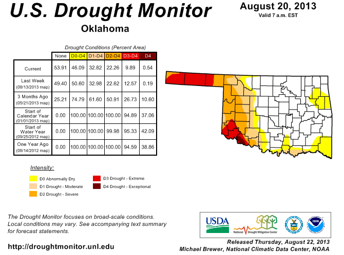
The biggest changes occurred in western Oklahoma where the D0 was erased up in
north central Oklahoma and the Extreme D3 drought area in Roger Mills and Beckham
counties were dropped to Severe D2 drought. But, we also saw the re-emergence of
Exceptional D4 drought in the far southwest, contained almost completely by
Tillman County. If you look at the rains we've had since mid-July, that remains
an area that has gone without the rather garish totals to the north and east.
Check out the southeast as well. That area is becoming primed for drought
intensification, where less than 3 inches has fallen since the summer rains
began back in early July.
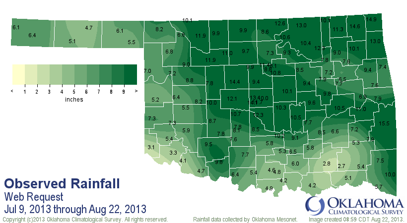
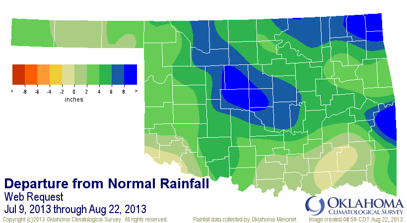
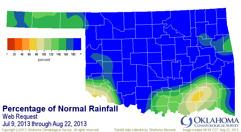
So while overall the state has had an average of 8.11 inches since July 9, more
than 4 inches above normal (4th wettest July 9-August 22 since 1921), those areas
down south have seen below normal rainfall. The prospects for the coming weeks
are not looking great so far, but as we know here in Oklahoma, that can change
in a hurry!
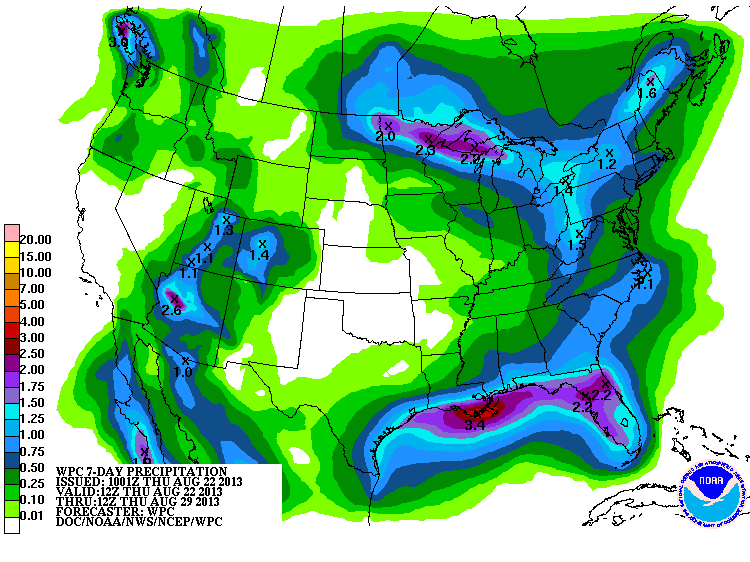
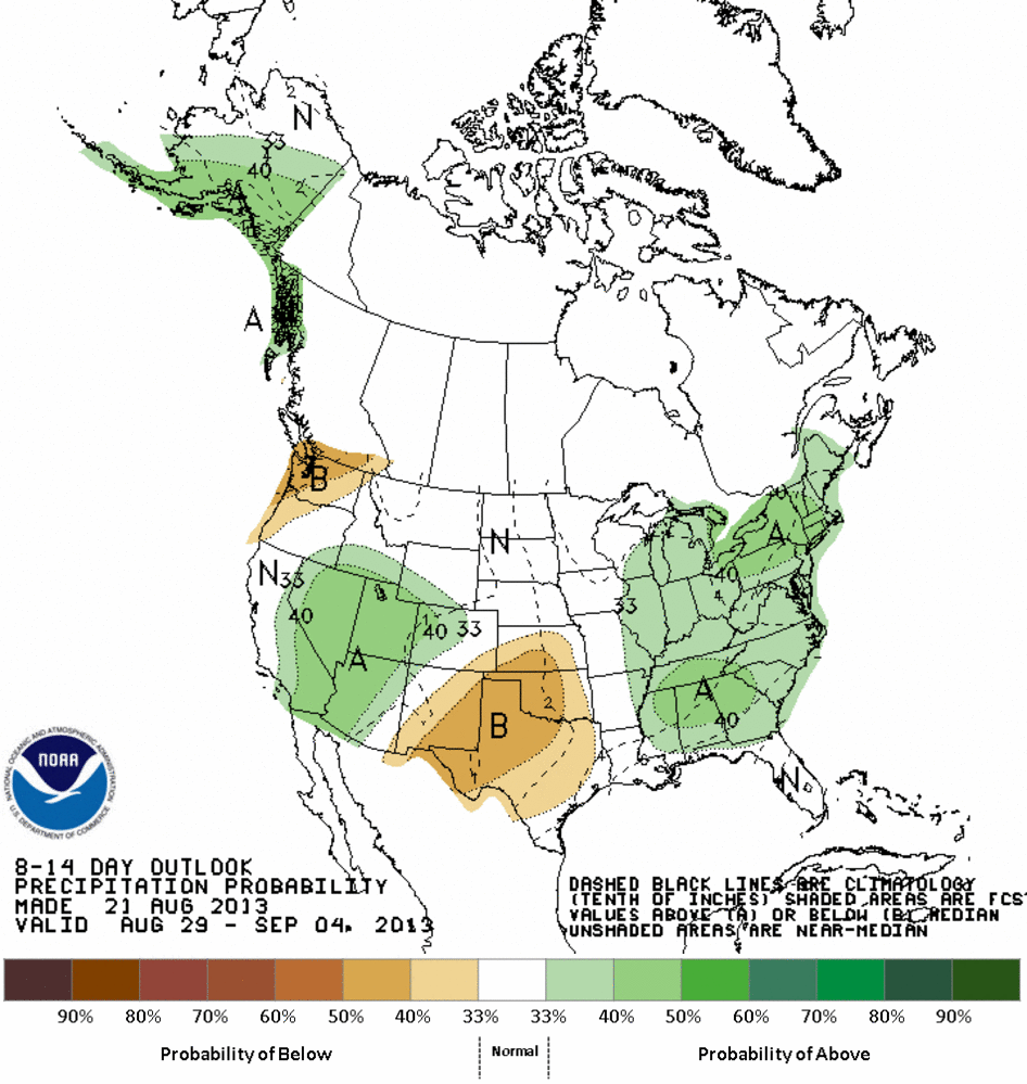
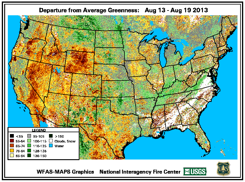
As for the temperatures we're getting back into now, no cause for alarm. We're
merely back into a normal Oklahoma August. The ground is just a bit squishier
than normal, and things are much greener than usual. This departure from average
greenness map shows just how much. And this was from last week.
This is an excerpt from the Ticker from August 6 of last year:
"Never have I seen our state so YELLOW, except for during the
winters around here, and maybe not even then."
I even provided a nice picture from I-40 west of OKC as proof.

What a difference a year can make (as well as a statewide average of 8" of rain
in the last month!).
Gary McManus
Associate State Climatologist
Oklahoma Climatological Survey
(405) 325-2253
gmcmanus@mesonet.org
August 22 in Mesonet History
| Record | Value | Station | Year |
|---|---|---|---|
| Maximum Temperature | 108°F | GRA2 | 2023 |
| Minimum Temperature | 48°F | BRIS | 2016 |
| Maximum Rainfall | 4.25″ | MRSH | 2005 |
Mesonet records begin in 1994.
Search by Date
If you're a bit off, don't worry, because just like horseshoes, “almost” counts on the Ticker website!