Ticker for August 19, 2013
MESONET TICKER ... MESONET TICKER ... MESONET TICKER ... MESONET TICKER ...
August 19, 2013 August 19, 2013 August 19, 2013 August 19, 2013
Eerie condition envelops state
Something extremely odd is going on in Oklahoma, and so far I have not heard
a good explanation for such a condition ... for the first time in
more than a month (since July 12, to be exact), no appreciable rain fell in the
state (Sunday). Okay, a few places did manage to pick up a hundredth of an inch,
but good luck making hay out of that. We don't have a totals map for just Sunday,
so we'll just go with the last 24 hours.
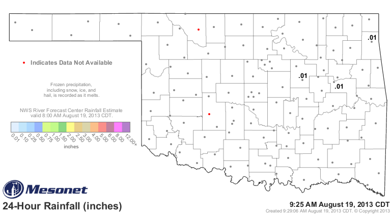
And furthermore, it appears the map might stay more white than not over the next
week or so.
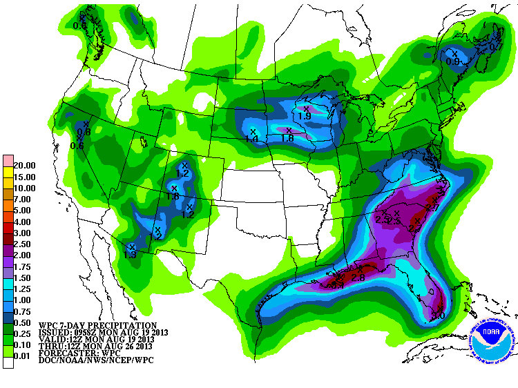
That lack of rainfall will come in conjunction with a large upper-level ridge
building across our area, so bye bye to the cool-ish frontal passages and also
the rain for awhile. This will allow something of a summertime pattern to return
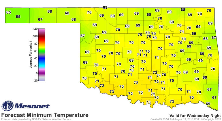
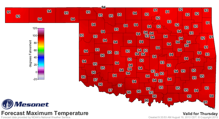
with highs jumping back up into the 90s across the state. Hey, it IS August, you
know. Nothing too nasty, however. We'll use the forecast highs and lows for
Thursday from the NWS as an example.
Tough to complain about the August we've had so far, especially when compared
to last year's brutal month (along with July). Well, provided you aren't in
Altus or some of those other communities out west still hard hit by drought.
But STILL this is better than last year. Check out the stats for August 1-18
this year, and then compare them to normal AND the last couple of years.
-***-
Year Avg. Highs Avg. Lows Avg. Mean Avg. Precip
2011 102.0 74.2 88.1 1.88
2012 98.8 70.1 84.4 0.82
2013 89.6 68.8 79.2 3.00
Normal 94.1 69.4 81.7 1.73
-****-
Remember, with a statewide average for the entire month of 87.9 degrees, August
2011 ended as the hottest on record for Oklahoma. Last August actually finished
at 81.5 degrees, so it cooled off considerably in the last half of the month.
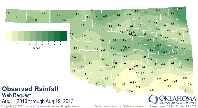
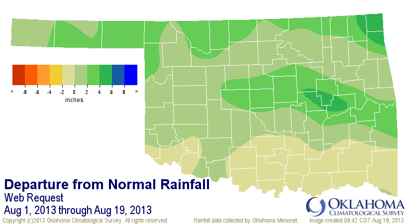
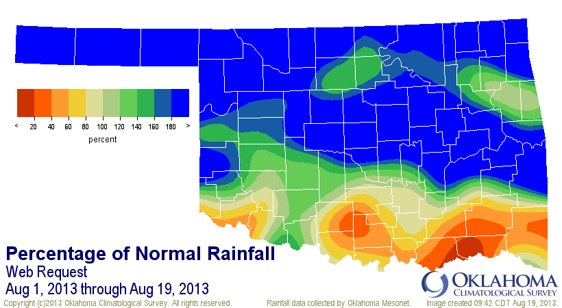
That statewide average of 3 inches already puts the entire month in the upper
half of the wettest since 1895, so lots of room to move up the rankings on that
statistic as well. Here's what it looks like on the map. Definitely a northern
two-thirds event this August, at least thus far.
I no longer try and guess what's going to happen the next day, let alone the
next month. What will September be like? I'd expect either 110 degrees everyday,
or snow.
We'll go from there.
Gary McManus
Associate State Climatologist
Oklahoma Climatological Survey
(405) 325-2253
gmcmanus@mesonet.org
August 19 in Mesonet History
| Record | Value | Station | Year |
|---|---|---|---|
| Maximum Temperature | 111°F | GRA2 | 2024 |
| Minimum Temperature | 51°F | ELRE | 2015 |
| Maximum Rainfall | 8.55″ | OKMU | 2007 |
Mesonet records begin in 1994.
Search by Date
If you're a bit off, don't worry, because just like horseshoes, “almost” counts on the Ticker website!