Ticker for August 13, 2013
MESONET TICKER ... MESONET TICKER ... MESONET TICKER ... MESONET TICKER ...
August 13, 2013 August 13, 2013 August 13, 2013 August 13, 2013
Hey Oklahoma, Noah called ...
He says he has some leftover lumber if we need it. The 2X2 thing is up to us,
however. Yes, rain is still the story with a stalled frontal boundary producing
showers and storms across the state, especially along the I-40 corridor.
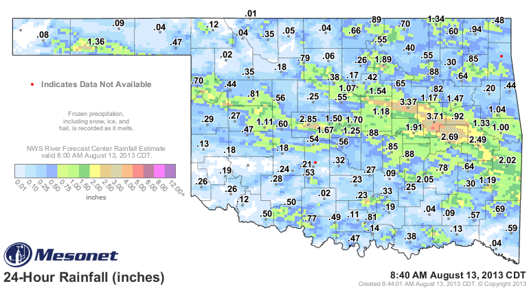
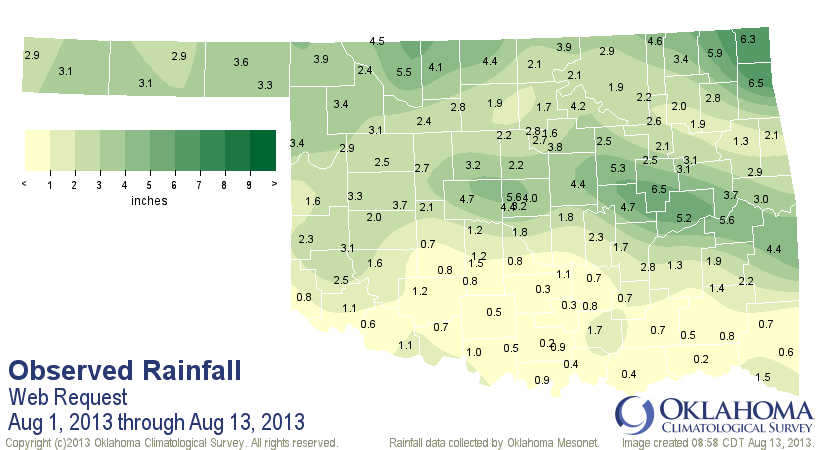
More than 3 inches of rain has fallen across east central Oklahoma, including
3.71 inches at Okmulgee. El Reno picked up another 2.85 inches to the west on
I-40. Even southern Texas County got into the act with more than an inch of rain.
That gives them 3 inches in the last 7 days. Coincidentally, this is the rainfall
we have to work with on this week's U.S. Drought Monitor map. Looks like there
will be some good improvements.
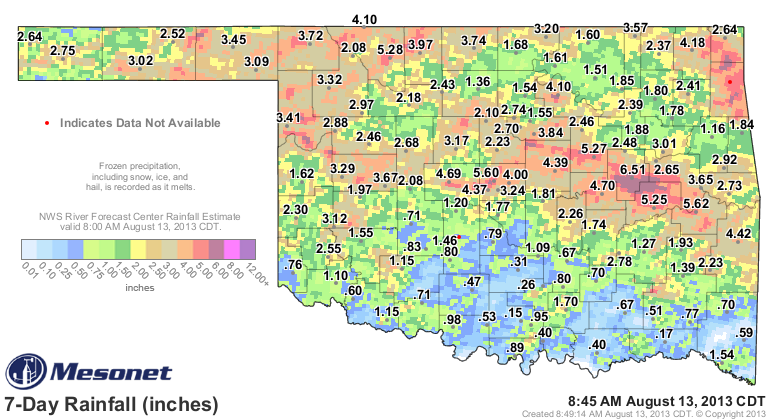
In those 7 days, widespread amounts of 3-5 inches fell across the NW and another
4-6 inches from central through east central Oklahoma, up into the northeastern
corner. Still not quite so much across southern Oklahoma, but as that front sags
farther to the south, perhaps they'll get a bit more action down that way. All
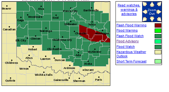
this rain has prompted a large flash flood watch over most of Oklahoma, and
already there are flash flood warnings for east central Oklahoma.
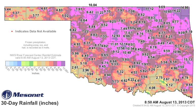
The soils are quite saturated across most of Oklahoma, as evidenced by the 30-
day rainfall map. Some massive totals on the map, even though some rainfall
has dropped off from earlier in July.
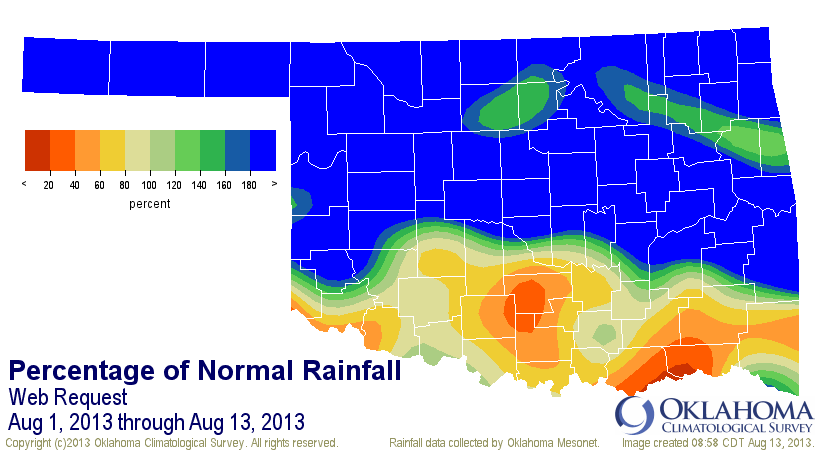
All this rain brings the statewide average total for August up to 2.48 inches.
That's already close to the normal total for all of August (2.75 inches), and
August 2013 becomes the wettest such month since August 2009's 3.85 inches.
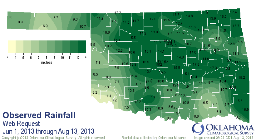
The summer totals thus far were not helped much by June, even though it was
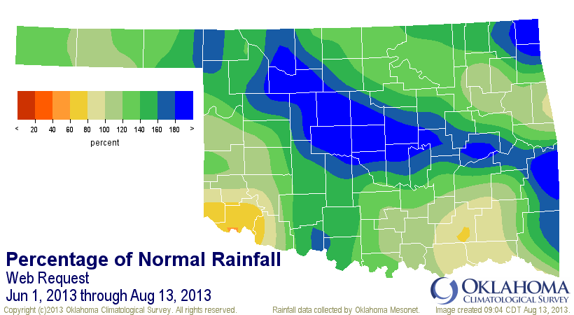
fairly wet the first half of that month. Nevertheless, the statewide average
for summer thus far (June 1-August 18) stands at 11.36 inches, which is 3.23
inches above normal for that period.
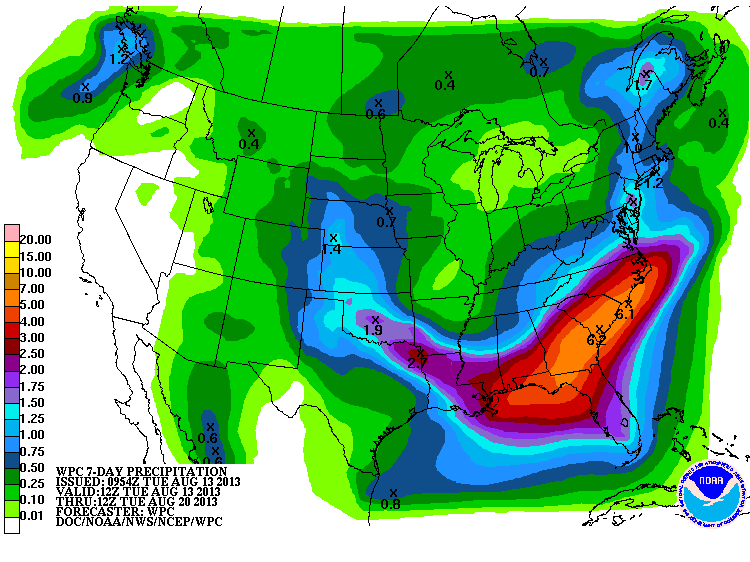
The kicker to this, of course, is that rain is STILL falling and even more is
expected in the next few days.
The longer we go into August with these rainy conditions, the chance for bigtime
summer heat to return becomes less and less. Oh, it can still get hot, and with
all this moisture, that would come with bigtime heat indices. But the chances
of any type of extended heat wave goes down the further we get into the month
and closer to September (and fall).
Drought relief and heat relief. What a summer!
Gary McManus
Associate State Climatologist
Oklahoma Climatological Survey
(405) 325-2253
gmcmanus@mesonet.org
August 13 in Mesonet History
| Record | Value | Station | Year |
|---|---|---|---|
| Maximum Temperature | 110°F | GRA2 | 2023 |
| Minimum Temperature | 48°F | MIAM | 2004 |
| Maximum Rainfall | 5.89″ | SALL | 2017 |
Mesonet records begin in 1994.
Search by Date
If you're a bit off, don't worry, because just like horseshoes, “almost” counts on the Ticker website!