Ticker for August 7, 2013
MESONET TICKER ... MESONET TICKER ... MESONET TICKER ... MESONET TICKER ...
August 7, 2013 August 7, 2013 August 7, 2013 August 7, 2013
A
That's the best way to describe how the Panhandle and far northwest has gotten its
rain this summer. Maybe a deluge here and there, but mostly hit and miss showers
and sometimes heavy storms. Check out the rainfall map for the last couple of
days and you can see said "smattering."
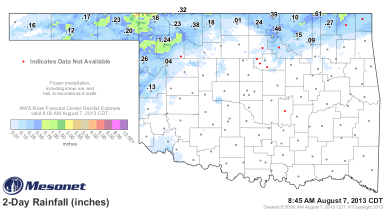
Woodward had a nice total of more than an inch, and it looks like northwest of
Buffalo may have had a downpour or two as well. But that area needs more than a
smattering. They need this to actually come true:
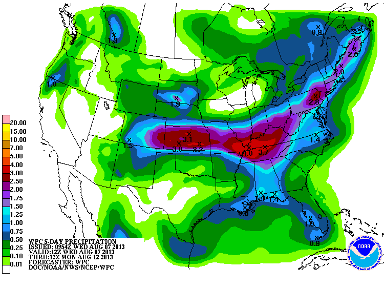
That's a really tight gradient across northern Oklahoma to the south, however.
Looks like the southwest will be left wanting, as they have all year. Here's
how the local NWS offices see it playing out over the next couple of days. Looks
like hot and steamy with a chance of severe storms.
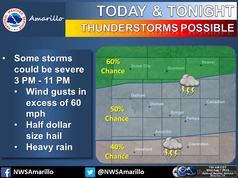

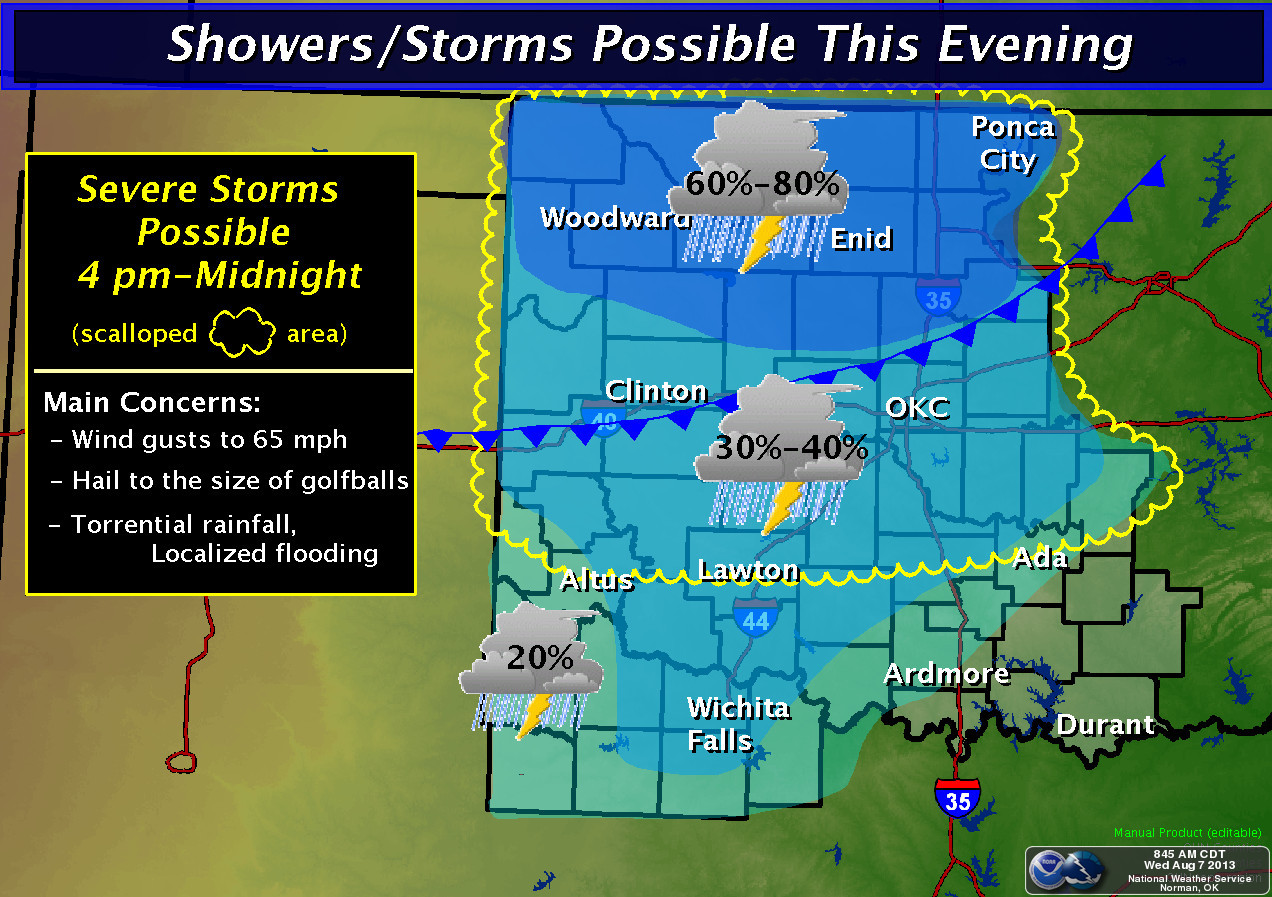
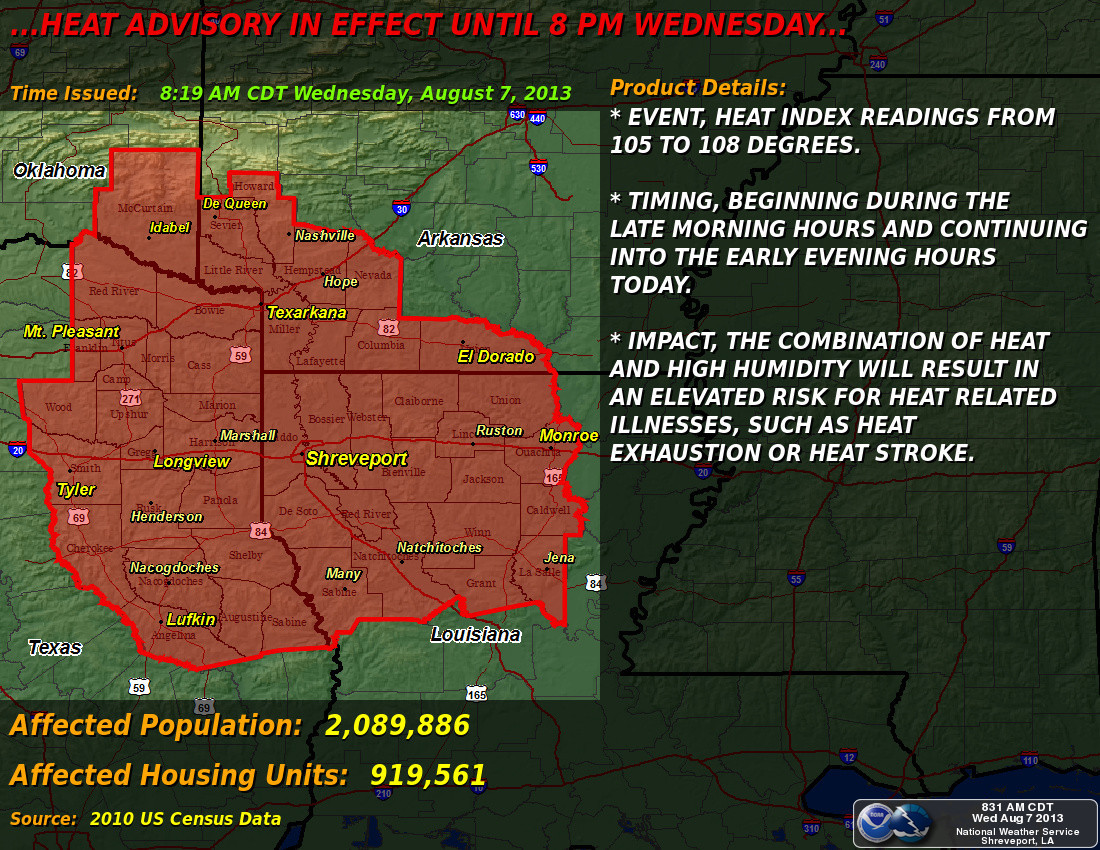
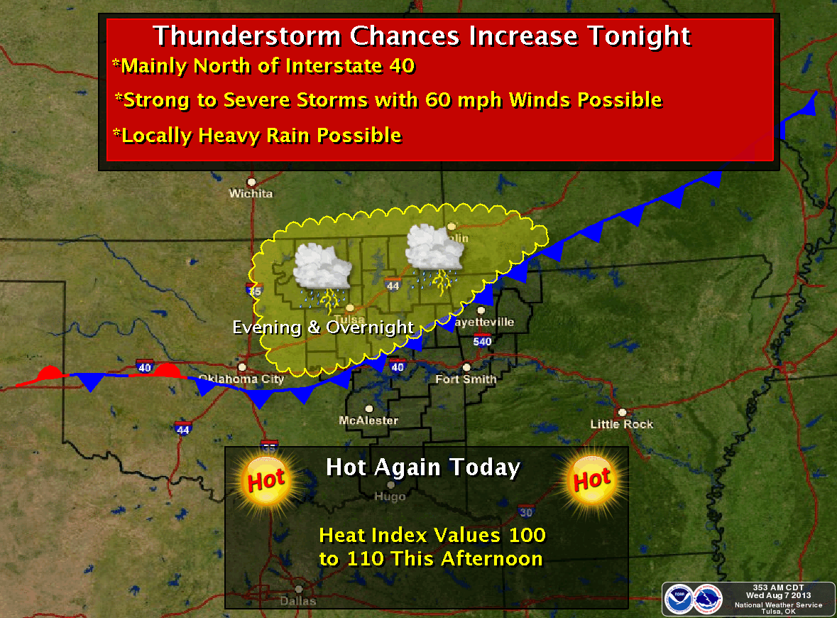
A 60% chance of rain across the Panhandle! However, as folks out there keep
reminding me ... they'll believe it when they see it.
-------------------------------------------------------------------------------
Speaking of all year, check out the change in the U.S. Drought Monitor from the
beginning of the year and the beginning of the water year (Oct. 1, 2012) to
last week's map.
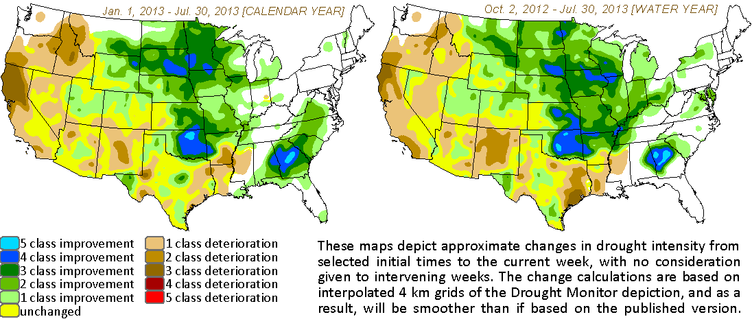
The entire state has seen improvements since the beginning of the water year
last Oct. 1 except for a small area in west central Oklahoma. The same type
of picture since the beginning of the year except in the far western Panhandle.
But the big relief has come across the eastern two-thirds of the state, as oft
mentioned. That 5-class improvement means from D4-Exceptional drought to D-Nada
(no drought or abnormally dry conditions. So quite a 7-month period of relief
for our parched state. The trick now is to keep it going.
And I think we can all agree Mother Nature has been quite tricky this year.
Gary McManus
Associate State Climatologist
Oklahoma Climatological Survey
(405) 325-2253
gmcmanus@mesonet.org
August 7 in Mesonet History
| Record | Value | Station | Year |
|---|---|---|---|
| Maximum Temperature | 111°F | MANG | 2003 |
| Minimum Temperature | 52°F | KENT | 1997 |
| Maximum Rainfall | 4.28″ | WEBR | 2020 |
Mesonet records begin in 1994.
Search by Date
If you're a bit off, don't worry, because just like horseshoes, “almost” counts on the Ticker website!